Aerial photography BC is now more efficient, accurate, and cost-effective, thanks to the rise of UAVs (unmanned aerial vehicles).
These UAV drones are changing how visual data is captured across various industries, from real estate to forestry.
Because they enable the collection of high-resolution aerial images and offer valuable insights from above.
That too, in Less Time and Less Cost than traditional methods.
In this blog post, we’ll discuss how modern UAVs are revolutionizing BC aerial photography, the benefits they offer. We will also touch upon how businesses and industries are using drone photography BC to improve data collection and decision-making.
What Is Aerial Photography and Why Is It Important in BC?
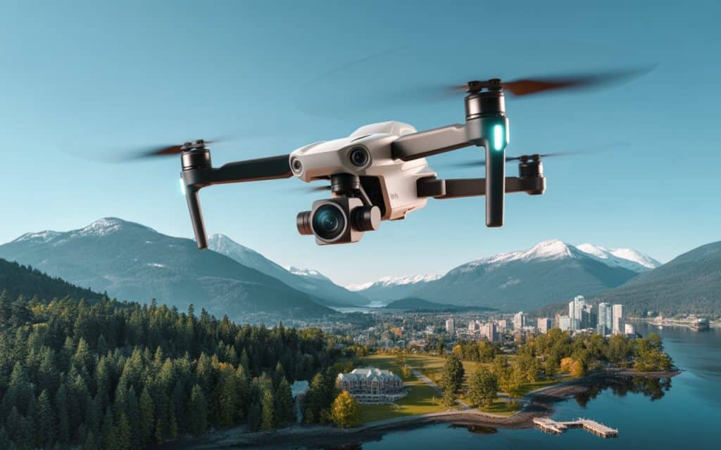
Aerial photography BC refers to capturing high-resolution images of the land from the air, using drones or other aircraft.
In BC, this technology has proven invaluable due to the province’s diverse landscapes, which include urban centers, forests, and mountains. UAVs are now essential tools for capturing detailed imagery of these areas, providing an overall view that would be difficult to achieve with traditional methods.
According to a report by Markets and Markets, The Global Drone Services (Drone as a service) Market Size is estimated to reach USD 57.8 billion by 2028. This surge in drone adoption reflects the increasing demand for high-resolution aerial images in industries ranging from real estate to agriculture.
In BC, aerial photography BC is used across various sectors, from real estate marketing to environmental monitoring. UAVs are capable of providing precise, high-quality data that allows businesses to make informed decisions and optimize operations.
To learn more about how UAVs are transforming industries, check out Rekon Solutions’ previous blog on aerial imagery.
How Modern UAVs Are Changing Aerial Photography in BC
1. Cost-Effective and Efficient Data Collection
Before UAVs, aerial photography in BC relied heavily on helicopters or small planes, which were costly and required extensive coordination. Today, BC aerial photography has become more accessible due to drones, which offer a far more affordable and efficient way to capture high-quality images.
Studies show that drone surveys can shorten project timelines by up to 45% and reduce field costs by 50%. This drastic reduction in costs and time makes drones an attractive solution for industries in BC.
2. Real-Time Data Capture and Analysis
One of the most significant benefits of using UAVs for drone photography BC is the ability to capture data in real-time. Drones allow for images and videos to be transmitted back to the operator immediately, enabling them to assess the quality of the footage and make adjustments during the flight.
In industries like forestry aerial imaging, where real-time data is crucial, drones allow forestry teams to capture images of large forested areas. They can also quickly analyze the health of the trees or assess potential hazards.
This speed of data collection ensures that timely decisions can be made without waiting for data to be processed manually.
3. Access to Hard-to-Reach Areas
BC’s rugged terrain, including dense forests and steep mountain ranges, often makes traditional aerial photography methods difficult or even impossible. UAVs have overcome these challenges by providing the ability to capture imagery in hard-to-reach areas, making aerial photography BC more versatile.
In the real estate aerial photos sector, drones are used to capture properties in remote locations. These aerial shots provide unique perspectives and enhance property listings by showcasing the surrounding landscape and the property’s proximity to natural attractions, a key selling point for buyers.
4. High-Resolution and Detailed Imagery
Modern UAVs are equipped with high-quality cameras capable of capturing high-resolution aerial images. These images provide detailed insights into areas that require precise analysis, such as construction sites, agricultural fields, or forest health.
For example, drones with high-definition cameras are able to provide detailed, high-resolution imagery of agricultural fields in BC. This imagery is used to monitor crop health, assess soil quality, and identify pests or diseases that could affect crops.
By using this data, farmers can optimize their practices and boost crop yields.
5. Increased Safety and Reduced Risks
Traditional methods of aerial photography BC using aircraft or helicopters can be risky, especially when working in difficult or hazardous environments.
UAVs, on the other hand, are much safer because they can be operated remotely, eliminating the need for personnel to be in potentially dangerous situations.
For instance, in the forestry sector, forestry aerial imaging allows drones to fly over dense forests or steep terrain without putting human operators at risk. This is especially important when assessing areas affected by wildfires, landslides, or other natural disasters, as drones can provide the necessary data without requiring on-site personnel.
Applications of UAVs in Aerial Photography in BC
1. Real Estate Marketing
In the competitive real estate market, real estate aerial photos are an excellent way to differentiate properties. Drone photography BC provides stunning aerial views of properties, which are crucial for showcasing features such as landscaping and surrounding amenities. These visuals are often used in online listings, promotional materials, and virtual tours.
2. Forestry and Environmental Monitoring
One of the most important uses of aerial photography BC is in forestry aerial imaging. UAVs enable forestry professionals to monitor the health of trees, map forest areas, and track changes in vegetation. These insights are crucial for managing BC’s vast forest resources sustainably.
Drones are also used to monitor wildlife habitats and assess environmental conditions in BC. By capturing high-resolution aerial images, environmentalists can track changes in ecosystems and assess the impact of climate change or human activities.
3. Construction and Land Development
In construction and land development, UAVs provide accurate and detailed data for planning and monitoring projects. Drones can capture high-resolution aerial images of construction sites, which are then used for site analysis, progress tracking, and planning.
By using aerial photography BC, developers can ensure that projects remain on schedule and within budget.
Drones also help identify any issues on-site, such as safety hazards or errors in design, enabling construction teams to address problems quickly and efficiently.
4. Agricultural Monitoring
In BC’s agricultural sector, aerial photography BC is used to monitor crop health and soil conditions.
Drones equipped with sensors can capture high-resolution images that reveal potential issues like pest infestations, irrigation problems, or nutrient deficiencies. This data is crucial for improving farm management and maximizing crop yields.
5. Tourism and Promotion
BC is renowned for its stunning natural beauty, and drones are used to capture breathtaking aerial images of its landscapes.
From the coastline to the mountains, drone photography BC helps showcase BC’s natural attractions, making it an essential tool for tourism marketing. These visuals are used in promotional materials, websites, and social media campaigns to attract visitors to the province.
FAQs
1. What is aerial photography BC?
Aerial photography BC involves capturing high-resolution images of BC’s landscapes from the sky using drones. It provides detailed views and is used for industries like real estate, agriculture, and construction.
2. How does drone photography BC benefit real estate?
Drone photography BC offers stunning aerial views that enhance property listings. These images attract more buyers by showcasing properties from unique perspectives.
3. What are high-resolution aerial images used for?
High-resolution aerial images are used for land mapping, monitoring crop health, inspecting infrastructure, and creating marketing materials for real estate and tourism.
4. Why is forestry aerial imaging important?
Forestry aerial imaging helps monitor forest health, track vegetation changes, and support sustainable forest management. Drones provide accurate, up-to-date data for effective conservation efforts.
Conclusion
Modern UAVs have significantly transformed aerial photography in BC. They offer cost-effective, high-resolution, and real-time data that is benefiting industries ranging from real estate to forestry. UAVs are now essential for capturing detailed imagery, improving efficiency, and enhancing decision-making processes.
If you want to incorporate drone photography for your next project to cut cost and effort, Rekon Solutions is here to help. Our dedicated team provides cutting-edge BC aerial photography services that deliver high-quality visual data tailored to your needs.
