How Drone Inspections Improve Safety and Accuracy
Imagine being tasked with inspecting a high-rise building or an oil rig—places that are difficult…
Rekon Solutions – LiDAR Drones
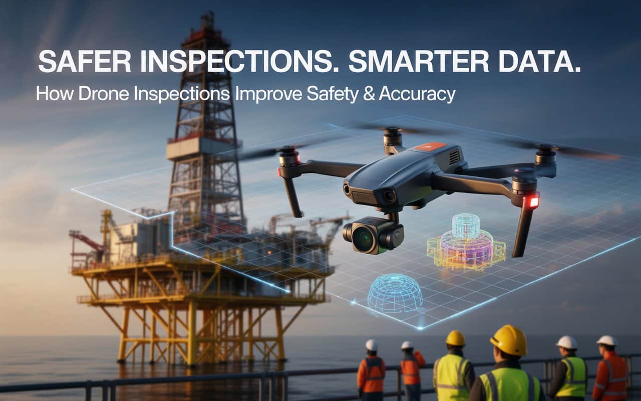
Imagine being tasked with inspecting a high-rise building or an oil rig—places that are difficult…
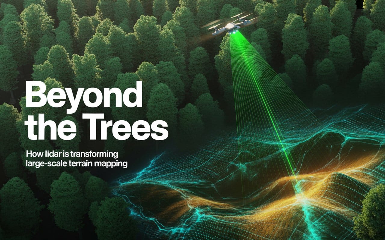
Mapping large landscapes has always been a challenge for surveyors and engineers. Dense forests, rugged…

Waterways shape landscapes, support ecosystems, and influence infrastructure decisions. Yet the most important information about…
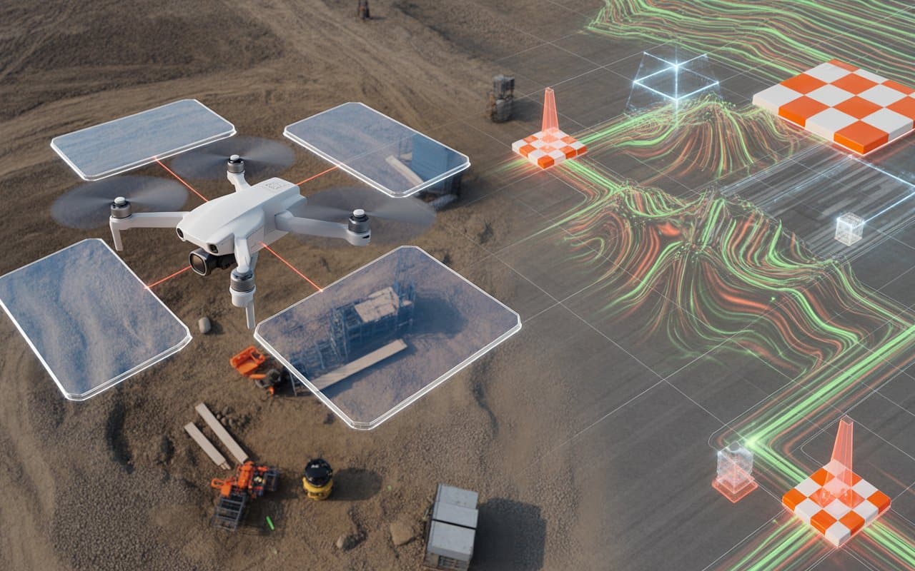
Surveying technology has changed dramatically over the last decade. Projects now move faster, expectations for…
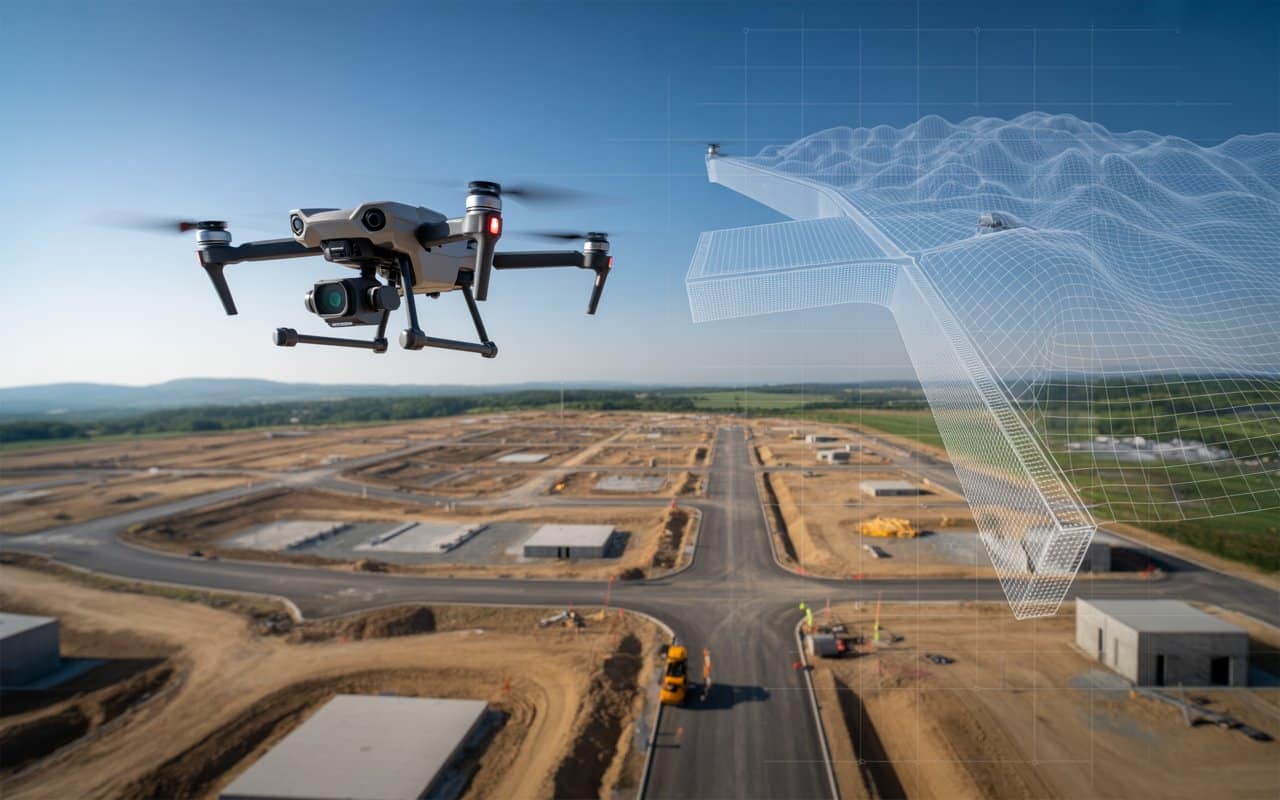
Accurate terrain information is the foundation of many modern projects. Construction planning, infrastructure development, environmental…
Have you ever wondered if there’s a faster, more efficient way to get your survey…
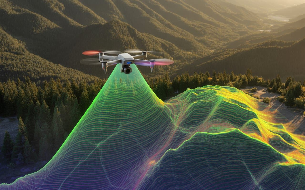
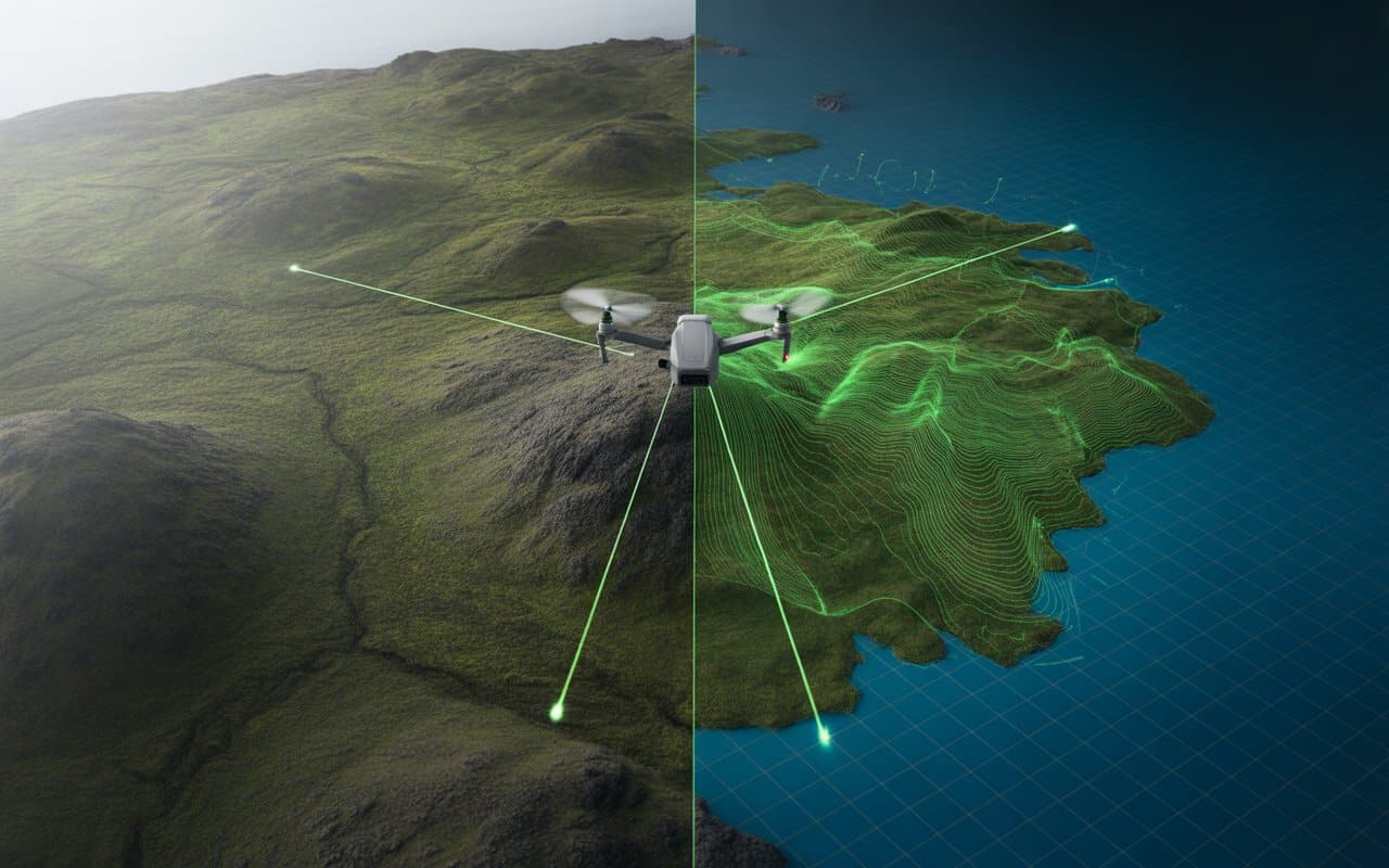
Imagine you’re tasked with creating a highly detailed topographic map of a rugged landscape. If…
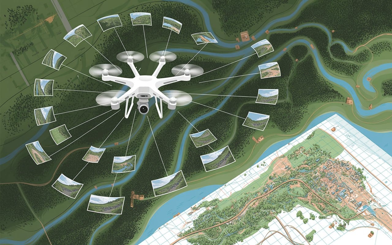
Photogrammetry has revolutionized the way we create detailed maps. By using overlapping aerial images, photogrammetry…
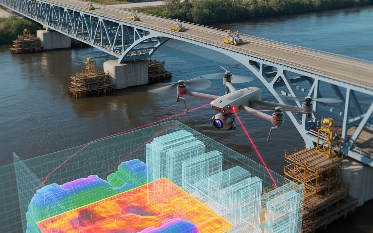
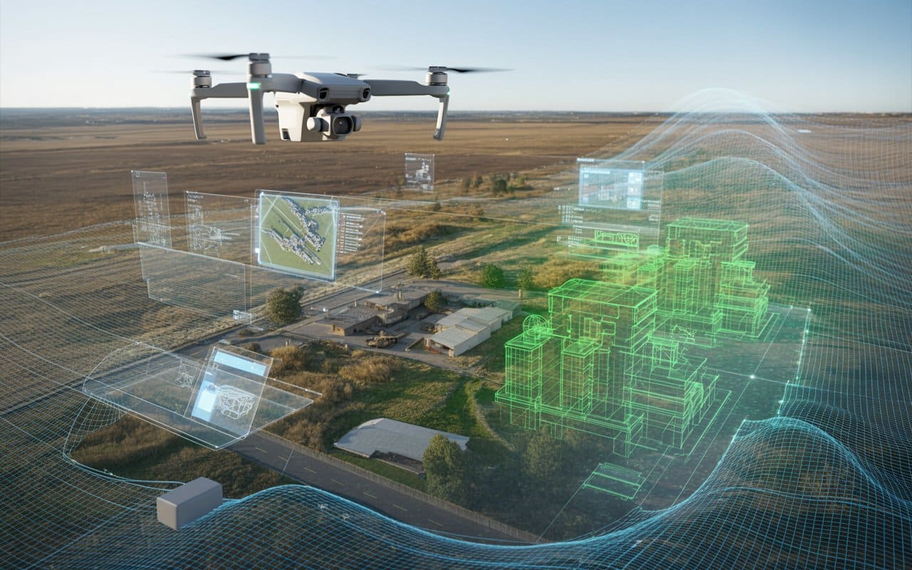
When it comes to infrastructure projects, maintaining safety and ensuring precision are key. Traditionally, inspections…

When it comes to mapping and surveying, precision is paramount. Traditional methods have been relied…
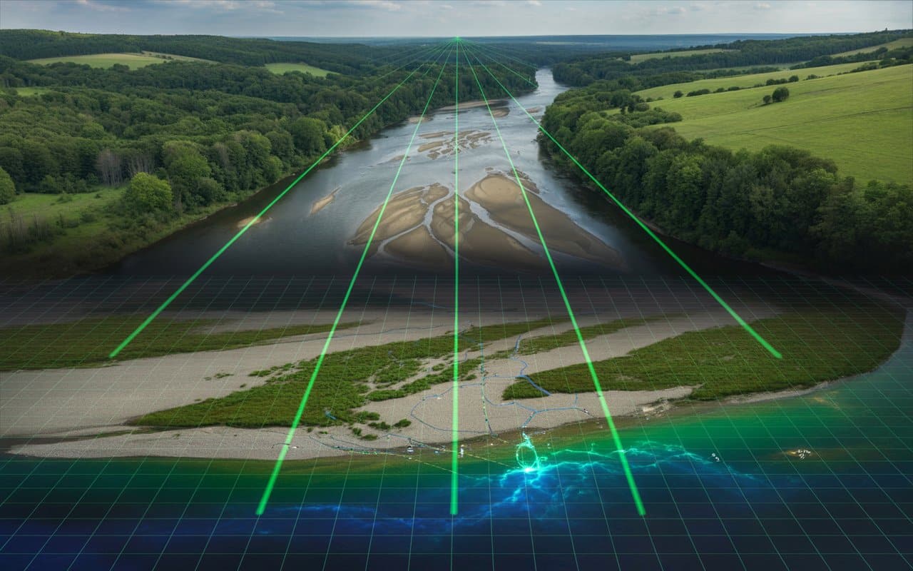
Rivers are constantly changing. Water levels rise and fall, sediments shift, and channels reshape over…
Modern projects demand more than flat maps. Engineers, planners and developers now rely on detailed…
In this post we will take a look at how the fires that ravaged the…


