How Do LiDAR Surveys Support Flood Risk and Erosion Management Projects?

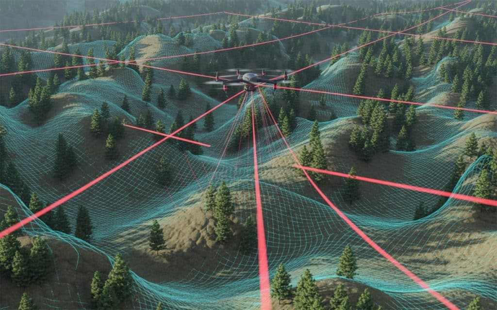
Can we predict and prevent the next flood before it happens? Flooding and erosion are growing environmental challenges that affect communities worldwide. Changing rainfall patterns, rising water levels, and urban development make flood management more complex than ever. Traditional surveying methods often miss the subtle changes in terrain that determine how water moves across land. That is why LiDAR flood mapping has become a breakthrough for scientists, engineers, and environmental planners. It captures the Earth’s surface with incredible accuracy, revealing details that help predict and prevent disasters before they occur. What Is LiDAR Flood Mapping LiDAR stands for Light Detection and Ranging. It uses laser pulses to measure distances to the ground and create highly detailed 3D maps. Each laser point reflects back to the sensor, producing precise elevation data that forms a complete topographic picture of the terrain. In flood management, this technology provides a detailed view of riverbanks, floodplains, and drainage paths. LiDAR for flood risk and erosion helps decision makers understand how water will behave under different conditions. It shows where flooding might occur, where soil is eroding, and which areas are most vulnerable to future damage. Why Traditional Flood Mapping Falls Short Conventional flood mapping depends on manual surveying and aerial photography. These methods can be slow, costly, and often inaccurate in complex or vegetated terrain. They may overlook small elevation changes that alter how water flows and accumulates. LiDAR technology solves this problem by scanning thousands of points every second. It captures data through vegetation and in hard to reach areas. This gives engineers a complete and highly accurate understanding of the landscape. How LiDAR Supports Flood and Erosion Management 1. Captures Detailed Elevation Data LiDAR provides elevation data with centimeter level precision. This allows engineers to build accurate digital elevation models that simulate how water flows and spreads during heavy rainfall. According to research published on ResearchGate, LiDAR driven surveys greatly improve floodplain modeling and flood prediction accuracy. They help planners design drainage systems and flood defenses that truly match the landscape’s needs. 2. Improves Watershed and Drainage Analysis Floods follow predictable paths based on slope and surface flow. LiDAR for flood risk and erosion helps identify these natural drainage networks. It allows planners to see where water will collect and how it will move across the land. This helps design efficient stormwater systems and flood control structures. It also assists in restoring natural waterways and reducing long term damage from poor land management. 3. Detects and Monitors Erosion Over Time Erosion weakens riverbanks and damages infrastructure slowly but steadily. LiDAR can detect these changes by comparing elevation data collected at different times. Even small shifts in soil or slope can be identified early. With this information, engineers can plan reinforcement work or vegetation restoration before erosion becomes critical. Continuous LiDAR monitoring ensures long term landscape stability. 4. Enhances Coastal and Riverbank Protection Coastal regions and rivers are highly prone to flooding and erosion. LiDAR flood mapping helps create accurate cross sections of coastlines and floodplains. The data allows modeling of storm surges and sea level rise to predict how far water will reach. A study published in the MDPI Remote Sensing Journal confirmed that LiDAR elevation data significantly improves coastal erosion assessments and shoreline management strategies. 5. Strengthens Emergency Planning and Disaster Response When a flood occurs, fast decisions save lives. LiDAR data helps authorities simulate different flood scenarios and plan evacuation routes before a storm arrives. After a disaster, drones or aircraft equipped with LiDAR can quickly scan the damaged areas. This real time mapping gives rescue teams the information they need to prioritize actions and protect affected communities. Beyond Flooding and Erosion LiDAR is not limited to flood studies. The same data supports wetland mapping, watershed management, and sustainable infrastructure design. Environmental scientists use it to measure sediment flow, assess vegetation health, and monitor land restoration after natural disasters. Its versatility makes LiDAR one of the most valuable tools in environmental and civil engineering today. Why LiDAR Is the Best Tool for Flood and Erosion Projects LiDAR offers unmatched accuracy, speed, and consistency. It can survey large or remote areas quickly while maintaining precision. It works even in dense vegetation where traditional methods fail. And it reduces the need for field crews to enter dangerous flood zones. Most importantly, LiDAR creates reliable baseline data that can be reused for years. This helps track environmental changes and predict risks long before they escalate. Rekon Solutions and LiDAR Expertise At Rekon Solutions, we combine advanced LiDAR systems with expert data analysis to support flood management and erosion control projects. Our team helps government agencies, engineers, and planners visualize terrain with unmatched clarity. Whether it is mapping a floodplain, assessing a vulnerable riverbank, or monitoring landscape changes after a major storm, Rekon delivers precise LiDAR data that guides smarter, safer decisions. Conclusion Floods and erosion are part of nature but their impact can be managed through better information. LiDAR flood mapping provides that clarity. It reveals how water interacts with the land and helps design solutions that protect communities and preserve the environment. With its precision and efficiency, LiDAR for flood risk and erosion has become the foundation for modern floodplain management. At Rekon Solutions, we are proud to deliver LiDAR surveys that help build safer, more resilient environments for the future. Frequently Asked Questions What is the main advantage of using LiDAR in surveying? LiDAR captures detailed elevation data quickly and accurately, providing insights that traditional surveying cannot match. How does LiDAR work for surveying? LiDAR sends out laser pulses and measures how long they take to return. This creates a detailed 3D map of the surface and its features. How is LiDAR technology useful in mitigating the effects of natural hazards? LiDAR helps identify flood prone and erosion sensitive areas, allowing early intervention and better emergency planning. How can LiDAR contribute to forest management practices? LiDAR helps measure canopy height, track vegetation density, and monitor deforestation or recovery after wildfires.
Drone LiDAR vs. Mobile LiDAR: Which Is Best for Your Infrastructure Project?

Are you choosing the right LiDAR for your project? When it comes to infrastructure projects, precision, speed, and cost-effectiveness are non-negotiable. Whether you’re surveying roads, bridges, or utilities, having the right tools can make all the difference. That’s where drone LiDAR and mobile LiDAR come into play. These two technologies are revolutionizing the way we collect data for infrastructure projects, but which one is best suited for your specific needs? In this blog, we’ll break down the pros and cons of drone LiDAR and mobile LiDAR to help you make an informed decision for your next infrastructure project. What is Drone LiDAR? Drone LiDAR is a powerful surveying tool that uses a drone equipped with LiDAR sensors to capture high-resolution data of the ground below. The drone flies over the area of interest, emitting laser pulses to measure distances and create 3D point clouds of the landscape. This makes it perfect for road surveying with LiDAR, large-scale infrastructure projects, and areas that are difficult to access. What is Mobile LiDAR? On the other hand, mobile LiDAR involves a LiDAR sensor mounted on a vehicle, typically a car or a specialized mobile unit. This technology is ideal for surveying long stretches of infrastructure, such as highways, railways, and urban environments. The mobile unit drives along the roads or infrastructure being surveyed, continuously collecting data in real-time. Drone LiDAR vs. Mobile LiDAR: The Key Differences 1. Data Collection Range Drone LiDAR offers flexibility in data collection, especially in areas where access is limited. Whether it’s remote or hard-to-reach terrain, drones can fly over obstacles like rivers, forests, or construction zones, capturing data from difficult angles. This makes drone LiDAR an excellent choice for surveying rugged terrains or urban environments where traditional methods may struggle. In contrast, mobile LiDAR excels at surveying large, linear stretches of infrastructure, such as roads, bridges, or pipelines. While drones may be limited by flight regulations and battery life, mobile LiDAR can cover longer distances without the same constraints. It is perfect for infrastructure projects that require extensive coverage, such as road surveying with LiDAR. 2. Accuracy and Precision Both drone LiDAR and mobile LiDAR offer impressive accuracy, but the precision depends on the quality of the equipment, the environment, and the method of deployment. Drone LiDAR typically offers higher accuracy in more confined, complex environments. The ability to fly at various altitudes and angles allows drones to capture detailed data even in challenging conditions like dense vegetation or construction zones. This makes drone LiDAR ideal for creating precise 3D models of infrastructure projects in urban or wilderness areas. However, mobile LiDAR is often better suited for larger-scale surveys, particularly when the terrain is more open or predictable. The stability of a vehicle allows for smooth, continuous data capture, ensuring reliable results for infrastructure projects requiring large-scale mapping, such as highways or railways. 3. Speed and Efficiency When it comes to surveying large areas, mobile LiDAR typically outperforms drone LiDAR in terms of speed. With a vehicle-mounted system, you can survey long stretches of infrastructure in a fraction of the time it would take a drone to cover the same area. However, drone LiDAR is more efficient in areas that are difficult for vehicles to access. Drones can easily fly over dense forests, bodies of water, or construction zones, collecting data without the need for road access. This makes drones the go-to choice for LiDAR for infrastructure in hard-to-reach places. 4. Cost Considerations Drone LiDAR may have a higher initial cost due to the specialized drones and LiDAR sensors required. However, for small-scale or hard-to-reach surveys, the cost can be justified by the ease of access and the speed of data collection. Mobile LiDAR, on the other hand, can be more cost-effective for large-scale infrastructure surveys. Since the vehicle-mounted system can cover long distances without the need for recharging or additional setup, it’s ideal for continuous, large-scale surveying projects. 5. Applications in Infrastructure Projects Both drone LiDAR and mobile LiDAR are invaluable for infrastructure projects, but their best applications vary: Drone LiDAR is perfect for surveying smaller, hard-to-reach sites, including: Urban areas Remote construction sites Complex topographies (e.g., forests, mountains) Creating 3D models of buildings, roads, and bridges Mobile LiDAR excels at surveying long stretches of linear infrastructure, such as: Highways and roads Railways and transit systems Powerline corridors Pipelines and utility networks Which LiDAR is Right for Your Project? Choosing between drone LiDAR and mobile LiDAR depends on the specifics of your project. Consider the following: If you need to survey a large, open area or linear infrastructure, mobile LiDAR is likely your best bet. It’s efficient, cost-effective, and perfect for projects like road surveying with LiDAR. If you need to access difficult or remote terrains, such as forests, mountains, or urban areas with complex structures, drone LiDAR offers unparalleled flexibility and precision. For infrastructure projects that involve a combination of open and complex environments, a combination of both drone LiDAR and mobile LiDAR might be the most effective solution. Conclusion Both drone LiDAR and mobile LiDAR have their strengths, and the right choice for your project depends on the scale, terrain, and specific needs. By understanding the differences, you can make a more informed decision and ensure that you’re using the best tool for the job. If you’re ready to take your infrastructure projects to the next level with LiDAR for infrastructure, Rekon offers the expertise and equipment you need to get precise, reliable data. Whether you choose drone LiDAR or mobile LiDAR, our team is ready to help you achieve your surveying goals with accuracy and efficiency. Frequently Asked Questions (FAQs) What is the main advantage of using LiDAR in surveying? LiDAR provides high-precision data collection over large areas in a short amount of time, improving accuracy and efficiency compared to traditional methods. What is the accuracy of LiDAR surveys? LiDAR can achieve accuracy levels of 1-3 centimeters, making it one of the most precise surveying methods available today. How is LiDAR used in
5 Reasons Why LiDAR Is the Future of Precision Mapping in Remote Areas
Have You Struggled with Mapping in Remote Locations? Surveying in remote areas is no easy feat. Whether you’re mapping rugged terrains, dense forests, or mountainous regions, traditional surveying methods often fall short. That’s where LiDAR in remote areas comes into play. LiDAR technology has become a game-changer for precision mapping in locations that were once difficult to reach. In this blog, we’ll explore why LiDAR for rugged terrain and remote surveying with LiDAR are transforming how we collect data in remote areas. If you’re looking for a faster, more accurate way to map challenging environments, keep reading! What Is LiDAR in Remote Areas? LiDAR (Light Detection and Ranging) uses laser pulses to measure distances between the sensor and the surface of the Earth. These pulses are reflected back to the sensor, providing highly accurate 3D data. When applied to remote areas, LiDAR technology allows for precise mapping of terrain, vegetation, and even infrastructure without needing direct access. In areas that are difficult to navigate, such as dense forests, mountains, or unstable environments, LiDAR enables surveyors to capture valuable data from above, using drones or aircraft. Why LiDAR is Revolutionizing Mapping in Remote Areas 1. LiDAR Can Access Hard-to-Reach Locations One of the biggest challenges in mapping remote areas is access. In many cases, it’s not feasible or safe to send survey teams into rugged or inaccessible locations. LiDAR for rugged terrain solves this by providing a bird’s-eye view of the landscape. Drones and aircraft equipped with LiDAR sensors can fly over difficult terrain and gather data in places that would otherwise be off-limits. For example, if you’re working in a dense forest or a remote mountain range, LiDAR in remote areas allows you to map the terrain without having to physically traverse the land. This can significantly reduce the time, cost, and risk associated with traditional field surveys. 2. Faster Data Collection Traditional surveying methods in remote areas can be slow and labor-intensive. LiDAR for rugged terrain, on the other hand, dramatically speeds up the process. Drones can cover vast areas in a short amount of time, capturing detailed precision mapping data as they fly over the landscape. Unlike traditional methods that require extensive ground surveys, remote surveying with LiDAR captures data quickly and efficiently. This is particularly valuable in industries like forestry, mining, and environmental monitoring, where timely data is crucial for decision-making and project management. 3. High-Resolution Data for Better Decision-Making Accuracy is essential when surveying remote areas, and LiDAR in remote areas provides some of the most precise data available. LiDAR sensors can capture millions of data points per second, creating detailed 3D models of the landscape. This level of precision is ideal for mapping complex features like topography, vegetation, and infrastructure. For example, LiDAR for rugged terrain can create detailed surface models of forested areas, capturing the heights of trees, the slope of the ground, and the distance between features. This data can then be used for planning purposes, such as determining the best route for a new road or assessing the stability of a hillside for construction. 4. Minimizing Environmental Impact Surveying in remote areas often requires heavy equipment or human presence, which can disturb the environment. LiDAR in remote areas minimizes this impact. By using drones or aircraft, surveyors can collect data without disturbing the land or vegetation. Unlike traditional methods, there’s no need for physical contact with the terrain, reducing the risk of environmental damage. This is especially important in sensitive ecosystems, such as wetlands, wildlife habitats, or protected lands. Remote surveying with LiDAR allows for thorough mapping without compromising the environment. 5. Cost-Effective Long-Term Solution While the initial cost of LiDAR for rugged terrain may be higher than traditional surveying methods, the long-term benefits far outweigh the expense. LiDAR in remote areas reduces the need for expensive field teams, travel costs, and lengthy surveys. In addition, the accuracy and speed of LiDAR reduce the need for follow-up surveys or data corrections, which can further lower costs. When you consider the time saved, the reduction in environmental impact, and the higher-quality data, LiDAR becomes a highly cost-effective solution for precision mapping in remote areas. Applications of LiDAR in Remote Areas 1. Forestry and Vegetation Mapping In forestry, LiDAR for rugged terrain can be used to map tree canopy heights, estimate biomass, and assess forest density. This is crucial for forest management, environmental studies, and resource planning. LiDAR technology also helps in calculating the volume of timber available for harvest, which can improve the efficiency of the logging industry. 2. Mining and Exploration LiDAR in remote areas is widely used in mining and exploration. The technology enables surveyors to create accurate models of mining sites, assess terrain stability, and monitor changes over time. LiDAR data is particularly useful in remote surveying with LiDAR for mapping areas that are difficult to access, such as remote mining sites or riverbeds. 3. Environmental Monitoring and Conservation LiDAR technology is being increasingly used in environmental monitoring to track changes in the landscape over time. For example, LiDAR in remote areas can be used to monitor glacier movements, coastal erosion, and deforestation. The ability to gather detailed, precise data from the air makes LiDAR an invaluable tool for environmental scientists working in remote or protected areas. 4. Infrastructure Development Whether it’s road construction, pipeline installation, or powerline mapping, precision mapping with LiDAR is vital for planning infrastructure projects in remote areas. LiDAR for rugged terrain helps planners understand the landscape and make informed decisions about routes, designs, and construction methods. It also enables surveyors to identify potential risks such as unstable ground or flood zones. Conclusion: Embrace the Future of Remote Mapping with LiDAR If you’re working on an infrastructure project in a remote area, LiDAR in remote areas offers the precision, speed, and cost-efficiency you need to succeed. From surveying rugged terrain to minimizing environmental impact, LiDAR is revolutionizing how we collect and analyze data in the world’s most challenging environments. At Rekon, we specialize in providing
How LiDAR Can Enhance Your Surveying Projects With High Precision Data?

Is Your Surveying Data as Accurate as You Think? Imagine you’re in the middle of a critical surveying project. You’ve gathered all the data, but there’s a nagging feeling—could your measurements be more precise? Could you be missing vital details that might affect your project’s success? If this sounds familiar, it’s time to consider a solution that’s reshaping the surveying industry: LiDAR technology. In this blog, we’ll explore how LiDAR can revolutionize your surveying projects by delivering high-precision data, faster results, and more reliable outcomes. What is LiDAR, and How Does It Work in Surveying? LiDAR stands for Light Detection and Ranging. It’s a technology that uses laser pulses to measure distances and create detailed 3D models of the landscape. But why is this important for surveying? Traditional methods rely on ground measurements and sometimes guesswork. LiDAR, on the other hand, delivers highly accurate data by capturing both vertical and horizontal features, even in complex environments. It sends laser beams to the surface, and the time it takes for these beams to return helps generate precise data. This process creates a point cloud that represents the surveyed area with exceptional accuracy. Why LiDAR is a Game-Changer for Surveying Projects Fast and Efficient Data Collection When it comes to surveying, time is often of the essence. Traditional methods can be time-consuming, especially when working with large areas. That’s where LiDAR comes in. By using LiDAR surveying equipment, you can gather extensive data quickly and accurately. For instance, LiDAR survey drones allow you to cover large sites in a fraction of the time it would take with traditional methods. Whether you’re mapping vast landscapes or surveying urban infrastructure, LiDAR offers faster turnaround times without compromising quality. High Precision That Makes a Difference Accuracy is everything in surveying. A small error in measurements can lead to costly mistakes down the line. LiDAR’s precision is one of its biggest advantages. With LiDAR, you can achieve centimeter-level accuracy, which means fewer errors and more reliable data. This is crucial when you need to capture fine details, such as elevation changes or intricate terrain features. LiDAR allows you to collect the data you need, regardless of the environment or conditions. Survey Difficult Terrain with Ease Surveying rugged, hard-to-reach areas has always been a challenge. With traditional methods, you’d need to send surveyors into remote locations, which can be dangerous, slow, and expensive. LiDAR changes this. With mobile LiDAR surveys or LiDAR survey drones, you can easily access and map areas that are otherwise difficult to survey. Dense forests, mountain ranges, or even bodies of water are no longer barriers to accurate data collection. Hence, LiDAR helps you gather reliable information from virtually any environment. LiDAR Surveying Equipment: What You Need to Know LiDAR isn’t a one-size-fits-all solution. Depending on your project, you might need different types of LiDAR surveying equipment. The most common options include: Terrestrial LiDAR: Stationary devices used for detailed scans of smaller areas. Mobile LiDAR: LiDAR systems mounted on vehicles, perfect for scanning roads, railways, or other infrastructure. LiDAR Survey Drones: Equipped with LiDAR sensors, these drones can cover large areas efficiently while capturing high-resolution data. Choosing the right equipment depends on the scale and requirements of your survey. Keep in mind that LiDAR survey costs can vary based on the equipment used and the size of the project. However, the investment is worth it for the speed and accuracy it brings to your work. How Accurate is LiDAR Surveying? LiDAR technology is renowned for its high accuracy. In most cases, LiDAR can achieve accuracy levels of 1-3 centimeters. This is far superior to traditional surveying methods, which can have larger margins of error. However, several factors can influence the LiDAR survey accuracy. These include the quality of the LiDAR equipment, the environment in which it’s used, and the type of surface being surveyed. For example, LiDAR may have different results when scanning dense vegetation compared to open land. Still, with proper equipment and conditions, LiDAR provides a level of precision that traditional methods simply can’t match. LiDAR Survey Cost: Is It Worth the Investment? You might be wondering about the LiDAR survey cost. Yes, the upfront investment in LiDAR equipment and services can be higher than traditional methods, but the value it provides is unmatched. LiDAR technology dramatically reduces the time spent on data collection, and its high accuracy means fewer revisions and less rework. This ultimately leads to cost savings in the long run. Plus, the detailed data you receive can help you make more informed decisions, preventing costly mistakes and delays down the road. Why Choose Rekon for Your LiDAR Surveying Needs? When it comes to high-precision LiDAR surveying, Rekon is the trusted partner you need. We specialize in delivering accurate, fast, and reliable LiDAR data tailored to your specific project needs. Whether you’re involved in construction, environmental monitoring, or land development, we’ve got the right tools and expertise to support your goals. With Rekon’s LiDAR survey drones and mobile LiDAR solutions, you can access fast, accurate data, even in the most challenging environments. Contact us today to learn more about how our LiDAR surveying services can enhance your next project. Frequently Asked Questions (FAQs) About LiDAR Surveying What is the main advantage of using LiDAR in surveying? The main advantage of LiDAR is its ability to provide highly accurate, detailed data quickly, even in difficult-to-reach areas. It eliminates errors and minimizes the time needed for data collection. What is LiDAR in surveying? LiDAR is a remote sensing technology that uses laser pulses to measure distances and create precise 3D models of the Earth’s surface. It’s widely used in surveying for its speed and accuracy. How accurate is LiDAR surveying? LiDAR can achieve accuracy levels of 1-3 centimeters, making it one of the most precise surveying methods available today. What factors can influence the accuracy of LiDAR measurements? The accuracy of LiDAR measurements can be influenced by factors such as the quality of the equipment, environmental conditions (like weather
How LiDAR in Construction Helps You Optimize Site Analysis and Planning

Have you ever faced unexpected challenges during a construction project due to inaccurate site data? Perhaps hidden utilities, uneven terrain, or unforeseen obstacles disrupted your plans. These issues often arise from traditional surveying methods that may not capture the full complexity of a site. But what if there was a way to gain a comprehensive, precise understanding of your construction site from the outset? Understand LiDAR technology. What Is LiDAR in Construction? LiDAR, or Light Detection and Ranging, is a remote sensing method that uses laser pulses to measure distances and create detailed 3D models of the Earth’s surface. In construction, LiDAR provides accurate topographic data, enabling professionals to visualize and analyze a site before breaking ground. The Advantages of LiDAR in Construction Site Analysis 1. Enhanced Accuracy and Detail Traditional surveying techniques can be time-consuming and may miss subtle features of the landscape. LiDAR offers high-resolution data that captures even the smallest details, such as vegetation, structures, and terrain variations. This level of precision is invaluable for tasks like creating digital elevation models, planning drainage systems, and assessing flood risks. 2. Time and Cost Efficiency Conducting manual surveys across large areas can be labor-intensive and costly. LiDAR technology accelerates data collection, reducing the need for extensive fieldwork. By providing rapid and accurate information, LiDAR helps you make informed decisions quickly, potentially saving both time and money in the long run. 3. Improved Safety and Risk Management Construction sites often present hazards that can be difficult to assess without comprehensive data. LiDAR allows for the identification of potential risks, such as unstable slopes or hidden utilities, before construction begins. This proactive approach enables you to implement safety measures early, reducing the likelihood of accidents and costly delays. 4. Seamless Integration with BIM Building Information Modeling (BIM) is a digital representation of a building’s physical and functional characteristics. LiDAR data integrates seamlessly with BIM, providing a solid foundation for design and construction planning. This integration facilitates clash detection, design optimization, and efficient project coordination. 5. Comprehensive Site Documentation Having accurate records of a construction site is crucial for future reference, maintenance, and potential renovations. LiDAR creates detailed 3D models that serve as comprehensive documentation of the site conditions at a specific point in time. These models can be invaluable for facility management and long-term planning. Real-World Applications of LiDAR in Construction Site Surveying and Mapping: LiDAR provides precise topographic data, aiding in the creation of accurate site maps and models. Volume Calculations: LiDAR can determine the volume of stockpiles and excavations, assisting in material estimation and cost planning. Foundation Design: Accurate terrain data from LiDAR helps in designing stable foundations, crucial for the structural integrity of buildings. Infrastructure Planning: LiDAR assists in planning roads, bridges, and utilities by providing detailed information about the existing landscape. Environmental Impact Assessment: LiDAR data aids in assessing the environmental impact of construction projects by mapping vegetation, waterways, and other natural features. Addressing Common Challenges with LiDAR While LiDAR offers numerous benefits, it’s essential to be aware of potential challenges: Data Processing: The large volume of data collected by LiDAR systems requires advanced processing capabilities and software. Initial Investment: Acquiring LiDAR technology can involve significant upfront costs. Training and Expertise: Effective use of LiDAR requires skilled professionals who are trained in data collection and analysis. To overcome these challenges, partnering with experienced professionals is crucial. At Rekon Solutions, we specialize in providing high-quality LiDAR services tailored to your construction needs. Why Choose Rekon Solutions? At Rekon Solutions, we understand the complexities of construction projects and the importance of accurate site data. Our team utilizes state-of-the-art LiDAR technology to deliver precise and detailed 3D models of your construction site. We work closely with you to ensure that our services align with your project goals, providing you with the insights needed for successful planning and execution. Conclusion Incorporating LiDAR technology into your construction projects offers a multitude of benefits, from enhanced accuracy and efficiency to improved safety and risk management. By leveraging detailed 3D models, you can make informed decisions that optimize site analysis and planning. Partnering with experts like Rekon Solutions ensures that you harness the full potential of LiDAR, setting the foundation for successful and sustainable construction projects.
Why Bare-Earth Models Are a Game-Changer for Engineering Accuracy
Imagine planning a multimillion dollar infrastructure project only to find out midway that your data was off. Slopes were misjudged, vegetation covered critical terrain details, and underground utilities did not align with your design. That one error could mean delays, budget overruns, and even safety risks. This is where bare earth models step in. They strip away vegetation, buildings, and other surface features to reveal the true terrain. With LiDAR technology and advanced processing, you can see the ground as it really is. For engineers, surveyors, and planners, that accuracy is a game-changer. At Rekon, we believe data should not only look sharp but also deliver a measurable impact. And when you work with reliable bare earth models, you reduce guesswork, make confident decisions, and complete projects on time. What Exactly Are Bare-Earth Models? Bare earth models are high resolution representations of the ground surface that remove trees, shrubs, and manmade structures. They are created by processing raw LiDAR point clouds and filtering out all elements that are not part of the actual terrain. The result is a digital terrain model that gives you a clear and accurate foundation for planning roads, bridges, pipelines, flood analysis, and countless other engineering projects. Think of it as peeling back the layers of nature and construction until all that remains is the true earth surface. Why They Matter for Engineering Accuracy Engineering thrives on precision. Even small errors in measurements can ripple into big consequences. According to a McKinsey report, large scale infrastructure projects overrun costs by an average of 20 percent. Mostly, many of these overruns come from unforeseen ground conditions. Bare earth models directly tackle that problem by giving you the most accurate baseline possible. Instead of relying on limited ground surveys or aerial images cluttered with vegetation, you get a clean dataset that makes calculations sharper. Slopes, contours, drainage paths, and soil stability can all be evaluated without interference. That clarity is not just helpful, it is essential. Practical Benefits You Can Count On Improved Design Accuracy Bare earth models let you detect elevation changes, subtle slopes, and potential hazards early. This translates into fewer redesigns and better safety outcomes. Faster Project Timelines Traditional surveying methods take weeks. LiDAR based terrain models can be produced in a fraction of that time. Rekon has delivered detailed bare earth datasets within days for projects that previously required months of fieldwork. Reduced Risk of Cost Overruns Every engineering manager dreads the words “unforeseen conditions.” With a precise digital terrain model, you reduce surprises and keep your budget intact. Better Environmental Analysis From floodplain mapping to soil erosion studies, bare earth models give environmental engineers a solid base for analysis. For example, a US Geological Survey study found that bare earth LiDAR data improved flood risk predictions by nearly 30 percent. Rekon’s Experience in Action At Rekon, we have seen firsthand how powerful bare earth models are for clients across industries. During a recent project in Western Canada, our LiDAR data helped engineers detect hidden depressions that traditional surveys had missed. By adjusting their design early, the project avoided costly drainage issues down the road. Another example comes from a forestry related project where vegetation had always complicated measurements. By delivering a clean bare earth model, Rekon enabled accurate slope calculations that guided sustainable harvesting and improved safety for operators. What sets us apart is not just our advanced LiDAR technology but also the way we collaborate with clients. We do not just deliver data files, we deliver insights you can act on. Why This Technology is a Game-Changer Bare earth models are not simply a “nice to have” anymore, they are becoming a necessity. Engineers, municipalities, and developers who embrace them gain a competitive edge. Projects become safer, smarter, and more efficient. Think about how critical accuracy is when designing a bridge foundation or assessing landslide risk. A single meter of error can alter calculations dramatically. Bare earth models eliminate that uncertainty. For you, that means confidence in every measurement and assurance that your project is built on reliable data. The Future of Engineering Precision As infrastructure needs grow and climate challenges intensify, data driven decisions will only become more important. Bare earth models will continue to play a central role, not just in civil engineering, but also in environmental management, resource planning, and disaster resilience. At Rekon, our mission is to make these solutions practical, quick, and accessible. Whether it is a highway expansion or a watershed study, our team approaches every project with professionalism and passion. When you partner with us, you are not just buying a service, you are gaining a team committed to your success. If you are looking to enhance your next project with reliable bare earth data, contact Rekon today. We are ready to support your vision with accuracy you can trust. Final Verdict Accuracy is not optional in engineering, it is the foundation of every successful project. And bare earth models give you that accuracy by revealing the ground as it truly is. They save time, cut costs, reduce risks, and make planning smoother. Rekon has proven experience delivering these models across industries, helping clients avoid pitfalls and complete projects with confidence. If you want to see how bare earth models can make a measurable difference for your work, reach out to us. Our team is here to bring clarity to your next big project.
Photogrammetry vs LiDAR: Which One Is Right for Your Next Survey?

Picture this: you are about to launch a major construction or infrastructure project. The design looks flawless on paper. Budgets are aligned. The team is ready. Yet one question remains. How accurate is your survey data? A small error in elevation or terrain mapping could turn into weeks of delays and heavy costs. This is why the debate of Photogrammetry vs LiDAR matters. Both tools are powerful in modern surveying. But, choosing the right one can decide if your project runs smoothly or faces setbacks. At Rekon, we know how important this choice is. Our work with LiDAR and mapping has shown us that the best option depends on your project needs. What Is Photogrammetry? Photogrammetry uses overlapping images from drones, planes, or satellites. Software matches common points between images. These are then stitched into detailed 3D models. Strengths of Photogrammetry Lower cost. Cameras and drones are budget friendly. Visual detail. It shows color, texture, and context along with elevation. Easy access. Setup is simple and works well for small or medium projects. Limits of Photogrammetry Vegetation issues. Trees and tall grass block the view of the ground. Light and weather. Poor light or shadows reduce accuracy. Photogrammetry works best when visual detail is important. Examples include construction monitoring, mining, and city planning. What Is LiDAR? LiDAR means Light Detection and Ranging. It uses laser pulses to measure distance and create accurate 3D models. A LiDAR sensor sends thousands of pulses every second. Each pulse records how long it takes to bounce back from the ground. Strengths of LiDAR High accuracy. LiDAR reaches centimeter level precision. Vegetation penetration. Lasers pass through trees to capture the real terrain. All conditions. Works in day or night and is not affected by shadows. Limits of LiDAR Higher cost. Sensors and data processing are expensive. More complex. It needs skilled operators and strong software. LiDAR is the best choice when precision is critical. It is used in flood mapping, transportation projects, forestry, and energy. Photogrammetry vs LiDAR: The Key Differences Accuracy LiDAR provides higher accuracy. The USGS reports it can achieve 10 cm or better. Photogrammetry accuracy depends on ground control and weather. Cost Photogrammetry is often cheaper for small projects. LiDAR is costly but reduces risks of errors in large projects. Project Environment Forests and vegetation. LiDAR wins because lasers see the ground. Urban areas. Photogrammetry works better as it shows clear detail. Processing Photogrammetry data is easier to process. LiDAR data is heavier but the accuracy is worth the time for complex projects. Case Studies from Rekon’s Experience We, at Rekon, have delivered both technologies for clients. In one forestry project in British Columbia, dense trees made photogrammetry difficult. Our LiDAR data gave a clean terrain model. Engineers found slope risks that kept operators safe. Whereas, for a city planning project, we found photogrammetry was the right choice. Our client wanted high resolution imagery for designing new housing layouts. Where the visual detail and lower cost matched the end goal. These cases prove a key point. In the debate of Photogrammetry vs LiDAR, the answer depends on your needs. It depends on project type, budget, and terrain. If you are unsure which option to choose, reach out to us at Rekon. We can guide you to choose the best fit for your project. Why Choosing the Right Survey Method Matters Survey data is the base of every engineering decision. Inaccurate maps cause delays, extra costs, and safety risks. A study by KPMG showed that only 31 percent of infrastructure projects stay on budget. Inaccurate data plays a big role in this problem. The right choice, whether it is photogrammetry or LiDAR, will protect your project from these risks. The Future of Surveying Technology Both photogrammetry and LiDAR methods keep improving over time. Drones with LiDAR sensors are making it easier to access. Whereas, AI tools are making photogrammetry more accurate even in hard conditions. The future may not be about choosing one or the other. It will be about using both together. A hybrid model gives the accuracy of LiDAR with the detail of photogrammetry. This mix creates powerful geospatial data. At Rekon, we already see this change happening. And we ensure to deliver fast, practical, and accurate results to our clients by picking the best method for them. Conclusion: Which One Is Right for You? When comparing Photogrammetry vs LiDAR, the answer is not about which is better. It is about which is right for your project. Photogrammetry is cost-effective and gives strong visual detail. In comparison, LiDAR delivers unmatched accuracy and works in forests or rough terrain. Rekon has the tools, skills, and passion to help you make the right choice. Our projects show how each method can add value when used in the right place. If you are ready to plan your next survey, contact Rekon today. We will provide data you can trust and solutions that bring success.
How LiDAR is Helping Save BC’s Salmon Habitats
Picture a river in British Columbia where the water runs fast, but beneath the surface salmon are struggling. But, rising temperatures, damaged riverbanks, and blocked passages are threatening their survival. In British Columbia, these salmon are more than fish. They are part of BC’s cultural identity, a key food source, and a cornerstone of ecosystems. The challenge is that many risks are hidden such as erosion, blocked channels, or poor shading along rivers. These are not always visible until the damage is done. That is why new technology is changing the way conservation teams work. LiDAR is giving scientists and engineers a bird’s-eye view of habitats, turning invisible risks into clear data. At Rekon, we have seen how this technology supports better decision making. With accurate information, restoration projects become faster, smarter, and more effective. What Is LiDAR and Why Does It Matter for Salmon? LiDAR stands for Light Detection and Ranging. It uses laser pulses from aircraft or drones to create detailed 3D maps of the earth’s surface. These maps capture fine details of rivers, floodplains, and forests. For salmon habitats, LiDAR is a game changer. It reveals where erosion is threatening banks, where vegetation is missing, and where barriers are blocking salmon migration. Traditional surveys cannot cover such wide areas with the same level of detail. The State of Salmon Habitats in BC BC salmon face serious threats. According to Fisheries and Oceans Canada, many Pacific salmon populations are at risk of decline. Habitat degradation from logging, urban development, and climate change is a major cause. A World Wildlife Fund Canada report found that freshwater ecosystems in BC are under pressure from rising temperatures and human activity. These challenges require precise data. Guesswork is not enough. LiDAR provides the level of clarity needed to act quickly and effectively. 4 Ways LiDAR Supports Salmon Conservation Mapping Rivers and Floodplains LiDAR captures the shape of riverbeds and floodplains with high accuracy. This helps scientists understand how water flows, where it spreads during floods, and how habitats shift over time. In the Nimpkish River, LiDAR was used to support estuary restoration by showing areas of erosion and sediment build-up. Identifying Barriers to Migration Salmon depend on clear routes to travel between spawning grounds and the ocean. Barriers like blocked culverts, natural slides, or manmade structures can stop migration. LiDAR helps locate these obstacles. Once identified, engineers can design ways to reconnect the pathways. Restoring Riparian Zones Riparian zones are the green areas along riverbanks. They provide shade, stabilize soil, and keep water temperatures cool. LiDAR highlights sections where vegetation is missing or sparse. Restoration teams then know exactly where to replant trees or reinforce banks. Studies show that shaded streams improve salmon survival by reducing heat stress during summer. Detecting Hidden Risks Thermal shifts in soil or patterns of erosion are often invisible from the ground. LiDAR detects subtle changes in slope and terrain that signal risks to habitat stability. These early warnings make it easier to act before habitats collapse. Case Studies Where LiDAR Made a Difference The Lower Nimpkish River A 36 square kilometer area of the Lower Nimpkish was mapped with LiDAR to support salmon habitat restoration. The data showed how the estuary had changed and where intervention was needed. This guided targeted work that improved habitat conditions for juvenile salmon. Heart of the Fraser In the Heart of the Fraser region, LiDAR supported projects that reconnected side channels and sloughs. Juvenile salmon gained access to vital rearing habitats. Without LiDAR, many of these channels would have remained hidden. Local Watershed Projects In BC watersheds, LiDAR has been used to identify erosion zones and design riparian restoration. For example, hot spots of erosion were mapped and stabilized before they caused large-scale damage. This proactive work reduced long-term risks to salmon spawning grounds. Why LiDAR Is More Effective Than Traditional Surveys Traditional field surveys are valuable, but they take time and cover limited ground. Rivers can stretch for hundreds of kilometers, and walking every section is impossible. LiDAR covers these areas in hours and delivers centimeter-level accuracy. This efficiency saves both time and money. It also ensures no critical areas are missed. For projects where salmon survival depends on quick action, this speed is essential. The Economic and Cultural Impact of Saving Salmon Salmon are not just important for ecosystems. They also support communities and economies. A report by the Pacific Salmon Foundation highlights that salmon contribute billions of dollars to BC’s economy through fisheries, tourism, and cultural practices. When habitats decline, both nature and people suffer. By using LiDAR, restoration teams ensure funds are spent where they matter most. Every dollar goes toward fixing real problems, not guesswork. That level of precision protects salmon and the communities that depend on them. The Future of LiDAR in Salmon Conservation LiDAR technology continues to evolve. Drones with lightweight sensors are making surveys more accessible. Artificial intelligence is being added to process LiDAR data faster and highlight risks automatically. This means future projects will be even quicker and more precise. Conservation teams will not just react to damage. They will predict risks before they happen. For BC salmon, that future could mean stronger habitats and better survival rates. At Rekon, we see LiDAR as more than a tool. It is part of a broader mission to protect ecosystems with technology and expertise. Our work shows that combining advanced mapping with local knowledge delivers the best results. If you are looking to integrate LiDAR into your environmental or infrastructure projects, contact our team. We will help you build solutions that protect nature while supporting progress. Conclusion The survival of salmon in BC depends on action. LiDAR is giving conservation teams the ability to act with accuracy, speed, and confidence. It maps rivers, highlights barriers, guides restoration, and detects risks before they turn into disasters. By saving salmon habitats, we are also saving cultural heritage, community livelihoods, and ecological balance. If you want to explore how LiDAR can support your next conservation
Heat Maps from the Sky: What Thermography Reveals About Infrastructure Risks
Imagine a bridge, a pipeline, or a power station that looks strong from the outside. Yet hidden inside are weak points that could fail without warning. Where the repairs would cost millions and put lives at risk. How will you detect these dangers before they become disasters? This is where thermography comes in. By using heat maps captured from the sky, you can identify risks that the human eye cannot see. Thermal imaging detects temperature differences across surfaces. And those differences often signal early warnings of cracks, leaks, or electrical overloads. For engineers, city planners, and utility operators, thermography is more than a tool. It is a way to prevent failure, cut costs, and protect communities. What Is Thermography? Thermography is the process of using infrared sensors to measure temperature changes. Drones or aircraft are equipped with thermal cameras to capture these images. The data is then processed into heat maps that show where temperatures rise or fall abnormally. Why It Works? As materials heat and cool in different ways, a small fault in a structure will change its thermal pattern. Cracks, leaks, or overloaded circuits show up as hot or cold spots. These spots highlight risks long before they are visible. Why Thermography Matters for Infrastructure? Infrastructure is aging worldwide. A World Economic Forum study noted that nearly 43 percent of bridges in the United States are over 50 years old. Similar challenges exist across roads, pipelines, and power systems. Failing infrastructure costs billions each year in repairs and lost productivity. Thermography helps you detect issues early. Instead of waiting for a failure, you can see the warning signs and act in time. Key Benefits of Thermography Early Detection of Problems Thermography highlights weaknesses in structures, pipelines, or electrical systems before they fail. Early detection allows targeted maintenance. This prevents costly shutdowns. Non Contact and Non Destructive Traditional inspections often require physical access. That means delays and safety risks. Thermography allows you to capture accurate data without touching the structure. Wide Area Coverage Drones can cover large areas quickly. Bridges, highways, or pipelines that stretch for miles can be scanned in hours instead of weeks. Cost Savings By finding problems early, thermography reduces repair costs. According to the US Department of Energy, predictive maintenance techniques like thermography save between 8% and 12% compared to traditional maintenance. Improved Safety Heat maps reveal risks that could lead to fires, collapses, or leaks. Acting on these insights protects both workers and the public. Real World Applications Bridges and Roads Thermal imaging is able to identify cracks, weak joints, or water damage in bridges and highways. This helps prevent sudden failures and supports long term safety. Power and Utilities Overloaded circuits, faulty transformers, and hidden cable faults clearly appear in heat maps. Utility operators use this thermography to avoid blackouts and extend equipment life. Pipelines Sometimes, pipelines carrying oil, gas, or water can develop leaks underground. Fortunately, thermal sensors can detect the changes in soil temperature above these leaks to provide early warnings. Buildings Thermography can show you where buildings lose heat through poor insulation or hidden cracks. It can also help identify water damage inside walls or roofs. Rekon’s Experience with Thermography At Rekon we have supported projects where thermography revealed risks that would have been missed by traditional surveys. In one case, our drone based heat mapping identified a hot spot on an electrical line in a remote region. By repairing it quickly, the client avoided a large-scale power outage. In another project, thermal imaging detected water intrusion under a section of roadway. Engineers were able to repair the affected area before it developed into a sinkhole. Our approach is built on accuracy, speed, and practical insights. We deliver more than images. We deliver data you can act on. So, if you are considering thermography for your infrastructure project, contact our team today. We will help you understand what risks may be hidden and how to address them. Why Heat Maps Are a Game Changer? Heat maps from the sky turn invisible risks into visible data. They change the way infrastructure is monitored. Therefore, instead of waiting for failures, you gain a proactive method of risk management. Consider this: A minor crack in a bridge support may not be visible to the eye. But thermal imaging will show a temperature variation caused by stress in the material. That small insight can prevent a major accident. The Future of Thermography Thermography is becoming more advanced every year. Drones with high resolution sensors now deliver detailed heat maps in real time. AI tools are improving interpretation, making risk detection faster and more accurate. Over time, thermography will become a standard in infrastructure management. In fact, cities, governments, and private companies are already investing in it to reduce costs and extend the life of critical assets. Conclusion Infrastructure is the backbone of modern life. Yet hidden risks can threaten safety and your budgets every day. With thermography, you get the ability to foresee those risks before they turn into disasters. Heat maps from the sky reveal cracks, leaks, and overloads that would otherwise stay hidden. By acting early, you save time, cut costs, and protect lives. Rekon is passionate about using thermography to support safer and smarter infrastructure projects. If you want to learn how heat maps can strengthen your work, contact us today.
