Imagine a bridge, a pipeline, or a power station that looks strong from the outside. Yet hidden inside are weak points that could fail without warning. Where the repairs would cost millions and put lives at risk.
How will you detect these dangers before they become disasters? This is where thermography comes in.
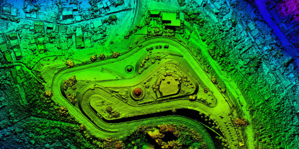
By using heat maps captured from the sky, you can identify risks that the human eye cannot see.
Thermal imaging detects temperature differences across surfaces. And those differences often signal early warnings of cracks, leaks, or electrical overloads.
For engineers, city planners, and utility operators, thermography is more than a tool. It is a way to prevent failure, cut costs, and protect communities.
What Is Thermography?
Thermography is the process of using infrared sensors to measure temperature changes.
Drones or aircraft are equipped with thermal cameras to capture these images. The data is then processed into heat maps that show where temperatures rise or fall abnormally.
Why It Works?
As materials heat and cool in different ways, a small fault in a structure will change its thermal pattern. Cracks, leaks, or overloaded circuits show up as hot or cold spots. These spots highlight risks long before they are visible.
Why Thermography Matters for Infrastructure?
Infrastructure is aging worldwide. A World Economic Forum study noted that nearly 43 percent of bridges in the United States are over 50 years old. Similar challenges exist across roads, pipelines, and power systems. Failing infrastructure costs billions each year in repairs and lost productivity.
Thermography helps you detect issues early. Instead of waiting for a failure, you can see the warning signs and act in time.
Key Benefits of Thermography
Early Detection of Problems
Thermography highlights weaknesses in structures, pipelines, or electrical systems before they fail. Early detection allows targeted maintenance. This prevents costly shutdowns.
Non Contact and Non Destructive
Traditional inspections often require physical access. That means delays and safety risks. Thermography allows you to capture accurate data without touching the structure.
Wide Area Coverage
Drones can cover large areas quickly. Bridges, highways, or pipelines that stretch for miles can be scanned in hours instead of weeks.
Cost Savings
By finding problems early, thermography reduces repair costs. According to the US Department of Energy, predictive maintenance techniques like thermography save between 8% and 12% compared to traditional maintenance.
Improved Safety
Heat maps reveal risks that could lead to fires, collapses, or leaks. Acting on these insights protects both workers and the public.
Real World Applications
Bridges and Roads
Thermal imaging is able to identify cracks, weak joints, or water damage in bridges and highways. This helps prevent sudden failures and supports long term safety.
Power and Utilities
Overloaded circuits, faulty transformers, and hidden cable faults clearly appear in heat maps. Utility operators use this thermography to avoid blackouts and extend equipment life.
Pipelines
Sometimes, pipelines carrying oil, gas, or water can develop leaks underground. Fortunately, thermal sensors can detect the changes in soil temperature above these leaks to provide early warnings.
Buildings
Thermography can show you where buildings lose heat through poor insulation or hidden cracks. It can also help identify water damage inside walls or roofs.
Rekon’s Experience with Thermography
At Rekon we have supported projects where thermography revealed risks that would have been missed by traditional surveys.
In one case, our drone based heat mapping identified a hot spot on an electrical line in a remote region. By repairing it quickly, the client avoided a large-scale power outage.
In another project, thermal imaging detected water intrusion under a section of roadway. Engineers were able to repair the affected area before it developed into a sinkhole.
Our approach is built on accuracy, speed, and practical insights. We deliver more than images. We deliver data you can act on.
So, if you are considering thermography for your infrastructure project, contact our team today. We will help you understand what risks may be hidden and how to address them.
Why Heat Maps Are a Game Changer?
Heat maps from the sky turn invisible risks into visible data. They change the way infrastructure is monitored.
Therefore, instead of waiting for failures, you gain a proactive method of risk management.
Consider this: A minor crack in a bridge support may not be visible to the eye. But thermal imaging will show a temperature variation caused by stress in the material. That small insight can prevent a major accident.
The Future of Thermography
Thermography is becoming more advanced every year. Drones with high resolution sensors now deliver detailed heat maps in real time. AI tools are improving interpretation, making risk detection faster and more accurate.
Over time, thermography will become a standard in infrastructure management.
In fact, cities, governments, and private companies are already investing in it to reduce costs and extend the life of critical assets.
Conclusion
Infrastructure is the backbone of modern life. Yet hidden risks can threaten safety and your budgets every day. With thermography, you get the ability to foresee those risks before they turn into disasters.
Heat maps from the sky reveal cracks, leaks, and overloads that would otherwise stay hidden. By acting early, you save time, cut costs, and protect lives.
Rekon is passionate about using thermography to support safer and smarter infrastructure projects. If you want to learn how heat maps can strengthen your work, contact us today.