How Detailed Is Drone Photogrammetry for Topographic Mapping
Accurate terrain data is critical for planning any engineering or construction project.
Without reliable mapping, even small elevation errors can lead to costly mistakes later.
That is why photogrammetry for topographic mapping is gaining attention as a fast and precise solution.
Today, projects demand both speed and accuracy in data collection.
Where traditional surveying methods often struggle to meet tight timelines while maintaining detail.
However, drone-based solutions are changing how you capture and analyze terrain data.
If you are wondering how detailed and reliable this approach really is, you are not alone. Let’s break down how drone photogrammetry works and what level of detail you can expect.
What Makes Photogrammetry for Topographic Mapping So Detailed
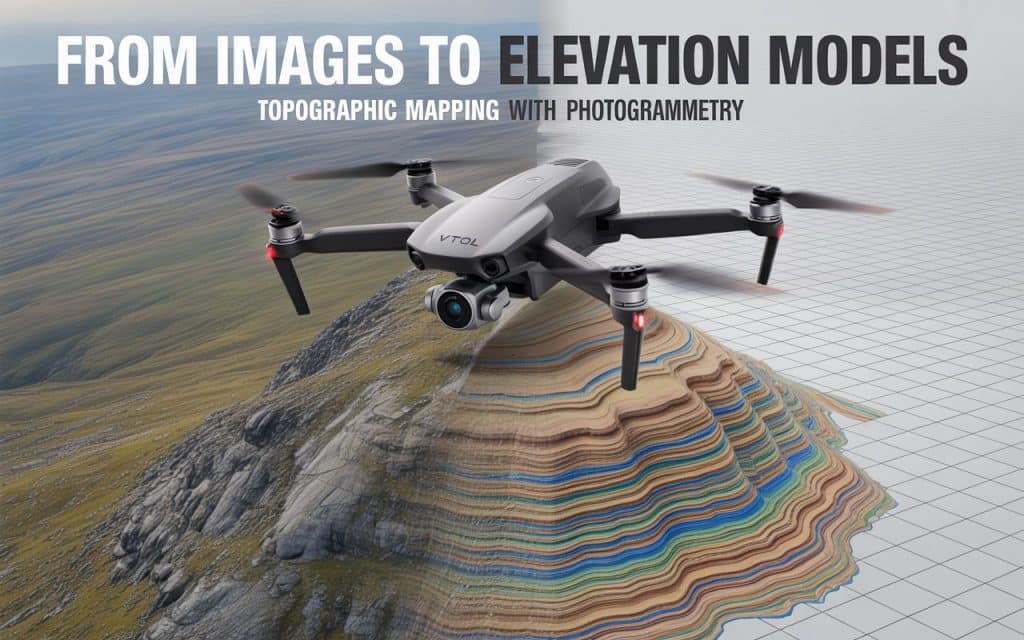
Photogrammetry for topographic mapping relies on capturing overlapping aerial images from multiple angles. These images are processed using software to generate accurate terrain models. The more overlap and image quality you have, the better the final results.
This process creates outputs like digital surface model (DSM) and digital terrain model (DTM). A DSM represents everything on the surface, including vegetation and structures. Meanwhile, a DTM removes those elements to show the bare earth terrain.
Because of this layered data, you gain both visual detail and elevation accuracy. This makes aerial photogrammetry mapping highly effective for topographic analysis.
How Accurate Is a Topographic Drone Survey
Accuracy is one of the biggest concerns when using drones for mapping. A well-executed topographic drone survey can achieve centimeter-level accuracy under the right conditions. This depends on flight planning, ground control points, and processing quality.
According to a study published by ScienceDirect, properly controlled photogrammetry surveys can achieve vertical accuracy within a few centimeters.
Additionally, research published by MDPI shows that drone photogrammetry can produce highly reliable elevation data and accuracy within 2cm, when combined with ground control points.
These findings confirm that photogrammetry survey accuracy is suitable for many engineering and construction applications.
Understanding DSM and DTM in Photogrammetry Mapping
When working with photogrammetry for topographic mapping, understanding DSM and DTM is essential. These models help you interpret terrain in different ways depending on project needs.
A digital surface model (DSM) includes buildings, trees, and other objects. This is useful when analyzing surface features or planning site layouts. In contrast, a digital terrain model (DTM) removes those objects to show ground elevation only.
This distinction is important for grading, drainage planning, and earthwork calculations. By using both models, 3D photogrammetry mapping provides a complete understanding of your site.
Factors That Affect Photogrammetry Survey Accuracy
While photogrammetry for topographic mapping is highly detailed, several factors influence the final output. Understanding these helps you get the best possible results.
First, image overlap plays a critical role. Higher overlap ensures better alignment during processing. This directly improves image-based terrain mapping accuracy.
Second, ground control points improve spatial accuracy. These reference points align aerial data with real-world coordinates. This is essential for achieving reliable results in a topographic drone survey.
Third, weather and lighting conditions matter. Consistent lighting and stable weather help maintain image quality. Poor conditions can reduce the accuracy of your final models.
Finally, processing software and expertise also impact results. Accurate aerial photogrammetry mapping depends on proper data handling and analysis.
Where Drone Photogrammetry Adds the Most Value
You will find photogrammetry for topographic mapping useful across many industries. In construction, it supports site planning, grading design, and progress tracking. Accurate terrain data helps reduce errors and improve efficiency.
In infrastructure projects, topographic drone survey data supports road design and utility planning. It provides clear elevation models without requiring extensive fieldwork.
Environmental and land development projects also benefit from image-based terrain mapping. You can monitor terrain changes, analyze slopes, and plan sustainable developments.
If you want to understand how aerial data supports inspections as well, you can read our blog here: The Value of Aerial Inspections for Infrastructure Projects
Comparing Photogrammetry with Traditional Survey Methods
Traditional survey methods are still widely used, but they often require more time and resources. Manual data collection can be slow, especially for large or complex sites. This can delay project timelines and increase costs.
In contrast, photogrammetry for topographic mapping allows faster data capture using drones. You can cover large areas in a single flight while maintaining detail. This improves both speed and efficiency.
Moreover, 3D photogrammetry mapping provides visual context that traditional methods may lack. You can see terrain features clearly instead of relying only on point measurements. This makes planning and communication easier.
When You Should Use Photogrammetry for Topographic Mapping
Not every project requires the same approach, but photogrammetry for topographic mapping works best in certain scenarios. It is ideal for large sites where speed and coverage matter.
It is also effective when visual outputs are important. For example, planners and stakeholders benefit from detailed 3D models and orthomosaics. These outputs improve understanding and decision making.
However, in areas with dense vegetation, LiDAR may be more suitable. Combining both technologies can often provide the best results.
If you are planning a project and need accurate terrain data, you can reach out to Rekon Solutions to discuss your requirements. The right approach ensures your mapping results meet project expectations.
Improving Detail in Aerial Photogrammetry Mapping
To get the most detailed results from photogrammetry for topographic mapping, certain best practices should be followed. These steps help maximize accuracy and data quality.
Plan flights with sufficient overlap and consistent altitude. This ensures reliable image capture across the site. Use high resolution cameras for better detail in outputs.
Incorporate ground control points wherever possible. These improve alignment and accuracy significantly. Also, ensure proper data processing using reliable software tools.
By following these practices, your photogrammetry survey accuracy improves noticeably. This leads to better decision making and fewer project risks.
FAQs
How accurate is photogrammetry for topographic mapping?
With proper planning and ground control points, photogrammetry survey accuracy can reach centimeter level precision.
What is the difference between DSM and DTM?
A digital surface model (DSM) includes objects like trees and buildings. A digital terrain model (DTM) shows only the ground surface.
When should you use a topographic drone survey?
A topographic drone survey is ideal for large areas where fast and detailed mapping is required.
Is photogrammetry better than traditional surveying?
Photogrammetry for topographic mapping is faster and provides visual data, but both methods can complement each other.
Moving Forward with Better Mapping Decisions
Accurate terrain data is essential for successful project outcomes. Photogrammetry for topographic mapping offers a reliable and efficient way to capture that data. It combines speed, detail, and flexibility in one solution.
As mapping needs continue to grow, adopting modern methods becomes necessary. Aerial photogrammetry mapping allows you to work smarter while maintaining accuracy.
If you are looking to improve your mapping workflows, consider working with experienced professionals. At Rekon Solutions, we help you achieve accurate and actionable results for your projects. Get your quote here.
