Mining has always been one of the most data-heavy industries in the world.
Whether it’s calculating volumes, planning excavation, or ensuring worker safety, every decision depends on accurate data.
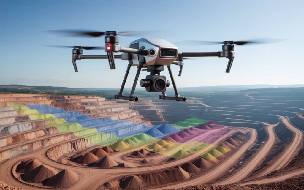
That’s where drone technology steps in.
Today, mine survey operations are faster, safer, and more accurate than ever before thanks to mine mapping drones and UAV mine survey methods.
So, how exactly are drones changing mine surveying, and why are companies in Canada and around the world making the switch? Let’s explore.
What Is Mine Surveying and Why Does It Matter?
Mine surveying is the process of measuring, mapping, and analyzing the surface or underground layout of a mine. It helps determine the volume of materials extracted, track site progress, and ensure compliance with safety and environmental regulations.
Traditional mine surveys often require workers to physically enter hazardous areas to take measurements. This not only takes more time but also increases risks.
Drones, however, allow teams to perform accurate surveys from the air, enuring that the process is quicker, safer, and much more efficient.
How Drones Are Transforming Mine Surveys
1. Faster Data Collection
In the past, surveying large mine sites could take days or even weeks. With mine mapping drones, teams can now capture detailed aerial data in just a few hours.
Drones equipped with high-resolution cameras and LiDAR sensors can cover large areas in a single flight, collecting thousands of data points.
For example, A recent study in the Journal of Archaeological Science highlights how drone photogrammetry can decrease data acquisition from several hours or days to mere minutes, covering larger areas with high-resolution imagery and data
Therefore, mining companies can make faster decisions and keep their operations running smoothly without long pauses for survey work.
2. Higher Accuracy With LiDAR and Photogrammetry
Modern drones are equipped with mining LiDAR technology and photogrammetry sensors that generate detailed 3D models of mine sites. These models allow engineers to measure distances, calculate volumes, and identify changes in terrain with pinpoint accuracy.
LiDAR sensors can capture precise elevation data even in areas covered by vegetation or debris. Resultantly, mine planners can identify potential hazards, design safer excavation routes, and plan stockpile movements more accurately.
For more on how LiDAR improves data collection, you can read our previous blog on LiDAR services in Canada.
3. Enhanced Safety for Workers
Mine sites are often filled with risks such as steep slopes, unstable ground, and heavy machinery. Traditional mine surveying exposes workers to these dangers. With UAV mine survey techniques, drones can safely access these high-risk areas and collect the required data without putting surveyors in harm’s way.
Therefore, mining companies can maintain high safety standards while still getting the accurate measurements they need.
As a result, fewer people need to enter hazardous zones, reducing both risk and downtime.
4. Accurate Volumetric Analysis
Calculating how much material has been extracted or how much remains in a stockpile is one of the most critical parts of mine surveying. Volumetric analysis using drones provides far more accurate results than manual methods.
Drones can generate 3D models that allow precise calculation of volume changes over time.
This helps mine operators monitor progress, plan future excavation, and ensure they’re meeting production targets.
5. Simplified Stockpile Measurement
Keeping track of materials on-site is another major challenge in mining. Manual stockpile measurements often require workers to climb piles or use heavy equipment to estimate volumes. This is not only slow but also dangerous.
With drone-based stockpile measurement, a single flight can capture detailed topographic data of multiple piles at once. Afterwards, advanced software processes the data into accurate 3D maps.
This allows mine managers to monitor material inventory in real time, to make reporting and compliance much easier.
6. Real-Time Monitoring and Reporting
Another major advantage of mine mapping drones is their ability to provide real-time updates. After each flight, drones send data directly to processing software that creates detailed 3D maps and orthophotos within hours.
This means managers don’t need to wait days to access reports. They can review current site conditions almost instantly. As a result, decisions can be made faster, and problems can be identified before they become costly.
7. Cost Savings Over Time
Switching to UAV mine survey methods doesn’t just save time, it also reduces costs. Fewer staff are needed on-site, insurance and safety costs go down, and operations experience less downtime. The initial investment in drone technology pays off quickly.
Although the upfront expense may seem high, the long-term benefits make it a smart financial move for mining operations.
The Role of Mining LiDAR in Underground and Surface Surveys
LiDAR technology has become one of the biggest advancements in modern mining. By sending thousands of laser pulses per second, LiDAR sensors create extremely accurate 3D representations of both surface and underground mine areas.
For surface operations, mining LiDAR can map terrain, track changes in slopes, and identify erosion. Underground, it helps map tunnels and shafts where visibility is limited. These precise 3D models improve safety and assist engineers in designing efficient extraction plans.
Therefore, LiDAR not only improves accuracy but also gives mining teams a deeper understanding of their site’s physical conditions — helping them make safer and smarter decisions.
How Drones Support Environmental Compliance
Mining operations must follow strict environmental guidelines. Drones make it easier to comply by offering accurate data for environmental assessments and rehabilitation tracking. Through mine survey data, companies can monitor land changes, water flow, and vegetation impact around their sites.
Furthermore, drones help track land reclamation progress after mining is complete. Resultantly, companies can ensure they meet environmental restoration goals and maintain transparency with regulators.
]Partner With Us for Aerial Mine Surveying
As drone technology continues to evolve, Rekon Solutions is helping mining companies across Canada collect accurate, reliable, and cost-effective data. Our team specializes in mine survey operations using advanced mine mapping drones and UAV mine survey systems.
We provide end-to-end solutions, including aerial data capture to volumetric analysis, stockpile measurement, and mining LiDAR mapping. With Rekon, your mining operations can achieve better results in less time and with greater safety.
Check out our previous blog on aerial mapping in BC to learn how UAVs are transforming data collection across industries.
Conclusion
Mine surveying with drones has completely changed how mining companies collect and use data. It’s faster, safer, and more accurate than traditional methods. From volumetric analysis to stockpile measurement and terrain mapping, drones deliver clear insights that help operations stay efficient and safe.
As demand for data-driven mining continues to rise, UAV mine survey methods will play an even bigger role in the future of the industry. If you’re ready to bring greater precision and safety to your mine operations, Rekon Solutions can help. Reach out today to learn how our mine surveying services can make your data collection faster, easier, and more reliable.
