Have you ever wondered which technology works best for your aerial survey?
In the world of topographic data collection there are two powerful tools that often come up in conversations: photogrammetry and LiDAR.
Both have their strengths.
Yet when it really matters you need to know exactly when to choose one over the other.
That is why understanding drone lidar and how it compares to photogrammetry.
In this guide we will break down the key differences between these technologies and explain when drone lidar is the better choice.
We will also look at real use cases and help you understand how to decide between lidar mapping and photogrammetry for your specific needs.
What is Drone LiDAR
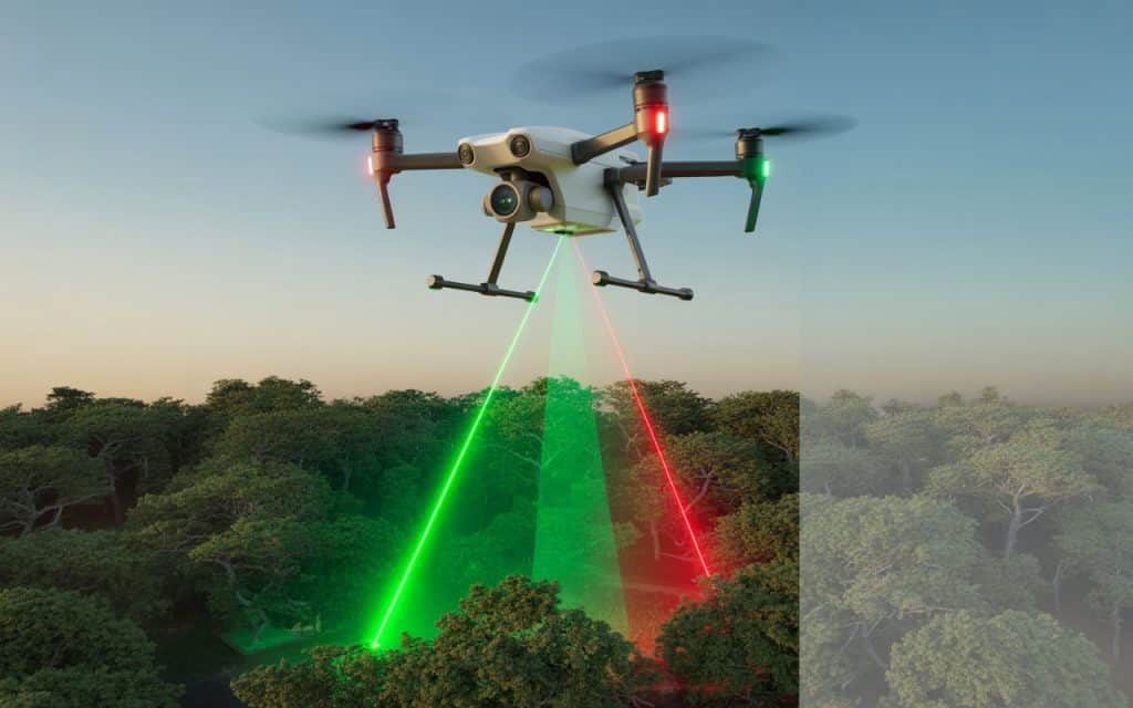
Drone lidar stands for light detection and ranging when applied on unmanned aerial vehicles. It uses laser scanners to measure distances between the aircraft and the ground.
For Lidar mapping, thousands of laser pulses are emitted every second. As these pulses hit the surface the time it takes for them to return to the sensor is recorded.
This allows the system to build extremely accurate three dimensional data of the terrain and objects on it.
The result of lithium based scanning is a detailed point cloud that reveals variations in surface elevation structure and shape with high fidelity. This makes lidar scanners ideal for applications that demand precision.
How Lidar Mapping Works
To capture lidar data a drone carries a lidar sensor above the area of interest.
Where the sensor emits laser pulses while inertial measurement units and GPS records the orientation and position of the scanner.
Once the flight is complete the collected data points are processed to produce a dense three dimensional model of the environment.
This processed data is ideal for generating bare earth models terrain contours vegetation analysis and other outputs needed in many industries.
Because lidar sees through vegetation and captures accurate ground returns it often produces more reliable elevation data than image based methods.
Lidar vs Photogrammetry What is the Difference
At a high level both lidar and photogrammetry create representations of the surface. Yet they use very different sensing methods.
Photogrammetry uses overlapping images to reconstruct three dimensional surfaces from two dimensional photos. It identifies common points in multiple images and uses those to build a reconstructed model.
Lidar on the other hand uses active laser scanning to directly measure distances. This means lidar does not rely on visual features to create accurate depth information.
This difference is important and it is one of the reasons you sometimes choose lidar over photogrammetry.
When You Should Choose LiDAR Over Photogrammetry
Vegetated or Forested Terrain
One of the clearest cases for choosing lidar mapping is when your survey area includes dense vegetation. Lidar pulses can penetrate gaps in foliage and reach the ground beneath. This allows you to capture accurate ground elevation even under heavy canopy.
Photogrammetry often struggles here because images taken from above are blocked by leaves, branches and thick vegetation. The result can be a surface model that floats above the true ground rather than representing it.
Complex Topography and Steep Slopes
If your project area includes steep slopes, cliffs or rugged terrain, lidar can capture accurate elevation values without distortion. This is because lidar records direct distance measurements for each point.
In contrast, photogrammetry may produce artifacts or less accurate elevation data in steep areas because the angles of image capture can warp the reconstructed surface.
Projects Requiring High Precision Elevations
Some projects require centimeter level precision in their data. Applications like infrastructure design, floodplain modelling and mining surveys often depend on this level of accuracy. Lidar scanners deliver high resolution vertical and horizontal measurements that are hard to replicate with image based methods.
In cases where precision is mandatory, lidar becomes the sensible choice.
Under Low Light or Poor Visibility Conditions
Because lidar uses active laser light it can capture data even when lighting conditions are not ideal. Early morning low sun shadows, dust or cloud cover do not impede laser pulses as much as they affect daylight based imaging.
If your survey windows include conditions where clear images are hard to capture, lidar maintains consistent returns.
Use Cases for UAV LiDAR Applications
Infrastructure Planning and Road Design
Infrastructure projects often require accurate surface models to plan roads, bridges and utilities. Lidar mapping provides highly detailed topographic maps that support design and engineering workflows. This can be critical when small elevation differences matter in drainage planning or alignment.
Floodplain Analysis and Risk Assessment
When modelling areas that might flood or erode lidar provides accurate ground models that help engineers understand water flow and gradients. This is especially important in regions where vegetation obscures the ground.
Forest and Vegetation Studies
In ecological and forestry work lidar can be used to measure canopy height biomass and structure. Because the laser pulses capture returns at multiple heights lidar provides detailed vertical information that photos cannot deliver.
Mining and Earthworks
Planning and monitoring excavation sites requires precise volume calculations and surface data. Lidar survey data gives mining professionals the accuracy and repeatability they need when comparing change over time.
Lidar Survey BC and Local Context
If your project is based in British Columbia or similar regions with rugged terrain and dense forests a lidar survey BC approach can save time and improve accuracy. These landscapes are challenging for photogrammetry alone and benefit from the robust nature of lidar scanning.
When Photogrammetry Might Be Sufficient
Photogrammetry remains a powerful tool in many scenarios. It works well when:
- The surface is mostly bare and unobstructed
- Visual textures are needed
- High resolution imagery is important for documentation
- Project budgets are tight and lidar precision is not necessary
In these cases photogrammetry survey outputs can be detailed and visually rich. Yet for applications where elevation precision and ground penetration are crucial, lidar still holds the advantage.
Combining Lidar and Photogrammetry
In many large projects both methods are used together. Lidar provides the accurate ground model while photogrammetry supplies high resolution imagery textures. When combined the result can be a rich and precise 3D representation that serves many analysis needs.
Using both methods allows you to leverage the strengths of each technology while minimizing their individual limitations.
How to Decide Between Lidar and Photogrammetry
Understand Your Project Requirements
Start by defining your accuracy, expectations, data deliverables and environmental conditions. If ground accuracy and feature penetration matter most, lidar may be the right decision.
Consider the Terrain and Vegetation
Photogrammetry alone may be adequate if the environment is level, open, and devoid of vegetation. Lidar can perform better than image-based techniques when the terrain is rough and covered in trees.
Review Project Timeline and Cost
Lidar flights and processing can be more expensive than standard aerial imaging. Yet when the cost of errors is high lidar may save money in the long run by reducing rework and improving reliability.
Think About Final Deliverables
If you need maps models, contours surfaces and color imagery a combination of lidar and photogrammetry may produce the richest end product.
How Rekon Uses Drone LiDAR
At Rekon Solutions, we provide advanced lidar mapping services tailored to client needs. Our team deploys high performance lidar scanners on drone platforms to capture precise elevation and surface data.
Whether you are planning infrastructure, conducting environmental assessment or developing land in challenging terrain, our team helps you choose the right survey method. We integrate lidar with other aerial technologies to produce accurate and actionable results so you can make confident decisions.
Conclusion
Understanding lidar vs photogrammetry is crucial when selecting the best survey method for your project. Drone lidar provides robust elevation data, dense point clouds and reliable results in complex environments. It excels in areas where vegetation shadowing and steep topography make image based methods less effective.
When precision matters and when ground detail cannot be compromised; lidar mapping often delivers the greatest value. Yet when landscapes are simple and clear, photogrammetry remains a cost effective tool.
If you are evaluating methods for your next project contact Rekon Solutions to explore how UAV lidar applications can bring clarity and accuracy to your data collection workflow.
FAQs
What makes drone lidar different from photogrammetry
Drone lidar uses lasers to measure distance directly while photogrammetry uses images to reconstruct 3D surfaces. Lidar is often more precise and can penetrate vegetation more effectively.
How accurate is lidar mapping
Lidar systems can achieve centimeter level accuracy when properly calibrated and flown with quality ground control data.
Is lidar survey more expensive than photogrammetry
Lidar can cost more but it often saves money in complex projects by reducing errors, rework and providing dependable data.
Can lidar and photogrammetry be used together
Yes, combining lidar and photogrammetry gives you accurate surface models with high resolution imagery textures for richer 3D results.
