Have you ever wondered how LiDAR mapping can reveal hidden details that traditional mapping methods miss?
From uncovering buried landscapes to creating precise 3D models of cities and forests, LiDAR (Light Detection and Ranging) is transforming how professionals map and measure the world.
In this post, we’ll explore what makes LiDAR mapping such a breakthrough technology, how it compares to other mapping methods like photogrammetry, and why industries across the globe are rapidly adopting it.
What is LiDAR Mapping?
LiDAR mapping uses laser light to measure distances between a sensor and surrounding objects.
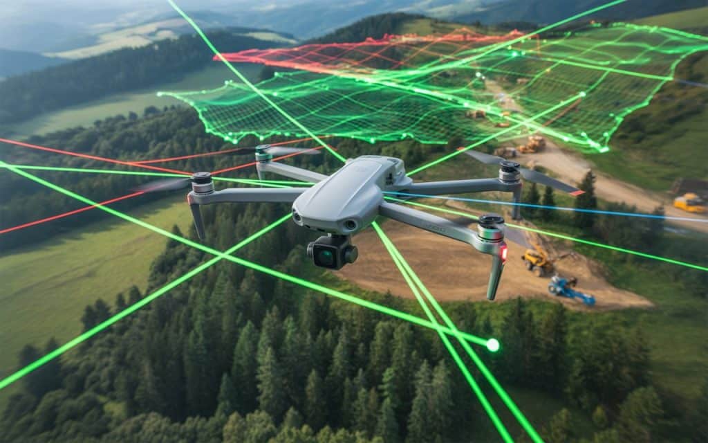
Mounted on drones, aircraft, or vehicles, LiDAR systems emit thousands of laser pulses per second, recording the time it takes for each pulse to bounce back.
This process generates a “point cloud”, which is a dense 3D dataset that reveals the exact shape of terrain, vegetation, and structures.
Unlike standard cameras that capture images in visible light, LiDAR sensors can penetrate vegetation and detect fine changes in elevation. It makes LiDAR mapping indispensable for surveying, construction, mining, and environmental studies.
According to research published in Sensors Journal (MDPI), LiDAR-based mapping achieves elevation accuracy within a few centimeters, outperforming most optical methods in both resolution and depth measurement (source).
Why LiDAR Mapping is a Game Changer
1. Unmatched Accuracy and Detail
The precision of LiDAR mapping lies in its ability to collect millions of data points per second. These points form high-resolution 3D models that allow professionals to analyze terrain in extreme detail.
Whether it’s detecting subtle changes in land elevation or calculating exact distances between structures, LiDAR’s accuracy is unparalleled. Even under dense vegetation or low-light conditions, LiDAR continues to deliver reliable measurements.
This level of accuracy is especially valuable in floodplain modeling, infrastructure design, and urban planning — where even small errors can lead to costly outcomes.
2. Speed and Efficiency
Traditional ground surveys or photogrammetry-based aerial mapping can take days or even weeks to complete, depending on terrain and accessibility. With LiDAR mapping, those same areas can be surveyed in hours.
Because LiDAR sensors collect data rapidly and require minimal human intervention, projects that once demanded multiple field visits now only need a single flight. The result? Lower labor costs and faster turnaround times.
3. Ability to See Beneath Vegetation
One of LiDAR’s biggest advantages is its ability to “see through” vegetation. The laser pulses penetrate tree canopies, allowing surveyors to capture both the top of the canopy and the ground surface below.
This makes mapping an ideal tool for forestry management, archaeology, and environmental monitoring. It reveals the details that traditional imagery simply can’t capture.
4. Versatility Across Industries
LiDAR technology isn’t limited to one industry. It’s revolutionizing:
- Construction and Infrastructure: For topographic surveys, earthwork measurements, and as-built documentation.
- Mining and Geology: To monitor pit walls, calculate stockpile volumes, and detect slope movements.
- Environmental Conservation: For mapping forests, monitoring erosion, and managing floodplains.
- Archaeology: To uncover ancient settlements hidden beneath dense vegetation.
- Utilities: For inspecting power lines, pipelines, and telecommunication routes with pinpoint precision.
5. Integration with Drone Technology
When combined with drones, LiDAR mapping becomes even more powerful. Drone-mounted LiDAR systems can capture high-accuracy data across vast or inaccessible areas while minimizing costs and safety risks.
Drones equipped with LiDAR are now being used for everything from highway design to dam inspection. This combination of mobility, automation, and precision makes it one of the most advanced mapping solutions available today.
6. Enhanced Data Quality and 3D Modeling
Unlike 2D imagery, LiDAR produces detailed 3D point clouds that can be converted into elevation models, contour maps, and digital twins.
These 3D datasets provide engineers and planners with a realistic representation of the site that is essential for accurate simulations and decision-making.
Advantages of LiDAR over Photogrammetry
While both LiDAR and photogrammetry are valuable for mapping, they differ in accuracy, data type, and environmental adaptability.
| Feature | LiDAR Mapping | Photogrammetry |
| Data Type | 3D point clouds using laser light | 2D/3D images using visible light |
| Accuracy | Centimeter-level, even in low light | Dependent on lighting and texture |
| Vegetation Penetration | Yes | No |
| Weather Dependence | Minimal | High |
| Processing Time | Faster | Requires more image processing |
| Best For | Terrain, vegetation, infrastructure | Visual mapping, aesthetic models |
Simply put, LiDAR mapping provides the level of detail and consistency required for engineering-grade applications, while photogrammetry excels in visual documentation.
The Purpose of LiDAR Mapping
The primary purpose of LiDAR mapping is to collect high-accuracy spatial data for analysis, planning, and monitoring. It enables professionals to:
- Generate detailed elevation and terrain models
- Identify geological hazards
- Monitor construction progress
- Plan transportation routes
- Assess environmental impact
Whether mounted on drones, aircraft, or vehicles, LiDAR sensors provide decision-makers with precise data that can guide large-scale projects with confidence.
Challenges and Limitations
Despite its advantages, LiDAR mapping has some limitations:
- Cost: LiDAR sensors are more expensive than cameras used for photogrammetry. However, the investment often pays off through accuracy and time savings.
- Complexity: Processing and managing large LiDAR datasets require technical expertise and computing resources.
- Surface Reflection: Highly reflective or transparent surfaces (like water or glass) can sometimes interfere with data capture.
Still, advancements in sensor design and cloud-based processing are steadily overcoming these challenges, making LiDAR mapping more accessible than ever.
The Future of LiDAR Mapping
The future of mapping lies in automation and artificial intelligence. Where LiDAR sits at the heart of this evolution. As sensors become lighter and more affordable, LiDAR will play an even bigger role in real-time mapping, self-driving vehicles, and digital twins of entire cities.
According to MarketsandMarkets, the global LiDAR mapping industry is projected to surpass USD 5.6 billion by 2030, driven by its growing use in construction, energy, and transportation sectors.
Conclusion
From uncovering hidden landscapes to enabling precision engineering, LiDAR mapping is redefining how we see and shape our world. Its ability to capture ultra-accurate 3D data, penetrate vegetation, and integrate with drones makes it an indispensable tool for industries that rely on reliable spatial intelligence.
If you’re ready to experience the future of mapping, Rekon Solutions offers advanced LiDAR mapping services tailored to your project’s unique needs. Where we promise to deliver precision, speed, and actionable insights every time.
FAQs
What are the advantages of LiDAR over photogrammetry?
LiDAR offers higher accuracy, can capture data in low light, and penetrates vegetation, making it ideal for terrain and infrastructure mapping.
What is the purpose of LiDAR mapping?
Its purpose is to create accurate 3D models of terrain, vegetation, and structures for planning, engineering, and environmental management.
What is a disadvantage of using LiDAR data to map terrain?
The main disadvantages are higher equipment costs and larger data volumes that require specialized processing.
Is LiDAR mapping more accurate than drone photogrammetry?
Yes. While photogrammetry provides high-resolution visuals, LiDAR captures more precise elevation and depth information — even under dense vegetation.
Can LiDAR be used underwater?
Bathymetric LiDAR systems can map shallow waters, making them valuable for coastal surveys and flood modelling.
