Rekon Solutions – LiDAR Drones
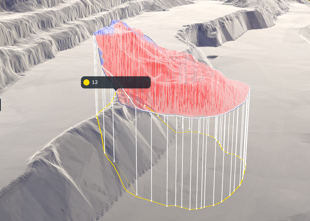
When precision mattered, Westridge turned to Rekon. Our drone photogrammetry delivered volume reports accurate within 1%, that was, faster, clearer, and built for trust.
Traditional surveys were falling short as they were slow, error-prone, and labor-intensive. It caused inventory discrepancies and pressure from the accounting team. The quarry needed reliable volume measurements, fast.

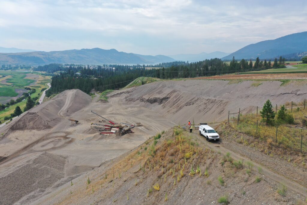
Drone photogrammetry is transforming how quarries handle stockpile volume measurement. We used it to map the stockpiles in ideal weather conditions.
The outcome: Volumes reconciled within 1% accuracy, faster processing, and a consistent baseline for future surveys.
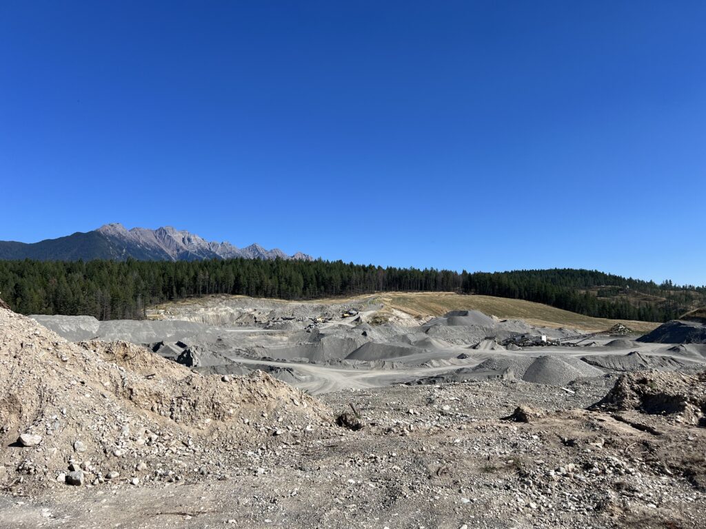
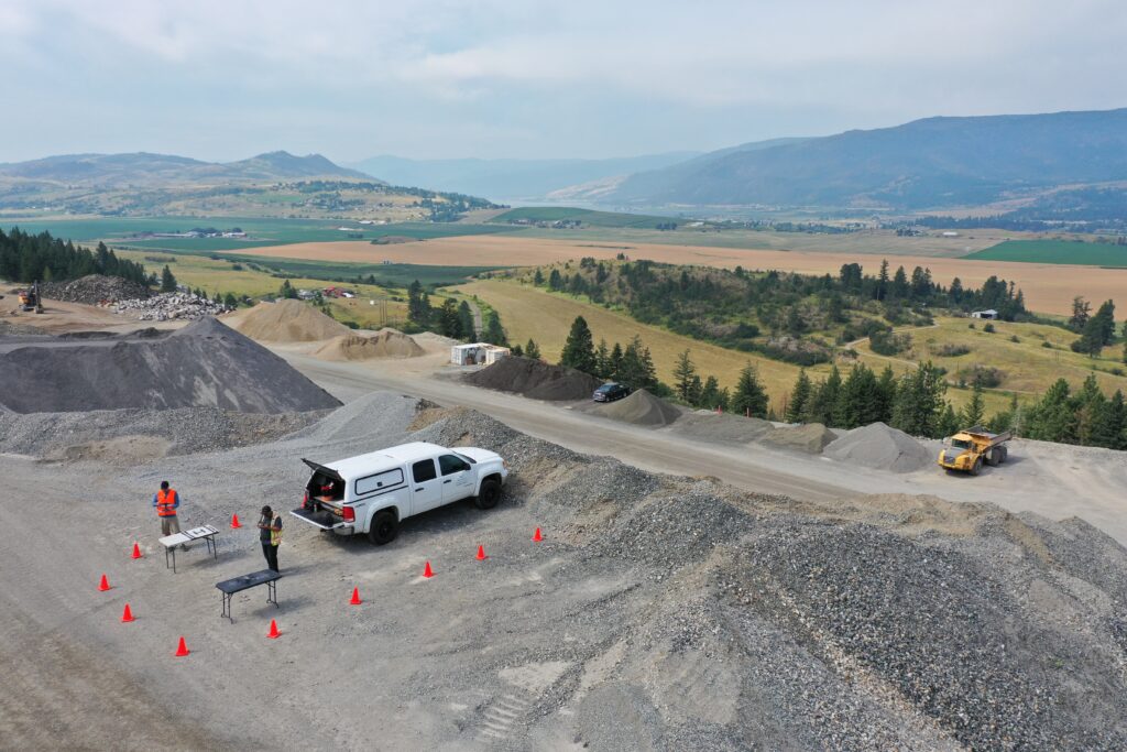
Before flying drones over Westridge’s Larkin Quarry, we studied every variable (such as terrain, access, and visibility) to ensure precision from the start.
The site was ideal for photogrammetry, allowing high-precision capture from all angles.
All delivered with speed and transparency—ready to integrate into operations or reporting systems.
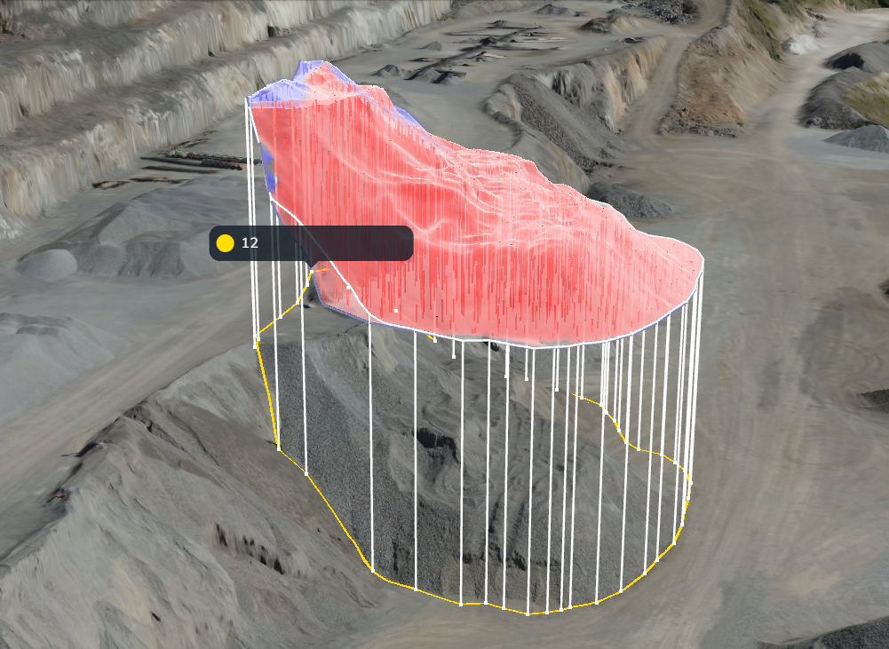
[✓] Stockpile volumes accurate within 1%
[✓] Established a baseline surface for consistent future surveys
[✓] Improved confidence in density factors
[✓] Saved time and operational costs by replacing slow, manual methods
From forests to highways, our drone and LiDAR solutions deliver accuracy, speed, and peace of mind. Let’s talk about your project Now.

See how Rekon transformed its mapping workflows with Propeller—delivering LiDAR and orthomosaic data faster than ever, while giving clients clearer insights and stronger results.