Rekon Solutions – LiDAR Drones
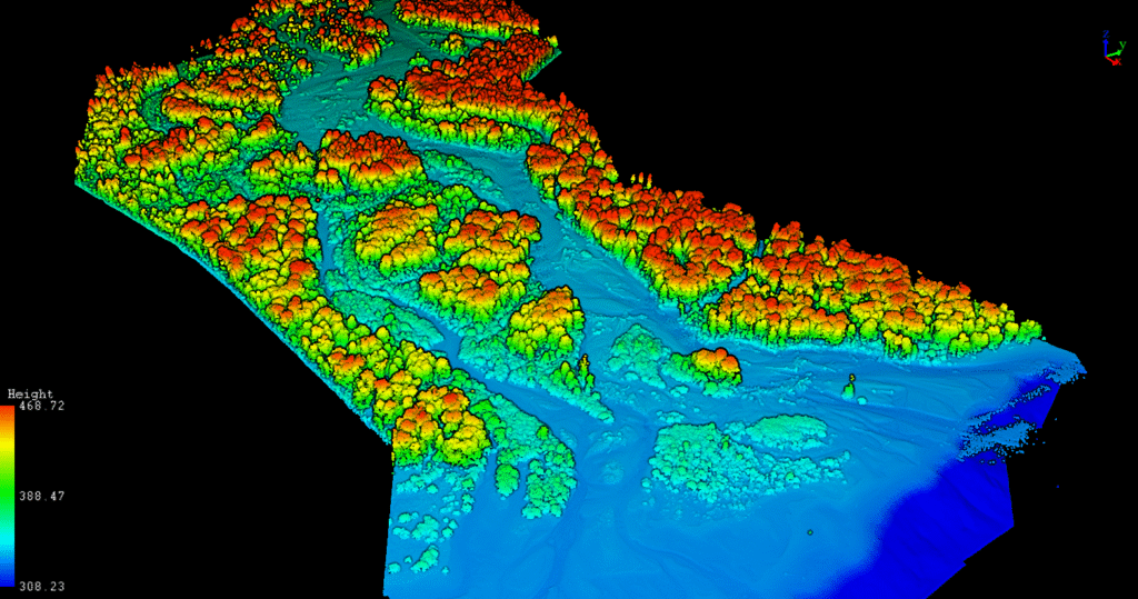
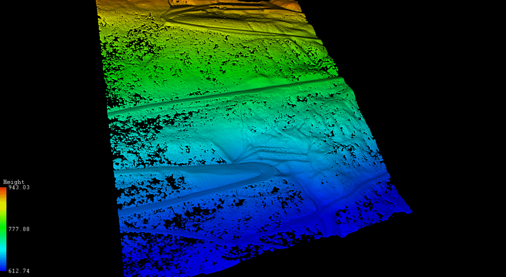
Post-wildfire erosion poses serious threats to ecosystems—especially along vulnerable riverbanks. Rekon delivered a comprehensive topographic and bathymetric model of the Lower Adams River after the 2023 fires, helping engineers assess erosion risks, restore salmon channels, and protect critical habitat.
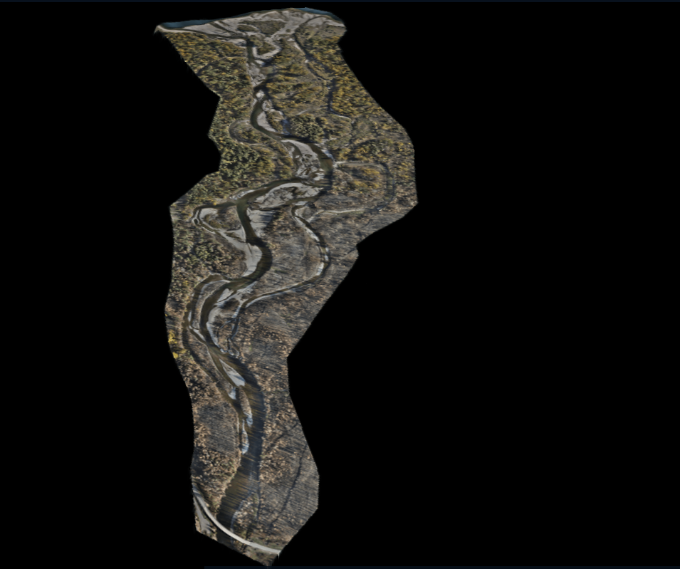
Wildfires in 2023 devastated the forests around the Lower Adams River, leaving slopes vulnerable to erosion and flash floods. This posed a major threat to one of BC’s largest salmon spawning grounds—with 4.5 million sockeye returning annually. Tetra Tech, funded by the Skwlāx te Secwepemcu’lecw (Little Shuswap Lake Band), needed an accurate topographic and bathymetric model to assess erosion risk, protect spawning areas, and potentially re-open old side channels to improve fish habitat.
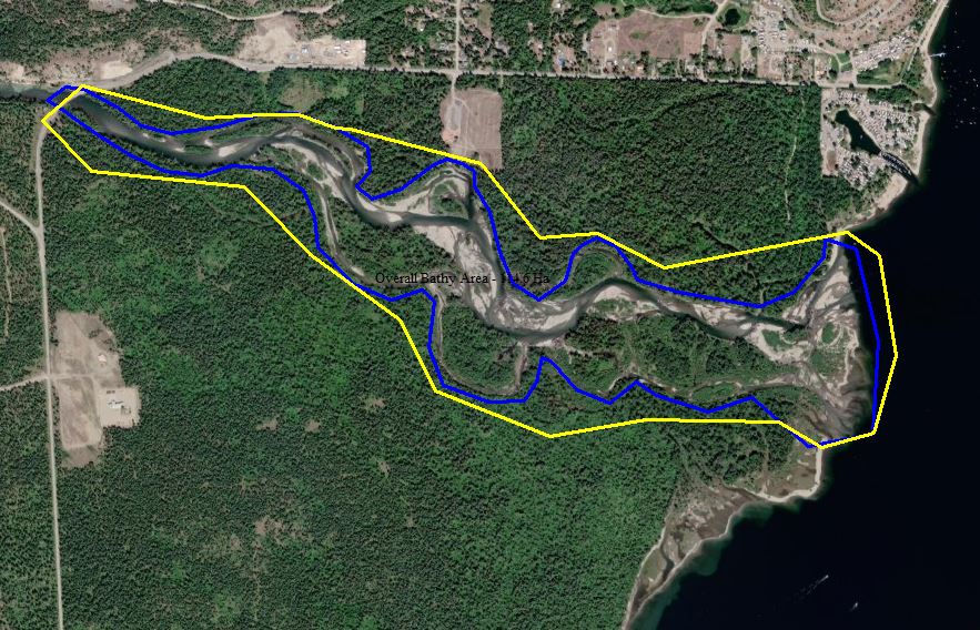
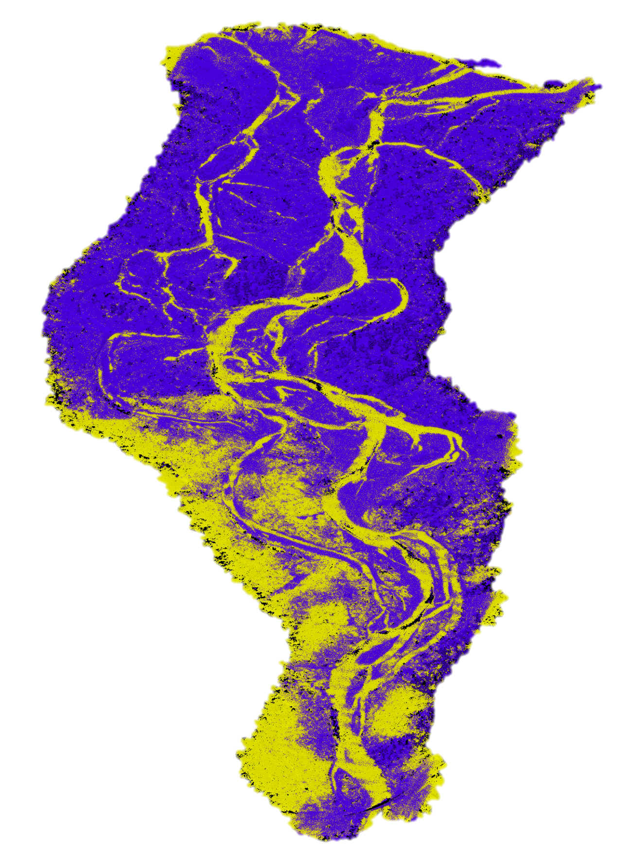
To support the hydrological study, we deployed a multi-layered mapping solution:
We used a Bathycat USV (Unmanned Survey Vehicle) equipped with a high-precision echo sounder and RTK GPS. The swift current and submerged hazards made the mission difficult—but manual piloting, safety coordination with local experts, and river-running experience kept the mission on track.

From forests to highways, our drone and LiDAR solutions deliver accuracy, speed, and peace of mind. Let’s talk about your project Now.
This e-book explores the critical constraints shaping drone LiDAR, such as payload weight vs. performance, limited flight time, high costs, and regulatory issues.