Rekon Solutions – LiDAR Drones
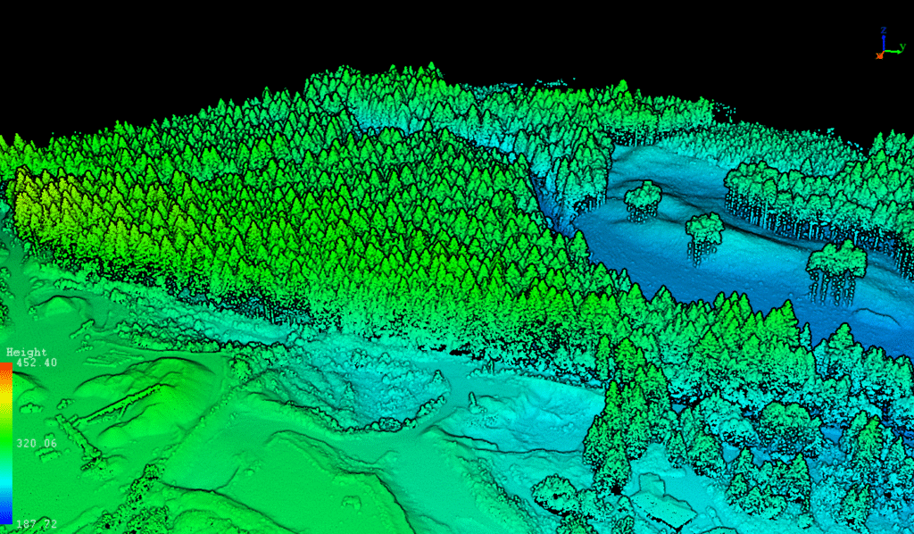
The mine engineer needed accurate topographic data for permitting and planning. Traditional walk-based surveys couldn’t access 40% of the site due to tree coverage and took up to 10× more time.


We deployed RPAS LiDAR to penetrate canopy cover, combined with photogrammetry for orthophotos. The data was processed and delivered in formats tailored to the engineer’s needs—cutting survey time by 90%.
We assessed tree cover, terrain, and survey goals to determine the right mix of LiDAR and photogrammetry. LiDAR was selected to ensure accurate ground points through dense vegetation.

From forests to highways, our drone and LiDAR solutions deliver accuracy, speed, and peace of mind. Let’s talk about your project Now.

See how Rekon transformed its mapping workflows with Propeller—delivering LiDAR and orthomosaic data faster than ever, while giving clients clearer insights and stronger results.