Rekon Solutions

Your Challenges

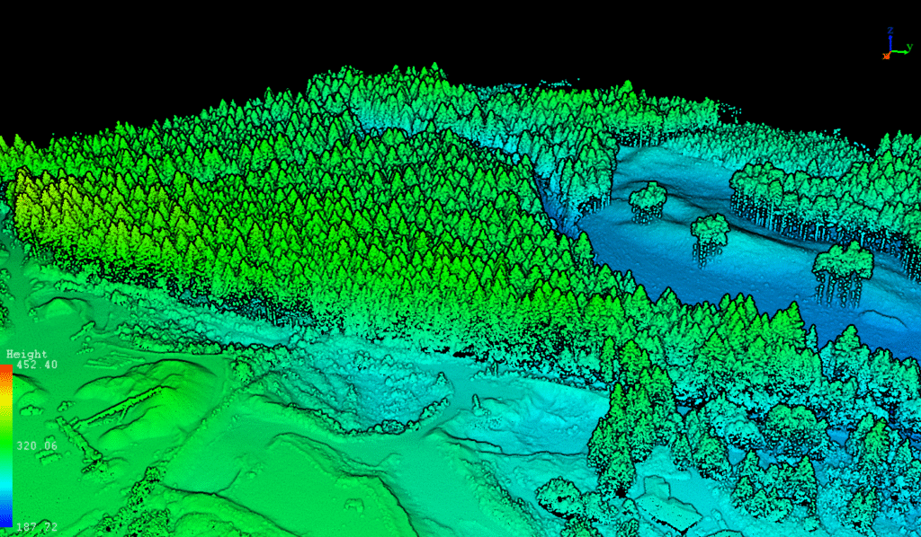
Challenge 2: Accurate Topography for Mine Design

AMR Systems chose Rekon to speed up mine design and they got 90% faster surveys, engineering-grade data, and accuracy even under dense canopy.

The Problem

The mine engineer needed accurate topographic data for permitting and planning. Traditional walk-based surveys couldn’t access 40% of the site due to tree coverage and took up to 10× more time.

The Rekon Solution

We deployed RPAS LiDAR to penetrate canopy cover, combined with photogrammetry for orthophotos. The data was processed and delivered in formats tailored to the engineer’s needs—cutting survey time by 90%.

Understanding the Site First

We assessed tree cover, terrain, and survey goals to determine the right mix of LiDAR and photogrammetry. LiDAR was selected to ensure accurate ground points through dense vegetation.

Smart Execution in the Field

  • Performed ground survey and LiDAR target setup
  • Coordinated clear-weather days for mapping
  • Conducted pre-planned drone LiDAR flights
  • Supplemented with photogrammetry for high-res visuals

Deliverables That Drove Design

  • Raw Data: LAZ, DEM, DSM, contours, orthophotos
  • CAD-ready files and Civil3D integration (on request)
  • Propeller viewer access for interactive site measurements

The Long-Term Impact

  • [✓] Cut survey time from 100 hrs to 10 hrs
  • [✓] Improved visibility and access with 5× point density
  • [✓] Enabled clear visuals of terrain obscured by canopy
  • [✓] Reduced risks from slips, equipment, and wildlife exposure

Rekon Let’s You Map Smarter

From forests to highways, our drone and LiDAR solutions deliver accuracy, speed, and peace of mind. Let’s talk about your project Now.