In the past, creating accurate maps of large areas was time-consuming, expensive, and sometimes dangerous.
But with the rise of drones, aerial mapping has entered a new era. Drones have revolutionized how we collect and analyze data, offering an efficient and cost-effective way to gather detailed information from the sky. If you’ve been curious about how drone data is supporting better planning decisions, you’ve come to the right place.
Let’s take a closer look at how drone aerial mapping works, the benefits it brings to various industries, and why UAV mapping services are becoming the go-to solution for projects big and small.
What is Aerial Mapping?
At its core, aerial mapping involves using aircraft or drones to capture images or data from above. These images and data are then processed into maps, models, and other forms of useful information. Traditionally, this was done with manned aircraft, but now mapping by drones is the preferred method for its precision, efficiency, and cost-effectiveness.
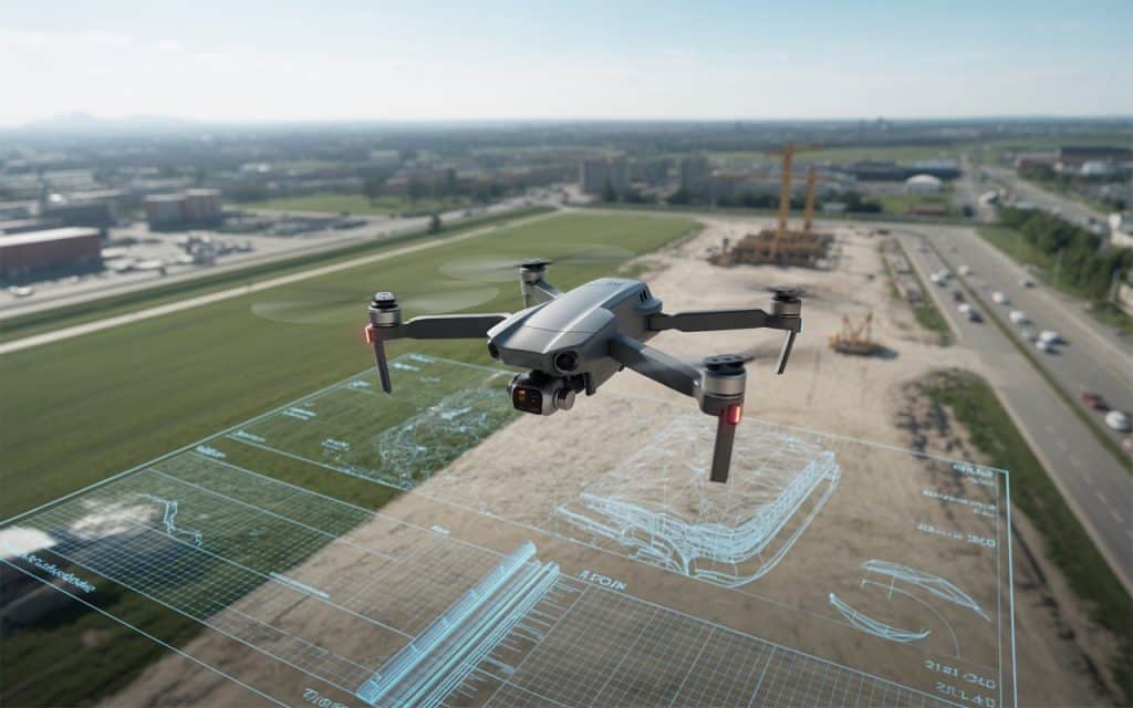
UAV mapping services can create 2D maps or 3D aerial maps that show terrain, buildings, vegetation, roads, and much more. These maps can be used for a wide range of applications, from urban planning to environmental monitoring, and even construction site management.
The Benefits of Drone Mapping
1. Speed and Efficiency
One of the biggest advantages of drone aerial mapping is speed. Traditional mapping methods, especially for large areas, could take days or even weeks. With drones, the same area can be mapped in just a few hours. Drones are equipped with cameras and sensors that capture data from every angle, creating a comprehensive view of the land in less time.
This speed doesn’t just save time; it also saves money. Less time spent on the field means lower labor and equipment costs, making UAV mapping services more affordable.
2. High Accuracy
Accuracy is crucial when it comes to planning projects, whether you’re designing a building, laying out a road, or assessing an environmental area. GIS aerial mapping and 3D aerial maps created by drones offer incredibly precise data.
By using GPS technology and advanced software, drones can achieve centimeter-level accuracy, making them perfect for tasks that require high precision. For example, a drone aerial mapping of a construction site can provide exact measurements, helping architects and engineers make better decisions.
3. Access to Hard-to-Reach Areas
Some areas are difficult or dangerous to reach, making traditional surveying methods a challenge. Think about surveying steep mountain slopes or dense forests. Mapping by drones is the solution. Drones can easily fly over these difficult terrains, collecting data without requiring surveyors to put themselves in harm’s way.
For example, airborne LiDAR BC (a LiDAR-based technology) uses drones to scan terrain, even through vegetation, giving surveyors a detailed, accurate picture of the land.
4. Real-Time Data Collection
Drones provide real-time data, which means you don’t have to wait for days to get the results of your survey. As the drone flies over the area, the data is instantly sent to the ground station, where it’s processed and analyzed. This allows for immediate decision-making, which is critical in fast-paced industries like construction and urban planning.
5. Cost-Effective
As we mentioned, UAV mapping services save both time and money. Traditional methods require a large team, expensive equipment, and a lot of labor. Drones, on the other hand, are more cost-efficient and require less manual labor. The upfront cost of purchasing or renting drones is quickly offset by the savings in time and labor.
How Are Drones Used for Mapping?
1. Urban Planning and Development
Drone aerial mapping is a game-changer for urban planning. City planners and developers can use drones to create accurate maps of existing land, infrastructure, and even future development areas. This data helps them plan roads, buildings, parks, and other infrastructure with a high degree of precision.
Drones are especially useful when mapping large areas of land that will be developed in stages. With UAV mapping services, city planners can continuously monitor the progress of construction, make adjustments as needed, and ensure everything stays on track.
2. Environmental Monitoring
Another area where drone aerial mapping excels is in environmental monitoring. Drones can be used to map forests, wetlands, or coastal areas, providing valuable data on the condition of ecosystems. For example, GIS aerial mapping can track changes in vegetation, water bodies, or even soil erosion.
These maps help environmental organizations monitor land use, assess the impact of climate change, and make informed decisions about conservation efforts. Drones provide a more efficient and less disruptive way of monitoring the environment compared to traditional methods, which can require heavy machinery and a lot of personnel.
3. Construction and Infrastructure
In construction, 3D aerial maps are used to map sites before construction begins. These maps help in designing the layout of roads, buildings, and utilities. During construction, drones can be used to monitor progress, ensuring the work is on schedule and within budget.
Additionally, drones can be used to monitor infrastructure such as bridges, powerlines, and communication towers. With drone surveying applications, these structures can be inspected quickly and accurately without the need for workers to climb or enter dangerous areas.
4. Agriculture
Farmers are increasingly using drone mapping for crop monitoring. By using drones equipped with multispectral sensors, farmers can track crop health, monitor irrigation systems, and assess soil conditions. Drones help farmers detect early signs of disease or pests, allowing them to take action before significant damage is done.
This real-time data helps farmers optimize their crop yields while minimizing the use of pesticides and water, leading to more sustainable farming practices.
5. Mining and Resource Management
In the mining industry, drone aerial mapping is used to monitor stockpiles, map mine sites, and track progress. Drones help mining companies save time by providing quick and accurate data on the size of stockpiles, the layout of the site, and the volume of material extracted.
These maps help managers make more informed decisions, from managing resources to planning future mining operations.
What Is the Primary Purpose of Using Drones for Aerial Surveying?
The main purpose of using drones for aerial surveying is to collect accurate, high-quality data in a faster, safer, and more efficient way. Whether it’s for urban planning, construction, agriculture, or environmental monitoring, drones provide a cost-effective and precise method for gathering the necessary information.
Drones are transforming the surveying and mapping industry by providing real-time data that can be analyzed quickly, leading to better planning decisions and more efficient operations.
How Rekon Solutions Can Help
At Rekon Solutions, we specialize in UAV mapping services that deliver fast, accurate, and reliable results. Our drone aerial mapping services help businesses and organizations in construction, agriculture, and environmental monitoring make better decisions with the most up-to-date data.
We use the latest drone technology to provide GIS aerial mapping, 3D aerial maps, and precision land surveys that meet your needs. If you’re ready to experience the benefits of mapping by drones, reach out to us today and find out how we can help you achieve your goals.
Learn more about our UAV mapping services by reading our previous blog on Aerial photography and how it is revolutionizing inspections.
Conclusion
Aerial mapping services powered by drones are quickly becoming a must-have tool for professionals across many industries. With drone aerial mapping, businesses can access accurate, real-time data that supports better planning and decision-making. From urban planning and construction to environmental monitoring and agriculture, drones are changing the way we gather data and make decisions.
If you’re looking for faster, more accurate, and cost-effective surveying and mapping solutions, Rekon Solutions is here to help. Get in touch with us today to learn how our UAV mapping services can take your projects to the next level.
