Drone photogrammetry construction work can save you weeks, or it can hand you a model nobody trusts. The difference is almost always in the details.
Done right, a single flight gives you an accurate, current view of the whole site. Done wrong, you get a pretty picture that quietly misleads your design team.
The good news is that the rules are simple once you know them. Accuracy comes down to a few key choices, and one of the biggest is ground control. A peer reviewed study in Remote Sensing found that the number and placement of ground control points directly drives the accuracy of UAV photogrammetry outputs, according to MDPI.
So here is what to capture, what to deliver, and what to avoid on your next site.
What should you capture on a construction site?
Good output starts with good capture. Before takeoff, you plan a flight that covers the whole site with heavy image overlap, usually around 70 to 80 percent.
That overlap lets the software match points across photos and build a solid model. For most construction site photogrammetry, you also fly at a steady height with consistent lighting to keep the imagery clean.
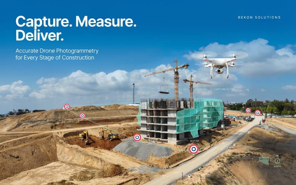
Ground control is the next must have. You place marked targets across the site and measure them with survey grade GPS, which anchors the model to real coordinates.
For trickier sites, capture both straight down and angled images. This helps the software reconstruct vertical faces, stockpiles, and structures during drone mapping construction site work. Smart capture is the foundation of every drone photogrammetry construction survey.
What deliverables should a construction survey produce?
Once the data is processed, you should receive a clear set of products, not just a raw point cloud. The core deliverable is usually an orthomosaic, a precise, map accurate image of the whole site.
From there, you get a digital surface model, contour lines, and a 3D model you can measure. Strong aerial photogrammetry construction outputs also include volume reports for cut, fill, and stockpiles, plus cross sections where your team needs them.
Most teams want these in formats that drop straight into their design tools. Good 3D mapping construction site data should open in your CAD or BIM software without a fight, so nobody wastes a day converting files.
We explain how those overlapping photos become measurable maps in our guide on how photogrammetry builds a map from overlapping photos. That process is the engine behind every deliverable in drone photogrammetry construction work.
What mistakes should you avoid?
Now for the part that saves you grief. The most common mistake is skipping or rushing ground control, which is exactly what the research above warns against.
Another is weak overlap. Fly too fast or too high, and the software cannot stitch the images cleanly, which leaves holes and warping in the model.
Watch the conditions too. Strong shadows, wet surfaces, water, and moving equipment all confuse photogrammetry, so timing your flight matters more than people expect. We cover these accuracy drivers in our guide on how to get your surveying right with photogrammetry.
Finally, do not treat every site the same. Dense vegetation hides the ground from a camera, so heavily treed sites may need LiDAR instead. These mistakes are what separate reliable drone photogrammetry construction work from a model nobody trusts.
How does photogrammetry support construction progress monitoring?
Beyond the first survey, the real power shows up over time. Flying the same site on a schedule turns single snapshots into a clear progress record.
A construction progress monitoring drone lets you compare this week to last, measure earthworks, and catch issues early. You can see exactly how much material moved and whether the work on the ground matches the plan on paper.
This is where drone surveying construction earns its budget. Instead of guessing, your team makes decisions from current, measured data.
Frequent construction site 3D mapping also builds a documented history. That record is gold for billing, disputes, and handover, since you can prove what the site looked like on any given day.
Repeat flights are where drone photogrammetry construction proves its long term value. The cost per visit drops, the data stacks up, and you end up with a complete timeline of the build rather than a few scattered surveys.
Frequently asked questions
How accurate is drone photogrammetry on a construction site?
With proper ground control and planning, it commonly reaches 2 to 5 centimetre accuracy. That is enough for design, earthworks, and most construction needs.
Do you need ground control points for construction photogrammetry?
For accurate, report grade results, yes. Ground control anchors the model and is the single biggest driver of accuracy on a site.
How often should you fly a construction site?
It depends on the pace of work. Many active sites are flown weekly or monthly to track progress and measure volumes.
Can photogrammetry replace ground surveyors on construction?
Not entirely. Drone photogrammetry construction surveys cover large areas fast, but licensed surveyors still handle legal boundaries and certified points.
How to get construction photogrammetry right
In the end, the formula is simple. Capture with care, deliver what your team can actually use, and avoid the shortcuts that wreck accuracy.
Get those three right, and drone photogrammetry construction work becomes one of the most reliable tools on your site. You plan from real data, track progress with confidence, and catch problems before they cost you.
If you have a site coming up, tell us what you need to build and how you will use the data. Rekon Solutions will plan the capture, the deliverables, and the quality checks to match, so your model is one you can build on.