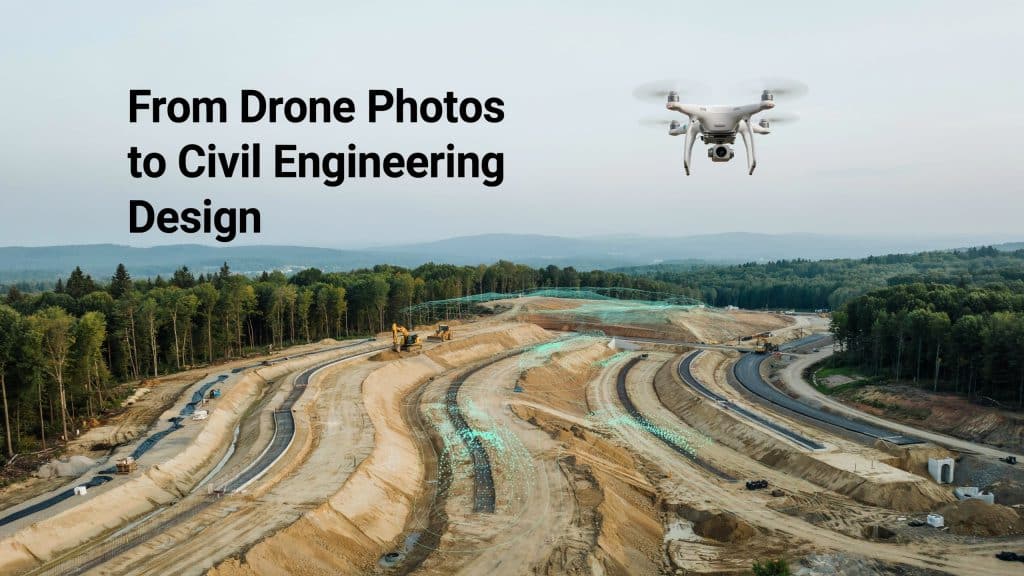
Photogrammetry in civil engineering has quietly become a design essential. It turns simple drone photos into precise, measurable models.
Engineers once waited weeks for a survey crew to finish. Now a single flight delivers the same data in hours.
That speed does not come at the expense of accuracy either. A civil engineering study clocked about 2.5 cm accuracy, per research in Drones.
That is tight enough for real design work, and it saves money. So let me show you how this data actually gets used.
What is photogrammetry and what is its purpose?
Let’s cover the basics before we go any deeper. Photogrammetry turns overlapping photos into accurate 3D measurements.
You fly a site and capture hundreds of overlapping images. Each photo overlaps the next by a wide margin. Software then rebuilds the whole scene as a detailed model.
The result is rich photogrammetry data you can actually measure. It includes maps, surfaces, and a dense photogrammetry point cloud.
Its purpose is simple, to swap slow fieldwork for fast, accurate data. This is the very foundation of photogrammetry in civil engineering.
How is photogrammetry used in civil engineering design?
Here is where it earns its keep on real projects. Engineers lean on the data across nearly every design stage.
These are the most common uses you will see today.
- Existing conditions surveys before any design begins
- Photogrammetry for site planning and early layout
- Earthworks, cut and fill, and grading design
- 3D mapping for civil engineering models and drainage
- Volume checks, inspections, and progress tracking
You can also compare surveys over time to spot change. In short, photogrammetry for engineering touches the whole design cycle. That breadth is exactly why photogrammetry in civil engineering keeps growing.
How does the data flow into Civil 3D and CAD?
Good data is only useful if your software can read it. Thankfully, photogrammetry outputs drop neatly into design tools.
You import surfaces, contours, and points straight into your workflow. Photogrammetry Civil 3D integration is now smooth and common. This saves hours of manual redrawing on every project.
Your photogrammetry mapping becomes the base surface for the whole design. It is where photogrammetry in civil engineering meets everyday drafting.
Curious how the photos become models? Our post on how photogrammetry builds a map walks through it.
Where does drone mapping fit in?
Most modern photogrammetry starts with a drone these days. It is simply the fastest way to capture a whole site.
Drone mapping for civil engineering covers large areas in one short flight. You get consistent data without closing roads or risking crews.
It also suits tricky sites that ground crews struggle to reach. You capture angles and detail a ground crew would miss. Drone surveying for construction has made this routine on active jobs.
Drone data is now the real backbone of photogrammetry in civil engineering. Good planning still matters, and getting your survey right shows how.
What about photogrammetry in construction?
Design and construction are really two sides of one coin. So photogrammetry construction work flows naturally from the design phase.
Teams reuse the same models to track progress and volumes. Photogrammetry in construction keeps everyone on one shared picture.
Reliable photogrammetry services for construction turn that data into decisions. They handle capture, processing, and quality from start to finish.
It is a natural extension of photogrammetry in civil engineering. The same model that guided design now guides the build. Done well, it saves time, money, and plenty of arguments on site.
What are the benefits for engineers?
So why are so many engineers making the switch? The advantages are hard to ignore once you see them.
- Faster data, so your design starts sooner
- Fewer site visits and safer field work
- One rich dataset for the whole team
- Accurate volumes and reliable measurements
- A permanent visual record of the site
Together, these gains speed up projects and cut costly rework. That is a strong return on a single short flight.
Frequently asked questions
1. How is photogrammetry used?
It captures overlapping photos and rebuilds them into 3D models. Engineers use those models for surveys, design, and measurement.
2. What are the four main types of photogrammetry?
The common split is aerial, terrestrial, close range, and satellite. Civil projects mostly rely on aerial and close range work. Each type suits a different scale and level of detail.
3. Is photogrammetry the same as 3D scanning?
Not quite, though the two overlap in purpose. Photogrammetry builds models from photos, while scanning uses lasers directly. Many teams happily use both, depending on the job.
4. Does photogrammetry replace ground surveyors?
No, it works alongside them on most projects. Surveyors still handle legal boundaries and certified control points.
Bringing photogrammetry into your next design
Photogrammetry in civil engineering has moved from novelty to design staple. It gives you fast, accurate data that fits straight into your tools.
Photogrammetry applied to civil engineering shortens timelines and sharpens decisions. You design from the real site, not from old or partial data.
The teams that adopt it early simply build with more confidence. That edge shows up in tighter budgets and smoother projects. Your competitors are likely exploring it already.
If you want that advantage on your next job, we can help. Tell us your goals, and Rekon Solutions will capture the data you need.