Across industries, visual data is becoming critical for smarter decision making.
Projects are expanding.
Environments are complex.
And expectations for accuracy keep rising.
As a result, traditional photography methods are no longer giving you the full picture.
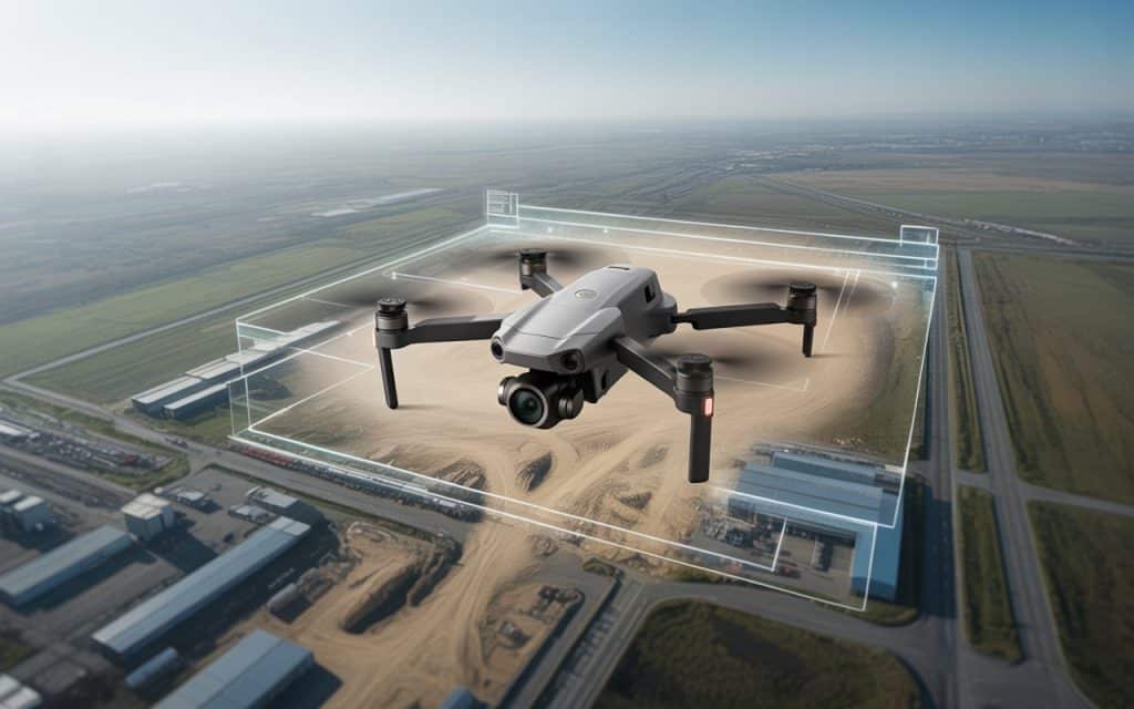
Aerial photography by drone offers a new way to see sites, assets, and environments clearly.
It provides high resolution visuals that support planning, monitoring, and operational confidence.
Instead of relying on limited ground views, you gain perspectives that reveal what truly matters.
Many teams already use drone imagery beyond marketing and media. They rely on it to improve safety, reduce guesswork, and support technical decisions.
So, if you want visuals that work harder for your projects, this approach deserves your attention.
What is aerial photography by drone?
Aerial photography by drone uses unmanned aircraft to capture images from above. These drones are equipped with advanced cameras and stabilization systems. This allows you to collect clear visuals from multiple angles safely.
Unlike traditional aerial photography, drones operate at lower altitudes. This produces sharper details and more precise imagery. You gain accuracy without relying on aircraft or heavy equipment.
The process is flexible and efficient for many environments. Flights can be planned quickly and adjusted when conditions change. That adaptability makes drone photography practical for you.
Why aerial imagery is evolving beyond marketing?
For years, aerial visuals were mainly used for promotion. They focused on branding, campaigns, and media content. Today, visual data supports real operational needs.
Industries now depend on visuals for planning and verification. Accurate imagery helps teams assess conditions and progress. This shift has expanded how aerial visuals are used.
Drone aerial photography removes many access limitations. It delivers consistent visuals without physical entry. That makes it valuable for technical and industrial projects.
Key advantages of drone based aerial photography
Drone imagery offers benefits beyond visual appeal. It improves access, accuracy, and efficiency across projects. These advantages directly support better outcomes for you.
1. Get high resolution visuals you can rely on
High-resolution drone images capture fine details clearly. Surface conditions, textures, and edges remain visible. This level of detail supports technical review.
Clear imagery reduces uncertainty during assessments. You can zoom in without losing clarity. That makes evaluations more reliable for you.
When visuals are used for reporting, quality matters. High resolution images prevent misinterpretation. They help communicate findings confidently.
2. Supports planning and site assessment
Aerial imagery plays a key role during early planning stages. You can assess terrain, access routes, and surroundings. This supports better preparation before work begins.
Drone imagery provides complete site context. It shows how structures relate to the environment. That perspective is difficult to capture from the ground.
By using aerial photography by drone, planning becomes informed. Decisions rely on real visuals instead of assumptions. This reduces risk for your projects.
3. Helps with industrial aerial photography
Industrial aerial photography supports operational and technical needs. Facilities often include elevated or restricted areas. Manual access to these areas can be risky.
Drones capture visuals without disrupting operations. This minimizes downtime while maintaining visibility. You gain insights without interrupting workflows.
In industrial environments, documentation is essential. Drone imagery provides consistent visual records. This helps track changes and conditions over time.
4. Monitors progress and asset conditions
Progress monitoring requires consistent visual reference points. Drone imagery captures the same views repeatedly. This makes comparisons easy and reliable.
Asset condition monitoring benefits from regular imagery. You can identify wear, damage, or changes early. This supports proactive maintenance planning.
With aerial photography by drone, monitoring becomes structured. Visual data supports long term asset management. Unexpected issues are reduced significantly.
5. Improves safety through remote visuals
Safety remains a major benefit of drone imagery. Drones remove the need for working at heights. They also reduce exposure to hazardous areas.
Remote visuals allow assessments from a safe distance. Fewer people are required on site. This lowers overall safety risks for you.
Over time, safer workflows improve confidence. Teams rely on visuals instead of physical access. That benefits everyone involved.
6. Efficient and time saving solution
Drone imagery significantly reduces data collection time. Large areas can be captured quickly. This helps keep projects on schedule.
Traditional photography may take days to complete. Drones accomplish the same task in hours. That efficiency matters when timelines are tight.
By using UAV photography services, workflows stay efficient. Faster visuals support quicker decisions. Productivity improves across teams.
Can you integrate imagery with other data?
Aerial imagery often complements mapping and surveying data. If you read our previous blog on UAV mapping for industrial inspection, you will see this connection. Because the visuals enhance spatial understanding for you.
Imagery also supports documentation and reporting. Clear visuals make technical data easier to interpret. This improves communication across stakeholders.
When imagery is combined with other datasets, insights improve. You gain a more complete site understanding. That supports informed decisions.
Choosing the right photography approach
Not all aerial photography solutions deliver the same value. Experience in flight planning and capture matters. Quality depends on execution, not equipment alone.
UAV photography services should align with your objectives. Image resolution and coverage must suit your needs. This ensures visuals remain useful.
A professional approach delivers consistent outcomes. It turns images into decision making tools. That is where real value lies.
Rekon approach to aerial photography
At Rekon Solutions, aerial photography is planned around operational requirements. The focus stays on accuracy, clarity, and usable visuals. This ensures imagery supports real world decisions.
The future of aerial photography by drone
Drone photography continues to evolve rapidly. Camera technology is improving and automation is increasing. Image quality will continue advancing.
As adoption grows, applications will expand further. Industries will rely more on visual data. This technology is becoming essential for you.
Aerial photography by drone is no longer optional. It is a practical operational tool. Its role will continue growing.
Frequently asked questions
What is aerial photography by drone?
Aerial photography by drone captures images using unmanned aircraft. It provides elevated views without manual access. This improves safety and accuracy.
How is drone photography used beyond marketing?
Drone imagery supports planning, monitoring, and assessments. It provides visuals for technical decision making. Many industries rely on it operationally.
What industries benefit from aerial photography by drone?
Construction, utilities, energy, and industrial sectors benefit most. They use imagery for monitoring and planning. Safety and efficiency improve.
Why are high resolution drone images important?
High resolution drone images capture fine details clearly. They support accurate assessments and documentation. This reduces uncertainty.
Moving forward with confidence
Visual data plays a critical role in modern projects. Aerial photography by drone delivers clarity and perspective. It supports smarter decisions across industries.
When accuracy and efficiency matter, aerial visuals help. They reduce risk and improve understanding. That is the true value of drone imagery.
If you are looking for reliable aerial photography services, get a quote here or contact our team to learn how we work.
