Aerial Photography: Capturing Stunning Views
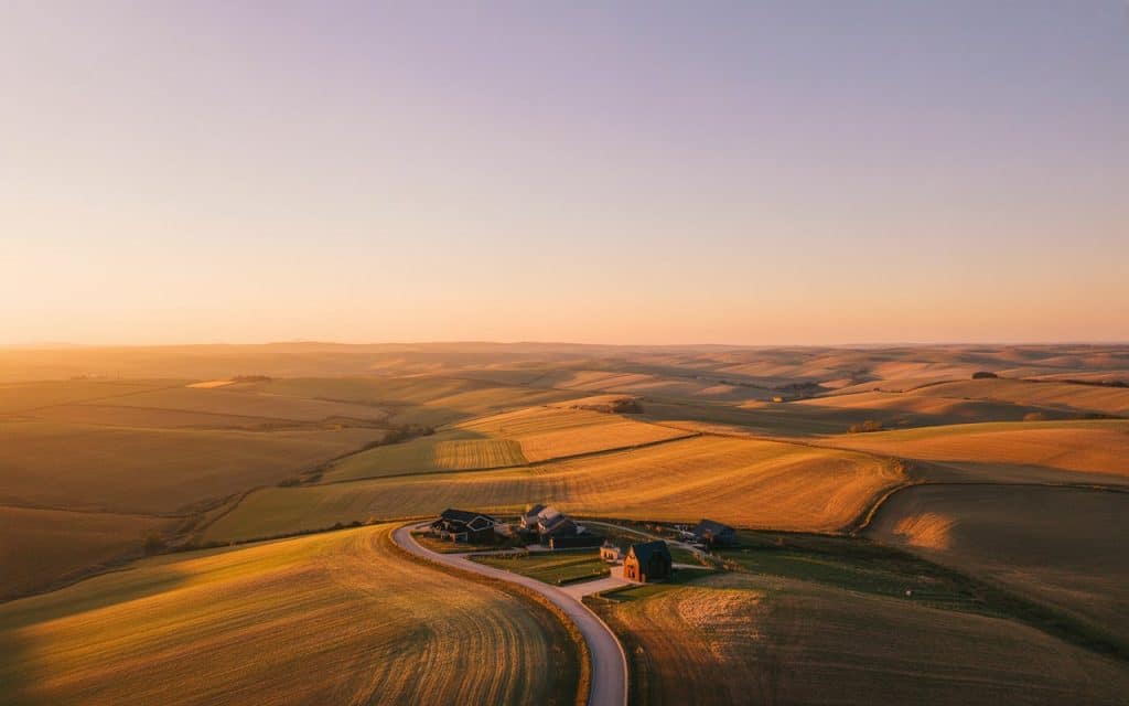
Have you ever looked at a landscape and wondered how different and breathtaking it might look from above? A ground level photo can be beautiful, but an aerial view reveals an entirely new world. Colors become richer. Shapes become clearer. Patterns appear that you could never see from eye level. This is the magic of aerial photography. It transforms ordinary scenes into extraordinary visual stories. Today aerial photography is more accessible than ever. With modern drones, even beginners can capture sweeping views that once required helicopters or airplanes. If you want to create powerful images that stand out, understanding how aerial photography works is the first step. What Makes Aerial Photography So Captivating Aerial photography gives you a chance to see the world in a new way. It opens a perspective that feels fresh and exciting. You see the lines of a coastline, the symmetry of a field, the curve of a river, or the movement of a city. This unique viewpoint is the reason aerial photography is widely used in travel content, advertising, filmmaking, real estate, construction, and environmental work. When done well, aerial photography feels like storytelling from the sky. It gives viewers a feeling of exploration. Also, it encourages curiosity. It allows you to capture stunning views that feel impossible from the ground. Drone Aerial Photography Makes It Accessible In the past, aerial landscape photography required hiring a pilot or renting a small aircraft. Now drones make the process simple and affordable. With a drone you control the angle, altitude, and movement. You can capture scenes with precision and creativity. This has made drone aerial photography one of the fastest growing forms of visual content. Content creators use it for travel videos. Businesses use it for marketing. Real estate professionals use it to highlight properties. Even homeowners use drones to get a beautiful shot of their land. Drones give you freedom. You can fly low over fields, rise above buildings, circle around objects, or glide through wide open spaces. This flexibility is what makes aerial photography so enjoyable. How Aerial Photography Helps Real Estate and Business Aerial Photography for Property Marketing One of the most common uses of aerial photography is in real estate. Aerial real estate photography gives buyers a better understanding of the property. They can see the neighborhood, lot size, roof condition, landscaping, and outdoor spaces. This level of detail is impossible with ground photos alone. Aerial Photography for Commercial Use Businesses also use commercial drone aerial photography to showcase buildings, hotels, resorts, event venues, farms, construction projects, and large facilities. These images communicate scale and beauty in a way normal photos cannot match. They help clients visualize the environment and imagine the experience. Aerial photography often increases interest, improves engagement, and builds trust. When customers see a full view from above, they understand more. They feel more confident in their decisions. What You Need for High Quality Aerial Photography Choosing the Right Drone Camera If you want amazing results, you need the right drone camera for aerial photography. Cameras with good resolution, stable sensors, and clear lenses make a big difference. Look for drones that offer smooth flight control and gimbal stabilization to keep your shots crisp and steady. Battery life also matters because aerial photos often require multiple angles or flight movements. A reliable drone gives you more freedom to explore the scene. Using the Right Light Lighting conditions play a big role in the quality of your aerial shots. Early morning and late afternoon offer softer light and dramatic shadows. These times of day are perfect for aerial landscape photography. The warm tones add emotion and depth to your images. Simple Drone Photography Tips for Beginners Plan Before You Fly Always plan your shot before taking off. Look at the landscape, think about leading lines, and visualize the angle you want. Planning helps you fly with purpose. Watch the Weather Stay aware of the weather. Strong winds affect stability and clarity. Calm conditions make everything easier. Use Smooth Movements Use slower flight movements. Smooth motions make your videos cinematic and your photos cleaner. Experiment With Altitudes Experiment with different heights. A lower altitude captures detail. A higher altitude captures patterns and shapes. Add Gentle Turns Try gentle turns and circles. These movements create dynamic angles that bring life to your images. With these simple drone photography tips, your photos become more intentional and visually attractive. Why Aerial Photography Creates Emotional Impact Photos taken from the air feel different. They create a sense of wonder. They show the viewer something they do not normally see. This emotional reaction is one of the biggest advantages of aerial photography. People love seeing places from a bird’s view. They want to see how the landscape stretches. They want to see how the world changes from above. This emotional appeal is powerful in storytelling. Aerial photography gives depth to any project. It brings beauty to marketing campaigns. Also, it adds clarity to professional documentation. It creates interest for real estate listings. Further, it elevates travel content. It highlights patterns and textures that go unnoticed on the ground. How Rekon Uses Aerial Photography in Real World Projects At Rekon Solutions we use aerial photography to support mapping, surveying, and project documentation. Our drone pilots capture detailed images that help clients visualize terrain, track progress, and present data with clarity. We combine aerial views with modern camera systems to produce high resolution results. This approach supports construction companies, property developers, mining operations, and environmental teams. Aerial photography helps us deliver accurate information and beautiful imagery at the same time. It also makes large or remote sites easier to understand. The Future of Aerial Photography With improvements in drone technology, the world of aerial photography is expanding quickly. Camera sensors are improving. Stability is increasing. Flight times are getting longer. These advances open new opportunities for creative and professional work. More businesses are adopting aerial photography because it enhances communication. Hence, more creators are using drones because it
Real World Applications of Drone LiDAR
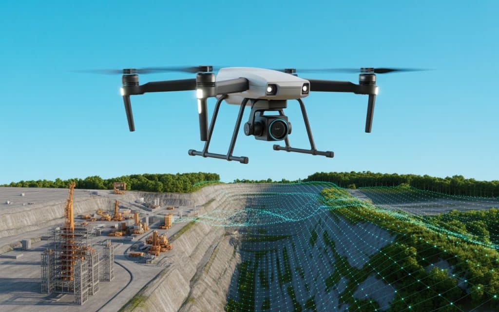
Have you ever wondered how a LiDAR Drone application can transform the way we map and monitor the world around us? Whether you’re surveying rugged terrain, managing infrastructure, or doing environmental monitoring, the right technology makes all the difference. In this article, we’ll explore the many facets of LiDAR Drone application and how it drives real world value across industries. What is a LiDAR Drone application? At its core, a LiDAR Drone application refers to mounting a LiDAR sensor on an unmanned aerial vehicle (UAV) and putting it to work in real life projects. These applications vary widely — from topographic mapping to floodplain modelling, to infrastructure inspection. When you equip a UAV with LiDAR (sometimes referred to as UAV with LiDAR or UAV LiDAR), you unlock capabilities traditional methods simply cannot match. One of the key parameters in any survey drone project is accuracy. In fact, studies show that drone LiDAR survey accuracy can rival or even outperform conventional ground based survey tools under the right conditions. For example, one paper measured UAV LiDAR altitudes and found strong agreement with airborne laser scanning data. Why do these Applications matter? 1. Faster, safer, and more versatile surveys In many real world scenarios, accessibility or safety is a major constraint. Think of steep mine walls, flood prone zones, dense forest canopies, or infrastructure over water. By using a LiDAR drone, you are able to fly into places humans might have trouble reaching. Furthermore, the data collected can be converted into 3D terrain models, digital elevation models (DEMs), and actionable intelligence. 2. Improved decision making When you deploy a LiDAR drone for surveying or engage with LiDAR drone survey services, you’re not just collecting raw data; rather you’re generating insights. Real world applications of drone LiDAR often lead to faster project timelines, fewer risks, and higher confidence in planning decisions. 3. Cost efficiency in the long run While the sticker price of the equipment (cheapest LiDAR drone might catch your eye) is one factor, the actual value lies in how much you save. With LiDAR technology, you have fewer field personnel, less time on dangerous climbs, fewer repeat visits, and more accurate data sooner. For many of our clients, the best LiDAR drones are the ones that deliver both accuracy and time savings. Key industry applications of LiDAR Drone application 1. Mining and Exploration In large scale mining operations, monitoring terrain, volumes of extracted material, and site changes is critical. A UAV with LiDAR can capture high resolution point clouds of stockpiles, pit walls, and haul roads. This application of survey drone tech significantly improves safety and operational efficiency. 2. Construction and Infrastructure From highways to bridges to urban development, a survey drone equipped with LiDAR can monitor progress, detect deviations from plan, and update BIM (Building Information Models). As one study on UAV LiDAR in vegetated terrain showed, the technology can achieve accuracies comparable to total station methods. 3. Environmental Monitoring and Conservation Real world applications of drone LiDAR extend to mapping wetlands, forests, floodplains, and erosion prone zones. For example, LiDAR drones have been used to measure ground settlement on reclaimed land, demonstrating how such technology provides reliable results in challenging contexts. 4. Archaeology and Heritage While perhaps less discussed in mainstream commercial use, LiDAR drone applications in archaeology are emerging strongly. Dense canopy can hide ancient features, but airborne laser pulses can capture bare earth models, revealing hidden structures. 5. Utilities and Energy Whether inspecting power line corridors, wind turbine sites, or pipeline rights of way, a LiDAR drone application offers a safer, quicker alternative to ground crews or manned helicopters. The ability to detect displacement, tilts or encroachments means proactive maintenance becomes achievable. How to pick the right solution: Best LiDAR Drone for Surveying Not all systems are equal. When selecting a LiDAR drone solution for your project, consider: Sensor specs and point density (higher density = better detail) Platform stability and GNSS/INS integration for geo accuracy Workflow compatibility: how easy it is to turn raw point clouds into actionable maps Operational cost including hardware, software, mission planning, and data processing Service models: sometimes LiDAR drone survey services (outsourced) make more sense than buying gear. If you’re looking for the best LiDAR drone for surveying, Rekon Solutions positions itself as a leading provider. We combine advanced drone LiDAR platforms with expert data processing and interpretation services, enabling you to focus on making decisions rather than battling tech. Accuracy matters: Drone LiDAR survey accuracy In one independent review, drone LiDAR systems achieved vertical accuracy well within established limits of field surveying standards when properly controlled. This means for many applications, a LiDAR drone application is not a compromise. Instead, it is a superior approach in terms of data density, speed, and safety. Challenges and considerations in real world applications While the technology is powerful, there are still real world considerations: Vegetation canopy, weather and terrain can affect performance. Data processing pipelines must handle large point clouds and classification tasks. Regulatory constraints around UAV operations (altitude, permissions) can affect access. Choosing the right team and workflow matters: a fleet of cheaper drones without support may cost more in reworks than a well defined service from a single provider. Conclusion In summary, a strong LiDAR Drone application integrates precision, speed, and real world utility. From mining and construction to environmental monitoring and heritage mapping, the possibilities are broad and growing. By choosing the best LiDAR drone for surveying and leveraging expert services like those from Rekon Solutions, you can unlock major advantages in both decision making and operational efficiency. If you’re ready to explore how our drone LiDAR solutions can support your next project, reach out to Rekon Solutions today. FAQs What drone is best for surveying? The best drone for surveying depends on your specific project. If you need high precision, a system with strong GNSS/INS integration, high point density and elite sensor specs is ideal. A survey drone outfitted for LiDAR is often the best fit for demanding