Drone inspection accuracy is the foundation of good decisions in inspection and infrastructure projects.
Whether you manage industrial facilities, or construction projects, the quality of your inspection data directly affects safety, maintenance planning, and operational costs.
If the data is unreliable, even the best decisions can be based on incorrect assumptions.
This is why drone inspection accuracy has become an important topic across multiple industries.
Drones can collect detailed visual and measurement data faster than traditional methods.
However, many people still wonder how accurate drone inspections really are and what factors influence the results.
The answer depends on more than the drone itself.
Sensor quality, flight planning, environmental conditions, and quality assurance workflows all play a role.
Let’s look at what determines inspection accuracy, where limitations exist, and how professional teams ensure reliable results.
Why Drone Inspection Accuracy Matters
Every inspection aims to answer a simple question. What is the current condition of the asset being inspected? The accuracy of that answer depends entirely on the quality of the collected data.
High levels of drone inspection accuracy help identify defects earlier and support more confident maintenance decisions. This reduces the risk of missed issues and unnecessary repairs. It also improves long term asset management.
For industries responsible for critical infrastructure, accurate inspections can prevent costly failures and unexpected downtime. Reliable data helps teams prioritize resources more effectively.
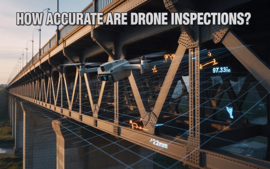
How Accurate Are Drone Surveys in Real Projects
One of the most common questions clients ask is how accurate are drone LiDAR surveys compared to traditional inspection methods. The answer varies depending on project requirements and technology selection.
Modern drones equipped with high resolution cameras can detect small visual defects from safe distances. When combined with photogrammetry or LiDAR workflows, drones can also provide highly accurate measurements and spatial data.
According to research published by the ASPRS (American Society for Photogrammetry and Remote Sensing), properly planned drone mapping workflows can achieve centimeter level accuracy under suitable conditions. This makes drones valuable tools for many inspection and survey applications.
The key phrase here is properly planned. Accuracy depends heavily on workflow quality rather than equipment alone.
4 Factors That Influence Inspection Accuracy
Several variables affect inspection performance during every project. Understanding these factors helps set realistic expectations and improve outcomes.
Sensor Quality
Higher quality sensors capture more detailed information. Camera resolution, thermal sensitivity, and LiDAR performance all affect the quality of collected data.
Flight Planning
Proper overlap, flight altitude, and viewing angles influence inspection results. Poor planning can create gaps or reduce measurement reliability.
Environmental Conditions
Wind, lighting, precipitation, and atmospheric conditions can affect image quality. Stable conditions generally produce more consistent datasets.
Operator Experience
Experienced teams understand how to adapt flight plans and processing workflows to site conditions. This improves overall reliability significantly.
These variables all contribute to final inspection accuracy.
Understanding UAV Inspection Accuracy Limits
Although drones provide impressive capabilities, every technology has constraints. Understanding UAV inspection accuracy limits helps avoid unrealistic expectations.
For example, visual inspections depend on line of sight. If a defect is hidden behind structural elements, the drone may not capture it directly. Lighting conditions can also influence visibility.
Distance from the asset affects image detail as well. While zoom lenses help, excessive stand off distances may reduce defect detection capability.
Additionally, certain measurements require specialized sensors rather than standard cameras. Understanding these limitations is part of responsible project planning.
Industrial Drone Inspection Accuracy in Practice
An industrial drone inspection often involves challenging environments. Facilities may contain tall structures, confined spaces, active equipment, or hazardous locations. Traditional inspections in these settings can expose personnel to significant risks.
Drones improve safety by reducing the need for direct access. At the same time, they collect detailed visual records from multiple perspectives.
Industries commonly using drone inspections include:
- Oil and gas facilities
- Power generation sites
- Manufacturing plants
- Mining operations
- Transportation infrastructure
In these environments, accuracy and repeatability are often just as important as safety improvements.
Measurement Accuracy Drone Mapping Can Achieve
Many inspections involve more than visual observations. Teams often require measurements for crack monitoring, deformation analysis, volume calculations, or dimensional verification.
This is where measurement accuracy drone mapping becomes important. Photogrammetry and LiDAR workflows allow drones to generate measurable spatial datasets. These datasets support engineering analysis and asset management programs.
Accuracy depends on factors such as:
- control point quality
- sensor calibration
- overlap settings
- processing standards
- environmental conditions
When these variables are managed properly, drone measurements can provide highly reliable results.
Construction Drone Inspection Reliability
Construction projects depend on accurate information throughout every phase. Progress tracking, quality control, and site verification all require dependable data.
Strong construction drone inspection reliability helps project teams monitor work more efficiently. Drones provide frequent site updates without disrupting operations. This improves communication between stakeholders and supports faster issue identification.
Additionally, drone inspections create consistent historical records. Teams can compare site conditions over time and verify progress against project plans.
This level of visibility helps reduce misunderstandings and improve accountability across construction workflows.
If you are interested in why drone inspection is better, read this: What Can Drone Inspections Detect That Ground Crews Miss
Why a Drone Inspection QA Process Is Essential
Accurate data does not happen by accident. Professional providers follow a structured drone inspection QA process to verify data quality before deliverables are released.
A typical QA workflow may include:
- flight plan verification
- sensor calibration checks
- data completeness review
- processing validation
- coordinate verification
- deliverable inspection
These steps help identify potential issues before results reach the client.
Quality assurance is often the difference between visually appealing outputs and genuinely reliable inspection data.
Inspection Data Validation Methods That Improve Reliability
A strong inspection workflow includes multiple inspection data validation methods. Validation ensures the collected information accurately represents field conditions.
Common validation techniques include comparing drone measurements against known control points. Teams may also conduct field verification of identified defects. Cross checking datasets from multiple sensors can further improve confidence.
Some projects require independent reviews before final acceptance. These practices help ensure that inspection findings are both accurate and defensible.
Validation is especially important for engineering, regulatory, and safety related applications.
Understanding Drone Surveying Error Margin
Every measurement system contains some level of uncertainty. Understanding the expected drone surveying error margin helps teams interpret results correctly.
Error margins vary depending on technology, project conditions, and required accuracy levels. Well planned workflows generally achieve significantly smaller margins than ad hoc data collection efforts.
Rather than focusing on absolute perfection, professional inspections aim for documented and predictable accuracy levels. This allows project teams to make informed decisions confidently.
Clear reporting of expected error ranges is a hallmark of quality inspection providers.
Photogrammetry Inspection Accuracy Versus LiDAR Inspection Precision
Many projects evaluate photogrammetry inspection accuracy alongside LiDAR inspection precision. Both technologies support inspections, but they perform differently depending on site conditions.
Photogrammetry uses overlapping images to create measurable models. It works particularly well in open environments with strong visual detail. LiDAR uses laser measurements and performs better in complex terrain or vegetated environments.
Neither technology is universally superior. The best choice depends on project objectives, asset characteristics, and required deliverables.
An experienced provider evaluates site conditions carefully before recommending a workflow.
If you need guidance selecting the right inspection method, Rekon Solutions can help determine which technology best supports your project goals.
FAQs
How accurate are drone inspections?
Drone inspections can achieve very high levels of accuracy when proper planning, quality control, and processing workflows are used.
What affects drone inspection accuracy?
Sensor quality, flight planning, environmental conditions, and processing standards all influence inspection accuracy.
Is LiDAR more accurate than photogrammetry?
LiDAR often performs better in vegetated or complex environments, while photogrammetry works well in open areas with strong visual detail.
Why is quality assurance important for drone inspections?
Quality assurance helps verify data accuracy, identify processing issues, and ensure reliable deliverables.
Making Better Decisions With Accurate Inspection Data
The value of drone inspections depends on the quality of the information they provide. Strong drone inspection accuracy supports safer operations, better maintenance planning, and more confident project decisions. However, achieving reliable results requires much more than simply flying a drone.
Professional workflows combine planning, validation, processing, and quality assurance to produce dependable inspection outputs. Understanding both the strengths and limitations of drone technology helps organizations use it more effectively.
If your team is evaluating inspection solutions, Rekon Solutions can help deliver accurate, reliable data tailored to your operational requirements. Get your quote by sharing your project details here.
The best inspection decisions begin with data you can trust.
