In the world of modern surveying, Drone LiDAR for surveying has become a game-changer.
These powerful machines allow surveyors to gather highly accurate topographic data over vast areas in a fraction of the time it would take using traditional methods.
Whether you’re working in construction, environmental conservation, or infrastructure development, the benefits of using Drone LiDAR for surveying are undeniable.
In this blog, we’ll explore how Drone LiDAR for surveying can revolutionize your approach to large-scale projects, making data collection faster, more precise, and cost-effective.
What is Drone LiDAR Surveying?
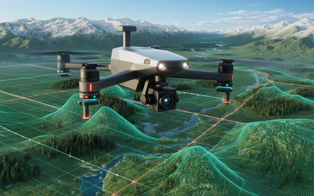
Drone LiDAR for surveying refers to the use of drone-mounted LiDAR (Light Detection and Ranging) sensors to scan and map the earth’s surface.
Unlike traditional survey methods, which can be slow and often require physical access to challenging areas, LiDAR technology works more efficiently. It uses laser pulses to gather detailed data about the topography and other features of the land. The drone’s mobility allows it to cover large areas quickly, even in hard-to-reach places like rugged terrain, forests, or flooded regions.
LiDAR drones combine the flexibility of unmanned aerial vehicles (UAVs) with the precision of LiDAR technology, offering a new level of surveying capability.
The best LiDAR drone for surveying can produce high-resolution 3D models that are invaluable for decision-making in industries such as construction, mining, agriculture, and more. Get in touch if you want to learn how Rekon achieves it for you.
Why Use a Drone LiDAR for Surveying?
1. Precision and Accuracy
One of the most significant advantages of using a Drone LiDAR for surveying is the unmatched accuracy it offers.
LiDAR sensors can measure distances with incredible precision, often down to a few centimeters. This level of detail is essential for projects that require highly accurate data, such as environmental monitoring, flood risk mapping, and infrastructure planning.
2. Speed and Efficiency
Surveying large areas traditionally can take weeks or even months, depending on the terrain.
However, with Drone LiDAR for surveying, surveyors can collect vast amounts of data in a fraction of the time.
For example, while a traditional crew might need several weeks to survey a few hundred acres, a Drone LiDAR for surveying can do the same job in just a few days.
3. Cost-Effective
The upfront cost of Drone LiDAR for surveying may seem high, but the long-term savings are significant.
By reducing the amount of manual labor required and speeding up data collection, LiDAR drones help minimize overall project costs.
Furthermore, the ability to access hard-to-reach areas without the need for expensive machinery or safety measures adds even more savings.
4. Remote Access
Surveying in areas that are difficult to reach — like mountains, dense forests, or flood zones — can be dangerous and time-consuming. A Drone LiDAR for surveying can fly over such areas, capturing accurate data without putting surveyors at risk. This is especially valuable for projects that take place in hazardous environments, such as construction near cliffs or floodplain management.
5. Comprehensive Data Collection
A Drone LiDAR for surveying can provide highly detailed 3D models, topographic maps, and digital elevation models (DEMs) that give surveyors a complete view of the land.
And these models can be used for planning, analysis, and monitoring, offering invaluable insights for decision-making.
The Best LiDAR Drone for Surveying: Why Rekon Solutions Stands Out
When it comes to finding the best LiDAR drone for surveying, Rekon Solutions provides cutting-edge drones equipped with the latest LiDAR technology. Our drones are designed to deliver unparalleled precision, efficiency, and cost-effectiveness for your surveying needs.
Rekon drones are particularly suited for industries such as:
- Mining and Exploration: LiDAR drones are crucial for mapping and analyzing mineral resources, helping mining companies make informed decisions about where to dig and how to optimize their operations.
- Construction: Whether you’re developing infrastructure or working on property development, LiDAR drones provide accurate data that enhances the planning and design processes.
- Environmental Conservation: LiDAR technology plays a key role in monitoring ecosystems, managing floodplains, and identifying erosion hotspots.
- Government and Infrastructure Projects: LiDAR drones provide invaluable data for urban planning, flood risk management, and other essential infrastructure developments.
With Rekon Solutions, you not only get a Drone LiDAR for surveying but also gain access to expert consultation, real-time data collection, and actionable insights that improve project outcomes.
What are the Costs Associated with Drone LiDAR Surveying?
LiDAR Drone Price
The price of LiDAR drones for surveying varies based on the technology, sensors, and features included. While the initial investment may seem significant, the benefits in speed, precision, and cost savings often outweigh the upfront costs.
Drone Topographic Survey Cost
The cost of a drone topographic survey depends on the size of the area to be surveyed and the complexity of the terrain. While traditional methods can incur high labor and equipment costs, LiDAR drones can reduce these expenses by providing more efficient and accurate data.
LiDAR Drone Rental
For those who only need a drone for a one-off project, LiDAR drone rental is a viable option. Renting a drone for a specific survey can save costs without the need for a long-term investment. Rekon Solutions offers affordable LiDAR drone rental services for short-term projects.
How Drone LiDAR Drones are Revolutionizing Surveying
Drone LiDAR for surveying are not just changing how surveyors work; they’re transforming entire industries. By reducing the time and costs associated with traditional surveying methods, LiDAR drones make it possible to complete complex projects faster and with greater accuracy. This transformation is especially evident in industries such as construction, where LiDAR drones are used to monitor progress, detect issues, and optimize resource allocation.
The technology also offers advanced features like real-time data processing and integrated GPS systems, allowing surveyors to gather high-quality data without the need for post-processing. As the technology evolves, we can expect even more powerful capabilities, such as enhanced sensor integration and improved data accuracy.
Final Verdict
The ability to survey large areas with precision, speed, and cost-effectiveness is what sets Drone LiDAR for surveying apart from traditional methods.
Whether you’re involved in construction, environmental monitoring, or any other field requiring detailed topographic data, LiDAR drones offer a powerful solution.
By choosing Rekon Solutions, you’re investing in the best LiDAR drone, ensuring your projects benefit from the most advanced technology available.
FAQs
1. What are the capabilities of LiDAR drones?
LiDAR drones can capture highly detailed data of the Earth’s surface, create 3D models, generate accurate digital elevation models, and monitor environmental changes. They are used for mapping rugged terrain, flood risk assessments, and other surveying tasks.
2. What drone is best for surveying?
The best drone for surveying depends on the specific needs of the project, but LiDAR drones equipped with high-precision sensors like those offered by Rekon Solutions are ideal for achieving the highest accuracy and efficiency.
What are the limitations of LiDAR drones?
While LiDAR drones offer exceptional accuracy, they may face limitations in extremely dense vegetation, poor weather conditions, or areas with high interference. Additionally, they can be expensive to purchase or maintain.
What is the main advantage of using LiDAR in surveying?
The primary advantage of using LiDAR in surveying is its ability to produce highly accurate data quickly, even in difficult-to-reach areas. It’s more efficient than traditional methods and provides detailed, actionable insights for a wide range of industries.
