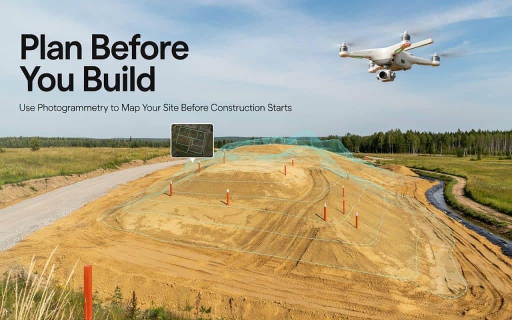
The best time to catch a costly problem is before a single machine touches the dirt.
That is exactly why photogrammetry before construction has become a quiet advantage for smart project managers.
Instead of guessing what a site holds, they capture it in full.
Where one drone flight produces a detailed model and real measurements, all before the schedule is locked in.
Undoubtedly, the stakes are enormous.
In fact, McKinsey found that large projects typically finish up to 80 percent over budget and 20 percent behind schedule, according to McKinsey.
And a lot of that pain traces straight back to poor early information.
So here is why planning with better data first is becoming standard practice, and how the sharpest PMs put it to work.
What is photogrammetry in construction?
Let us start with the basics. Photogrammetry in construction is the process of turning overlapping photos into accurate maps and 3D models.
A drone flies the site and captures hundreds of images. Software then stitches them together, measuring the position of every point to build a true to scale model of the ground.
This is why drone mapping for construction has taken off. From a single flight you get orthomosaics, contours, elevations, and a full 3D site mapping dataset you can measure and share.
In fact, it is the same core technique used across modern surveying, adapted to the pace and precision a construction site demands.
We break down how those overlapping photos become measurable data in our guide on how photogrammetry builds a map from overlapping photos. Understanding this model is the first step to putting it to work early.
Why use photogrammetry before construction?
Here is the heart of it. Every decision you make early shapes the entire project, and good decisions need good data.
A proper pre construction site survey shows you exactly what you are working with. You see the real terrain, existing features, drainage, access, and obstacles before you commit a dollar.
That clarity transforms pre construction planning. Instead of designing from old surveys or rough assumptions, your team plans from the site as it truly is today.
The reason smart PMs ask why use photogrammetry before construction is simple. Catching a problem on a screen costs you a meeting, while catching it after mobilisation costs you a fortune.
What are the benefits of photogrammetry in construction?
The advantages stack up quickly once the data is in hand. First is accuracy, since aerial mapping for construction captures the whole site to centimetre level detail.
Speed is next. A flight covers in hours what a ground crew would need days to survey, so your planning never waits on fieldwork.
Then there is cost control. Detailed construction site mapping means fewer surprises, fewer change orders, and far less expensive rework once the build begins.
Finally, communication improves. The benefits of photogrammetry in construction include a shared visual model that keeps owners, designers, and trades looking at the same site.
That single source of truth cuts confusion, speeds approvals, and stops small misunderstandings from turning into costly disputes.
Stack these gains together and the early investment pays for itself many times over.
How do smart project managers use it in planning?
This is where theory becomes advantage. The best teams use photogrammetry for construction planning at several key moments.
They start with a baseline survey, capturing the untouched site as a permanent record and a design foundation. Earthworks come next, where accurate volumes let them plan cut and fill precisely instead of guessing. That single number can swing a budget by thousands, so pinning it down early is well worth the flight.
They also use construction planning with drones to spot risks early. A clear model reveals grading issues, drainage problems, and access constraints long before they become expensive field surprises.
A drone survey for construction even sharpens bidding and estimating, since accurate quantities produce tighter, more confident numbers.
Good drone surveying services turn all of this into deliverables that drop straight into your design tools.
Most importantly, getting that workflow right matters, as we’ve explained it in our guide on how to get your surveying right with photogrammetry. In short, photogrammetry before construction gives a PM a head start that lasts the whole project.
Frequently asked questions
1. How accurate is photogrammetry for construction?
With good ground control and planning, it commonly reaches 2 to 5 centimetre accuracy, which suits most site planning, design, and earthworks needs.
2. When should you fly to a site before construction?
Ideally before any earthworks begin, so you capture the original ground. A baseline flight gives you a clean record and a solid design foundation.
3. Does photogrammetry replace a ground survey?
Not entirely. It covers large areas fast and feeds design, but licensed surveyors still handle legal boundaries and certified control points.
4. Is photogrammetry better than LiDAR for construction?
It depends on the site. Photogrammetry excels on open, visible ground, while LiDAR sees through vegetation. Many projects use whichever fits, or both together.
Plan first, build once
In the end, great project management is about removing surprises, and surprises love a site that nobody mapped properly. Photogrammetry before construction replaces guesswork with a precise, shared picture of the ground you are about to build on.
The payoff shows up as tighter budgets, smoother schedules, and fewer painful change orders down the line. You plan once, from real data, instead of fixing the same problem three times.
If you have a project on the horizon, the smartest first move is to see the site clearly. Tell us about your upcoming build, and Rekon Solutions will capture the data you need before you break ground. Contact us now.