Many teams assume LiDAR quality depends only on the drone or sensor being used.
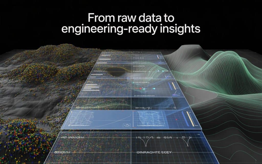
In reality, collecting the data is only the beginning of the process.
What truly determines project value is how that data gets processed, validated, and delivered afterward.
This is why understanding engineering grade LiDAR data matters before hiring any survey provider.
Reliable LiDAR outputs require much more than aerial scanning alone.
They depend on structured workflows, quality control, and precise data handling standards.
For engineering and construction projects, small data errors can create major downstream problems.
That is why experienced teams focus heavily on workflow reliability instead of just flight capability.
Let’s break down what actually makes LiDAR data engineering ready for real world use.
Why Engineering Grade LiDAR Data Is Different From Basic Mapping
Not all LiDAR outputs meet engineering standards. Some datasets work well for visualization or preliminary planning but lack the precision needed for construction and infrastructure projects. This difference becomes critical once designs, measurements, and site decisions depend on the data.
True engineering grade LiDAR data must support accurate calculations and dependable terrain analysis. Engineers rely on it for grading, drainage, corridor design, and construction coordination. Because of this, data consistency and verification become essential parts of the workflow.
Additionally, engineering projects often require documented accuracy reporting. Without proper validation, even visually impressive datasets may not meet operational requirements.
Why LiDAR Accuracy Depends on More Than Sensors
High quality sensors matter, but they are only one part of the process. Flight planning, control networks, calibration, and processing workflows all influence final results. This is where many low quality mapping projects fail.
For example, poor overlap settings can reduce point cloud consistency significantly. Weak control networks may introduce positional drift across large sites. Inaccurate calibration can also affect elevation precision.
This is why survey grade LiDAR accuracy depends on complete workflow discipline rather than hardware alone. Reliable outputs come from repeatable standards across every project phase.
The Importance of LiDAR Data Processing Standards
Raw LiDAR scans are not immediately useful for engineering teams. Before the data becomes actionable, it must pass through several processing stages. This is where strong LiDAR data processing standards become essential.
Processing workflows typically include:
- trajectory correction
- point cloud alignment
- noise filtering
- ground classification
- accuracy validation
- deliverable generation
Each stage affects the reliability of the final outputs. Even small processing mistakes can reduce terrain accuracy or introduce modeling issues.
Professional providers follow strict quality assurance workflows to maintain consistency across datasets.
Understanding LiDAR Point Cloud Classification
One of the most important stages in processing involves LiDAR point cloud classification. This process separates terrain points from vegetation, structures, vehicles, and other surface objects.
Without proper classification, terrain models become unreliable. Engineers may receive distorted elevation data that affects grading or drainage analysis. Classification helps isolate the actual ground surface accurately.
Different project types may require additional classifications as well. Forestry projects, for example, often separate canopy layers from understory vegetation. Infrastructure projects may classify utilities or structures independently.
This step plays a major role in producing dependable engineering deliverables.
Why Georeferenced LiDAR Data Outputs Matter
Accuracy means little if the data does not align properly with project coordinates. This is why georeferenced LiDAR data outputs are critical for engineering workflows.
Georeferencing ensures the LiDAR data matches real world coordinate systems precisely. This allows engineers, GIS teams, and contractors to integrate datasets directly into design environments.
Poor georeferencing creates alignment problems between survey data and existing project files. These issues can lead to costly redesigns or field conflicts later.
Reliable providers validate coordinate systems carefully before finalizing deliverables.
The Role of CAD Ready LiDAR Data
Engineering teams rarely work directly with raw point clouds. Instead, they require processed outputs compatible with design software and drafting workflows. This is where CAD ready LiDAR data becomes important.
Processed deliverables may include:
- contour files
- terrain surfaces
- breaklines
- cross sections
- digital terrain models
- coordinate referenced datasets
These outputs allow engineering teams to begin design work immediately without extensive reprocessing internally.
This is one reason why LiDAR deliverables for engineers vary depending on project goals and software environments.
How GIS LiDAR Datasets Support Broader Planning
Modern projects often involve more than engineering teams alone. Environmental analysts, planners, and GIS specialists also rely heavily on spatial datasets. Because of this, many projects require well structured GIS LiDAR datasets alongside engineering deliverables.
These datasets support:
- environmental assessments
- flood analysis
- land management
- infrastructure inventories
- corridor planning
- vegetation analysis
The ability to integrate LiDAR into GIS workflows improves collaboration across departments significantly.
This broader usability increases the long term value of the survey itself.
Construction LiDAR Mapping Standards and Quality Control
Construction projects demand consistency because small terrain errors can affect scheduling, grading, and infrastructure alignment. This is why construction LiDAR mapping standards emphasize accuracy validation and quality reporting.
Professional workflows often include checkpoints and independent verification throughout processing. Quality control teams compare LiDAR outputs against known control points to confirm reliability.
Following recognized standards improves confidence in the final deliverables.
Why LiDAR Data Processing Workflow Matters
A strong LiDAR data processing workflow ensures consistency from collection through final delivery. Every stage influences how usable the final data becomes for engineering and construction teams.
The workflow typically includes:
- mission planning
- control establishment
- flight execution
- trajectory correction
- classification
- QA validation
- deliverable preparation
Skipping or rushing any stage increases project risk significantly.
This is why experienced providers focus as much on office processing as field collection. The real value of LiDAR often comes after the flight itself.
If your team needs engineering ready mapping outputs, Rekon Solutions can help structure deliverables around your project requirements.
What Engineers Should Ask Before Hiring a LiDAR Provider
Many project issues begin because teams focus only on pricing or equipment specifications. Instead, engineers should ask deeper workflow questions before selecting a provider.
Important questions include:
- What accuracy standards do you follow
- How is classification validated
- What deliverables are included
- Are outputs CAD and GIS compatible
- How is quality assurance documented
- What coordinate systems are supported
These questions help reveal whether the provider truly understands engineering workflows.
Choosing a provider with strong processing standards often matters more than choosing one with the newest drone. Contact us now.
You can also explore more about How Accurate Is Drone LiDAR for Engineering and Construction Projects?
FAQs
What is engineering grade LiDAR data
It is highly accurate LiDAR data processed and validated for engineering and construction use.
Why is LiDAR point cloud classification important
Classification separates terrain from vegetation and structures to improve mapping accuracy.
What are CAD ready LiDAR data outputs
They are processed deliverables formatted for engineering and drafting software workflows.
What affects survey grade LiDAR accuracy
Flight planning, control networks, processing quality, and calibration all influence accuracy.
Moving Forward with Reliable LiDAR Workflows
Reliable mapping requires much more than successful drone flights alone. Engineering grade LiDAR data depends on structured workflows, precise processing, and rigorous quality control throughout the project lifecycle. Without these elements, even advanced sensors cannot guarantee dependable results.
By understanding how LiDAR data becomes engineering ready, teams can evaluate providers more effectively and avoid costly project risks. The best LiDAR workflows prioritize usable deliverables, documented accuracy, and long term project reliability.
If you are planning an engineering or construction survey, Rekon Solutions can help deliver LiDAR outputs designed around real project requirements.
Because in professional mapping, the value is not just in collecting the data. It is in making the data reliable enough to build from.
