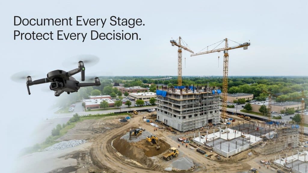
Memory fades, but a photo does not. On a busy build, construction site photo documentation is often the only thing that can prove what actually happened, and when.
Every project generates decisions, changes, and surprises by the hundred. Without a clear record, those details vanish the moment the next layer goes in.
That gap gets expensive fast.
A Construction Industry Institute study found that the average cost of rework on industrial projects exceeds 12 percent of total cost, and that design deviations (changes, errors, and omissions) accounted for roughly 80 percent of those increased costs, while construction deviations accounted for only about 20 percent.
A strong visual record helps close that gap. So here is why aerial documentation has become essential on modern construction sites.
Why does a construction site need a visual record?
Think of documentation as the project’s memory. Good construction photo documentation captures conditions on a set schedule, so nothing important slips through the cracks.
It answers the questions that always come up later. What did the ground look like before we started? Was that utility line already there? When exactly did the wall go up? A photo settles each one in seconds.
Beyond disputes, a clear record keeps everyone aligned. Construction visual documentation lets owners, designers, and trades see the same site, even when they cannot all be there in person.
It also supports safety and planning. A current construction site aerial view shows hazards, access routes, and staging at a glance. Together, these needs are exactly what construction site photo documentation is built to serve.
What does aerial add over ground photos?
Ground photos are useful, but they only show fragments. A camera in the air shows the whole thing at once.
With aerial photography construction sites gain a complete, top down view that no handheld shot can match. You see the full layout, the relationships between areas, and progress across the entire footprint in a single frame.
Consistency is the other advantage. Fly the same path each time, and every construction progress photograph sets lines up perfectly with the last, so change is easy to spot.
Aerial photography building work also scales beautifully. One flight documents a site that would take hours to walk and shoot on foot. This complete, repeatable view is what makes aerial construction site photo documentation so valuable.
How does photo documentation protect you in a dispute?
This is where the record pays for itself. Construction disputes turn on evidence, and a dated aerial image is hard to argue with.
When a claim lands about timing, damage, or scope, strong construction progress photo documentation shows exactly what the site looked like on any given day. That clarity can end an argument before it ever becomes a lawsuit.
It protects against rework charges too. If you can show the work was correct at a point in time, you avoid paying for it twice. Good construction site photo documentation turns he said, she said into a clear, time stamped fact that everyone can see.
Insurers and lawyers value it for the same reason. A consistent visual history removes doubt, speeds up claims, and often keeps small disagreements from ever escalating.
Those images become measurable, mapped evidence once processed. We explain how overlapping photos turn into accurate records in our guide on how photogrammetry builds a map from overlapping photos.
How often should you document a site?
The right cadence depends on how fast the work moves. Many active sites fly weekly, while slower phases may need only a monthly capture.
The key is consistency. A regular schedule turns single images into a smooth timeline of the whole build, rather than a random scatter of shots.
Time your flights around milestones too. Capture before earthworks, at each major phase, and at handover, so the record covers every moment that matters. This is where photogrammetry construction documentation shines, since the same flights that document progress can also produce measurements.
Accuracy still depends on how the data is captured and processed, the same as any survey. We cover that in our guide on how accurate drone LiDAR is for engineering and construction projects. For dependable construction site photo documentation, the workflow behind the camera matters as much as the camera itself.
Frequently asked questions
1. What is construction site photo documentation?
It is a consistent visual record of a construction project over time. Aerial and ground images capture site conditions, progress, and changes for reference, planning, and proof.
2. Why use drones for construction documentation?
Drones capture the whole site fast, from a consistent angle, without anyone walking every corner. The result is a complete, repeatable record that ground photos cannot match.
3. How often should a construction site be photographed?
It depends on pace. Active sites are often flown weekly or monthly, plus at key milestones like earthworks, major phases, and handover.
4. Can photo documentation be used as legal evidence?
Yes. Dated, consistent images are widely used to support claims and defend against disputes, since they show exactly what a site looked like on a specific day.
Why the record is worth it
In the end, a build without a record is a build you cannot fully defend. Construction site photo documentation gives you proof, alignment, and a clear view of progress that memory and paperwork simply cannot.
The payoff shows up everywhere. Fewer disputes, faster decisions, cleaner handovers, and a team that always works from the same picture.
If you have a project underway, or one about to break ground, let us set up a documentation plan that fits its pace. Tell us about your site, and Rekon Solutions will capture a record you can rely on from day one all the way to handover.