Challenge 5: Bidding with Accurate Cut-Fill Volumes
In competitive bidding environments, even small errors in estimating earthwork volumes can make or break a deal. Rekon helped (The Client) secure a development project by delivering precise cut and fill measurements using drone photogrammetry.
The Problem
To win a property development bid, the client needed to know exactly how much material had to be moved. With tight timelines and margin-sensitive pricing, guesswork wasn’t an option.
The Rekon Solution
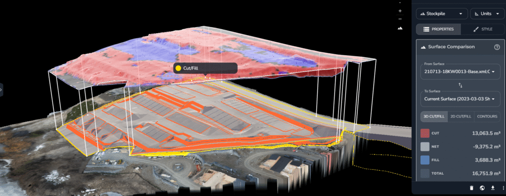
We used drone photogrammetry to deliver a fast, clear measurement of cut and fill volumes that helped DirtPro bid with confidence and win.
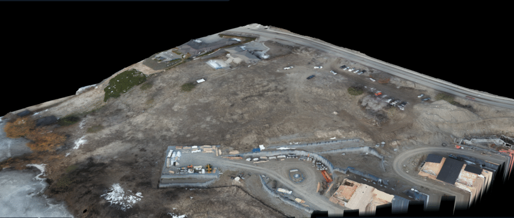
Understanding the Site First
We assessed vegetation coverage and confirmed that while some areas were brush-covered, the client was comfortable with photogrammetry as the preferred method. This allowed us to move quickly with a lightweight setup and minimal disruption.
Efficient Mapping That Informed the Bid
Conducted ground survey and placed control targets
Flew a high-resolution photogrammetry mission
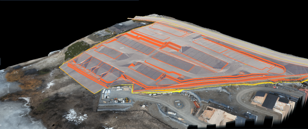
Captured topography and compared with design surface
Used Propeller to calculate cut-fill volumes
Deliverables That Sealed the Deal
PDF Volume Measurement Report
LAZ, DEM, DSM, contours, orthophotos
Online viewer access via Propeller for 3D review
Zoom call walkthrough to confirm findings in real-time
The Long-Term Impact
[✓] Accurate volume estimate for bid submission
[✓] Helped client secure the project with confidence
[✓] Saved time and cost vs. traditional survey
[✓] Built trust in digital survey data for future projects
Rekon Let’s You Map Smarter
From forests to highways, our drone and LiDAR solutions deliver accuracy, speed, and peace of mind.Let’s talk about your project Now.