Flooding is becoming a growing concern for infrastructure, communities, and environmental planning.
Without accurate terrain and water data, predicting flood behavior becomes extremely difficult.
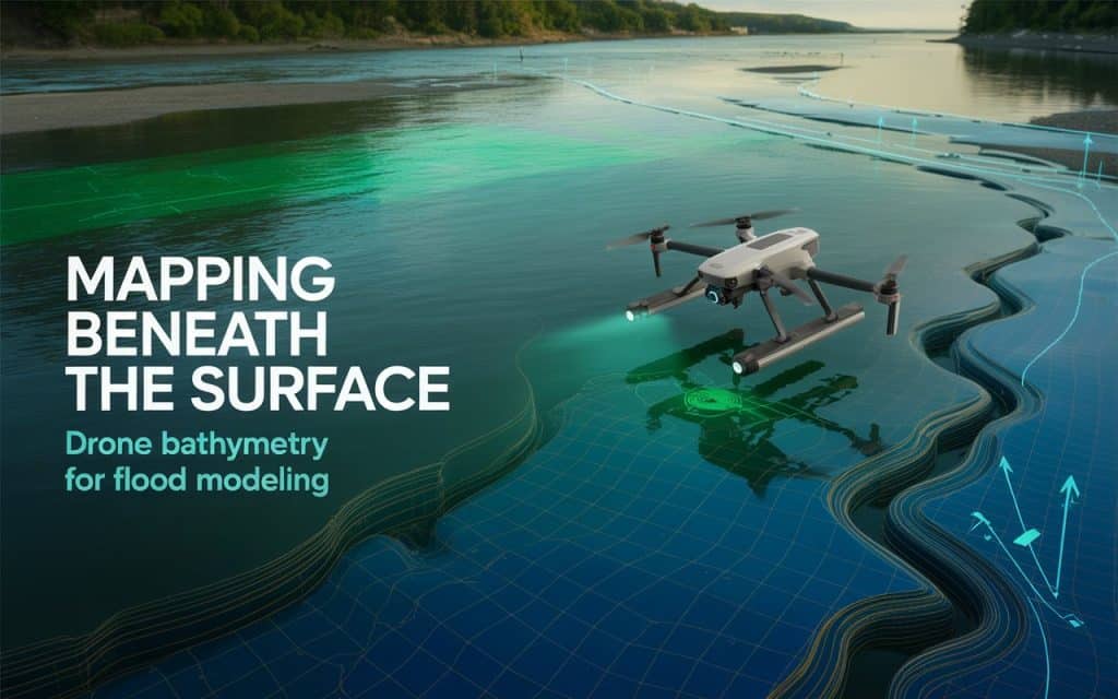
This is where drone bathymetry plays a critical role in modern mapping and analysis.
Today, flood modeling depends on precise elevation and water depth information.
Traditional methods often miss underwater terrain or take too long to collect data.
However, drone-based solutions now allow you to gather both land and underwater insights efficiently.
If you are involved in planning, engineering, or environmental management, understanding this technology can help you make better decisions.
Let’s explore how it works and why it matters for flood modeling.
What Is Drone Bathymetry and How Does It Work
As per NOAA, bathymetry refers to depth of ocean relative to sea level.
Where, drone bathymetry is the process of mapping underwater terrain using drones equipped with specialized sensors. These sensors capture water depth and surface data to create accurate models of rivers, lakes, and coastal areas. This process is often part of a broader bathymetric survey or hydrographic survey.
Drones use technologies like LiDAR or photogrammetry combined with water-penetrating sensors. This allows you to perform water depth mapping even in shallow or hard-to-access areas. As a result, bathymetric mapping becomes faster, safer, and more efficient.
This method is especially useful for capturing river bathymetry, where traditional survey methods may struggle. You can collect consistent data across large areas without disrupting the environment.
Why Drone Bathymetry Is Essential for Flood Modeling
Flood modeling depends on accurate terrain and water flow data. Without detailed elevation and depth information, predictions can be unreliable. This is why drone bathymetry is essential for generating high-quality flood modeling data.
When you combine land elevation with underwater mapping, you get a complete picture of the terrain. This supports hydrological modeling and improves flood predictions. It also helps identify how water moves through different areas during heavy rainfall.
According to the United States Geological Survey report published in Science Direct, accurate elevation data is critical for reliable floodplain mapping and risk assessment.
These findings show how floodplain mapping and water flow analysis depend on accurate data from both land and water.
How Bathymetric Mapping Supports Flood Risk Analysis
Flood risk analysis requires understanding how water behaves across terrain. Drone bathymetry provides the missing link by capturing underwater features that influence water movement. This improves flood risk mapping and helps you plan mitigation strategies.
For example, underwater slopes and channels affect how quickly water flows. Without this data, models may underestimate or overestimate flood impact. With accurate bathymetric survey data, you can improve predictions significantly.
This also supports the creation of a digital elevation model flood dataset. These models combine terrain and water depth data to simulate flood scenarios. As a result, planners can identify high-risk areas more effectively.
Advantages of Drone Water Mapping Over Traditional Methods
Traditional hydrographic survey methods often require boats, manual measurements, and extended timelines. These approaches can be expensive and limited in shallow or complex environments. In contrast, drone water mapping offers a more efficient solution.
Drones can quickly capture data across large areas with minimal setup. This reduces time and operational costs while improving coverage. You also gain access to areas that may be unsafe or inaccessible for traditional surveys.
Another advantage is data consistency. Drone bathymetry provides uniform data collection, which improves the quality of analysis. This is especially important for hydrological modeling and long-term monitoring.
If you want to see how aerial data supports mapping accuracy, you can read our blog here: How Drone Inspections Improve Safety and Accuracy
Applications of Drone Bathymetry in Real Projects
You will find drone bathymetry useful across many applications. In flood management, it supports flood modeling data collection and risk assessment. This helps protect communities and infrastructure.
In environmental projects, it supports river bathymetry and ecosystem monitoring. You can track sediment movement and changes in water bodies over time. This helps maintain ecological balance.
Infrastructure planning also benefits from bathymetric mapping. Projects involving bridges, dams, or drainage systems require accurate underwater data. This ensures safe and efficient design.
If you are planning a project that requires precise water and terrain data, you can contact Rekon Solutions to explore suitable mapping solutions.
How Drone Bathymetry Improves Hydrological Modeling
Hydrological modeling relies on accurate data to simulate water movement. By using drone bathymetry, you improve the quality of input data significantly. This leads to more reliable flood predictions.
For example, water flow analysis becomes more accurate when underwater terrain is included. This helps engineers understand how water will behave under different conditions. It also supports better planning for drainage and flood control systems.
Combining drone bathymetry with topographic data creates a complete dataset. This improves the accuracy of flood simulations and supports better decision making.
Key Factors That Influence Data Accuracy
While drone bathymetry is highly effective, certain factors influence accuracy. Sensor quality is one of the most important elements. High-quality sensors provide better depth and elevation data.
Water clarity also plays a role in data collection. Clear water allows better penetration for mapping sensors. In contrast, murky water may reduce accuracy.
Flight planning and processing methods also matter. Proper workflows ensure reliable outputs for bathymetric survey projects. This is why working with experienced professionals is important.
FAQs
What is the difference between bathymetric and bathymetry?
Bathymetry refers to measuring water depth and underwater terrain. A bathymetric survey is the process used to collect that data.
What is the main purpose of using drones in topographic mapping?
Drones improve speed, safety, and coverage. They allow efficient data collection for both land and water mapping.
What is the importance of bathymetry?
Bathymetry helps understand underwater terrain. It is essential for navigation, construction, and flood modeling.
What is the purpose of a bathymetric survey?
A bathymetric survey provides accurate depth and terrain data. This supports mapping, engineering, and environmental analysis.
Moving Forward with Better Flood Modeling
Flood risks are increasing, and accurate data is more important than ever. Drone bathymetry provides the detail needed for reliable modeling and planning. It helps you understand terrain, predict water movement, and reduce risk.
As mapping technologies evolve, combining land and water data becomes essential. Drone bathymetry ensures you have the insights needed for effective decision making.
If you are looking to improve your flood modeling or mapping workflows, consider working with experts who understand your needs. At Rekon Solutions, we provide accurate and reliable data to support your projects. Contact us today.
