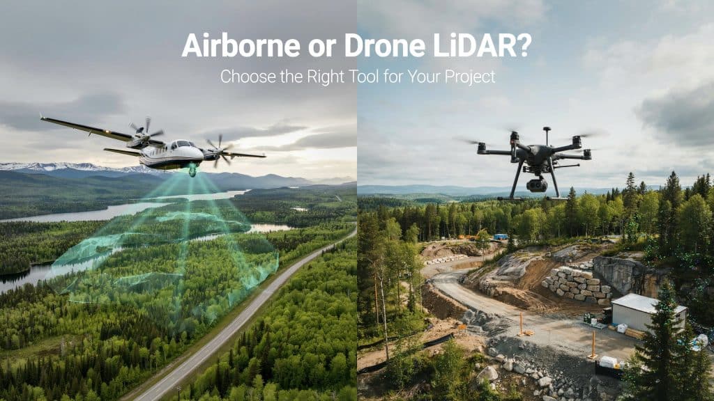
Choosing between drone LiDAR vs airborne LiDAR is one of your first big calls. Both capture stunning 3D detail, yet they suit very different jobs.
Pick the right one, and you save real time and money. Pick wrong, and you overpay or miss the detail you needed.
It helps to know how much each method actually delivers. The USGS maps the nation with airborne LiDAR at 2 points per square metre.
Drone LiDAR, flown low and slow, can capture far more than that. So let me walk you through which one fits your project.
What is airborne LiDAR?
Let’s start with the traditional option first. Airborne LiDAR uses a laser scanner mounted on a crewed aircraft.
A plane or helicopter flies high above your site. It sweeps huge areas in a single, efficient mission.
This is the backbone of large scale Airborne LiDAR Mapping. It can cover hundreds of square kilometres in one day.
The resulting Airborne lidar data is broad, consistent, and reliable. Many airborne mapping services rely on it for regional projects.
The trade off is lower detail from that height. Fine features can blur when you fly so high above.
That sheer reach is where airborne wins the drone LiDAR vs airborne LiDAR debate.
What is drone LiDAR?
Now for the newer, nimbler option you keep hearing about. Drone LiDAR mounts a similar laser on an unmanned aircraft.
The drone flies low, slow, and close to your target. That closeness produces incredibly dense, detailed point clouds.
You mobilise it fast, often with a small two person crew. This makes drone mapping services ideal for smaller, detailed sites.
The trade off is limited range and flight time. One drone covers far less ground in a single day.
It shines whenever you need precision over sheer coverage. Here the drone LiDAR vs airborne LiDAR balance tips toward the drone.
How do they compare?
So how does drone LiDAR vs airborne LiDAR really stack up? The honest answer comes down to a few simple trade offs.
Here is how the two methods differ in practice.
- Airborne covers huge regions, while a drone covers smaller sites
- Drone LiDAR delivers far higher point density and resolution
- Airborne suits big jobs, and drones win on the small ones
- Drones reach tight, tricky spots far more easily
- Drones mobilise quickly with a small, flexible crew
An aerial lidar survey by plane trades fine detail for broad speed. Both still give you an accurate lidar survey when planned well.
The right lidar data collection method simply depends on your goal. Accuracy holds up on both, as we cover in how accurate drone LiDAR is.
What factors decide the choice?
A handful of practical factors will point you the right way. Weigh these carefully before you commit to either method.
- The size of the area you need to map
- The level of detail your project truly demands
- Your budget and your delivery timeline
- How remote or hard to reach the site is
- Whether crewed flights are even permitted there
Run through this short list, and the answer usually becomes obvious. Your project rarely needs both, so match it to the biggest factor.
When should you choose airborne LiDAR?
Airborne LiDAR earns its place on truly large projects. Think highways, pipelines, forests, and whole watersheds.
If you must map hundreds of square kilometres, fly crewed. The cost per acre drops fast at that kind of scale.
Endurance matters here too, on sprawling jobs. A crewed plane simply stays airborne far longer than any drone.
It also suits regional planning and broad aerial mapping services. You get consistent coverage across an enormous footprint.
For massive coverage, drone LiDAR vs airborne LiDAR points clearly to airborne.
When should you choose drone LiDAR?
Drone LiDAR is the smart pick for smaller, detailed sites. Think construction, quarries, corridors, and complex terrain.
When you need dense data on a tight budget, fly a drone. It captures fine detail that a high flying plane would miss.
Drones also handle rough, hidden ground with ease. We show this in how LiDAR performs in dense forest and mountain terrain.
You also avoid putting a pilot up in the air. That safety and flexibility is a real bonus on tricky sites.
For most site scale work, drone LiDAR vs airborne LiDAR favours the drone.
Frequently asked questions
Is drone LiDAR more accurate than airborne LiDAR?
Drone LiDAR usually captures denser, more detailed data. Both reach high accuracy when planned and processed well.
Which one covers a large area faster?
Airborne LiDAR wins easily on very large sites. A crewed aircraft maps in hours what a drone cannot.
Is drone LiDAR cheaper than airborne LiDAR?
For small sites, yes, drones are far cheaper to run. For huge areas, airborne cost per acre drops below drones.
Can you combine both methods?
Yes, and many large projects do exactly that. Airborne covers the bulk while drones capture the key detail.
Choosing the right LiDAR for you
In the end, drone LiDAR vs airborne LiDAR is not a rivalry. It is simply about matching the tool to the job.
A big region with broad coverage means airborne every time. A small site with fine detail means a drone serves you better.
The best lidar surveying services help you make that call clearly. They match the method to your area, budget, and goals.
If you are unsure which one fits, let us help you decide. Tell us about your site, and Rekon Solutions will recommend the right approach.