A LiDAR point cloud looks like magic, right up until you see the invoice. Then you start wondering what you are really paying for.
The raw points are only a small part of the story. Most of the real value is hidden in the work behind them.
Understanding that work helps you spend wisely and compare quotes fairly. It also stops you from overpaying for the wrong thing.
For context, the USGS maps the nation at 2 points per square metre. Higher density costs more, and it is not always needed.
So let me break down exactly what you are buying here.
What is a LiDAR point cloud?
Let’s start with the basics, so nothing feels like jargon. So what is a point cloud, in plain everyday terms?
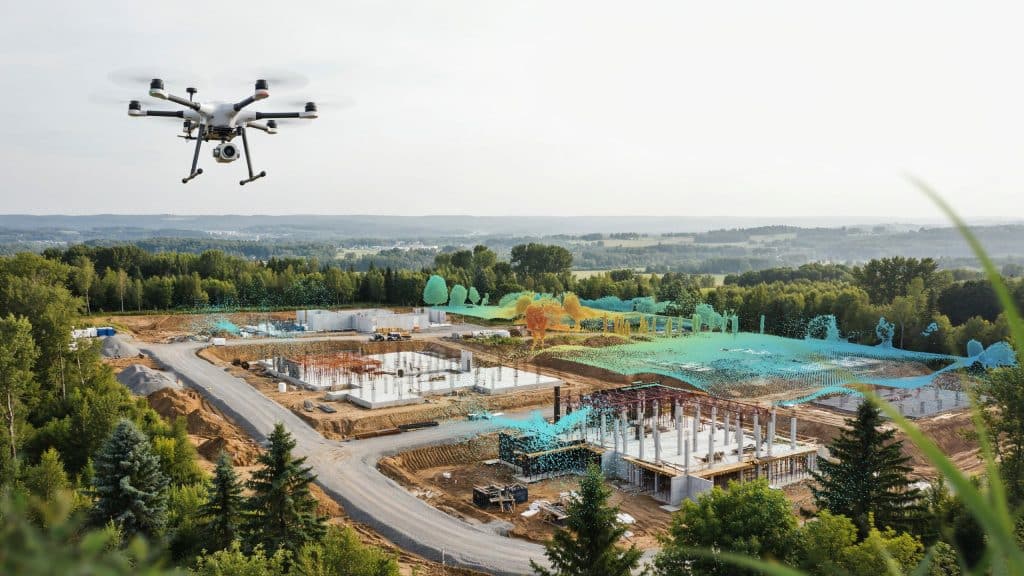
A LiDAR point cloud is millions of measured 3D points. Each point marks a real spot the laser actually hit.
Together, this LiDAR point cloud data forms the shape of your site. You see ground, trees, buildings, and structures in fine detail.
Raw point cloud data is dense, accurate, and a little overwhelming. On its own, it is a starting point rather than an answer.
From it, your team builds a clean point cloud model to work with.
What are you actually paying for?
Here is the part most people never see clearly. The points are cheap, but the process behind them is not.
A real LiDAR job involves several stages of skilled work.
- Planning the flight and the ground control carefully
- LiDAR data collection in the field, safely and precisely
- Point cloud scanning turned into clean, aligned data
- Careful lidar point cloud processing and classification
- Quality checks that prove the data is accurate
That LiDAR data processing is where raw scans become usable. You are paying for a trustworthy LiDAR point cloud, not loose points.
What drives the cost of a point cloud?
So why do two quotes ever look so different? A few clear factors move the price up or down.
Point density is the big one, and it matters a lot. The USGS baseline sits at 2 points per square metre.
You can ask for far more, but each extra point adds cost. Higher density means slower flights and heavier processing.
Your LiDAR survey cost also depends on site size and access. Rough terrain and tight deadlines both push the price higher.
LiDAR mapping cost climbs with the detail and accuracy you demand. Understanding your true LiDAR data cost starts with your goals.
Match the LiDAR data to the job, and you never overpay. That is what really shapes the price of your LiDAR point cloud.
How is drone LiDAR different?
You may be weighing drone LiDAR against a crewed aircraft. That choice changes both your cost and your detail.
Drone LiDAR mapping flies low and captures very dense data. It suits smaller sites that need fine, close up detail.
A crewed LiDAR survey covers huge areas far more cheaply per acre. It simply trades some density for sheer speed.
Either way, a good LiDAR mapping workflow protects your accuracy. Both give you a solid LiDAR point cloud when done right.
Terrain still matters, as we show in how LiDAR performs in forest and mountains.
How do you get value from your point cloud?
A point cloud only pays off if you actually use it. Sitting on a hard drive, it helps nobody at all.
Good point cloud management keeps your data organised and findable. You store it safely and share it in the right formats.
From there, you extract models, contours, volumes, and measurements. The cloud becomes the source for every single deliverable.
Accuracy underpins all of it, which is why QA matters so much. We explain the numbers in how accurate drone LiDAR is.
Used well, your LiDAR point cloud pays for itself many times over.
How do you avoid overpaying?
A little planning saves you real money on any LiDAR job. These simple steps keep your spend honest and lean.
- Define your accuracy and deliverables before you buy
- Ask only for the point density you truly need
- Share your site size and access details upfront
- Request a clear, itemised quote every single time
Do this, and you pay for value instead of guesswork. A good provider will happily walk you through each step.
Frequently asked questions
What is a point cloud in simple terms?
It is a set of millions of 3D points that map a real surface. Each point holds an exact position in space.
Why is point cloud processing so expensive?
Because turning raw scans into clean, classified data takes real skill. That expertise is most of what you actually pay for.
How dense should my point cloud be?
It depends entirely on your project and its detail needs. More density means more cost, so match it to the goal.
Can you reduce LiDAR survey cost without losing quality?
Yes, by scoping the job well and flying only what you need. Clear goals stop you from paying for wasted detail.
Choose the right point cloud
In the end, a LiDAR point cloud is far more than raw points. You are paying for the skill that makes it trustworthy.
Know what drives the cost, and you buy exactly what you need. That means no overpaying, and no nasty surprises later.
Match the density and accuracy to your real project goals. This one habit keeps your whole budget firmly in check.
If you want data you can trust at a fair price, let us help. Tell us your goals, and Rekon Solutions will scope it right.