Try to survey a powerline corridor with traditional methods and you’ll quickly understand the problem. The most important features — the conductors, the guy wires, the cross-arms — are thin, they’re up in the air, and they’re the exact things a ground crew or a set of aerial photos struggles most to capture.
LiDAR powerline mapping is one of those jobs where the laser isn’t just a good option — it’s genuinely the right tool, and it’s worth understanding why.
Why utility corridors are so hard to map
Three things make powerline corridors a nightmare for conventional survey:
- The features are tiny in profile. A conductor cable might be a couple of centimetres thick. Photogrammetry, which builds models from matching points across overlapping photos, struggles badly with thin wires against a busy background — there’s just not enough for it to lock onto.
- They’re linear and long. Corridors run for kilometres across whatever terrain is in the way — forest, ravines, farmland. Walking it is slow; closing it isn’t an option.
- Vegetation is part of the job. A huge reason to survey a corridor is vegetation management — knowing where trees encroach on clearance zones. That means you need to see through the canopy to the ground and the wires both.
Why LiDAR powerline mapping solves it
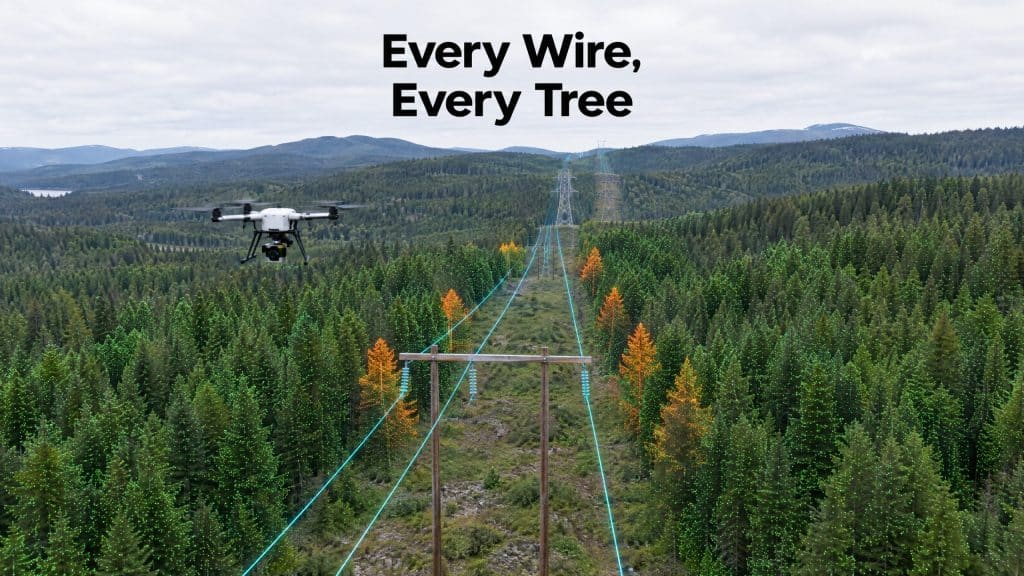
LiDAR fires hundreds of thousands of laser pulses per second, and those pulses behave differently from a camera. They’ll catch a return off a thin wire that a photo would miss entirely. Fly a drone low and slow along the corridor, and you capture the conductors, the poles, the guy wires, and the cross-arms as distinct, measurable features.
Because LiDAR also penetrates vegetation, the same flight gives you the bare ground beneath and the canopy above — so you can measure exactly how close vegetation is to the lines. That’s the core of why drone LiDAR is so well suited to detailed corridor and terrain work.
What you actually get out of it
A properly flown corridor survey delivers:
- Classified data separating wires, structures, vegetation, and ground into their own layers
- Clearance analysis — precise distances between conductors and encroaching vegetation or terrain
- Wire modelling, including sag, which changes with temperature and load
- A bare-earth model of the corridor for any civil or access work
- Structure detail for condition and inventory purposes
All of it captured without sending a crew climbing structures or hiking a live corridor for weeks.
Why the drone matters specifically
Manned aircraft have flown corridor LiDAR for years, and they’re great for very long transmission lines. But a drone flies lower and slower, which means dramatically higher point density — and that density is exactly what you need to resolve small features like guy wires cleanly. For the detailed inspection-grade end of corridor work, the drone’s proximity is a real advantage.
The bottom line
If your corridor survey needs to capture the wires themselves — not just the ground near them — LiDAR is the method that actually does it, and a drone-mounted system captures them in the kind of detail that makes the data genuinely useful for clearance, design, and maintenance planning.
Have a corridor to map? Let’s talk about the right approach for your lines →