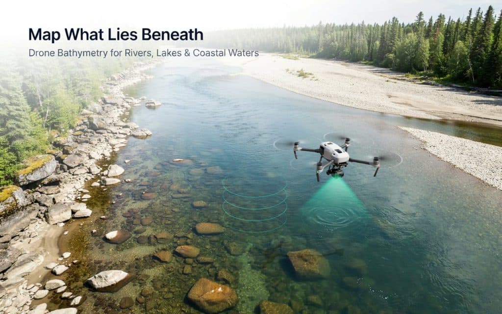
Water hides a surprising amount of important ground.
And the uses of drone bathymetry all come down to revealing it.
Beneath the surface sits terrain that shapes floods, habitats, and structures, yet it stays invisible from the bank.
A drone carrying a green laser can map that hidden bed from the air.
Where it can capture depth and shape without a boat, a diver, or anyone stepping into the current.
That one ability unlocks a long list of jobs.
A peer reviewed review in the journal Sensors notes that green laser bathymetry can measure depth to around three times the Secchi depth. Moreover, it is already used for river erosion studies, stream restoration, and coastal mapping, according to research in Sensors.
So let us walk through where this technology actually earns its keep.
How does drone bathymetry work?
The idea is simpler than it sounds. Most drone bathymetry mapping uses a green wavelength laser, because green light passes through clear water where ordinary lasers cannot.
The laser fires down, reflects off the bed, and returns to the sensor. Timing that trip reveals the depth at every point, building a detailed model of the bottom.
An underwater mapping drone captures the shoreline and the shallow bed in the same flight. That gives you one seamless surface, from dry land to river bottom, which is exactly what most projects need.
Because it works from the air, this kind of bathymetry survey covers ground fast and keeps people safely out of the water.
How is it used for flood and river management?
This is one of the biggest uses of drone bathymetry, and for good reason. Accurate flood models need the shape of the river channel, not just the land around it.
By mapping the bed, engineers can model how water moves, where it will spill, and how high it might rise. That feeds directly into flood mapping, culvert sizing, and emergency planning.
After a storm or wildfire, rivers change shape fast. A quick bathymetric mapping flight shows exactly how the channel shifted, so restoration and protection work can begin right away instead of weeks later.
How does it protect the environment and habitat?
Healthy rivers depend on their shape below the waterline, which makes environmental work a natural fit. Fish habitat in particular lives and dies by depth, gravel, and flow.
Biologists use underwater mapping with drones to track spawning beds, monitor erosion, and check how habitat changes across the seasons. The data guides restoration without anyone disturbing sensitive ground.
These are some of the most valuable uses of drone bathymetry in British Columbia, where salmon streams and First Nations waters need careful, low impact monitoring.
Among all drone bathymetry applications, habitat work may be the one that matters most to local communities, since these bathymetry applications protect the very ecosystems people depend on.
A drone gathers the full picture without wading through the very habitat it is meant to protect.
Where does it help construction and infrastructure?
Anything built near water needs to know what the water is hiding. That is where the uses of drone bathymetry move firmly into engineering.
Bridge and culvert design depends on the channel shape and how it scours over time. A bathymetry survey shows engineers the bed they are building over, so foundations account for real conditions.
The same data supports shoreline protection, marina planning, and pipeline crossings.
Accuracy is critical here, and it follows the same rules as any survey, which we cover in our guide on how accurate drone LiDAR is for engineering and construction projects.
How is it used in dredging and resource work?
Moving material in or around water is expensive, so precise volumes matter. Dredging teams rely on bathymetry to measure how much sediment sits on the bottom before and after a job.
Compare two surveys and you get an exact volume, which keeps billing honest and dredging efficient. Mining and industrial sites use the same approach for tailings ponds and settling basins.
Terrain and vegetation around the water still shape the flight, much like any survey in rugged country, as we explain in our post on how LiDAR performs in dense forest and mountain terrain. Handled well, these are some of the most practical uses of drone bathymetry of all.
Frequently asked questions
1. What is drone bathymetry?
It is the use of a drone to map the depth and shape of a riverbed, lakebed, or shallow coastal floor. A green laser sensor reads through clear water to capture the bottom.
2. How deep can drone bathymetry measure?
It depends on water clarity. In clear water it can reach roughly two to three times the visible depth, though murky water sharply reduces that range.
3. Is drone bathymetry accurate?
Yes, in suitable conditions it delivers reliable depth data, which is why the uses of drone bathymetry keep expanding. Clarity, calm water, and careful planning all shape the final quality.
4. When should you use sonar instead?
Use sonar for deep, dark, or turbid water where light cannot reach the bottom. Many projects pair drone bathymetry for the shallows with sonar for the depths.
Is drone bathymetry right for your project?
The uses of drone bathymetry come down to a simple promise. If the ground you care about sits under shallow, clear water, a drone can map it quickly, safely, and in detail.
From flood models to fish habitat to bridge foundations, the same flight serves a remarkable range of needs. And when the water turns too deep or murky, pairing it with sonar fills the gap.
If you have a river, lake, or shoreline that holds answers you need, let us help you get them. Tell us about your water and your goals, and Rekon Solutions will map what lies beneath.