Every developer knows the quiet killer of a project timeline: the approvals process. It’s not usually one big rejection that sets you back — it’s the slow drip of back-and-forth. A reviewer has a question. You respond. They have another. Weeks evaporate while nothing gets built.
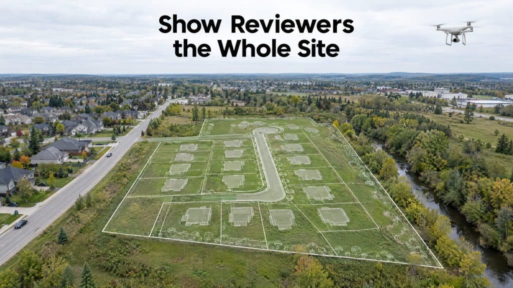
A surprising amount of that friction comes down to one thing: the people reviewing your project can’t clearly see what they’re being asked to approve. And that’s a problem aerial photography for property development is remarkably good at solving.
Why approvals stall
Planners, councils, and review boards are making decisions about a place most of them will never physically visit. They’re working from site plans, written descriptions, and maybe a few ground-level photos that show fragments — a corner here, a boundary there. When the picture is incomplete, the natural response isn’t “approve” — it’s “we have more questions.”
Every one of those questions is a round-trip. Every round-trip is time.
What a clear aerial view changes
An aerial photo — or better, an orthomosaic map you can actually measure on — gives reviewers the whole site in one honest frame. Scale, context, access, neighbouring properties, existing features, topography: all of it, instantly legible.
When a reviewer can see exactly what you see, several things happen:
- Questions get answered before they’re asked. A lot of back-and-forth exists only because something was unclear. Show it plainly and the question never comes up.
- Stakeholders align faster. Everyone’s looking at the same reality instead of arguing over interpretations of a 2D plan.
- Proposals get more persuasive. A development plan overlaid on a real aerial view of the site is far more convincing than an abstract drawing. Reviewers, neighbours, and investors all grasp it immediately.
Aerial photography for property development, beyond the approval
The value doesn’t stop when the permit clears. The same aerial imagery earns its keep across the project:
- A pre-construction baseline — a documented, dated record of exactly how the site looked before anyone touched it. This protects you if boundaries, conditions, or responsibilities are ever disputed later, which is exactly why pre-construction documentation matters so much.
- Progress documentation — regular flights that show the project advancing, useful for stakeholders, lenders, and your own records.
- Marketing material — the same imagery that convinced the review board also sells units and attracts investors.
It’s not just pretty pictures
The distinction worth making: this isn’t about glossy marketing shots (though you get those too). It’s about information. A measurable, accurate aerial record removes ambiguity — and ambiguity is what slows approvals down. For larger or more complex sites, pairing photography with accurate terrain data makes the submission even stronger, giving reviewers both the visual and the measurable picture in one.
If approvals are the bottleneck on your development, better visuals are one of the cheapest, fastest levers you can pull. You’re not changing the project — you’re just letting everyone see it clearly. And clarity, it turns out, moves faster than paperwork.
Planning a development submission? Let’s talk about the imagery that’ll move it forward →