Choosing the wrong mapping method can quietly affect your entire project.
Many teams adopt drone mapping because it looks fast and cost effective, but not every site is suitable for photogrammetry.
Terrain, lighting, vegetation, and surface conditions all influence the final results.
That is why understanding when to use drone photogrammetry matters before data collection even begins.
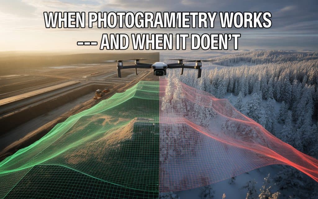
Photogrammetry can deliver highly detailed mapping outputs under the right conditions.
However, there are also situations where it struggles and creates avoidable accuracy issues.
Smart project teams know that technology should match site conditions, not trends.
Let’s look at where photogrammetry performs exceptionally well and where other methods may be the smarter choice.
Why Drone Photogrammetry Performs So Well in Open Terrain
One reason when to use drone photogrammetry has become such an important discussion is because of how effective it can be in the right environment. Photogrammetry works by stitching together overlapping aerial images into measurable spatial models. When terrain conditions cooperate, the results are impressive.
Open landscapes with visible surface detail usually produce strong outputs. Construction sites, gravel pits, road corridors, and exposed terrain are ideal examples. These environments provide clear visual reference points that software can process accurately.
This is where best conditions for drone photogrammetry become important. Consistent textures, stable lighting, and minimal obstruction help improve reconstruction quality significantly.
How Terrain Conditions Influence Mapping Results
Terrain directly affects how well photogrammetry performs. Flat or moderately varied surfaces usually process more reliably than heavily obstructed areas. This makes terrain suitability for photogrammetry one of the most important planning considerations.
For example, rocky terrain with clear texture often creates excellent datasets. Snow covered surfaces, reflective materials, or dense forests create more processing difficulty. These environments reduce image consistency and weaken reconstruction accuracy.
Additionally, steep elevation changes can sometimes create shadowing or visibility gaps. Flight planning helps reduce these issues, but terrain still plays a major role in final output quality.
The Best Conditions for Drone Photogrammetry
Several environmental factors help maximize photogrammetry performance. Understanding these conditions allows teams to improve mapping consistency and reduce processing errors.
1. Consistent Lighting Conditions
Even lighting improves image clarity and overlap consistency. Harsh shadows or rapidly changing sunlight can affect reconstruction accuracy.
2. Strong Surface Texture
Detailed surfaces help software identify matching points between images. Uniform surfaces like sand, water, or snow are more difficult to process.
3. Minimal Vegetation Obstruction
Open terrain generally produces better results than dense forests. Thick vegetation can hide the ground surface from aerial imagery.
4. Stable Weather Conditions
Wind can affect image sharpness and flight consistency. Calm weather improves data quality significantly.
These are some of the drone survey accuracy factors experienced teams evaluate before planning a mission.
When Photogrammetry Is Not Accurate
Understanding when photogrammetry is not accurate is just as important as understanding its strengths. Many mapping problems happen because teams use photogrammetry in environments where it was never the ideal solution.
Dense forests are one common challenge. Since photogrammetry depends on visible surfaces, thick canopy cover blocks the ground completely. This limits terrain accuracy beneath vegetation.
Reflective or transparent surfaces also create problems. Water bodies, glass, or shiny metal structures often confuse image reconstruction software. These conditions increase the likelihood of drone mapping errors and limitations.
Low texture environments create another issue. Uniform fields or featureless terrain provide fewer matching points for image alignment.
Comparing LiDAR vs Photogrammetry Use Cases
Many organizations now compare LiDAR vs photogrammetry use cases before selecting a mapping workflow. While both technologies create spatial data, they solve different problems more effectively.
Photogrammetry excels in visually rich, open environments where detailed imagery matters. It is cost effective and produces strong visual outputs. LiDAR, however, performs better in forests, steep terrain, and heavily vegetated areas.
This is why photogrammetry vs LiDAR comparison discussions should always focus on project conditions rather than popularity. One method is not universally better than the other.
For example:
- Photogrammetry works well for construction progress tracking
- LiDAR performs better for terrain mapping beneath vegetation
- Photogrammetry captures stronger texture detail
- LiDAR delivers more reliable elevation data in difficult terrain
Choosing the right tool depends entirely on project requirements.
Learn more about how LiDAR performs in dense terrain.
Understanding Drone Mapping Accuracy Limitations
No mapping method is perfect in every situation. Understanding drone mapping accuracy limitations helps teams plan realistic expectations before data collection begins.
Ground control placement, image overlap, flight altitude, and camera calibration all influence final accuracy. Even experienced operators must account for environmental variables carefully.
Additionally, processing quality matters as much as image collection. Poor alignment settings or insufficient overlap can reduce reconstruction precision. This is why experienced survey teams focus heavily on workflow consistency.
According to the American Society for Photogrammetry and Remote Sensing, aerial photogrammetry accuracy depends heavily on image quality, control accuracy, and environmental conditions.
These factors directly affect how reliable the final outputs become.
Photogrammetry Limitations Canada Teams Often Encounter
Projects across Canada frequently involve forests, mountains, snow coverage, and changing weather. These conditions create unique photogrammetry limitations Canada teams must consider carefully.
For example, snow covered terrain reduces visible texture and image contrast. Dense boreal forests limit ground visibility. Rapid weather changes also affect lighting consistency during flights.
This does not mean photogrammetry is ineffective in Canada. It simply means project planning becomes more important. Teams often combine photogrammetry with LiDAR depending on terrain complexity.
An experienced provider understands when one technology should support the other instead of forcing a single solution everywhere.
Why Some Teams Combine Multiple 3D Mapping Methods
Modern projects increasingly rely on hybrid workflows rather than single technologies. Combining aerial imagery with LiDAR often improves both visualization and elevation accuracy.
This approach helps address 3D mapping methods differences more strategically. LiDAR captures terrain beneath vegetation, while photogrammetry provides detailed visual textures for topographic mapping. Together, they create more complete datasets.
This combination is especially useful for infrastructure, mining, and environmental projects involving varied terrain conditions.
If your team is evaluating drone mapping options, Rekon Solutions can help determine which workflow best supports your project goals.
How Smart Teams Decide Which Technology Fits Best
Experienced teams rarely ask which technology is universally better. Instead, they evaluate which method fits the project environment most effectively.
They consider:
- vegetation density
- terrain complexity
- required accuracy
- project timelines
- deliverable expectations
- environmental conditions
This practical approach leads to more reliable mapping outcomes and fewer costly surprises later.
FAQs
1. When should you use drone photogrammetry
Photogrammetry works best in open terrain with strong surface visibility and consistent lighting.
2. When is photogrammetry not accurate
Dense vegetation, reflective surfaces, snow, and poor lighting can reduce accuracy significantly.
3. Is LiDAR better than photogrammetry
LiDAR performs better in forests and rugged terrain, while photogrammetry excels in detailed visual mapping.
4. What factors affect drone mapping accuracy
Terrain conditions, overlap quality, lighting, weather, and processing workflows all influence mapping accuracy.
Moving Forward with Better Mapping Decisions
Understanding when to use drone photogrammetry helps you avoid costly data issues before projects begin. Photogrammetry can deliver highly detailed and efficient mapping results when conditions are suitable. However, recognizing its limitations is equally important for reliable outcomes.
By evaluating terrain, vegetation, and project goals carefully, teams can select the right workflow with confidence. Sometimes photogrammetry is the perfect solution. Other times, LiDAR provides the accuracy the site demands.
If you are planning a mapping project and need guidance on the best approach, Rekon Solutions can help you choose the right technology for your terrain and objectives. Contact us with your project details to learn about further roadmap.
The best mapping results start with choosing the right tool for the environment.
