Save the Salmon! Bathymetry in a Hydrological Study
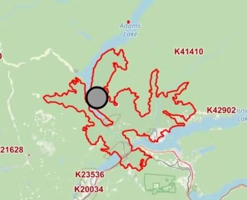
In this post we will take a look at how the fires that ravaged the East Adams Lake area in 2023 threatened to potentially destroy precious Salmon breading grounds in the Lower Adams River, and the work that is still being done to mitigate the damages and hopefully improve the Salmon Run for years to come. The 2023 Wildfires 2023 saw one of the most destructive wildfire seasons in British Columbia’s recorded history, with more that 2.84 million hectares of forest and land burned, tens of thousands of people forced to evacuate and hundreds of homes and structures lost or damaged. With the Adams Lake complex fire measuring over 10,004.9 hectares at its peak, and surrounding the Lower Adams River on all sides, the damage to the forests vegetation could cause serious erosion issues in the event of heavy rainfall. When a wildfire burns through an area, it burns up most if not all vegetation, leaving the soil compromised not able to absorb the moisture of a heavy rainfall. If you couple this scenario with steep terrain, the water that is not absorbed can run and carry debris with it. This water and debris all flow and settle in the river systems. This erosion would severely impact the Lower Adams River and would pose a serious risk to a large population of salmon that rely heavily on this section of river for their annual spawning grounds. The Salmon Run “A salmon run is an annual fish migration event where many salmonid species, which are typically hatched in fresh water and live most of their adult life downstream in the ocean, swim back against the stream to the upper reaches of rivers to spawn on the gravel beds of small creeks.” – wikipedia The Lower Adams River is one of the largest annual spawning grounds in BC for several Salmon species. In the third week of August, the late-run sockeye salmon run alone was estimated to be nearly 4.5 million returning to the Lower Adams River spawning grounds. With such a large population of Salmon dependent on this river system something had to be done to protect the Salmon’s spawning grounds. To answer the call for action was the Skwlāx First Nations Band. Skwlāx te Secwepemcu’lecw (formerly Little Shuswap Lake Band) The Skwlāx First Nations Band is centered in and around the Lee Creek area and pride themselves on being stewards and protectors of the land. It was the bands approved funding that put in motion the wheels for change. The band put together a project task force comprised of Band leaders, community leaders, project managers, engineering staff, Department of Fisheries staff and drone LiDAR subcontractors to assess, diagnose and troubleshoot a path forward. Working with the Skwlāx First Nations Band, the task force experts first needed to conduct a Hydrological Study of the Lower Adams River to assess the risk level, engineer mitigation measures and possibly even produce a plan to increase the Salmon’s spawning grounds by potentially opening up older dry channels in the river system. In order to conduct the Hydrological study the engineers required accurate topography data of the Lower Adams River as well as the surrounding area. In order to provide accurate data for the Hydrological study, Rekon was tasked to deploy Drone LiDAR Mapping to produce an accurate topographic survey of the surrounding area as well as Drone Photogrammetry Mapping to produce a high accuracy Orthomosaic Map. While LiDAR is great at topographic surveying, even in dense vegetation, LiDAR does not return data in water (the laser light is reflected on the surface of the in water) thus, creating missing data in the survey. Which isn’t ideal for a Hydrological Study. Good thing there is such a thing as Bathymetry. Bathymetric Survey This section will take a look at how Rekon used their Bathymetry system to survey the Lower Adams River floor elevations to “fill in” the missing river sections of topography data from the LiDAR survey. But first, what is Bathymetry? Wikipedia describes Bathymetry as “the study of underwater depth of ocean floors (seabed topography), lake floors, or river floors. In other words, bathymetry is the underwater equivalent to hypsometry or topography“. For visual representation, see the image below from an article in LiDAR Magazine “Overcoming Hurdles to Modeling River Bathymetry”. Check it out the article here! Example image of river bed topography (image supplied by https://lidarmag.com/2019/05/08/overcoming-hurdles-to-modeling-river-bathymetry/) The first component to collecting bathymetry data is the vehicle. At Rekon we deploy an Unmanned Survey Vehicle, or USV made by Bathycat, designed to complete bathymetric surveys with a single beam echo sounder while remaining safely on the shore or river banks. This catamaran style USV is remotely piloted with two forward and reverse thrusters that can carry out manual maneuvering or automated missions. The second component to collecting bathymetry data is the depth measuring device or sensor. Integrated into the Bathycat is a survey grade 200kHz single beam echo sounder, capable of collecting data points at a ping rate of 1Hz – 10Hz (1-10 soundings per second) from a minimum depth of 0.4m (1.3 ft) up to 100m (328ft) deep. It is also capable of being mounted on other watercraft such as kayaks, rafts or motorized boats which allows us to choose the right watercraft for the waterway so we can collect accurate data safely. The third component of collecting Bathymetry data is the GNSS receiver or GPS survey receiver. This multi-band RTK GNSS receiver is capable of centimeter precision and communicates via Wifi with the Bathycat onboard computer to record position data along with the elevation data from the echo sounder. Data Collection In the planning phase of the project, the Bathymetry missions were created to ensure adequate coverage of the river in approximately 5-10m cross sections, as seen below. However the urgency of project, the water levels, partly submerged obstacles and swift current of the Lower Adams River meant collecting the data while operating the USV fully manual was the safest choice. Conducting the
Aerial Mapping Services: How Drone Data Supports Better Planning Decisions
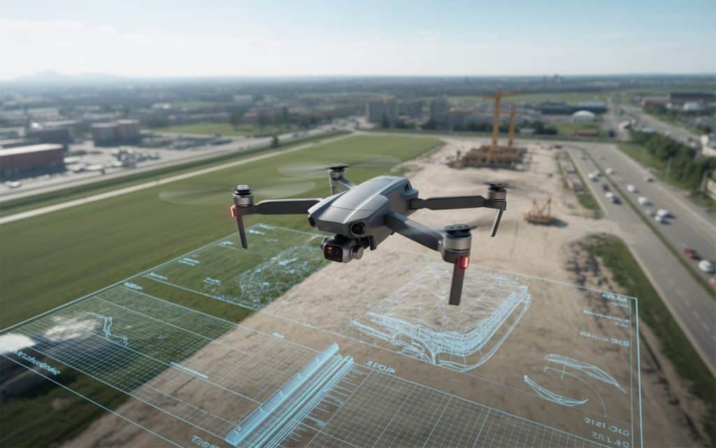
In the past, creating accurate maps of large areas was time-consuming, expensive, and sometimes dangerous. But with the rise of drones, aerial mapping has entered a new era. Drones have revolutionized how we collect and analyze data, offering an efficient and cost-effective way to gather detailed information from the sky. If you’ve been curious about how drone data is supporting better planning decisions, you’ve come to the right place. Let’s take a closer look at how drone aerial mapping works, the benefits it brings to various industries, and why UAV mapping services are becoming the go-to solution for projects big and small. What is Aerial Mapping? At its core, aerial mapping involves using aircraft or drones to capture images or data from above. These images and data are then processed into maps, models, and other forms of useful information. Traditionally, this was done with manned aircraft, but now mapping by drones is the preferred method for its precision, efficiency, and cost-effectiveness. UAV mapping services can create 2D maps or 3D aerial maps that show terrain, buildings, vegetation, roads, and much more. These maps can be used for a wide range of applications, from urban planning to environmental monitoring, and even construction site management. The Benefits of Drone Mapping 1. Speed and Efficiency One of the biggest advantages of drone aerial mapping is speed. Traditional mapping methods, especially for large areas, could take days or even weeks. With drones, the same area can be mapped in just a few hours. Drones are equipped with cameras and sensors that capture data from every angle, creating a comprehensive view of the land in less time. This speed doesn’t just save time; it also saves money. Less time spent on the field means lower labor and equipment costs, making UAV mapping services more affordable. 2. High Accuracy Accuracy is crucial when it comes to planning projects, whether you’re designing a building, laying out a road, or assessing an environmental area. GIS aerial mapping and 3D aerial maps created by drones offer incredibly precise data. By using GPS technology and advanced software, drones can achieve centimeter-level accuracy, making them perfect for tasks that require high precision. For example, a drone aerial mapping of a construction site can provide exact measurements, helping architects and engineers make better decisions. 3. Access to Hard-to-Reach Areas Some areas are difficult or dangerous to reach, making traditional surveying methods a challenge. Think about surveying steep mountain slopes or dense forests. Mapping by drones is the solution. Drones can easily fly over these difficult terrains, collecting data without requiring surveyors to put themselves in harm’s way. For example, airborne LiDAR BC (a LiDAR-based technology) uses drones to scan terrain, even through vegetation, giving surveyors a detailed, accurate picture of the land. 4. Real-Time Data Collection Drones provide real-time data, which means you don’t have to wait for days to get the results of your survey. As the drone flies over the area, the data is instantly sent to the ground station, where it’s processed and analyzed. This allows for immediate decision-making, which is critical in fast-paced industries like construction and urban planning. 5. Cost-Effective As we mentioned, UAV mapping services save both time and money. Traditional methods require a large team, expensive equipment, and a lot of labor. Drones, on the other hand, are more cost-efficient and require less manual labor. The upfront cost of purchasing or renting drones is quickly offset by the savings in time and labor. How Are Drones Used for Mapping? 1. Urban Planning and Development Drone aerial mapping is a game-changer for urban planning. City planners and developers can use drones to create accurate maps of existing land, infrastructure, and even future development areas. This data helps them plan roads, buildings, parks, and other infrastructure with a high degree of precision. Drones are especially useful when mapping large areas of land that will be developed in stages. With UAV mapping services, city planners can continuously monitor the progress of construction, make adjustments as needed, and ensure everything stays on track. 2. Environmental Monitoring Another area where drone aerial mapping excels is in environmental monitoring. Drones can be used to map forests, wetlands, or coastal areas, providing valuable data on the condition of ecosystems. For example, GIS aerial mapping can track changes in vegetation, water bodies, or even soil erosion. These maps help environmental organizations monitor land use, assess the impact of climate change, and make informed decisions about conservation efforts. Drones provide a more efficient and less disruptive way of monitoring the environment compared to traditional methods, which can require heavy machinery and a lot of personnel. 3. Construction and Infrastructure In construction, 3D aerial maps are used to map sites before construction begins. These maps help in designing the layout of roads, buildings, and utilities. During construction, drones can be used to monitor progress, ensuring the work is on schedule and within budget. Additionally, drones can be used to monitor infrastructure such as bridges, powerlines, and communication towers. With drone surveying applications, these structures can be inspected quickly and accurately without the need for workers to climb or enter dangerous areas. 4. Agriculture Farmers are increasingly using drone mapping for crop monitoring. By using drones equipped with multispectral sensors, farmers can track crop health, monitor irrigation systems, and assess soil conditions. Drones help farmers detect early signs of disease or pests, allowing them to take action before significant damage is done. This real-time data helps farmers optimize their crop yields while minimizing the use of pesticides and water, leading to more sustainable farming practices. 5. Mining and Resource Management In the mining industry, drone aerial mapping is used to monitor stockpiles, map mine sites, and track progress. Drones help mining companies save time by providing quick and accurate data on the size of stockpiles, the layout of the site, and the volume of material extracted. These maps help managers make more informed decisions, from managing resources to planning future mining operations. What Is the
Mine Surveying With Drones: Faster Data, Higher Accuracy, and Safer Operations
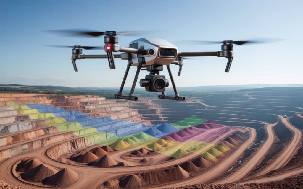
Mining has always been one of the most data-heavy industries in the world. Whether it’s calculating volumes, planning excavation, or ensuring worker safety, every decision depends on accurate data. That’s where drone technology steps in. Today, mine survey operations are faster, safer, and more accurate than ever before thanks to mine mapping drones and UAV mine survey methods. So, how exactly are drones changing mine surveying, and why are companies in Canada and around the world making the switch? Let’s explore. What Is Mine Surveying and Why Does It Matter? Mine surveying is the process of measuring, mapping, and analyzing the surface or underground layout of a mine. It helps determine the volume of materials extracted, track site progress, and ensure compliance with safety and environmental regulations. Traditional mine surveys often require workers to physically enter hazardous areas to take measurements. This not only takes more time but also increases risks. Drones, however, allow teams to perform accurate surveys from the air, enuring that the process is quicker, safer, and much more efficient. How Drones Are Transforming Mine Surveys 1. Faster Data Collection In the past, surveying large mine sites could take days or even weeks. With mine mapping drones, teams can now capture detailed aerial data in just a few hours. Drones equipped with high-resolution cameras and LiDAR sensors can cover large areas in a single flight, collecting thousands of data points. For example, A recent study in the Journal of Archaeological Science highlights how drone photogrammetry can decrease data acquisition from several hours or days to mere minutes, covering larger areas with high-resolution imagery and data Therefore, mining companies can make faster decisions and keep their operations running smoothly without long pauses for survey work. 2. Higher Accuracy With LiDAR and Photogrammetry Modern drones are equipped with mining LiDAR technology and photogrammetry sensors that generate detailed 3D models of mine sites. These models allow engineers to measure distances, calculate volumes, and identify changes in terrain with pinpoint accuracy. LiDAR sensors can capture precise elevation data even in areas covered by vegetation or debris. Resultantly, mine planners can identify potential hazards, design safer excavation routes, and plan stockpile movements more accurately. For more on how LiDAR improves data collection, you can read our previous blog on LiDAR services in Canada. 3. Enhanced Safety for Workers Mine sites are often filled with risks such as steep slopes, unstable ground, and heavy machinery. Traditional mine surveying exposes workers to these dangers. With UAV mine survey techniques, drones can safely access these high-risk areas and collect the required data without putting surveyors in harm’s way. Therefore, mining companies can maintain high safety standards while still getting the accurate measurements they need. As a result, fewer people need to enter hazardous zones, reducing both risk and downtime. 4. Accurate Volumetric Analysis Calculating how much material has been extracted or how much remains in a stockpile is one of the most critical parts of mine surveying. Volumetric analysis using drones provides far more accurate results than manual methods. Drones can generate 3D models that allow precise calculation of volume changes over time. This helps mine operators monitor progress, plan future excavation, and ensure they’re meeting production targets. 5. Simplified Stockpile Measurement Keeping track of materials on-site is another major challenge in mining. Manual stockpile measurements often require workers to climb piles or use heavy equipment to estimate volumes. This is not only slow but also dangerous. With drone-based stockpile measurement, a single flight can capture detailed topographic data of multiple piles at once. Afterwards, advanced software processes the data into accurate 3D maps. This allows mine managers to monitor material inventory in real time, to make reporting and compliance much easier. 6. Real-Time Monitoring and Reporting Another major advantage of mine mapping drones is their ability to provide real-time updates. After each flight, drones send data directly to processing software that creates detailed 3D maps and orthophotos within hours. This means managers don’t need to wait days to access reports. They can review current site conditions almost instantly. As a result, decisions can be made faster, and problems can be identified before they become costly. 7. Cost Savings Over Time Switching to UAV mine survey methods doesn’t just save time, it also reduces costs. Fewer staff are needed on-site, insurance and safety costs go down, and operations experience less downtime. The initial investment in drone technology pays off quickly. Although the upfront expense may seem high, the long-term benefits make it a smart financial move for mining operations. The Role of Mining LiDAR in Underground and Surface Surveys LiDAR technology has become one of the biggest advancements in modern mining. By sending thousands of laser pulses per second, LiDAR sensors create extremely accurate 3D representations of both surface and underground mine areas. For surface operations, mining LiDAR can map terrain, track changes in slopes, and identify erosion. Underground, it helps map tunnels and shafts where visibility is limited. These precise 3D models improve safety and assist engineers in designing efficient extraction plans. Therefore, LiDAR not only improves accuracy but also gives mining teams a deeper understanding of their site’s physical conditions — helping them make safer and smarter decisions. How Drones Support Environmental Compliance Mining operations must follow strict environmental guidelines. Drones make it easier to comply by offering accurate data for environmental assessments and rehabilitation tracking. Through mine survey data, companies can monitor land changes, water flow, and vegetation impact around their sites. Furthermore, drones help track land reclamation progress after mining is complete. Resultantly, companies can ensure they meet environmental restoration goals and maintain transparency with regulators. ]Partner With Us for Aerial Mine Surveying As drone technology continues to evolve, Rekon Solutions is helping mining companies across Canada collect accurate, reliable, and cost-effective data. Our team specializes in mine survey operations using advanced mine mapping drones and UAV mine survey systems. We provide end-to-end solutions, including aerial data capture to volumetric analysis, stockpile measurement, and mining LiDAR mapping. With Rekon, your
LiDAR Services in Canada: Where They’re Used & Why Demand Is Growing
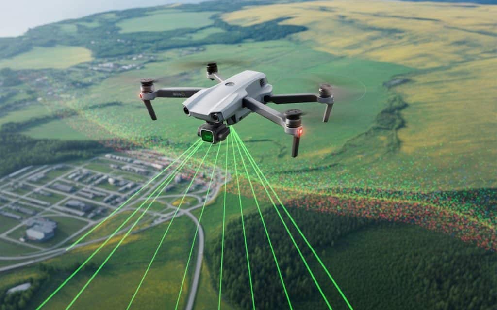
Have you ever wondered how professionals measure and map the Earth’s surface with such precision? The answer is LiDAR (Light Detection and Ranging). LiDAR services in Canada are becoming more and more popular as industries recognize how valuable they are. But why is the demand for these services growing so fast? Let’s take a look at where LiDAR mapping BC and 3D LiDAR scanning are used and why they are becoming so important. What Is LiDAR and How Does It Work? LiDAR, which stands for Light Detection and Ranging, is a technology used to measure distances by sending laser pulses and measuring the time it takes for them to return. These laser beams create detailed 3D models of the environment, capturing everything from trees to buildings. LiDAR data is used in the form of LiDAR point clouds, which are dense collections of points that represent the surface of objects. Topographic LiDAR surveys create highly detailed maps that help professionals better understand the layout and terrain of an area. Where Is LiDAR Used in Canada? 1. Infrastructure LiDAR One of the main areas where LiDAR services in Canada are used is infrastructure LiDAR. It’s crucial for mapping and analyzing infrastructure projects, including roads, bridges, and buildings. With LiDAR mapping in BC, cities and provinces can accurately measure their existing infrastructure, plan improvements, and carry out repairs. 2. Forestry and Environmental Monitoring LiDAR is also essential in forestry and environmental monitoring in Canada. LiDAR mapping BC helps measure tree heights, forest density, and canopy cover, which are crucial for sustainable forest management. It’s also used for monitoring wildlife habitats and assessing the effects of climate change. 3. Mining and Land Development In mining and land development, LiDAR services in Canada offer highly accurate data that’s needed for planning, design, and excavation. LiDAR allows surveyors and engineers to create precise 3D models of mining sites or undeveloped land. Afterward, this data can be used to assess materials and land, providing better planning for land development. As a result, LiDAR technology helps businesses make smarter, more cost-effective decisions when it comes to resource management and land development. 4. Agriculture and Crop Monitoring LiDAR mapping BC is also used in agriculture to help farmers monitor crop health, evaluate soil conditions, and track irrigation. Drones equipped with LiDAR can capture high-resolution images of farms, offering insights into potential issues like pest infestations or nutrient deficiencies. Multiple studies have shown that using LiDAR technology in agriculture improves crop yields by offering detailed data on soil and crop conditions (1) , (2). This means farmers can make decisions that increase efficiency and reduce waste. 5. Urban Planning and City Modeling LiDAR is often used in urban planning to map cities and their surroundings. Cities like Toronto and Vancouver use LiDAR services in Canada to create 3D models of their urban environments. This data helps with everything from zoning to planning public spaces, ensuring that new developments have the least environmental impact. By using 3D LiDAR scanning, urban planners can visualize how buildings, roads, and other structures will fit into the city. This is crucial for maintaining sustainable development in growing urban areas. Why Is Demand for LiDAR Services in Canada Growing? 1. Increased Accuracy and Efficiency LiDAR is far more accurate than traditional methods of surveying. For instance, traditional surveys often take longer and can be prone to human error. LiDAR, however, is much quicker, more precise, and can cover larger areas in less time. As a result, more businesses and industries are adopting it. 2. Cost-Effectiveness While the initial cost of using LiDAR services in Canada may seem high, the long-term savings are significant. By reducing the need for field workers, travel costs, and equipment, LiDAR is an efficient choice for many businesses. The efficiency and accuracy it provides result in fewer mistakes and costly delays. 3. Advancements in Drone Technology Another reason why LiDAR services in Canada are in high demand is the rapid growth of drone technology. Drones equipped with LiDAR sensors can quickly cover large areas and provide detailed data. This makes LiDAR technology more accessible, especially for industries that need to capture data in remote or hard-to-reach areas. Additionally, drones are much cheaper to operate than manned aircraft, which has made LiDAR services available to a wider range of businesses and industries in Canada. 4. Government and Environmental Regulations As Canada continues to prioritize environmental conservation and sustainable development, more industries are turning to LiDAR technology to meet regulatory requirements. LiDAR helps businesses collect the detailed data they need to comply with environmental assessments, ensuring that projects are in line with government regulations. For example, environmental LiDAR is used by the Canadian government to monitor forest cover, flood risks, and habitat changes. As government regulations become stricter, businesses are increasingly relying on LiDAR to help them meet these demands. Rekon Solutions: Your LiDAR Partner in Canada As demand for LiDAR services in Canada continues to rise, Rekon Solutions is ready to provide you with the most accurate, efficient, and cost-effective LiDAR solutions. Whether you’re in construction, forestry, agriculture, or urban planning, we offer 3D LiDAR scanning and topographic LiDAR surveys to help you make more informed decisions. To see how LiDAR technology can benefit your business, check out how LiDAR is revolutionizing industries. Conclusion LiDAR is quickly becoming a key tool for data collection and mapping in Canada. From LiDAR mapping BC to infrastructure LiDAR, the technology is essential for a variety of industries. The demand for LiDAR services in Canada will only continue to grow, with businesses and government agencies turning to LiDAR for its speed, accuracy, and cost-effectiveness. If you’re looking to improve your data collection and mapping with LiDAR services, Rekon’s LiDAR drones can help you. Get in touch to learn how our 3D LiDAR scanning and topographic LiDAR surveys can help your business achieve its goals.
How UAV Inspection Services Reduce Downtime for Industrial Operations?
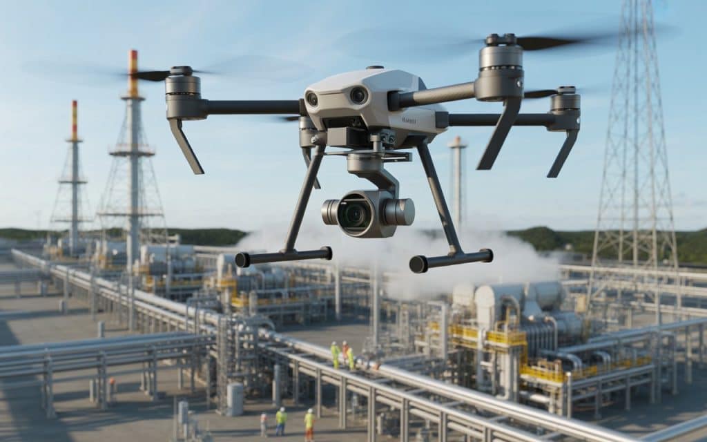
In today’s fast-paced industrial world, reducing downtime is critical to maintaining productivity and profitability. Whether it’s in manufacturing plants, energy infrastructure, or pipelines, any pause in operations can have significant financial and operational impacts. This is where unmanned aerial vehicle (UAV) inspection services come in, offering industries a fast, safe, and efficient solution for maintaining and monitoring critical assets. By utilizing drone inspection service technology, companies can inspect assets like towers, pipelines, and machinery with minimal disruption to ongoing operations. In this blog, we will explore how industrial drone inspections are transforming industries, reducing downtime, and improving asset management. What Are UAV Inspection Services? UAV inspection services use UAVs or drones equipped with high-resolution cameras, LiDAR sensors, and other advanced technology to conduct inspections. These inspections provide real-time, high-quality data without requiring personnel to access hazardous or hard-to-reach areas. Compared to traditional inspection methods, drones are quicker, safer, and can operate in environments that are difficult or dangerous for human workers. As a result, industries are increasingly relying on asset inspection drones for routine maintenance checks, safety assessments, and condition monitoring. How UAV Inspection Services Reduce Downtime 1. Speeding Up the Inspection Process In the past, traditional industrial inspections could take days or even weeks. Workers would need to physically inspect equipment or infrastructure, which often meant shutting down operations temporarily. These inspections could also require scaffolding, lifts, or even helicopters, which added to the time and cost. With drone inspection services, the time taken for inspections is drastically reduced. Drones can cover vast areas in a short amount of time, providing operators with detailed visual or sensor data in just a few hours. Industrial drone inspections are especially beneficial for inspecting large infrastructure such as tower inspections or pipeline inspections, where drones can survey miles of land or high structures without the need for extensive downtime. This increase in inspection speed means companies can keep operations running smoothly, minimizing the time spent waiting for inspections and reports. Consequently, production and operations are less likely to be interrupted, allowing for greater overall efficiency. 2. Improved Safety and Reduced Risk of Accidents Safety is a major concern during traditional inspections. In many industries, inspectors are required to climb towers, enter confined spaces, or operate in high-risk environments, such as oil rigs or manufacturing plants. These tasks are not only time-consuming but also inherently dangerous, increasing the risk of accidents or injuries. UAV inspection services help eliminate these risks by allowing drones to perform inspections from the air or at a distance. Asset inspection drones can easily fly over large, hard-to-reach areas, capturing detailed images or videos without any human intervention. This significantly reduces the likelihood of accidents and injuries during inspections. By reducing the need for workers to be in potentially dangerous situations, industrial companies can reduce workplace accidents, minimize worker compensation claims, and improve overall safety metrics. 3. Real-Time Data and Immediate Reporting UAV inspection services provide real-time data during inspections, which can be immediately analyzed. Traditional methods often involved gathering data manually, which had to be processed afterward. This led to delays in identifying issues and addressing potential problems. With drone inspection service technology, operators can view the results as the drone collects data. In cases of critical damage or safety concerns, real-time reporting allows for quicker decisions and faster corrective actions. For instance, if a tower inspection reveals a fault, the maintenance team can immediately schedule repairs or take corrective action, avoiding any risk of failure or additional downtime. Real-time data also allows companies to track the condition of their assets over time. By comparing current inspection data with past reports, trends in equipment wear and tear can be identified early, allowing for predictive maintenance rather than reactive repairs. 4. Cost-Effectiveness While drones may require an upfront investment in technology, they ultimately save money by reducing operational costs. Traditional inspection methods, like scaffolding or using helicopters, can be expensive, not to mention the costs associated with any downtime required during these processes. UAV inspection services significantly reduce these costs. Drones are faster, require fewer workers, and eliminate the need for costly equipment such as scaffolds or cranes. Moreover, with industrial drone inspections, companies can inspect assets more frequently, catching small issues before they become costly repairs. 5. Minimizing Downtime in Hard-to-Reach Areas In some industries, such as oil and gas or telecommunications, there are critical assets that are difficult or dangerous to access. These might include offshore rigs, tall towers, or extensive pipeline networks. Traditional inspections of these assets often require significant downtime as workers are brought in to perform manual inspections, sometimes resulting in days of operational disruption. Drones, on the other hand, can reach these hard-to-access areas with ease. Pipeline inspections across long stretches of land, for example, can be completed in a fraction of the time it would take using traditional methods. Similarly, tower inspections can be done from the air, preventing the need for workers to climb dangerous heights or set up scaffolding. By allowing inspections to take place without interrupting operations, UAV inspections help to keep critical infrastructure up and running, minimizing downtime in hard-to-reach areas. 6. Enhanced Asset Monitoring and Preventive Maintenance Drones can perform continuous monitoring of critical assets, providing valuable insights into their condition over time. With asset inspection drones, companies can schedule routine checks and track wear and tear, which helps prevent unexpected breakdowns or failures. For example, industrial drone inspections can monitor the health of turbines, pipelines, and electrical towers, identifying potential issues before they cause major disruptions. Preventive maintenance becomes easier, and the overall lifespan of equipment is extended. With drones, companies can collect more data, more frequently, without causing significant disruptions to their operations. This ongoing monitoring helps to keep assets functioning smoothly, reducing the likelihood of unexpected failures that can lead to costly downtime. 7. Better Decision-Making Through Data Integration The data captured during drone inspections can be integrated into existing asset management systems, creating a detailed digital record of all inspections and maintenance
The Rise of UAV Drone Surveying: Accuracy, Cost Savings, and Real-World Use Cases
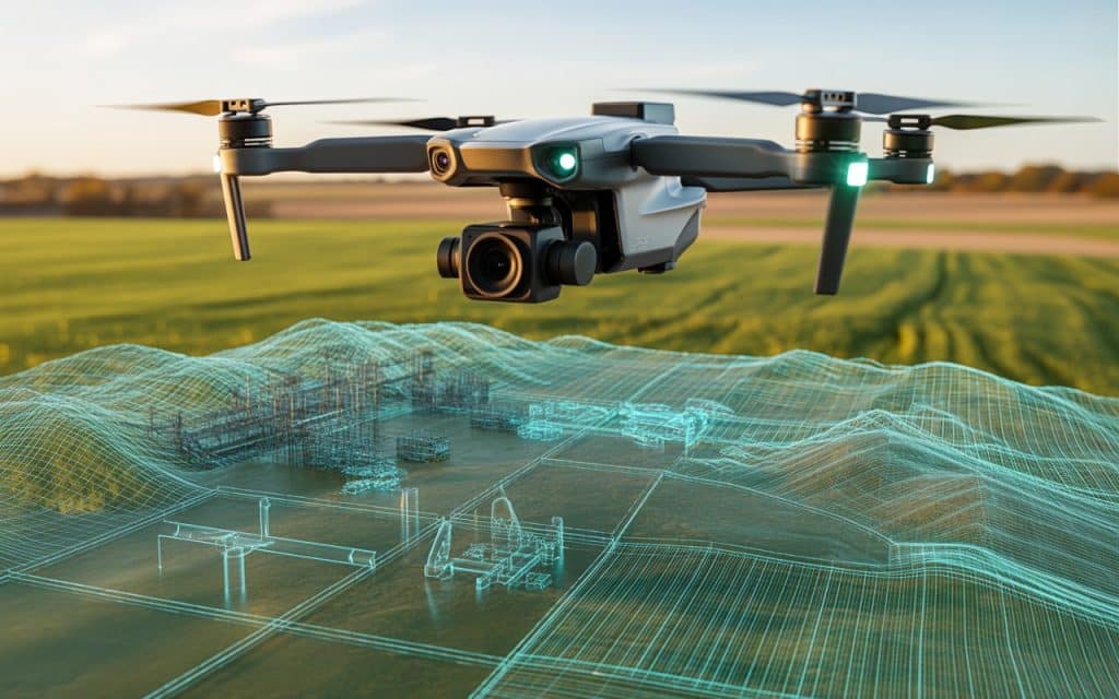
Have you ever wondered how drones are revolutionizing land surveying? In the past, land surveying required labor-intensive methods and was time-consuming. Now, UAV drone survey technology has completely changed that. Drones make surveying faster, more accurate, and cost-effective. In this blog, we’ll explore how UAV surveying works and its real-world applications. We’ll also look at how it’s transforming the industry by offering improved accuracy and efficiency. What Is a UAV Drone Survey? A UAV drone survey uses drones equipped with cameras and sensors.These drones capture data from the air to create maps, 3D models, and digital elevation models. UAV surveying allows large areas to be surveyed quickly and accurately. This is a huge improvement over traditional land surveying, which can take days or weeks. Drone mapping services use drones to collect precise measurements and imagery. This data is processed into maps, models, and reports, making it more efficient and effective. The Accuracy of UAV Drone Surveys UAV drone survey technology provides high-precision data. Drones equipped with LiDAR or photogrammetry sensors capture millions of data points every second. This creates accurate 3D models of terrain, structures, and infrastructure. The precision of these surveys is crucial for projects that require reliable measurements. With high-accuracy UAV mapping, you can create detailed maps that were once difficult to produce. Cost Savings with UAV Surveying One of the biggest advantages of UAV surveying is the cost savings. Traditional surveying methods require expensive equipment and manual labor. On the other hand, UAV drone surveys reduce labor costs by using drones that cover large areas quickly. Drones can be deployed with minimal setup, saving time and money. By reducing both labor and equipment costs, drone mapping services make surveying more affordable. This makes it possible to survey larger areas for a fraction of the cost of traditional methods. Real-World Use Cases for UAV Drone Surveying Construction and Infrastructure Projects UAV drone surveys are commonly used in construction to map land and inspect structures. Aerial survey drones provide high-resolution data to help engineers and architects. They make it easier to monitor construction sites and ensure everything is on track. Drones are used to create topographic maps and 3D models for design and planning. This data helps construction teams make informed decisions and prevent costly mistakes. Agriculture and Environmental Monitoring In agriculture, UAV surveying helps monitor crop health, assess irrigation needs, and track land conditions. Drones equipped with multispectral sensors can capture data about vegetation health. This allows farmers to optimize their practices and increase crop yield. For environmental monitoring, drone mapping services are used to study ecosystems and habitats. Drones can capture data on land use, vegetation cover, and natural resources without disturbing the environment. Mining and Resource Management UAV drone surveys are used in mining to monitor mining sites, track excavation progress, and inspect stockpiles. Drones can create detailed 3D models of the land, allowing mining companies to assess the site. Industrial drone inspection services help mining teams monitor the site without sending workers into dangerous areas. Drones also help with regulatory compliance by providing accurate and up-to-date data. Real Estate and Land Development In real estate, UAV drone surveys are used to capture aerial images of properties and land for sale. Aerial real estate photography provides a clear view of the property’s size, layout, and surroundings. Real estate developers use UAV surveying to inspect potential development sites and plan accordingly. Drones are also used to monitor construction progress and assess land conditions for development. The Benefits of UAV Drone Surveying 1. Accuracy and Precision UAV drone survey technology provides precise and accurate data for mapping and surveying projects. Drones equipped with LiDAR or high-resolution cameras capture detailed measurements. This ensures the creation of highly accurate maps, models, and digital elevation models. High-accuracy UAV mapping is crucial for any project that demands reliability and precision. 2. Time and Cost Efficiency Drone mapping services save time by covering large areas quickly. A drone can survey a site in hours, while traditional methods would take days or even weeks. This makes UAV surveying much more time-efficient and cost-effective. By reducing the need for manual labor and expensive equipment, drones cut overall costs. 3. Safety Safety is a top priority in any surveying project. UAV drone surveys eliminate the need for workers to access dangerous or hard-to-reach areas. Drones can fly over tall buildings, hazardous terrain, or unstable structures to collect data. This reduces the risk of injury and allows workers to remain safe while still gathering critical information. 4. Accessibility UAV surveying makes it easier to inspect areas that are difficult or dangerous to reach. Drones can access remote or rugged terrain that would be difficult or costly to survey by foot. This is particularly useful for surveying mountains, forests, coastlines, or large industrial sites. With BC land surveying drones, it’s possible to collect data from challenging environments that are otherwise inaccessible. How Rekon Solutions Uses UAV Drone Surveying At Rekon Solutions, we specialize in UAV drone surveys for a variety of industries. Our team uses drone mapping services to help clients in construction, real estate, agriculture, mining, and more. We provide high-precision data that helps our clients make better decisions and plan projects effectively. Whether you need topographic maps, 3D models, or aerial images, our UAV surveying technology can meet your needs. We focus on safety, accuracy, and efficiency, ensuring that our drone inspections provide the most reliable results. The Future of UAV Drone Surveying The future of UAV drone survey technology looks promising. Advancements in drone technology will continue to improve the accuracy, efficiency, and safety of surveys. As drones become more advanced, they will be able to capture even more precise data and cover larger areas. UAV surveying will continue to revolutionize industries, providing quicker and more cost-effective solutions. Conclusion UAV drone surveys are transforming the way we approach land surveying, construction, and resource management. By offering high accuracy, reducing costs, improving safety, and increasing efficiency, drones are quickly becoming the go-to tool for surveying
How Photogrammetry Is Transforming Large Scale Land Development Projects?
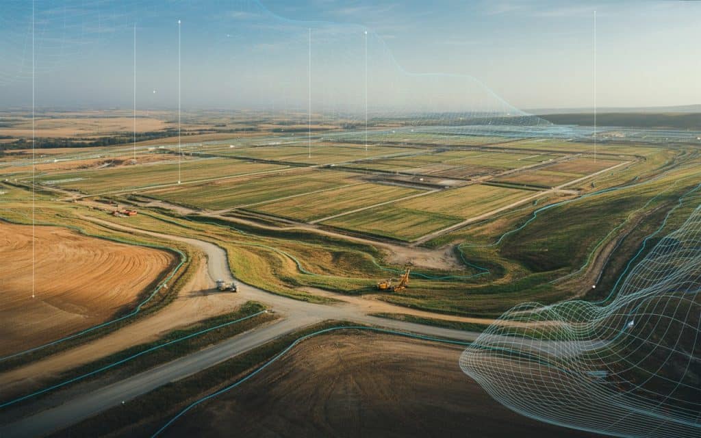
Have you ever wondered how developers manage massive land projects with speed, accuracy and confidence? Large scale land development comes with complexity, including vast areas, uneven terrain, tight deadlines, high financial risk. Where one wrong assumption about elevation drainage or boundaries can lead to costly delays. This is where photogrammetry is changing everything. Because photogrammetry allows you to capture real world environments with precision using images taken from above. And when it’s applied correctly, it turns land development from a guessing game into a data driven process. Consequently, it helps you plan better, build smarter and move faster. What Photogrammetry Means for Modern Land Development Photogrammetry is the process of using overlapping images to create accurate measurements and digital models of land. These images are captured from drones or aircraft and processed into detailed outputs such as maps, surface models and 3D visuals. In land development, photogrammetry replaces slow manual surveying methods with a faster and more scalable solution. It provides reliable data across large areas without the need for constant ground access. Why Photogrammetry Fits Large Scale Projects Perfectly It covers massive areas efficiently Traditional survey methods struggle with scale. Walking long sites takes time and resources. Whereas, with drone photogrammetry, you can capture hundreds of acres in a single flight. This makes it ideal for subdivisions, industrial zones, highways and mixed use developments. The speed of capture allows teams to gather data early and revisit sites frequently as work progresses. It delivers consistent and accurate measurements Photogrammetry survey outputs are built from hundreds or thousands of images stitched together through advanced processing. The result is a highly accurate representation of the site. Developers use this data to measure distances, elevations, slopes and volumes. This consistency reduces disputes and supports better planning decisions. It supports better collaboration Large projects involve many stakeholders. Engineers, planners, contractors and investors all need clarity. Three dimensional models created through 3D mapping make it easier for everyone to understand the site. Instead of interpreting flat drawings teams can explore the terrain visually. This improves communication and reduces misunderstandings. How Drone Photogrammetry Improves Planning and Design Better site analysis from the start Drone photogrammetry gives you a complete view of the land before construction begins. You can assess terrain conditions, drainage patterns, access points and environmental constraints. These insights help you avoid design mistakes early on. Additionally, it also allows planners to adapt layouts to real world conditions rather than assumptions. Accurate cut and fill calculations Earthworks are a major cost in land development. Photogrammetry helps calculate volumes precisely. You can estimate how much material needs to be moved and where. This level of accuracy improves budgeting and scheduling. It also reduces waste and rework. Ongoing monitoring during development As construction progresses photogrammetry survey data can be collected repeatedly. This allows teams to track changes over time. You can compare current conditions with earlier models to monitor progress. This helps ensure work stays aligned with plans and timelines. The Role of Photogrammetry in Construction Site Mapping Construction site mapping benefits greatly from photogrammetry. Instead of relying on outdated drawings teams can access up to date visuals of the site. These maps support logistics planning, safety assessments and quality control. They help identify conflicts between trades and ensure that structures are built in the right locations. Photogrammetry also improves documentation. Each survey creates a visual record of progress that can be reviewed later if questions arise. How Aerial Mapping Services Add Value Aerial mapping services powered by photogrammetry give developers a strategic advantage. They provide accurate data without interrupting operations. Because drones capture data from above there is minimal disruption to work on the ground. This makes it easier to integrate surveys into active construction schedules. Professional aerial mapping services also ensure that data is processed correctly. High quality outputs depend on proper flight planning, image overlap and processing expertise. Why Photogrammetry Reduces Risk in Land Development Risk in land development often comes from uncertainty. Unknown terrain conditions, unclear boundaries or inaccurate measurements can derail projects. Photogrammetry reduces this uncertainty. It gives you confidence in your data. It supports better decision making and reduces surprises. By using photogrammetry developers can identify issues early. They can adjust plans before problems become expensive. This proactive approach saves time and money. How Rekon Applies Photogrammetry to Real Projects At Rekon Solutions, photogrammetry is used to support large scale land development across multiple sectors. Our team delivers drone photogrammetry surveys that provide accurate three dimensional models and detailed site maps. We help clients visualize land conditions, plan construction phases and monitor progress over time. Our aerial mapping services integrate seamlessly with planning and engineering workflows. By combining advanced capture methods with careful data processing Rekon ensures that every photogrammetry survey delivers reliable and actionable insights. The Future of Land Development with Photogrammetry As land development projects grow in scale and complexity the need for accurate data will only increase. Photogrammetry is becoming a standard tool rather than a specialized option. Advances in drone technology and processing software continue to improve accuracy and efficiency. This makes photogrammetry more accessible and more powerful. Developers who adopt photogrammetry early gain a competitive edge. They plan better respond faster and build with greater confidence. Frequently Asked Questions What is photogrammetry used for in land development Photogrammetry is used to create accurate maps, models and measurements of land. It supports planning, design, earthworks and progress tracking in large development projects. How accurate is drone photogrammetry When performed correctly drone photogrammetry delivers high accuracy suitable for planning and monitoring. Accuracy depends on flight planning, ground control and processing quality. How does photogrammetry compare to traditional surveying Photogrammetry covers larger areas faster and provides visual context. Traditional surveying may still be used for specific control points but photogrammetry enhances overall efficiency. Can photogrammetry be used throughout a project lifecycle Yes, photogrammetry survey data can be collected before, during and after construction. This supports planning, monitoring and documentation at every stage. Conclusion Photogrammetry is transforming how large
Drone Thermography for Industrial Inspections

Have you considered how to spot hidden problems on your site before they become disasters? Industrial facilities are full of hidden challenges. Machinery overheats. Roof seams fail. Insulation degrades. Pipes leak. And when issues lie unseen, a small flaw can escalate into a costly failure. That is why using drone thermography industrial inspections can give you the upper hand. It reveals what the eye cannot see and it does so without putting workers at risk. In this post we explore how drone thermography industrial inspections transform safety and efficiency on industrial sites. We look at the real world advantages and show why this method is becoming central to modern inspection risk management industrial strategies. What is Drone Thermography Industrial Inspections? Drone thermography industrial inspections combine remote aerial imaging and heat sensing technology to inspect assets from above. A drone equipped with thermal sensors flies around a facility. It captures heat signatures across surfaces. These sensors detect temperature differences that may indicate problems under the surface. The result is a detailed thermal map of equipment, structures and infrastructure. This method is part of industrial drone thermography practices. It is defined by remote access and high resolution thermal imaging inspections. It gives a fast and accurate way to assess risk in structures that are large or dangerous or hard to reach. Why Do Thermal Imaging Inspections Make Sense in Industry? 1. Safety for inspection crews Industrial drone inspection services remove the need to send personnel into dangerous zones. Workers no longer need to climb towers, enter confined spaces, or work around active machinery under risky conditions. Instead they can operate drones from a safe distance and review the images remotely. This approach dramatically lowers the chances of accidents and injury on site. 2. Early detection of hidden faults Heat leaks inside equipment or under insulation often show up as hot or cold patches on thermal images long before any visible signs appear. Overheating components, failing insulation, moisture accumulation, structural heat loss and electrical faults all produce thermal differences detectable by drone thermal imaging inspections. That early detection helps prevent breakdowns before they trigger bigger problems. 3. Fast and comprehensive coverage A drone can scan entire facilities quickly. It can inspect warehouses, rooftops, pipelines, tanks, and structural supports all in a single flight. This level of coverage would take days with manual inspection. With drone thermography industrial inspections the turnaround time shrinks significantly. Issues are identified before small faults become costly repairs. 4. Detailed documentation for maintenance and compliance Thermography drones produce comprehensive data sets. Thermal images, temperature logs, and meta data like GPS location and timestamp are stored. This makes it easier to track changes over time. When you perform your next inspection you can compare the new thermal map with the previous one. That helps monitor degradation trends and supports predictive maintenance drone thermography strategies. This documentation also supports regulatory compliance and audit readiness. Facility owners and managers can show clear evidence of inspection records, repairs and condition monitoring over time. How Risk Based Inspection Methods Benefit from Drones Risk based industrial inspection methods focus on assets and structures that matter most. These are parts of the facility that if they fail cause major impact. By using drone thermography industrial inspections you can apply risk based methods with more precision. You begin by identifying high risk zones such as aging pipelines, high heat systems, pressure vessels, electrical panels, or rooftop HVAC units. Then you target them with industrial drone thermography to detect anomalies. This targeted approach makes inspection workflows more efficient and effective. Moreover, with repeated inspections over time you build a baseline thermal map. This helps track deterioration or unusual trends. And when a spike in heat appears you know something requires immediate action. This is predictive maintenance drone thermography in practice and it helps avoid unplanned downtime. What Types of Industrial Projects Work Best with Drone Thermal Imaging Inspections Drone thermography industrial inspections can support a variety of projects. Large scale manufacturing plants often house complex equipment that runs around the clock. Thermal inspections can reveal overheating motors, faulty conveyors, or failing electrical panels. Energy facilities such as power plants or distribution centers use critical components that benefit from thermal condition monitoring. Infrared drone inspections industrial style help detect early signs of heat stress or leaks in energy systems. Storage tanks and chemical plants need regular checks for integrity. Drone thermography helps monitor insulation integrity, spot leaks, and capture thermal anomalies before chemicals or pressure cause damage. Infrastructure sites like bridges, pipelines, or storage facilities often have complex or elevated structures. Drone based inspections reduce risk by removing personnel from heights and providing comprehensive thermal data for structural health monitoring. Best Practices for Effective Drone Thermal Imaging Inspections Begin with clear planning: Identify the key assets and prioritize areas that pose highest hazard or risk. Use existing records, maintenance history, and structural knowledge to guide your survey. Schedule inspections when external conditions are optimal: Early morning or late evening often yield better thermal contrast, especially when surfaces are cool and thermal anomalies stand out clearly. Fly at multiple angles and heights: A single perspective may not capture all potential issues. Using varied angles improves chances of detecting hidden problems. Use a qualified inspection team for data analysis: Thermal images require interpretation to differentiate between harmless thermal deviations and true hazards. Experienced analysts help avoid false positives. Maintain consistent archives: Save thermal images with timestamps and notes. On repeated inspections comparing old and new data makes it easy to spot gradual changes or emerging issues. Common Challenges and How to Mitigate Them Drone inspections depend on clear weather and stable conditions. Heavy winds or rain can disrupt data collection. Plan inspections carefully around weather forecasts. Thermal imaging may be affected by surface reflectivity, moisture, or insulation coverings. That can mask actual issues. Combine thermal imaging data with visual inspection or other sensor data to validate findings. Regulatory compliance and safety protocols must be followed. Even though drones reduce physical
Reducing Risk in Industrial Inspections

Are you confident that every hidden hazard in your facility is being identified before it becomes a serious problem? Industrial sites contain many risks that are not always obvious. Equipment wears down quietly. Heat builds up inside machinery. Structural weaknesses develop over time. Small issues can grow into major failures if inspections are not thorough. This is why reducing risk in industrial inspections is essential for every industry. Modern inspection methods now allow you to uncover hazards earlier and with far more accuracy. Drone based inspections and advanced imaging make it possible to assess complex structures without exposing teams to danger. But when used correctly, these tools transform inspection risk management industrial practices and raise safety standards across the site. Why Industrial Inspection Risk Matters Industrial environments involve heavy machinery, high pressure systems, electrical components, height exposure, and difficult to reach areas. Whereas, traditional inspections often require workers to climb, enter confined spaces, or operate near active equipment. These tasks introduce risk and increase the chance of accidents. Reducing risk in industrial inspections begins with using safer methods. The goal is to gather accurate information while minimizing exposure. This is where drone based solutions and remote sensing tools offer a major advantage. They keep workers safe while providing better visibility of potential hazards. How Technology Helps Reduce Industrial Inspection Risk Removing the Need for Dangerous Manual Access Drones and remote imaging tools allow you to inspect equipment from a safe distance. You no longer need to send workers onto unstable roofs, inside tanks, near hot machinery, or beneath tall structures. This minimizes direct exposure to danger. Rekon Solutions uses aerial and ground based technology that reaches tight spots or elevated surfaces without requiring physical access. This approach strengthens industrial inspection risk reduction because workers remain safe while data is collected from above or from remote positions. Capturing Detailed Visual and Thermal Data Modern sensors can reveal temperature differences, surface changes, cracks, leaks, corrosion, debris buildup, or structural deformation. These signs might not be visible during a standard inspection. With thermal imaging and high resolution cameras, hazard identification industrial inspections become faster and more accurate. You can spot early signs of problems that would otherwise go unnoticed. Supporting Consistent and Repeatable Inspections Industrial sites need regular inspections to track changes over time. Drone based imaging creates visual records for comparison. This helps you recognize gradual wear before it becomes severe. Consistency is a core part of inspection risk management industrial systems. When inspections are performed the same way every time, teams gain reliable data. Drones provide that consistency by capturing images and measurements in the same locations across repeated visits. How Risk Based Methods Improve Inspection Quality Focusing on High Risk Areas First Risk based industrial inspection methods prioritize the areas most likely to fail or cause harm. These could include aging structures, pressure vessels, high temperature systems, or locations exposed to weather. By concentrating resources on high risk areas, inspections become more effective. This approach saves time, improves safety, and reduces the chance of missing critical issues. Remote inspection tools help focus on priority areas without sending teams into hazardous zones. Using Data to Predict Future Problems Historical data helps identify patterns. If you know where failures have occurred before, you can predict where they may occur again. When combined with drone imagery and sensor data, risk based methods become even more accurate. Rekon Solutions integrates imaging data into inspection planning to help clients anticipate potential hazards. This supports long term industrial safety inspection best practices and reduces the likelihood of unexpected failures. Improving Communication Across Teams Clear communication is essential in any safety program. Visual data makes it easier to explain issues to maintenance teams, managers, and decision makers. Photos and thermal images create a shared understanding of risk. This clarity improves decision making and ensures that corrective actions happen quickly. The Role of Checklists in Industrial Risk Reduction Building a Clear and Consistent Process Inspection checklists for industrial risk reduction help teams stay organized and thorough. They outline every area that needs attention and ensure no steps are missed. When combined with drone imagery, checklists become even more powerful. Rekon Solutions supports clients by creating visual inspection files that align with their checklists. This gives teams a clear path to follow during each inspection. Ensuring Compliance and Documentation Industrial sites must follow regulations and safety standards. Checklists help demonstrate compliance by providing a record of completed inspections. They also guide teams in documenting hazards, corrections, and follow up actions. Reducing Human Error Checklists reduce the chance of forgetting an important step. They keep the process structured and reliable. When a drone inspection provides additional visibility, the combination creates a stronger safety system. Why Drone Based Inspections Reduce Risk Effectively Drone inspections provide significant benefits for industrial environments. They reduce the need for working at height and eliminate the need for entering confined spaces. They speed up data collection and increase the accuracy of hazard detection. Rekon Solutions uses advanced drone platforms and imaging systems to support clients across many industries. Whether the goal is structural assessment, equipment monitoring, roof evaluation, or environmental review, drone based inspection methods provide safer and more reliable results. Applications Where Risk Reduction Matters Most 1. Manufacturing Plants Moving machinery and high temperature processes create many hazards. Drones help evaluate equipment without stopping production. 2. Mining and Aggregate Sites Steep slopes, loose ground, and heavy vehicles make inspections risky. Remote tools improve safety and visibility. 3. Construction Projects New structures need regular safety checks. Drone imagery helps track progress and identify risks early. 4. Energy and Utility Facilities Pipelines, power lines, towers, and substations require careful monitoring. Drones provide a safe method for capturing detailed data. How Rekon Solutions Helps Clients Reduce Inspection Risk? Rekon Solutions specializes in remote inspections using drones and advanced imaging tools. Our team supports organizations by providing complete visual data without exposing workers to dangerous environments. We deliver high quality imagery, thermal analysis, and structured reports that help
The Benefits of Drone Thermography

andHave you ever wished you could spot hidden building problems before they become expensive surprises? Thermal issues inside buildings often stay invisible until they cause real damage. A roof leak may hide under layers of material. Poor insulation may quietly drain energy every month. Electrical components may overheat long before anyone notices. These problems are hard to detect with the naked eye. This is where the benefits of drone thermography become incredibly valuable. It allows you to see what natural light cannot. It helps you discover early signs of trouble. And it gives you accurate information without putting anyone at risk. What is Drone Thermography? Drone thermography uses small remotely operated drones fitted with thermal cameras. These cameras read temperature differences on surfaces and convert them into color based images. These images highlight warm and cool areas so you can understand what is happening inside or behind building materials. Because the drone captures this information from the air, you get a wide view of the structure. You can see roofs, facades, solar panels, mechanical systems, or large industrial sites in minutes. This makes the benefits of drone thermography even more powerful because you can inspect areas that would normally take hours or require risky climbing. Why the Benefits of Drone Thermography Matter Every building holds unseen thermal patterns. Some are harmless. Others point to leaks, moisture, insulation gaps, or electrical faults. The goal is to find these signs early. The benefits of drone thermography help you do exactly that. Here’s how Drone Thermography will help you: 1. Faster Inspections With More Coverage Traditional inspections require ladders, scaffolding, or long hours on foot. With thermography drones, you can cover large rooftops, long building facades, or wide industrial properties in a fraction of the time. A drone flies over the area and collects all the thermal information in one smooth process. This improves efficiency and reduces the need for manual labor. It also lowers safety risks since no one needs to physically climb or enter dangerous spaces. 2. Detect Hidden Problems Before They Spread One of the biggest benefits of drone thermography is the ability to detect invisible issues early. A thermal camera shows temperature differences that reveal problem spots. You may see warm areas caused by missing insulation might find cool pockets that suggest water intrusion. You can pinpoint overheating electrical components that need attention. Early detection saves money. It prevents energy waste. It avoids major repairs that could have been prevented with a simple inspection. 3. Ideal for Commercial and Residential Properties You can use commercial drone thermography to inspect large buildings, warehouses, solar farms, or industrial facilities. You can also use residential drone thermography to evaluate single family homes, townhouses, or small apartment buildings. Both offer the same benefit. They provide thermal insight without exposing people to risky heights or unstable surfaces. They also produce visual documentation for reports and future planning. 4. Clear and Accurate Data You Can Trust Another reason the benefits of drone thermography are so valuable is the accuracy of the data. Thermal images help you understand the exact location and extent of a problem. You can see surface temperature differences in a clean, visual format. This makes drone thermal inspection useful for insurance companies, property managers, construction teams, facility operators, and homeowners. Everyone benefits from having clear information when making decisions about repairs or improvements. 5. Perfect for Inspections of Complex Structures Some buildings have areas that are difficult to reach. For example tall facades, angled roofs, mechanical rooms, or wide factory floors. Drone thermography building inspection allows you to examine these spaces safely from above. An aerial thermography drone can fly around rooftops, structures, or equipment to capture every angle. This level of access is almost impossible with traditional tools. It gives you a complete understanding of the condition of your building. 6. Cost Savings Through Preventative Maintenance Repairing a major structural issue can be costly. Many of these problems begin as small, unnoticed issues. By using thermography drones, you can schedule regular inspections and identify concerns early. This allows you to act before damage becomes severe. The benefits of drone thermography extend beyond detection. They support long term maintenance strategies and help you plan future repairs. They keep properties safer and more energy efficient. How Does Rekon Support Thermal Drone Inspections? At Rekon Solutions, we bring advanced technology and field experience together to deliver reliable drone thermal services. Our team uses aerial thermography drone equipment to help clients evaluate roofs, buildings, and industrial assets with precision. We provide clear data and easy to understand results so you can make confident decisions. Why Drone Thermography Will Continue to Rise in Demand As energy costs rise and buildings age, thermal inspections are becoming essential. Property owners want ways to avoid unnecessary damage. Engineers need accurate data. Facility managers want safer and faster methods. The benefits of drone thermography meet all of these needs. It offers speed, safety, accuracy, and clarity. Also, it works on commercial and residential properties. It reduces costs and improves long term planning. And it provides a level of insight that traditional inspections cannot match. Conclusion Drone based thermal imaging is reshaping the way we understand buildings. It gives you the ability to see hidden problems early. It increases the safety of inspections, improves accuracy and saves time and money. Most importantly, it helps protect your property before issues become serious. If you want to explore how thermal drone inspections can support your building or project, reach out to Rekon Solutions. Our team is ready to help you uncover the thermal story that your property cannot show on its own.