How Does LiDAR Perform in Dense Forest and Mountain Terrain
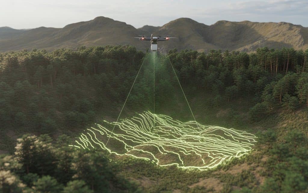
Mapping dense forests and steep mountain landscapes has always been challenging. Thick vegetation blocks visibility, while rugged terrain limits physical access for survey teams. These conditions often reduce the accuracy and efficiency of traditional mapping methods. This is where lidar in forest mapping becomes a powerful solution for you. By using laser pulses that penetrate vegetation, LiDAR captures both surface and ground data. Moreover, it allows you to map complex environments with a level of detail that is difficult to achieve otherwise. If your projects involve forests or mountainous regions, understanding how this technology performs can help you plan better. Let’s break down how LiDAR handles these demanding conditions. Why LiDAR in Forest Mapping Works in Dense Environments Lidar in forest mapping works by emitting laser pulses toward the ground and measuring their return time. These pulses can pass through gaps in vegetation, reaching the terrain below. This process is known as lidar forest penetration, and it is key to accurate mapping. Unlike traditional methods, LiDAR does not rely on clear visibility from above. Instead, it collects multiple returns from different surfaces such as leaves, branches, and the ground. This allows you to separate vegetation from terrain data. As a result, forestry lidar mapping provides both canopy and ground-level insights. This makes it highly effective for mapping dense forests. Understanding Canopy Penetration and Ground Detection One of the biggest advantages of lidar in forest mapping is its ability to penetrate the canopy. Canopy penetration lidar refers to how effectively laser pulses reach the ground through vegetation layers. The system records multiple returns for each pulse. The first return may represent the canopy, while later returns capture lower vegetation and the ground. This enables accurate lidar ground detection even in dense areas. This capability is essential for creating reliable terrain models. Without it, mapping in forested regions would remain incomplete. How LiDAR Improves Terrain Mapping in Mountain Regions Mountain environments present a different set of challenges. Steep slopes, uneven surfaces, and limited access make traditional surveys difficult. However, lidar terrain mapping overcomes these challenges effectively. By capturing elevation data remotely, LiDAR eliminates the need for extensive ground access. This is particularly useful for mountain terrain mapping, where safety and accessibility are major concerns. Additionally, LiDAR provides high-resolution elevation data. This supports accurate elevation mapping lidar outputs, even in rugged landscapes. Accuracy of LiDAR in Dense Vegetation Accuracy is often questioned when mapping through dense vegetation. However, lidar in forest mapping delivers reliable results when properly executed. The ability to capture multiple returns improves data quality significantly. According to United States Geological Survey, LiDAR can accurately measure ground elevation even in heavily forested areas. The findings confirm that lidar accuracy in dense vegetation is suitable for many engineering and environmental applications. Applications of Forestry LiDAR Mapping You will find forestry lidar mapping useful in many real-world scenarios. It supports forest management, biomass estimation, and environmental monitoring. By analyzing canopy structure, you can assess vegetation health and density. It also plays a key role in vegetation mapping lidar applications. You can classify different vegetation types and track changes over time. This is valuable for conservation and land management. In addition, LiDAR helps identify terrain features hidden beneath vegetation. This improves planning for infrastructure and development projects. If you want to explore how mapping technologies support planning, you can read our blog here: Aerial Mapping Services: How Drone Data Supports Better Planning Decisions Mapping Rugged Terrain with Precision Rugged terrain requires accurate data for safe and efficient project planning. Lidar in forest mapping supports this by providing detailed elevation and slope information. For example, rugged terrain survey projects benefit from precise measurements of elevation changes. This helps engineers design stable structures and manage risks effectively. Similarly, slope mapping technology allows you to analyze gradients and identify potential hazards. This is critical for construction, mining, and infrastructure projects. By combining these capabilities, LiDAR delivers a comprehensive understanding of challenging landscapes. Limitations and Considerations While lidar in forest mapping is highly effective, certain factors can influence performance. Extremely dense vegetation may reduce the number of pulses reaching the ground. However, advanced systems can still capture sufficient data for analysis. Weather conditions can also affect data collection. Rain, fog, or heavy cloud cover may impact accuracy. Proper planning helps minimize these challenges. Additionally, data processing requires expertise. Extracting accurate terrain models from LiDAR data involves specialized workflows. Working with experienced professionals ensures reliable results. If you are planning a project in forested or mountainous terrain, you can contact Rekon Solutions to discuss how LiDAR can support your mapping needs. Combining LiDAR with Other Mapping Methods In some cases, combining LiDAR with other technologies improves results further. For example, photogrammetry adds visual detail to LiDAR’s elevation data. This creates a more complete dataset for analysis. By integrating these approaches, you enhance both accuracy and usability. This is especially useful for complex projects requiring detailed insights. FAQs How does LiDAR work in dense forests LiDAR uses laser pulses that pass through gaps in vegetation. This allows it to capture both canopy and ground data. Can LiDAR detect ground under dense vegetation Yes, lidar ground detection works by capturing multiple returns. This helps identify the ground beneath vegetation layers. Is LiDAR accurate in mountain terrain Yes, LiDAR provides high-resolution elevation data. It is highly effective for mountain terrain mapping. What industries use forestry LiDAR mapping Forestry, construction, mining, and environmental management all benefit from LiDAR mapping. Moving Forward with Better Terrain Mapping Mapping dense forests and rugged terrain no longer needs to be a limitation. Lidar in forest mapping provides the detail and accuracy required for modern projects. It helps you understand both vegetation and terrain clearly. By using LiDAR, you improve safety, efficiency, and data reliability. This supports better planning and decision making across industries. If your project requires accurate mapping in challenging environments, contact us at Rekon Solutions so you can achieve reliable results. When terrain becomes complex, the right technology makes all the difference.
What Is Drone Bathymetry and Why Is It Required for Flood Modeling
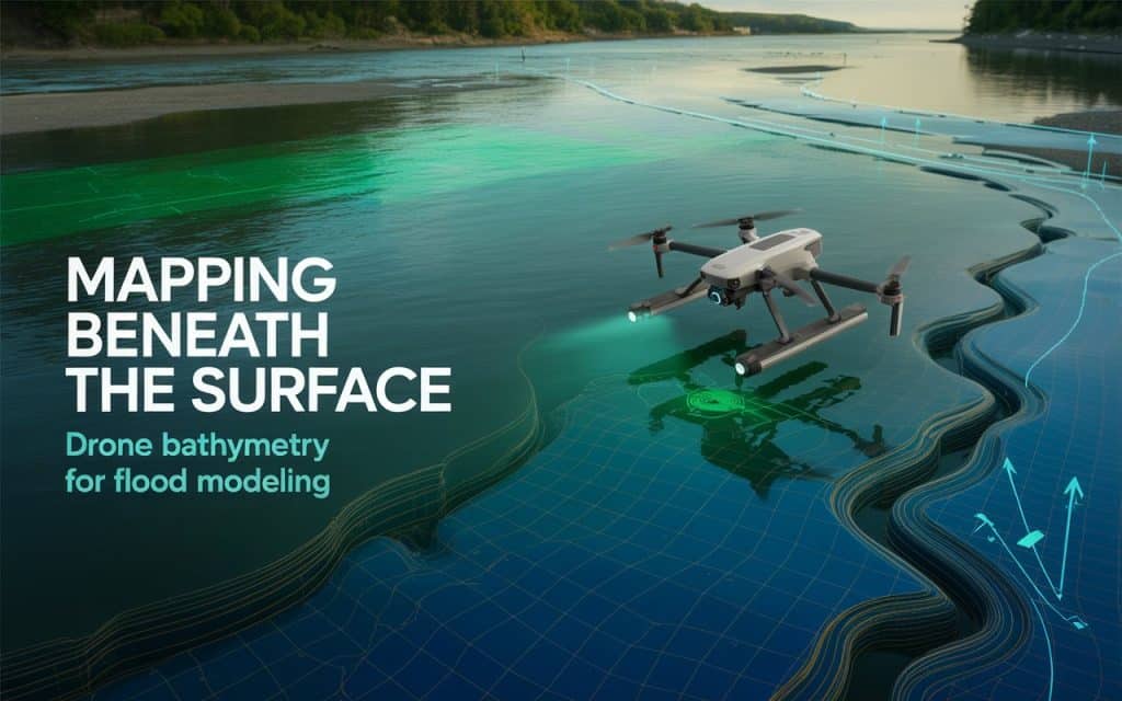
Flooding is becoming a growing concern for infrastructure, communities, and environmental planning. Without accurate terrain and water data, predicting flood behavior becomes extremely difficult. This is where drone bathymetry plays a critical role in modern mapping and analysis. Today, flood modeling depends on precise elevation and water depth information. Traditional methods often miss underwater terrain or take too long to collect data. However, drone-based solutions now allow you to gather both land and underwater insights efficiently. If you are involved in planning, engineering, or environmental management, understanding this technology can help you make better decisions. Let’s explore how it works and why it matters for flood modeling. What Is Drone Bathymetry and How Does It Work As per NOAA, bathymetry refers to depth of ocean relative to sea level. Where, drone bathymetry is the process of mapping underwater terrain using drones equipped with specialized sensors. These sensors capture water depth and surface data to create accurate models of rivers, lakes, and coastal areas. This process is often part of a broader bathymetric survey or hydrographic survey. Drones use technologies like LiDAR or photogrammetry combined with water-penetrating sensors. This allows you to perform water depth mapping even in shallow or hard-to-access areas. As a result, bathymetric mapping becomes faster, safer, and more efficient. This method is especially useful for capturing river bathymetry, where traditional survey methods may struggle. You can collect consistent data across large areas without disrupting the environment. Why Drone Bathymetry Is Essential for Flood Modeling Flood modeling depends on accurate terrain and water flow data. Without detailed elevation and depth information, predictions can be unreliable. This is why drone bathymetry is essential for generating high-quality flood modeling data. When you combine land elevation with underwater mapping, you get a complete picture of the terrain. This supports hydrological modeling and improves flood predictions. It also helps identify how water moves through different areas during heavy rainfall. According to the United States Geological Survey report published in Science Direct, accurate elevation data is critical for reliable floodplain mapping and risk assessment. These findings show how floodplain mapping and water flow analysis depend on accurate data from both land and water. How Bathymetric Mapping Supports Flood Risk Analysis Flood risk analysis requires understanding how water behaves across terrain. Drone bathymetry provides the missing link by capturing underwater features that influence water movement. This improves flood risk mapping and helps you plan mitigation strategies. For example, underwater slopes and channels affect how quickly water flows. Without this data, models may underestimate or overestimate flood impact. With accurate bathymetric survey data, you can improve predictions significantly. This also supports the creation of a digital elevation model flood dataset. These models combine terrain and water depth data to simulate flood scenarios. As a result, planners can identify high-risk areas more effectively. Advantages of Drone Water Mapping Over Traditional Methods Traditional hydrographic survey methods often require boats, manual measurements, and extended timelines. These approaches can be expensive and limited in shallow or complex environments. In contrast, drone water mapping offers a more efficient solution. Drones can quickly capture data across large areas with minimal setup. This reduces time and operational costs while improving coverage. You also gain access to areas that may be unsafe or inaccessible for traditional surveys. Another advantage is data consistency. Drone bathymetry provides uniform data collection, which improves the quality of analysis. This is especially important for hydrological modeling and long-term monitoring. If you want to see how aerial data supports mapping accuracy, you can read our blog here: How Drone Inspections Improve Safety and Accuracy Applications of Drone Bathymetry in Real Projects You will find drone bathymetry useful across many applications. In flood management, it supports flood modeling data collection and risk assessment. This helps protect communities and infrastructure. In environmental projects, it supports river bathymetry and ecosystem monitoring. You can track sediment movement and changes in water bodies over time. This helps maintain ecological balance. Infrastructure planning also benefits from bathymetric mapping. Projects involving bridges, dams, or drainage systems require accurate underwater data. This ensures safe and efficient design. If you are planning a project that requires precise water and terrain data, you can contact Rekon Solutions to explore suitable mapping solutions. How Drone Bathymetry Improves Hydrological Modeling Hydrological modeling relies on accurate data to simulate water movement. By using drone bathymetry, you improve the quality of input data significantly. This leads to more reliable flood predictions. For example, water flow analysis becomes more accurate when underwater terrain is included. This helps engineers understand how water will behave under different conditions. It also supports better planning for drainage and flood control systems. Combining drone bathymetry with topographic data creates a complete dataset. This improves the accuracy of flood simulations and supports better decision making. Key Factors That Influence Data Accuracy While drone bathymetry is highly effective, certain factors influence accuracy. Sensor quality is one of the most important elements. High-quality sensors provide better depth and elevation data. Water clarity also plays a role in data collection. Clear water allows better penetration for mapping sensors. In contrast, murky water may reduce accuracy. Flight planning and processing methods also matter. Proper workflows ensure reliable outputs for bathymetric survey projects. This is why working with experienced professionals is important. FAQs What is the difference between bathymetric and bathymetry? Bathymetry refers to measuring water depth and underwater terrain. A bathymetric survey is the process used to collect that data. What is the main purpose of using drones in topographic mapping? Drones improve speed, safety, and coverage. They allow efficient data collection for both land and water mapping. What is the importance of bathymetry? Bathymetry helps understand underwater terrain. It is essential for navigation, construction, and flood modeling. What is the purpose of a bathymetric survey? A bathymetric survey provides accurate depth and terrain data. This supports mapping, engineering, and environmental analysis. Moving Forward with Better Flood Modeling Flood risks are increasing, and accurate data is more important than ever. Drone bathymetry provides
How Photogrammetry Revolutionizes Mapping with Aerial Precision
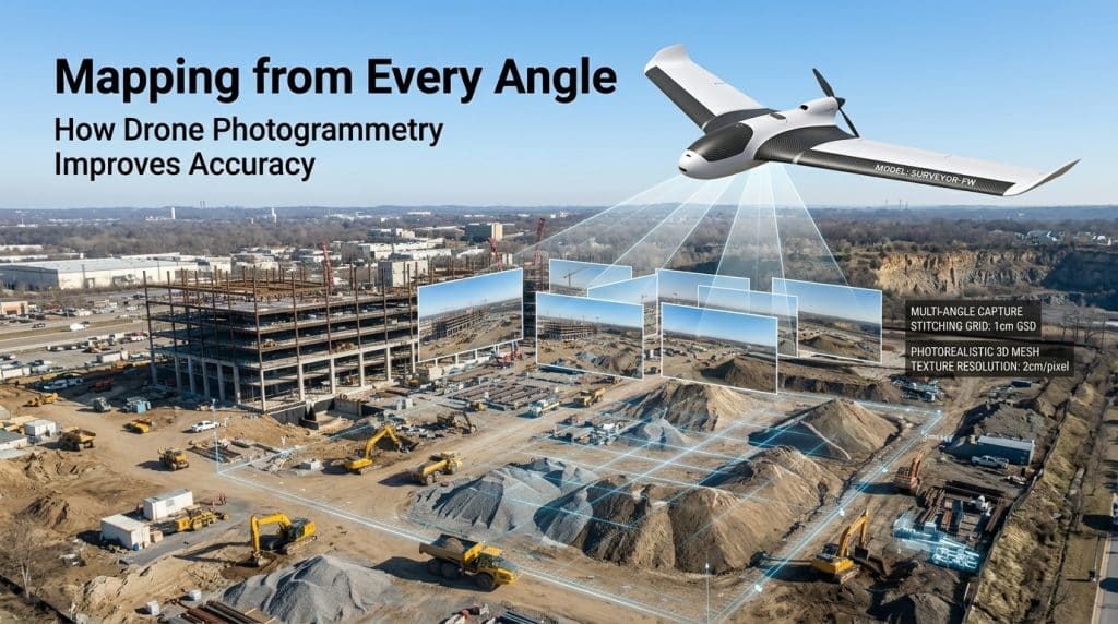
Mapping has always been essential for planning, design, and decision making. However, traditional methods often take time, require heavy resources, and still miss important details. And as projects grow more complex, the demand for faster and more accurate data continues to increase. This is where drone photogrammetry is transforming how you approach mapping. By using aerial images and advanced processing, you can generate precise maps and models in less time. Moreover, this approach improves efficiency while maintaining high levels of accuracy across projects. If you are looking for reliable and scalable mapping solutions, understanding how this technology works can help you make better decisions. Let’s walk through how photogrammetry is changing mapping workflows for you. What is Drone Photogrammetry and How Does It Work Drone photogrammetry uses drones to capture overlapping aerial images of a site from multiple angles. These images are then processed using specialized software to create accurate maps and 3D models. This process is known as photogrammetry mapping, and it relies on identifying common points across images. The result is a highly detailed output such as orthomosaics, point clouds, and 3D photogrammetry models. These outputs help you visualize terrain, structures, and site conditions with clarity. As a result, aerial photogrammetry becomes a powerful tool for modern mapping needs. This method also supports consistent data capture across large areas. You can repeat surveys over time and compare results easily. That makes geospatial data collection more reliable and actionable. Why Aerial Photogrammetry is Changing Mapping Workflows Mapping workflows are evolving because projects now require faster turnaround and higher accuracy. Traditional survey methods can be slow and labor intensive, especially for large or complex sites. In contrast, aerial mapping drones can cover vast areas quickly and safely. With drone mapping services, you can reduce field time significantly. Data collection that once took days can now be completed in hours. Additionally, automated processing speeds up data delivery, helping you move projects forward faster. Accuracy is another major advantage. By using image-based mapping, you can capture fine details that may be missed through manual surveys. This improves planning, reduces rework, and supports better project outcomes. Key Benefits of Drone Photogrammetry for Your Projects You will notice several advantages when using drone photogrammetry for mapping. These benefits directly impact efficiency, cost, and decision making across your projects. First, speed is a major factor. Drone survey mapping allows rapid data collection without extensive manpower. This helps you meet tight deadlines without compromising quality. Second, safety improves significantly. Surveyors no longer need to access hazardous or difficult terrain. Instead, drones handle data capture from a safe distance. Third, cost efficiency becomes clear over time. Fewer resources are needed for data collection and processing. As a result, photogrammetry survey methods reduce overall project costs. Finally, data quality improves. High resolution imagery ensures better photogrammetry mapping outputs. This supports accurate measurements and reliable analysis. Where Drone Photogrammetry Delivers the Most Value Drone photogrammetry is used across many industries because of its flexibility and precision. In construction, it supports site planning, progress tracking, and volume calculations. You can monitor changes over time using consistent aerial data. In infrastructure projects, aerial photogrammetry helps inspect roads, bridges, and utilities. It provides clear visuals without disrupting operations. This makes inspections faster and more efficient. Mining and environmental projects also benefit from image-based mapping. You can analyze terrain, monitor changes, and manage resources more effectively. These insights support better long term planning. If you want to see how aerial data supports inspections, you can read our blog on drone inspections. Improving Accuracy with Photogrammetry Mapping Accuracy is critical in any mapping project. With drone photogrammetry, accuracy depends on factors like image overlap, flight planning, and processing quality. When done correctly, results can reach near survey grade levels. For example, proper overlap ensures that each point is captured multiple times. This improves alignment during photogrammetry survey processing. As a result, your outputs become more precise. Ground control points can further enhance accuracy. These reference points help align aerial data with real world coordinates. This improves the reliability of your geospatial data collection. Additionally, consistent flight paths and stable conditions contribute to better results. Together, these factors ensure high quality outputs from drone mapping services. Choosing the Right Approach for Your Mapping Needs Not every project requires the same level of detail or approach. However, drone photogrammetry offers flexibility for different use cases. Whether you need quick visuals or detailed models, this method can adapt to your needs. You should consider project size, required accuracy, and timeline when choosing a mapping method. For many projects, aerial mapping drones provide the right balance of speed and precision. Working with experienced professionals also makes a difference. At Rekon Solutions, mapping workflows are designed around your specific project goals. This ensures that the data you receive is both accurate and actionable. If you are planning a project and need reliable mapping support, feel free to contact Rekon to discuss your requirements. Integrating Photogrammetry with Modern Mapping Technologies Modern mapping often combines multiple technologies for better results. For example, drone photogrammetry can complement LiDAR data for more comprehensive insights. While LiDAR captures elevation accurately, photogrammetry adds visual detail. This combination improves both accuracy and usability of mapping outputs. You gain a complete understanding of terrain and structures. That supports better planning and execution. You can also explore our blog on LiDAR mapping for vast landscapes to understand how both technologies work together. As mapping technology continues to evolve, integrating these methods will become more common. This ensures that your projects benefit from the best available tools. FAQs How does drone photogrammetry work in mapping Drone photogrammetry captures overlapping images and processes them into maps and models. This creates accurate visual and spatial data for analysis. How accurate is photogrammetry mapping With proper planning and processing, photogrammetry mapping can achieve high accuracy. Ground control points further improve precision. What is the benefit of aerial photogrammetry Aerial photogrammetry allows fast data collection over large areas. It improves efficiency while
How Drone Inspections Improve Safety and Accuracy
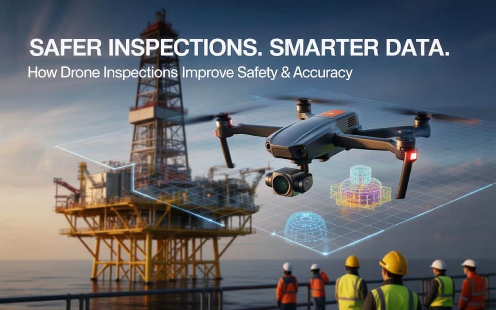
Imagine being tasked with inspecting a high-rise building or an oil rig—places that are difficult to access, full of potential hazards. Traditionally, inspectors would have to scale heights, enter confined spaces, or work in hazardous environments to gather essential data. These conditions make inspections not only time-consuming but also risky. Industrial drone inspections are changing the game. By using drones to collect data remotely, industries can now complete inspections faster, more safely, and with higher precision. This revolutionary approach to LiDAR asset inspection and infrastructure inspection drones has increased operational efficiency and greatly reduced risk. In this blog, we’ll explore how drone inspections improve safety and accuracy, offering a glimpse into their growing role in industries such as construction, energy, and manufacturing. Plus, we’ll cover how inspection data reporting and risk reduction with drones are driving smarter decisions. The Power of Drones in Industrial Inspections Drone inspections have gained widespread adoption in the last decade, thanks to their ability to access hard-to-reach places quickly and safely. Whether inspecting a wind turbine, a building facade, or an oil pipeline, industrial drone inspections provide an efficient way to gather high-quality data. You hit your targets without putting inspectors in dangerous situations. When traditional inspections require workers to use scaffolding, ropes, or ladders, drones take over, flying to locations and capturing detailed imagery and videos. These drones can be equipped with high-definition cameras, thermal sensors, and LiDAR (Light Detection and Ranging) technology for even more precise data capture. Several studies confirm that drones greatly reduce inspection errors, help companies finish inspections on time and improve workplace safety by eliminating the dangerous terrain inspection people have to do. This incredible time-saving capability allows businesses to complete more inspections in a shorter amount of time, reducing costs and improving safety. Let’s dive deeper into how drone inspections work and how they enhance safety and accuracy in real-world scenarios. How Drones Enhance Safety in Industrial Inspections Safety is one of the most compelling reasons to use drones in industrial inspections. In industries like construction, oil and gas, and utilities, workers are often required to access high-risk areas such as confined spaces, high structures, or hazardous environments. With confined space inspections, workers previously had to enter cramped or dangerous areas, such as tanks or ducts, to assess conditions. This not only exposed them to potential harm but also slowed down the process. Drones change this by allowing inspectors to gather the necessary data without entering these spaces. For instance, drones can fly through ventilation shafts, access oil tanks, or inspect the roofs of tall buildings, capturing high-resolution imagery without exposing workers to risk. This not only reduces accidents but also helps companies comply with safety regulations, which is critical in high-risk industries. The Role of Drones in Improving Accuracy Another major benefit of industrial drone inspections is the enhanced accuracy they bring to data collection. Unlike traditional manual inspections, which are prone to human error, drones are equipped with precise GPS systems and sensors that capture highly accurate data. Drones can be equipped with thermal cameras to detect heat anomalies or LiDAR sensors for precise elevation measurements, giving inspectors more detailed and reliable data. This data is then used for accurate reporting, which supports better decision-making for maintenance, repairs, and upgrades. The ability to capture high-resolution terrain data and bathymetric data (underwater mapping data) further boosts the precision of drone inspections. Drones capture comprehensive, multi-angle imagery that is processed into 3D models and orthomosaics, giving teams a more accurate picture of their infrastructure. This level of detail and precision is crucial for industries like energy, construction, and utilities, where accurate data is essential for preventing failures and ensuring operational efficiency. As a result, companies can save time and money by addressing potential issues before they escalate. Data Reporting and Analysis Made Easy After completing a drone inspection, the next critical step is inspection data reporting. With drones, this process becomes more streamlined and efficient. The data collected by drones can be automatically uploaded to a cloud-based platform for analysis. Inspection data is then processed using specialized software, which converts raw footage into actionable insights. These reports are far more detailed than those generated by traditional methods, allowing teams to identify issues such as cracks, corrosion, or electrical malfunctions. In industries such as construction and infrastructure, detailed inspection data helps businesses make informed decisions about maintenance schedules, repairs, and replacements. This reduces downtime and keeps operations running smoothly. By providing clear, high-resolution images and 3D models, drone inspections make data reporting simpler and more effective, resulting in more informed decisions and better asset management. LiDAR Asset Inspection and Risk Reduction One of the most valuable aspects of LiDAR asset inspection is its ability to reduce risk in the inspection process. Whether it’s inspecting power lines, wind turbines, or buildings, drones can access dangerous areas without putting workers in harm’s way. For instance, powerline inspections traditionally required workers to climb utility poles or use helicopters, both of which carry significant risks. With drones, the risk of worker injury is minimized, and inspections can be conducted quickly without disrupting the power grid. By enabling more frequent and safer inspections, drones help prevent accidents and failures. Risk reduction with drones means identifying problems before they become serious. It ensures that assets stay in good condition and minimizes the likelihood of costly emergencies. This ability to proactively identify maintenance needs and mitigate potential risks is a major benefit for industries that rely on complex infrastructure. The industries include oil and gas, telecommunications, and transportation. How Drone Inspections are Revolutionizing Industries Drones are revolutionizing the way inspections are performed across various sectors. From infrastructure inspection drones to asset inspection by LiDAR, the benefits are clear. Drones increase safety, provide more accurate data, reduce operational downtime, and ultimately save money. In industries such as construction, energy, and manufacturing, drones have become indispensable tools for monitoring the condition of critical infrastructure. Companies can reduce the cost of hiring ground crews, avoid safety incidents, and
Beyond the Trees: How LiDAR Is Transforming Large-Scale Terrain Mapping
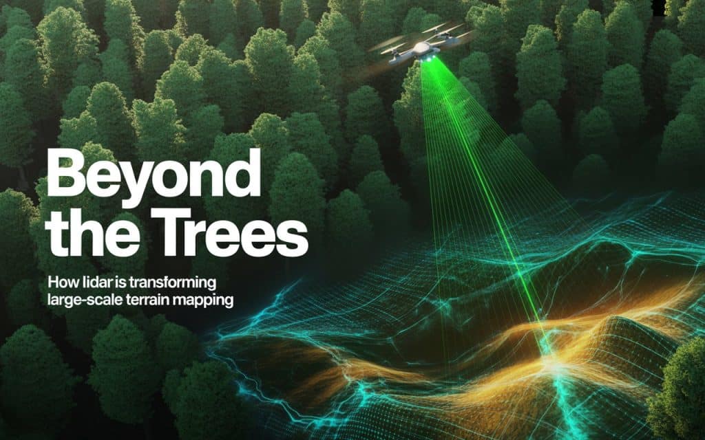
Mapping large landscapes has always been a challenge for surveyors and engineers. Dense forests, rugged terrain, and limited accessibility often make traditional surveying slow, expensive, and sometimes unsafe. For decades, gathering accurate data across large areas required teams on the ground navigating through vegetation and difficult conditions. Today, airborne LiDAR mapping is changing that reality. By using laser-based sensors mounted on aircraft or drones, LiDAR technology can capture incredibly detailed terrain information. From forestry planning to infrastructure development, LiDAR is redefining how professionals conduct large-area terrain surveys and create highly accurate digital models of the landscape. What Is Airborne LiDAR Mapping? Airborne LiDAR mapping uses laser pulses emitted from a sensor mounted on an aircraft or drone. These pulses travel toward the ground, bounce off surfaces, and return to the sensor. By measuring the time it takes for each pulse to return, the system calculates precise distances and generates millions of data points representing the terrain. These points form what is known as a point cloud, which is a highly detailed 3D representation of the landscape. Unlike traditional aerial photography, LiDAR can capture multiple returns from a single laser pulse. For example, the first return may reflect from the treetops, while later returns penetrate through branches and leaves to reach the ground surface. This capability allows LiDAR to reveal terrain that would otherwise remain hidden. The result is a highly accurate dataset that supports 3D terrain modeling, environmental analysis, and engineering design. Why Traditional Terrain Surveys Struggle in Forested Areas Traditional mapping methods struggle when terrain is covered by dense vegetation. Survey teams often need to physically access the site, which can involve clearing paths, navigating steep slopes, or working in remote environments. These challenges can lead to: Long survey timelines Limited coverage in difficult terrain Safety risks for field crews Incomplete data in heavily forested areas In regions with extensive tree cover, the actual ground surface may be almost impossible to measure using conventional techniques. This is where LiDAR offers a major advantage. Learn how Aerial Mapping services supports better planning decisions. Forest Canopy Penetration: Seeing Through the Trees One of the most powerful capabilities of LiDAR is forest canopy penetration. Because LiDAR sensors emit thousands of laser pulses every second, some of these pulses are able to pass through gaps in the vegetation and reach the ground below. This allows surveyors to collect elevation data even in areas with dense forest cover. By capturing multiple returns from each laser pulse, LiDAR can distinguish between different layers of the environment, including: Tree canopy Branches and vegetation Understory growth Ground surface This multi-layer data provides a complete view of the landscape—from treetops down to the terrain beneath. For forestry professionals and environmental scientists, this ability to see through vegetation is invaluable for understanding ecosystems and monitoring land changes. Vegetation Filtering with LiDAR Collecting raw LiDAR data is only the first step. Once the data is captured, specialized software processes the point cloud to separate vegetation from the ground surface. This process is known as vegetation filtering LiDAR. Algorithms analyze the point cloud and classify points into categories such as: Ground points Vegetation points Buildings or structures Water surfaces After classification, vegetation points can be removed or filtered out, leaving only the ground points behind. This enables surveyors to generate accurate bare-earth digital elevation models (DEMs). These filtered terrain models are essential for engineering applications such as road design, drainage analysis, and site planning. Conducting Large-Area Terrain Surveys Efficiently Another major benefit of LiDAR technology is its ability to cover large areas quickly. Traditional ground surveys may take weeks or even months to map extensive terrain. With LiDAR, aircraft or drone platforms can capture data across hundreds—or even thousands—of hectares in a fraction of that time. For example, airborne LiDAR systems can: Survey large forested regions in a single flight Capture millions of elevation points per square kilometer Map remote areas that are difficult to access on foot This efficiency makes LiDAR particularly valuable for large-area terrain surveys required in industries such as mining, forestry, and environmental management. Applications of LiDAR in Forestry and Environmental Studies The ability to collect detailed terrain and vegetation data has made LiDAR for forestry an essential tool for land managers and researchers. 1. Forest Structure Analysis LiDAR can measure tree height, canopy density, and forest structure. This data helps forestry teams understand forest health and monitor growth patterns. 2. Habitat and Ecosystem Monitoring By revealing both vegetation layers and ground terrain, LiDAR supports environmental studies related to wildlife habitats and watershed management. 3. Wildfire Risk Assessment Detailed vegetation data allows researchers to analyze fuel loads and assess wildfire risks in forested areas. 4. Sustainable Forest Management LiDAR datasets provide valuable insights that help forestry professionals make informed decisions about harvesting, conservation, and land use planning. Learn more: The Value of Aerial Inspections for Infrastructure Projects LiDAR and 3D Terrain Modeling Once LiDAR data is processed and classified, it can be used to generate highly accurate 3D terrain models. These models provide a digital representation of the landscape that can be analyzed and visualized in various ways. Applications of 3D terrain modeling include: Engineering design and planning Hydrological and flood modeling Infrastructure corridor mapping Landslide and erosion monitoring Because LiDAR captures extremely dense datasets, these models can reveal subtle terrain features. It includes small drainage channels, slopes, and elevation changes that might be missed using other mapping methods. Advantages of Airborne LiDAR for Large-Scale Mapping Airborne LiDAR offers several advantages compared to traditional surveying techniques. 1. Speed and Coverage Large landscapes can be surveyed quickly, reducing project timelines and improving efficiency. 2. High Data Density Millions of elevation points provide extremely detailed terrain information. 3. Access to Remote Areas Aircraft and drones can map areas that are difficult or dangerous for ground crews to reach. 4. Vegetation Penetration LiDAR can capture ground data even beneath dense forest canopy. 5. Integration with Other Technologies LiDAR datasets can be combined with photogrammetry or satellite imagery to produce
Unlocking Hidden Waterways with Bathymetry
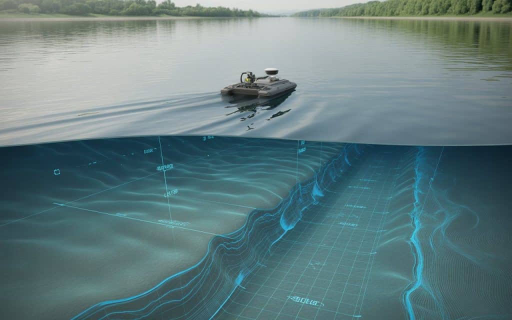
Waterways shape landscapes, support ecosystems, and influence infrastructure decisions. Yet the most important information about rivers, lakes, and coastal environments lies beneath the surface. That’s where a hydrographic bathymetric survey becomes essential. By using advanced sonar and geospatial technologies, bathymetry reveals the hidden contours of underwater terrain. It helps engineers, environmental scientists, and planners understand aquatic environments with precision. From inland water mapping to flood modeling and habitat monitoring, bathymetry provides the underwater data needed to make informed decisions. What Is a Hydrographic Bathymetric Survey? A hydrographic bathymetric survey measures the depth and shape of underwater terrain in rivers, lakes, reservoirs, and coastal areas. In simple terms, it is the underwater equivalent of a topographic survey on land. Specialized sensors capture underwater depth measurements and combine them with precise positioning systems such as GNSS. The result is a detailed model of the aquatic landscape, including riverbeds, lake floors, and submerged structures. These surveys support a wide range of applications, including: River mapping and lake mapping Floodplain analysis Infrastructure planning near water bodies Environmental and habitat monitoring Navigation safety assessments By transforming sonar readings into accurate digital models, bathymetry makes it possible to visualize underwater terrain with remarkable clarity. Why Is Inland Water Mapping Essential for Engineering Projects? Many engineering and environmental projects rely on accurate data about water bodies. However, traditional mapping methods often focus only on visible terrain, leaving critical underwater features undocumented. Inland water mapping fills this gap by providing detailed insights into underwater conditions. This information is essential for: 1. Flood Risk Management Riverbed shape directly influences water flow and flood behavior. Bathymetric surveys allow engineers to analyze channel depth, sediment buildup, and erosion patterns to better predict flood risks. 2. Infrastructure Design Bridges, dams, culverts, and pipelines all interact with waterways. Without accurate bathymetric data, designing these structures can become risky and inefficient. 3. Environmental Protection Aquatic habitats depend heavily on underwater terrain. Bathymetric data helps scientists understand habitat conditions and identify areas suitable for conservation or restoration. How Riverbed Mapping Technology Works Modern riverbed mapping technology combines multiple tools to collect and process underwater data efficiently. 1. LiDAR or Unmanned Survey Vehicles (USVs) Autonomous or remotely operated survey boats are commonly used to navigate rivers and lakes during bathymetric surveys. These compact vessels allow operators to safely collect data without entering hazardous waters. LiDARs are particularly useful in areas with: Strong currents Shallow channels Limited access points Environmental sensitivity 2. Echo Sounders for Depth Measurement Echo sounders are the core technology used in bathymetry. These instruments send acoustic pulses toward the waterbed and measure the time it takes for the signal to return. From this information, survey systems calculate precise underwater depth measurements. Modern echo sounders can collect data points multiple times per second, producing dense datasets that reveal underwater contours in great detail. 3. GNSS Positioning Systems Accurate positioning is critical for bathymetric data. Multi-band GNSS receivers record the exact geographic coordinates of each depth measurement, ensuring the resulting dataset aligns perfectly with land-based survey data. This combination of sonar depth readings and satellite positioning enables precise bathymetric data collection across large water bodies. From Raw Data to Aquatic Terrain Models Once field data is collected, it is processed to create detailed underwater maps and models. Survey software combines the depth measurements and positioning data to generate: Digital Elevation Models (DEMs) of riverbeds or lake floors Contour maps showing underwater depth variations 3D terrain models for visualization and analysis These outputs support aquatic terrain modeling, which helps engineers and scientists better understand underwater environments. When bathymetric data is integrated with LiDAR or photogrammetry surveys, the result is a seamless land-to-water terrain model. This combined dataset provides a complete picture of the landscape above and below the waterline. Contact us to learn more about Rekon’s bathymetric survey services. Applications of Bathymetric Surveys Bathymetry plays a crucial role in many industries where water and terrain interact. 1. Floodplain and Hydrological Studies Hydrological models depend on accurate terrain information. Bathymetric surveys reveal the depth and slope of river channels, allowing engineers to simulate water flow and design flood mitigation strategies. 2. Environmental and Habitat Monitoring Fish populations and aquatic ecosystems rely on specific underwater conditions. Bathymetry helps identify spawning grounds, sediment movement, and habitat structures that influence biodiversity. Learn more: Save the Salmon! Bathymetry in a Hydrological Study 3. Infrastructure and Development Planning Construction projects near rivers and lakes must account for underwater terrain. Bathymetric surveys help ensure bridges, docks, and shoreline developments are designed with accurate environmental data. 4. Sediment and Erosion Monitoring Over time, sediment accumulation can alter water depth and channel structure. Bathymetric surveys allow researchers to track changes and identify areas where erosion or deposition may impact infrastructure or habitats.(1) Advantages of Modern Bathymetric Data Collection Compared to traditional manual depth measurements, modern bathymetric technology offers significant advantages. 1. Faster Data Collection Autonomous survey vehicles and advanced sensors allow large water bodies to be mapped efficiently. 2. Improved Accuracy High-frequency echo sounders and GNSS positioning provide reliable depth measurements for engineering and environmental analysis. 3. Safer Survey Operations Remote survey systems eliminate the need for personnel to enter dangerous or fast-moving waters. 4. Integration with Other Geospatial Data Bathymetric surveys can be combined with aerial LiDAR or drone photogrammetry to create comprehensive terrain models. These benefits make bathymetry an essential component of modern mapping workflows. The Future of Aquatic Terrain Mapping As geospatial technology continues to evolve, bathymetry is becoming more integrated with other mapping techniques. Advanced workflows now combine: Drone LiDAR for above-water terrain Photogrammetry for high-resolution imagery Bathymetry for underwater mapping Together, these technologies provide a complete and highly detailed representation of complex environments. For engineers, environmental scientists, and planners, this integrated approach offers a deeper understanding of landscapes where land and water meet. Seeing What Lies Beneath Water may hide the terrain beneath it, but modern survey technologies such as LiDAR make it possible to uncover those hidden details. A hydrographic bathymetric survey reveals the underwater features that influence
When to Use Photogrammetry for Your Next Survey
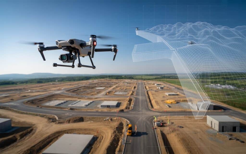
Have you ever wondered if there’s a faster, more efficient way to get your survey done with more precision? That’s where photogrammetry survey services come in, offering image-based land surveys that provide accurate, detailed data. Instead of relying on manual measurements and traditional methods, aerial survey solutions and drone survey photogrammetry are changing the game. In this blog, we’ll explain when you should consider using photogrammetry for your next survey and how this method offers a cost-effective surveying method for different projects. What is Photogrammetry and Why Does It Matter for Surveys? Photogrammetry is the science of making measurements from photographs. Using aerial imagery captured by drones or aircraft, photogrammetry provides data that can be used to create: 3D models Topographic maps Digital elevation models (DEMs). This technique relies on overlapping aerial images, which are processed through advanced software to extract detailed, accurate measurements. Lately, photogrammetry has become essential in fields like construction, environmental studies, mining, and urban planning. Unlike traditional survey methods, photogrammetry survey services can be performed remotely, saving time and resources. In fact, an AJOL research paper Assessment of Unmanned Aerial Vehicle Versus Terrestrial Method of Topographic Surveying show that drone-based photogrammetry applications can reduce survey times by up to 45% compared to traditional ground-based surveys, while increasing the accuracy of the data collected. When Should You Use Photogrammetry for Your Survey? 1. When You Need Accurate 3D Mapping and Modeling Photogrammetry is ideal when your project requires detailed 3D mapping of the terrain or environment. The technology captures accurate elevation data and models that can be used for planning and analysis. Whether you’re developing a site, managing resources, or conducting environmental studies, drone survey photogrammetry provides the precision and detail needed to make informed decisions. The ability to generate 3D models and orthophotos (georeferenced images) from aerial imagery allows you to visualize land features with clarity. This capability is crucial when working on projects like: Urban development Construction site mapping Environmental monitoring Agricultural land assessments Check out our previous blog on the role of LiDAR in mapping vast landscapes. 2. For Large-Scale or Difficult-to-Access Areas One of the standout features of aerial survey solutions is their ability to survey large areas quickly and efficiently. Whether it’s vast agricultural fields, expansive construction sites, or rugged terrains, photogrammetry survey services can cover a much larger area than traditional methods. This is especially valuable when the site is remote or challenging to access, such as in mountains, forests, or flood-prone regions. In these cases, using drones equipped with high-quality cameras can provide clear, accurate data without the need for personnel to physically access hazardous or difficult locations. With image-based land surveys, you can collect detailed measurements in a fraction of the time it would take with manual techniques. 3. When You Need Cost-Effective Surveying Methods Photogrammetry is one of the most cost-effective surveying methods available today. Traditionally, land surveys required heavy equipment, multiple crew members, and a significant amount of time to complete. With drones and photogrammetry, these costs are significantly reduced. Aerial survey solutions eliminate the need for scaffolding, cranes, and manual labor, while providing high-quality data for your survey. In fact, drone-based photogrammetry surveys can cut surveying costs by up to 50-70% in comparison to traditional methods. For smaller projects, this reduction in cost can make photogrammetry an obvious choice. 4. When You Need Real-Time Data and Quick Turnaround In fast-paced industries like construction or urban planning, having real-time data is crucial. Photogrammetry provides real-time data that can be analyzed almost immediately after data collection. Drones can fly over the project site, capture the necessary images, and within hours, the data can be processed and delivered in the form of maps or 3D models. This quick turnaround is not only beneficial for decision-making but also helps prevent costly delays. It allows project managers to adjust plans and schedules on the fly, ensuring work stays on track. Benefits of Photogrammetry for Surveys High-Precision Mapping: Photogrammetry allows for extremely precise data collection, especially when paired with GPS and ground control points (GCPs). Faster Data Collection: Drones can cover large areas in a short amount of time, reducing the need for labor-intensive surveying. Cost Efficiency: By eliminating manual labor and costly equipment, photogrammetry provides a more affordable surveying solution. Versatility: Photogrammetry can be used for a wide range of industries, including construction, agriculture, mining, and environmental monitoring. The Role of Drone Survey Photogrammetry in Surveying Drone survey photogrammetry has become a preferred method due to its efficiency and flexibility. Unlike traditional methods, drones can capture images from angles and altitudes that were previously inaccessible or dangerous. This allows surveyors to gather detailed data without stepping foot on-site, which is especially helpful for hard-to-reach or hazardous locations. Photogrammetry applications for drones extend far beyond construction. Drones are used in agriculture for crop management, in mining for resource extraction analysis, and in environmental sciences for habitat monitoring. The versatility of photogrammetry makes it an invaluable tool across industries. Learn more about aerial inspection services for infrastructure projects. When to Combine Photogrammetry with Other Survey Methods While photogrammetry survey services are incredibly effective, there are instances where combining them with other survey methods may be necessary. For example, when LiDAR technology is used alongside photogrammetry, it can provide even more detailed elevation data. This combination is often used in modern topographic solutions where both high-resolution images and precise elevation data are required. Photogrammetry is also often combined with ground control points (GCPs) to increase the accuracy of the results. This hybrid approach is particularly useful when extreme accuracy is required, such as in boundary surveys or detailed site mapping. Frequently Asked Questions (FAQs) Why is overlap important in photogrammetry? Overlap ensures that the software can match common points across multiple images, creating a seamless, accurate map or model. The higher the overlap, the better the results. What is the recommended image overlap for accurate photogrammetry? A 60% to 80% overlap is typically recommended for optimal photogrammetric results. This ensures that enough reference
The Value of Aerial Inspections for Infrastructure Projects
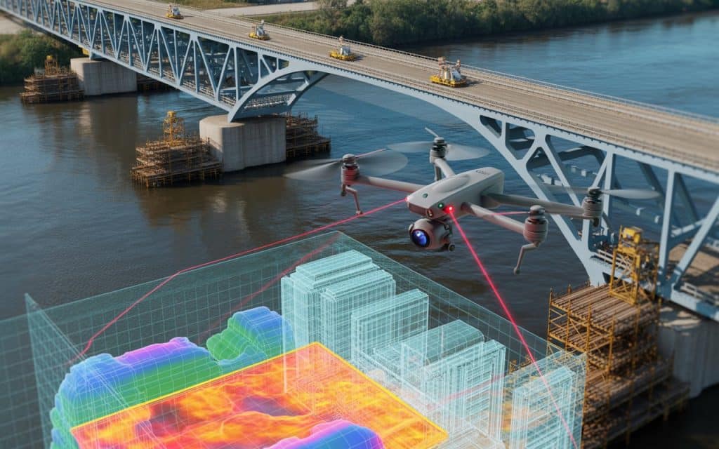
When it comes to infrastructure projects, maintaining safety and ensuring precision are key. Traditionally, inspections were time-consuming, risky, and limited by accessibility. However, aerial inspections are now revolutionizing the way projects are monitored, bringing higher efficiency and accuracy. With the introduction of aerial inspection benefits through drones, complex and hazardous inspections are becoming safer, faster, and more reliable. In this blog, we’ll explore why aerial inspections are gaining popularity and how they are enhancing infrastructure projects. What Are Aerial Inspections? Aerial inspections refer to the process of using unmanned aerial vehicles (LiDAR), or drones, to inspect infrastructure. These inspections use high-resolution cameras, sensors, and LiDAR technology to capture detailed data remotely. Drones fly over and around structures, gathering visuals and measurements without direct human involvement in dangerous environments. Compared to traditional methods, drones are more efficient in collecting large quantities of data quickly. Infrastructure drone inspection can cover vast areas and provide clear, high-resolution images for in-depth analysis. Aerial inspections offer several aerial inspection benefits, such as speed, safety, and cost-effectiveness. Drones can easily access hard-to-reach areas like tall buildings or bridges, reducing the need for scaffolding, ropes, or ladders. Key Benefits of Aerial Inspections Faster Data Collection Traditional inspections involve scaffolding, personnel, and heavy equipment. Whereas aerial inspections can survey large areas in minutes, providing real-time insights. By capturing high-resolution images and video footage in minutes, drones make inspections more efficient. Enhanced Safety Aerial inspections reduce the need for workers to access dangerous or hard-to-reach places. Therefore, risk factors such as heights, confined spaces, and extreme weather conditions are minimized. Moreover, using these bridge inspection drones for tall or hard-to-reach structures ensures the safety of personnel. Cost-Effectiveness Traditional inspection methods involve heavy equipment, personnel, and significant downtime. In contrast, LiDAR inspection services reduce labor costs and increase overall productivity. These aerial inspections eliminate costly scaffolding setups and minimize project delays. High-Quality Data LiDAR are equipped with powerful cameras, LiDAR sensors, and thermal imaging systems. They capture accurate, high-quality data that supports better decision-making. In addition, aerial inspection benefits include clearer, more detailed images that improve monitoring and analysis. Aerial Inspections for Infrastructure Projects Bridge Inspections Bridge inspection drones are increasingly being used to inspect bridges and other elevated structures. Drones can fly around a bridge, capturing images and videos from multiple angles. They can quickly identify wear and tear, cracks, rust, or any structural issues that require attention. Traditional bridge inspections often require workers to climb or use cranes, which can be time-consuming and risky. Drones, however, can complete inspections in a fraction of the time. With aerial inspections, even the most complex and hard-to-reach parts of bridges can be assessed with minimal disruption. Asset Inspections by Drone Asset inspection by drone offers an efficient, accurate way to monitor infrastructure such as powerlines, communication towers, and wind turbines. Drones can access remote or difficult areas without risking worker safety. They capture high-resolution imagery that is useful for maintaining and managing these assets. Drones can inspect large areas quickly, detecting potential issues such as corrosion, damage, or faults. This allows teams to address problems before they turn into costly repairs or safety hazards. Aerial Inspections vs. Traditional Inspection Methods When comparing aerial inspections to traditional methods, the advantages are clear. Traditional inspections typically involve more people, equipment, and manual labor, all of which increase the cost and duration of the process. In contrast, drones offer a more streamlined approach: Speed Drones can inspect large sections of infrastructure in much less time than traditional methods. For example, bridge inspection drones can capture detailed footage in a matter of minutes, while traditional methods could take hours or days. Accuracy Aerial inspections provide precise, high-resolution images and data, reducing the chance for errors. Manual inspections are often prone to oversight or human error, especially in hard-to-reach areas. Accessibility Drones can fly into places that would be difficult or dangerous for workers to access. This makes them ideal for inspecting high structures like communication towers, rooftops, and bridges. Safety Traditional inspections often require workers to climb or rappel, which can be risky and labor-intensive. With drones, the need for workers to physically access hazardous locations is eliminated, reducing the chance of accidents. Applications of Aerial Inspections in Infrastructure Projects 1. Structural Inspections Drones can perform detailed inspections of buildings, bridges, and other structures. They are designed to capture high-resolution footage, allowing for a comprehensive assessment of structural integrity. 2. Thermal Inspections LiDARs equipped with thermal imaging cameras can identify temperature variations in buildings, electrical equipment, or pipelines. This helps detect issues like heat loss, electrical faults, or insulation problems. 3. Monitoring Construction Progress Drones provide aerial views of construction sites, tracking the progress of projects. They can monitor the site from different angles, comparing the actual progress with planned designs. 4. Environmental Monitoring Drones can be used to monitor environmental factors that affect infrastructure. They can track vegetation, water levels, erosion, and other environmental elements that may impact long-term structural health. Learn more about Aerial photography beyond media. The Future of Aerial Inspections in Infrastructure The future of LiDAR inspection services in infrastructure projects looks promising. During a forecast period (2025 – 2035), the aerial drone inspection industry is projected to expand at a CAGR of 17.6%. It explains the fact how efficient, safe and precise the inspection method is. As technology advances, drones are becoming even more precise, capable, and autonomous. We can expect improvements in sensor technology, longer battery life, and more advanced data analytics. Aerial inspections are already transforming the way infrastructure is inspected, maintained, and monitored. They will continue to replace outdated and risky traditional inspection methods, making infrastructure management safer and more reliable. Get an instant quote for LiDAR services. Frequently Asked Questions (FAQs) What is the main benefit of aerial inspections? Aerial inspections provide faster, safer, and more accurate data compared to traditional methods. They reduce the need for workers to access dangerous areas while ensuring high-quality data collection. How do LiDAR inspection services improve safety? LiDAR
Bathymetry The Missing Link in River Mapping
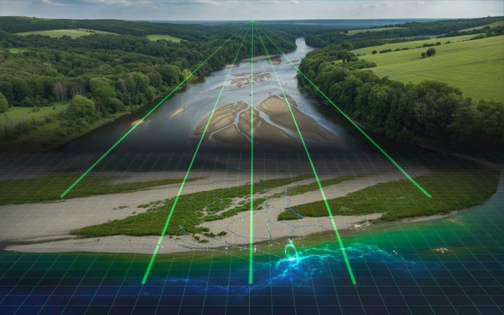
Rivers are constantly changing. Water levels rise and fall, sediments shift, and channels reshape over time. Yet many mapping projects still focus only on what is visible above the waterline. This leaves a major gap in understanding the true structure of a river system. Bathymetry fills that gap. It reveals the underwater terrain that influences flow patterns, erosion, flood risks, and infrastructure planning. Without bathymetry, river mapping is incomplete and decision making becomes less reliable. Across Canada, where rivers play a major role in transportation, forestry, energy, and environmental management, accurate bathymetry is becoming essential. What is bathymetry Bathymetry refers to the measurement and mapping of underwater terrain. It is similar to topographic mapping on land, but instead of hills and valleys, it captures the depth and shape of the riverbed or lake floor. River bathymetry helps engineers and environmental teams understand how water moves through a channel. It provides data on depth, slope, and underwater features such as sandbars, pools, and submerged structures. This information forms the foundation for hydraulic modeling, infrastructure design, and flood risk assessments. Why river mapping needs bathymetry Traditional river mapping often focuses on the banks and surrounding terrain. While this information is useful, it does not reveal what is happening beneath the surface. The shape of the riverbed directly affects Water velocity and flow direction Sediment transport Flood behavior Bridge and culvert performance Without river bathymetry, models and designs rely on assumptions rather than real measurements. This increases uncertainty and can lead to costly mistakes. How bathymetric lidar works Bathymetric lidar is a technology that uses laser pulses to measure underwater depth. Unlike standard lidar, which reflects off solid surfaces, bathymetric systems use green wavelength lasers that can penetrate water. The process works in two steps. First, a laser pulse reflects off the water surface. Second, part of that pulse continues through the water and reflects off the riverbed. By measuring the time difference between these two reflections, the system calculates the water depth and creates an accurate underwater terrain model. This approach allows for fast and efficient underwater terrain mapping across large river corridors. Advantages over traditional hydrographic survey methods Conventional hydrographic survey techniques often rely on boats equipped with sonar. While effective in certain conditions, these methods have limitations. They can be slow in shallow or narrow channels. Access can also be difficult in remote or hazardous areas. Bathymetric lidar offers several advantages Faster coverage over long river sections Reduced need for boats and physical access Safer data collection in remote or fast flowing areas Seamless integration with land based lidar data These benefits make bathymetric lidar especially valuable for large scale water depth mapping projects. Research insights on bathymetric mapping Recent research highlights the growing role of lidar in river studies. A study published in Journal of Hydrology found that lidar based river surveys improved the accuracy of hydraulic models by providing more detailed channel geometry. This led to better predictions of water flow and flood behavior.. Another research paper on small footprint green lidar showed that bathymetric lidar could successfully map riverbeds in clear water conditions while reducing the time required for field surveys. A remote sensing study also demonstrated that combining bathymetric lidar with aerial imagery improved overall terrain models in river corridors. These studies confirm that bathymetry is not just an added layer of information. It is a critical component of accurate river mapping. Applications of river bathymetry Bathymetric data supports a wide range of industries and projects. Infrastructure planning Bridges, culverts and pipelines often cross rivers. Accurate river bathymetry ensures these structures are designed with the correct depth and flow conditions in mind. Flood risk analysis Understanding underwater terrain helps predict how water will spread during high flow events. This is essential for floodplain mapping and community protection. Environmental monitoring Bathymetry reveals habitat conditions for fish and aquatic ecosystems. It also helps track erosion sediment buildup and channel changes. Forestry and resource corridors In forested regions, rivers often intersect access roads and utility lines. Water depth mapping ensures crossings are designed safely and efficiently. Learn how UAV inspections reduce downtime for industrial operations. Combining bathymetry with topographic data One of the greatest strengths of modern mapping is the ability to combine land and underwater data into a single model. By merging bathymetric lidar with standard lidar or photogrammetry, teams can create a complete representation of the river corridor. This integrated approach provides Continuous elevation models from riverbank to riverbed Improved hydraulic simulations Better planning for infrastructure and environmental projects The future of river mapping As climate patterns shift and infrastructure demands grow, accurate river data will become even more important. Bathymetry is no longer an optional layer. It is a fundamental part of understanding how rivers behave and how projects interact with them. Across Canada, organizations are adopting bathymetric mapping to improve flood modeling, environmental assessments, and infrastructure planning. Rekon Solutions supports these efforts by providing integrated mapping services that capture both land and underwater terrain. FAQs What is river bathymetry? River bathymetry is the measurement and mapping of the depth and shape of the riverbed. It helps engineers and environmental teams understand underwater terrain. What information is included in bathymetric data? Bathymetric data includes water depth, riverbed elevation, underwater features, and channel shape. How accurate is bathymetric mapping? Accuracy depends on the technology and water conditions. Modern bathymetric lidar systems can achieve high accuracy suitable for engineering and environmental applications. How to read a bathymetric map? Bathymetric maps use contour lines or color gradients to show depth. Closer contour lines usually indicate steeper underwater slopes.
Photogrammetry Turning Aerial Images into Precise 3D Models
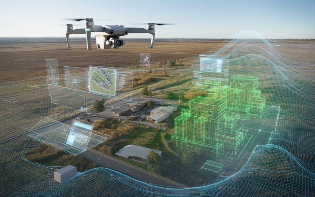
Modern projects demand more than flat maps. Engineers, planners and developers now rely on detailed digital models to understand terrain structures and progress over time. This is where photogrammetry 3d models have become a powerful tool across construction infrastructure forestry and environmental projects. Photogrammetry transforms simple aerial images into accurate three dimensional representations of the real world. With the help of drones and advanced software, teams can capture vast areas and turn them into precise models for analysis and planning. What is photogrammetry? Photogrammetry is a method that creates three dimensional models from overlapping images. A drone or aircraft captures hundreds or thousands of photographs of a site from different angles. Specialized software then analyzes these images and calculates the position of every visible point. By identifying shared features across multiple photos, the system reconstructs the shape of the terrain or structure. This process produces detailed photogrammetry 3d models that can be used for measurement planning and visualization. How does drone photogrammetry work? Drone photogrammetry has made this technology more accessible and efficient. Instead of relying on manned aircraft or ground crews, drones can capture high resolution images quickly and safely. The process usually follows a few clear steps. First, the drone flies over the project area in a planned grid pattern. This ensures enough image overlap for accurate reconstruction. Next, the captured photos are processed through software that identifies matching points across images. Finally, the software generates 3d mapping from images, creating a digital surface model, orthomosaic, and full three dimensional representation of the site. This workflow allows teams to move from raw aerial photos to complete photogrammetry 3d models within a short time frame. The role of structure from motion At the core of photogrammetry lies a technique known as structure from motion. This method analyzes the movement and position of features across multiple images. As the software compares overlapping photos, it calculates how the camera moved between each shot. From this information it determines the spatial position of each point. The result is a dense point cloud that represents the shape of the landscape or structure. This point cloud is then converted into a surface model or mesh. Structure from motion is what makes aerial 3d reconstruction possible without needing direct distance measurements. Benefits of photogrammetry for large projects Photogrammetry offers several advantages that make it valuable across many industries. Fast data collection Drones can capture large areas in a short amount of time. This is especially useful for construction sites or infrastructure corridors where conditions change frequently. Detailed visual models Photogrammetric modeling produces highly realistic 3D visuals. These models help teams communicate plans and progress with stakeholders. Cost efficiency Compared to some other mapping technologies, drone photogrammetry often requires less expensive equipment. This makes it a practical option for many projects. Safe access to difficult terrain Drones can capture data over steep slopes, forests or active construction zones without putting survey crews at risk. Common applications of photogrammetry 3d models Photogrammetry is widely used across different industries. Its flexibility and visual clarity make it suitable for a range of tasks. Construction planning and monitoring Construction teams use photogrammetry 3d models to track progress, measure volumes and compare design plans with actual site conditions. Infrastructure development Road rail and utility projects rely on aerial 3d reconstruction to understand terrain conditions before construction begins. Forestry and environmental surveys In open forest areas or regions with moderate canopy cover, drone photogrammetry helps assess land features and monitor environmental changes. Mining and stockpile measurement Mining operations use photogrammetric modeling to calculate stockpile volumes and monitor site activity. Accuracy in photogrammetric modeling Accuracy in photogrammetry depends on several factors. Image quality and resolution Overlap between photos Flight planning and altitude Ground control points When these factors are managed correctly, photogrammetry 3d models can achieve high levels of accuracy suitable for planning and measurement. However, dense vegetation or uniform surfaces may reduce reliability. In such cases, other technologies like LiDAR may be considered. Photogrammetry compared to other 3d mapping methods Among different 3d mapping methods, photogrammetry stands out for its visual detail and efficiency. It is particularly effective on open construction sites, urban areas and projects where visual context matters. Teams can see textures, colors and real world features directly in the model. While other technologies may provide stronger performance under heavy vegetation, photogrammetry remains a versatile and cost effective solution for many mapping tasks. Learn why LiDAR is now the industry standard. Why photogrammetry continues to grow in popularity Advancements in drone technology software processing and computing power have made photogrammetry more accessible than ever. Projects that once required weeks of fieldwork can now be mapped in a single day. The ability to generate accurate and visually rich photogrammetry 3d models has changed how teams approach planning and analysis. Across Canada, construction and infrastructure projects increasingly rely on aerial data to improve efficiency and decision making. Rekon Solutions supports these efforts by helping clients capture accurate site models using advanced drone mapping techniques. Get in touch. FAQs What is photogrammetry used for Photogrammetry is used to create three dimensional models and maps from images. It is commonly used in construction, infrastructure, forestry and environmental projects. How accurate are photogrammetry 3d models With proper flight planning and ground control, photogrammetry 3d models can achieve high accuracy suitable for measurement and planning. What is structure from motion in photogrammetry Structure from motion is a process that analyzes overlapping images to determine the position of points in three dimensional space. Is drone photogrammetry better than traditional surveying Drone photogrammetry can be faster and safer for large areas, but traditional surveying is still important for precise ground control and verification.