Thermal Imaging vs Visual Inspection: What Each Method Can (and Can’t) Reveal
Many inspection programs rely heavily on what can be seen with the human eye. Cracks,…
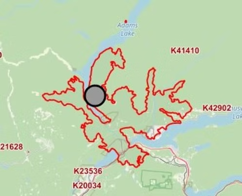
Rekon Solutions – LiDAR Drones
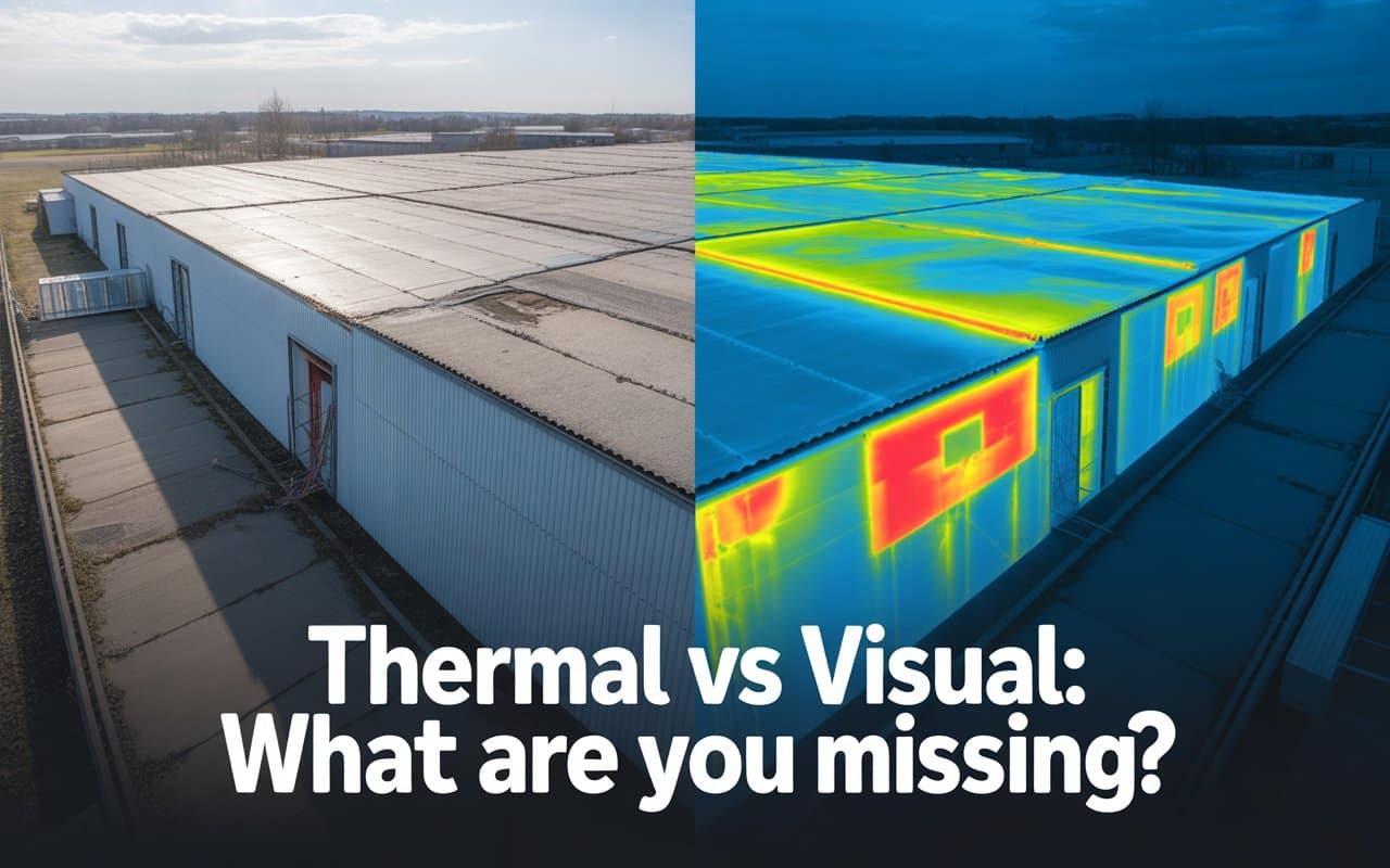
Many inspection programs rely heavily on what can be seen with the human eye. Cracks,…

Drone inspection accuracy is the foundation of good decisions in inspection and infrastructure projects. Whether…
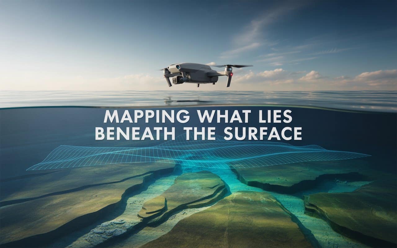
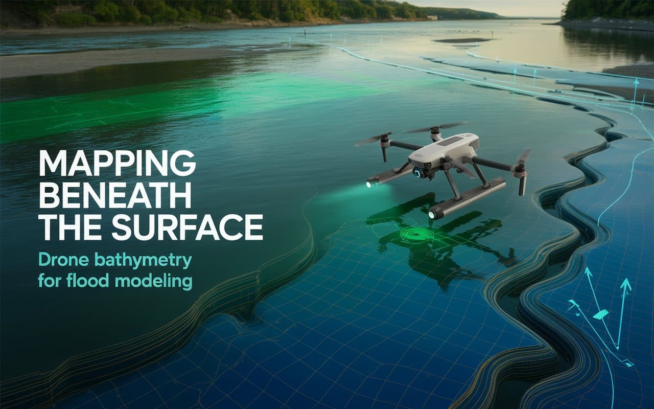
What lies beneath the water often matters just as much as what sits above it. …
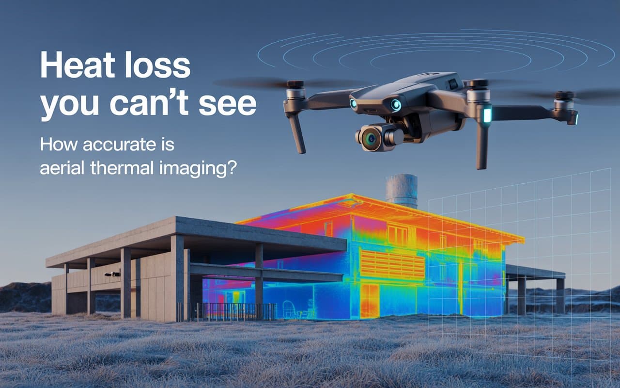
Heat loss is one of the most expensive and least visible building performance issues. If…
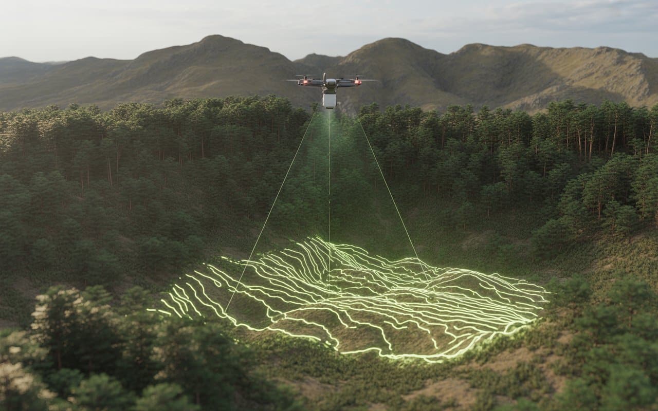
Mapping dense forests and steep mountain landscapes has always been challenging. Thick vegetation blocks visibility,…
Flooding is becoming a growing concern for infrastructure, communities, and environmental planning. Without accurate terrain…
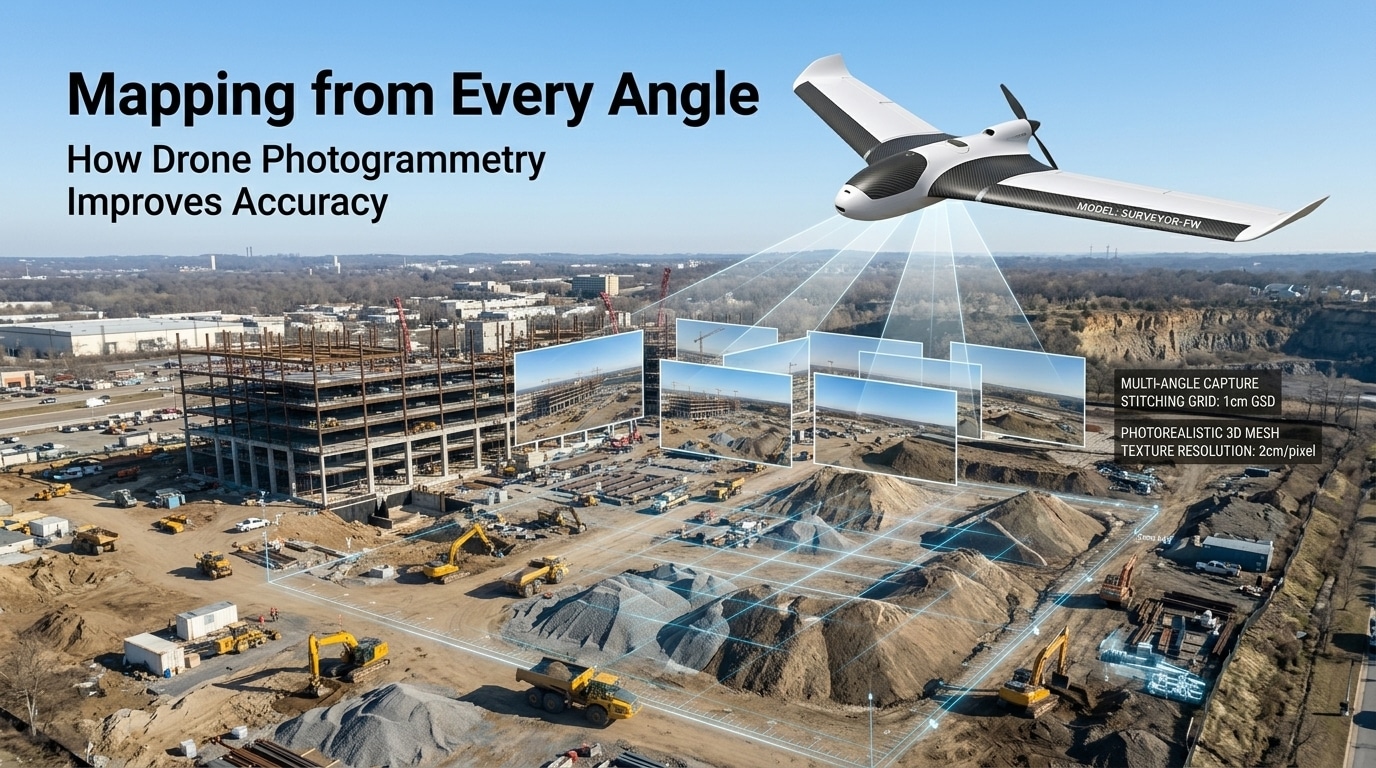
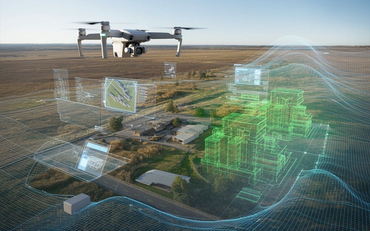
Mapping has always been essential for planning, design, and decision making. However, traditional methods often…
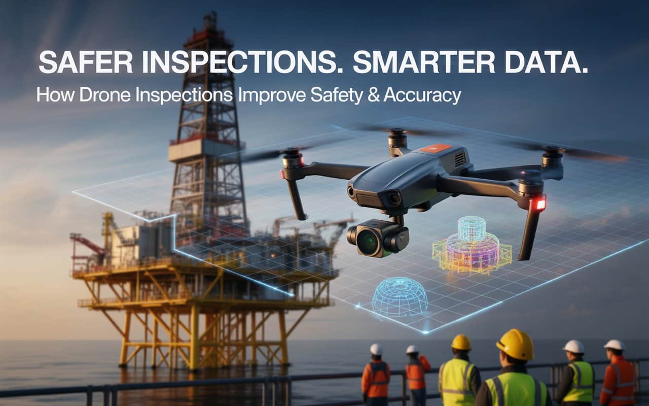
Imagine being tasked with inspecting a high-rise building or an oil rig—places that are difficult…
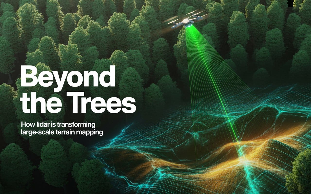
Mapping large landscapes has always been a challenge for surveyors and engineers. Dense forests, rugged…

Waterways shape landscapes, support ecosystems, and influence infrastructure decisions. Yet the most important information about…
Have you ever wondered if there’s a faster, more efficient way to get your survey…
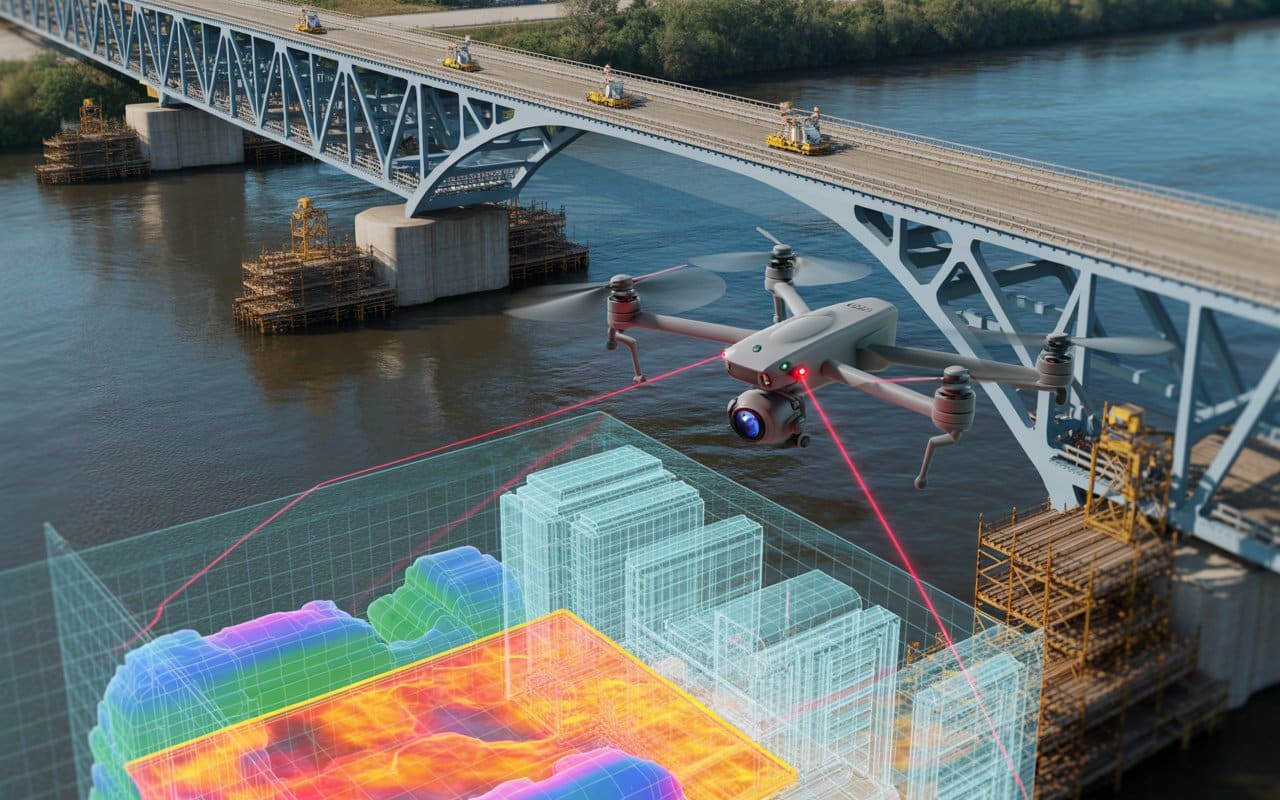
When it comes to infrastructure projects, maintaining safety and ensuring precision are key. Traditionally, inspections…
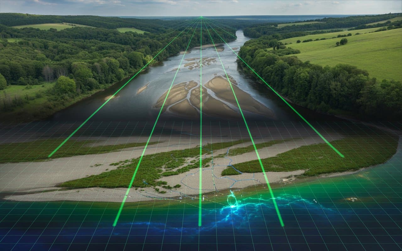
Rivers are constantly changing. Water levels rise and fall, sediments shift, and channels reshape over…
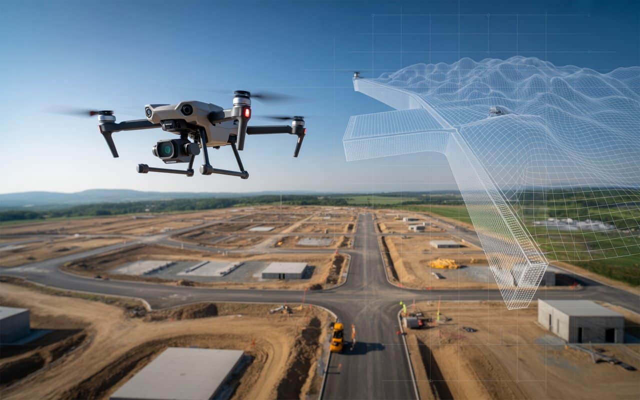
Modern projects demand more than flat maps. Engineers, planners and developers now rely on detailed…
In this post we will take a look at how the fires that ravaged the…
