Drone Inspection Reporting That Works: How to Turn Images into Decisions
A folder full of drone photos is not the same as an answer. Strong drone…
Rekon Solutions – LiDAR Drones
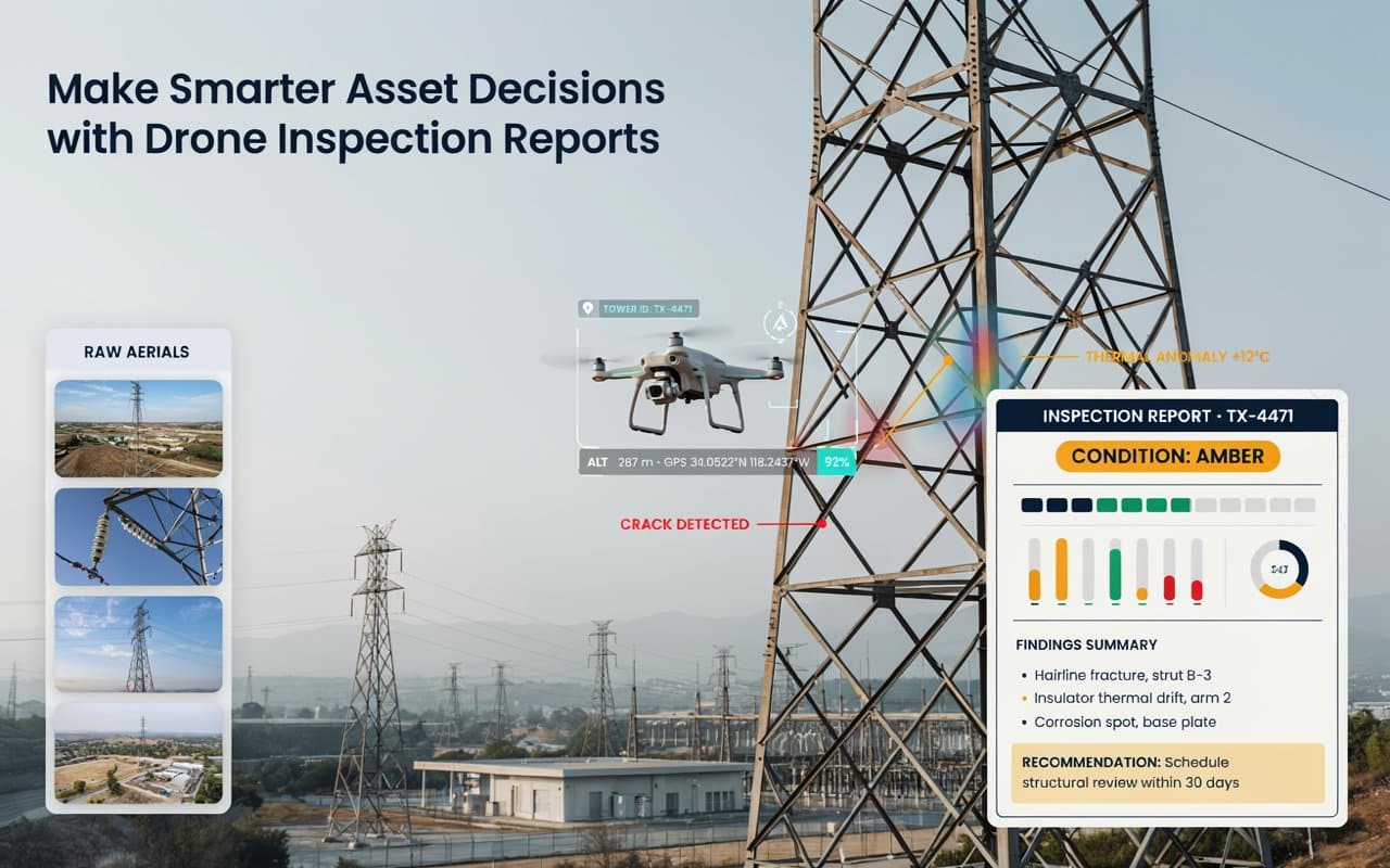
A folder full of drone photos is not the same as an answer. Strong drone…
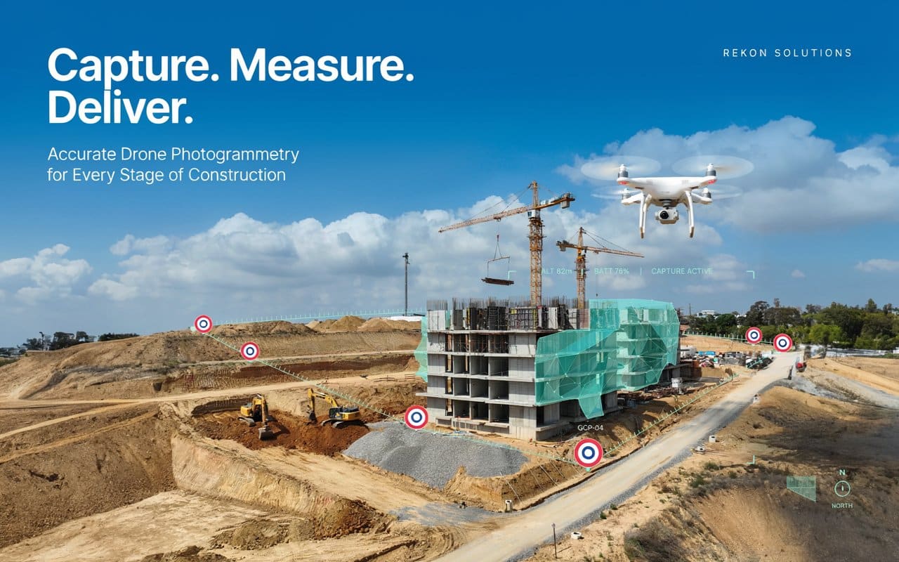
Drone photogrammetry construction work can save you weeks, or it can hand you a model…
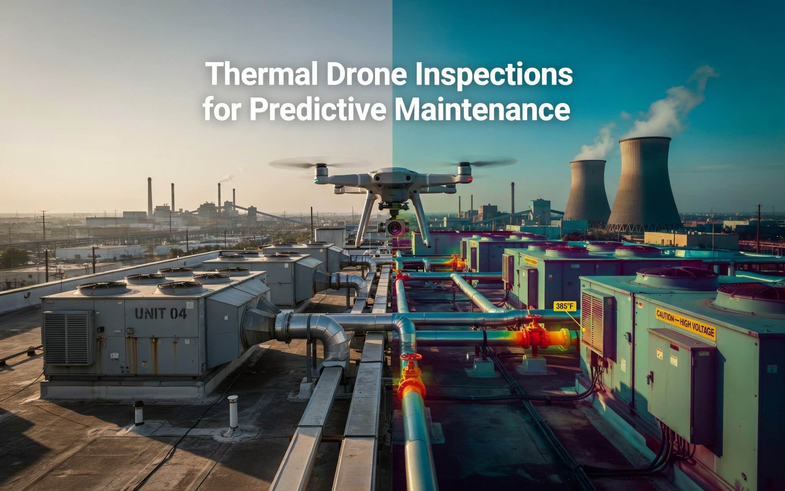
Imagine your industrial facility’s HVAC system suddenly failing during a heatwave, causing major downtime and…
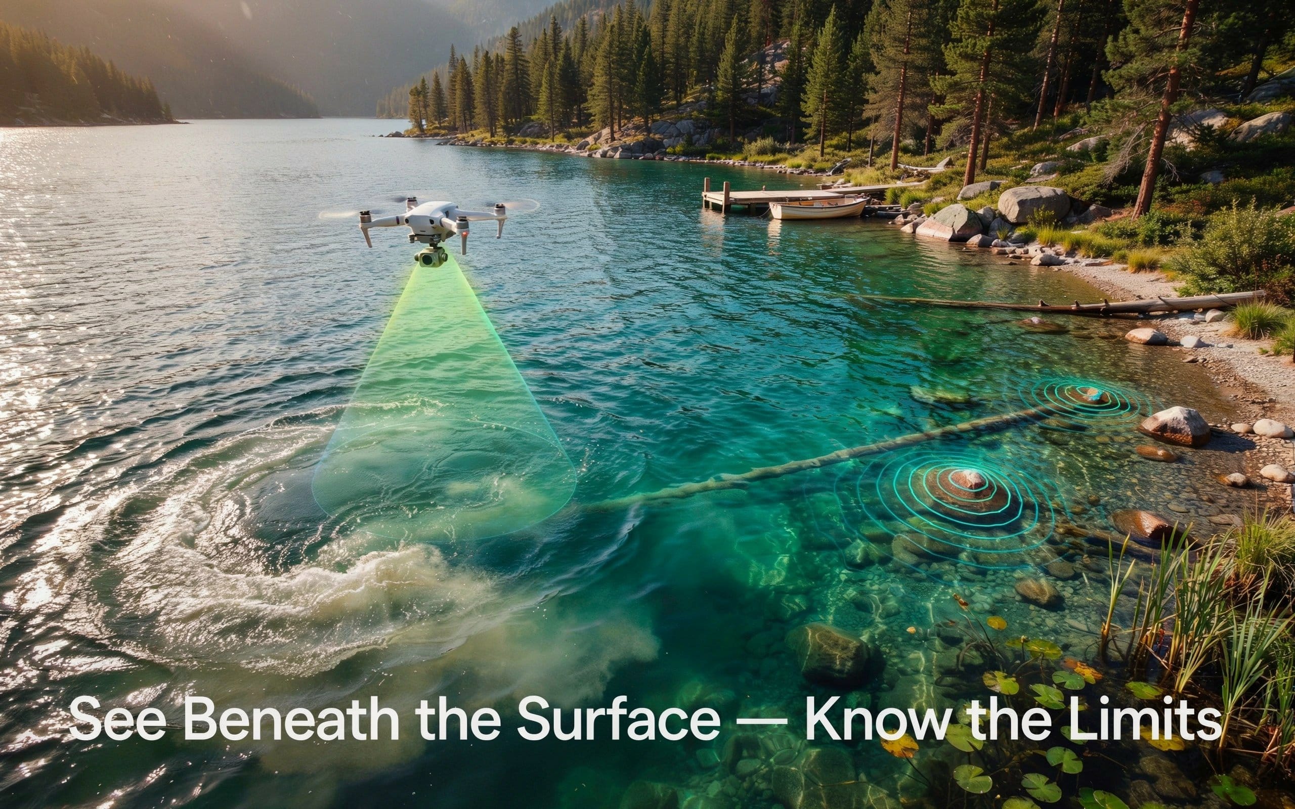
Mapping the bottom of a river or lake once meant a boat, a sonar unit,…
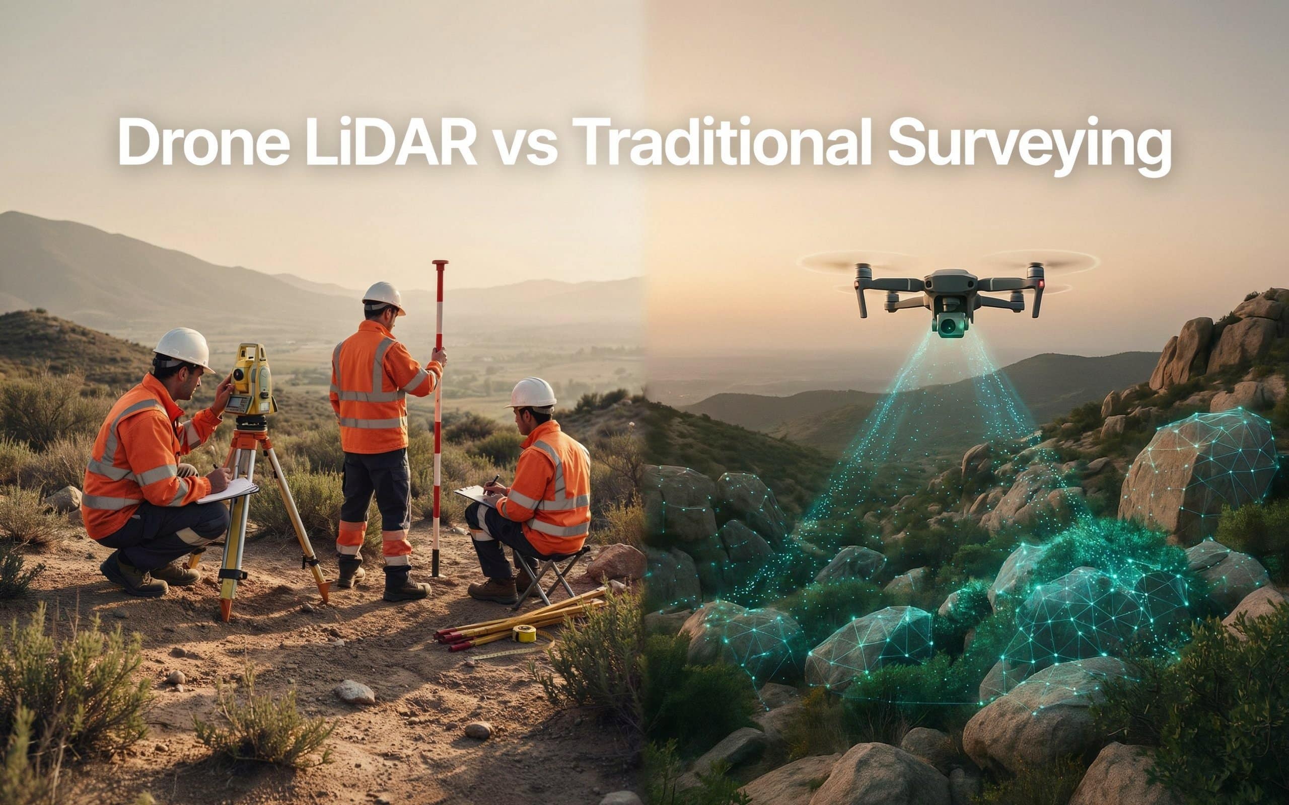
Picking between drone lidar vs traditional surveying can be tricky. And the wrong choice can…

Surveying has always been about gathering accurate information. The challenge is that collecting that information…
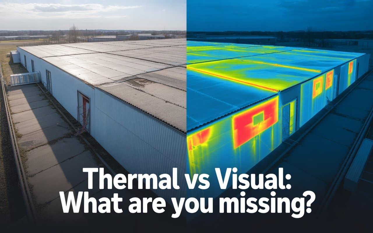
Many inspection programs rely heavily on what can be seen with the human eye. Cracks,…

Drone inspection accuracy is the foundation of good decisions in inspection and infrastructure projects. Whether…
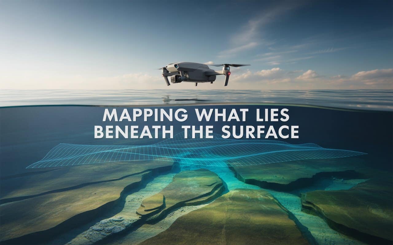
What lies beneath the water often matters just as much as what sits above it. …
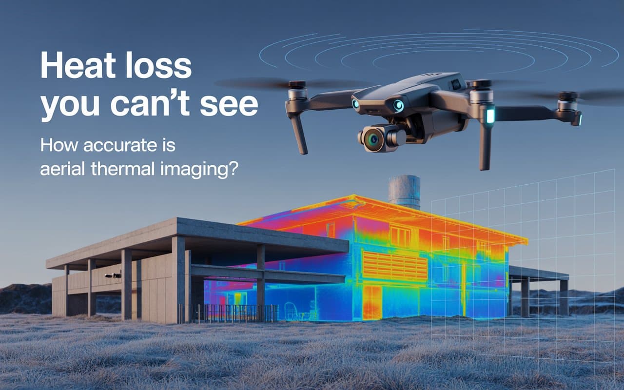
Heat loss is one of the most expensive and least visible building performance issues. If…
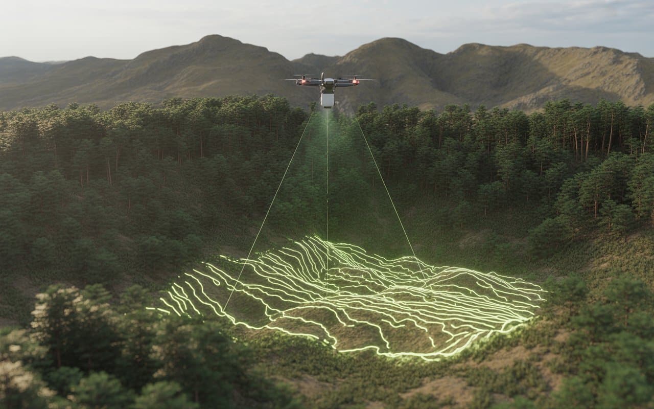
Mapping dense forests and steep mountain landscapes has always been challenging. Thick vegetation blocks visibility,…
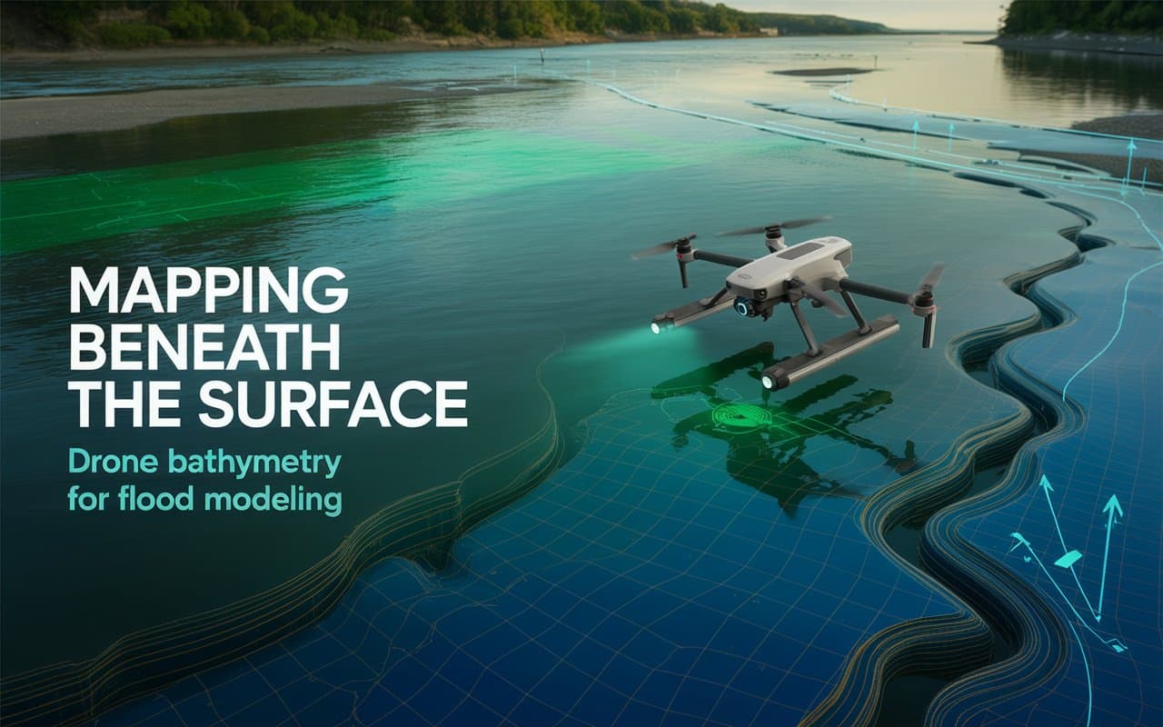
Flooding is becoming a growing concern for infrastructure, communities, and environmental planning. Without accurate terrain…
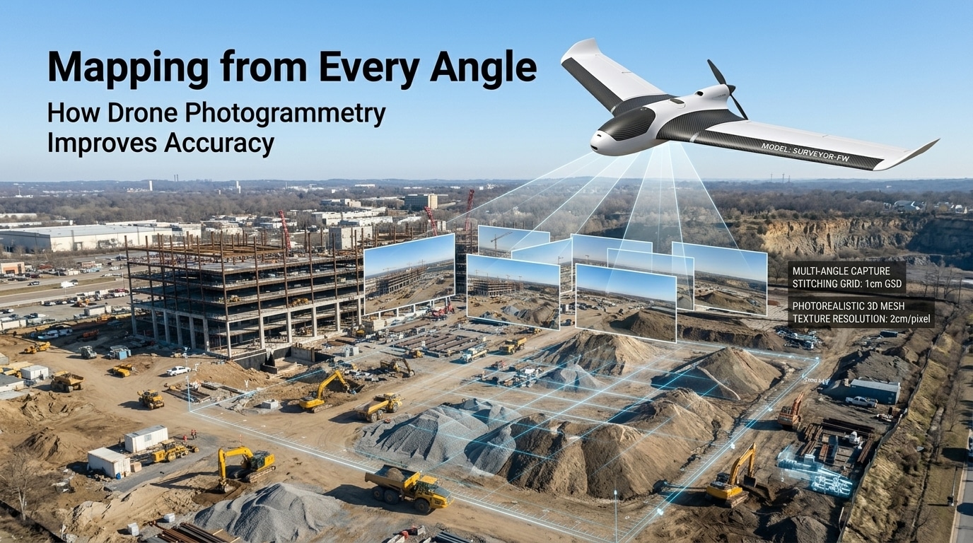
Mapping has always been essential for planning, design, and decision making. However, traditional methods often…

Imagine being tasked with inspecting a high-rise building or an oil rig—places that are difficult…

Mapping large landscapes has always been a challenge for surveyors and engineers. Dense forests, rugged…
