How Thermography Helps Prevent Costly Failures?
Imagine your industrial facility’s HVAC system suddenly failing during a heatwave, causing major downtime and…
Rekon Solutions – LiDAR Drones
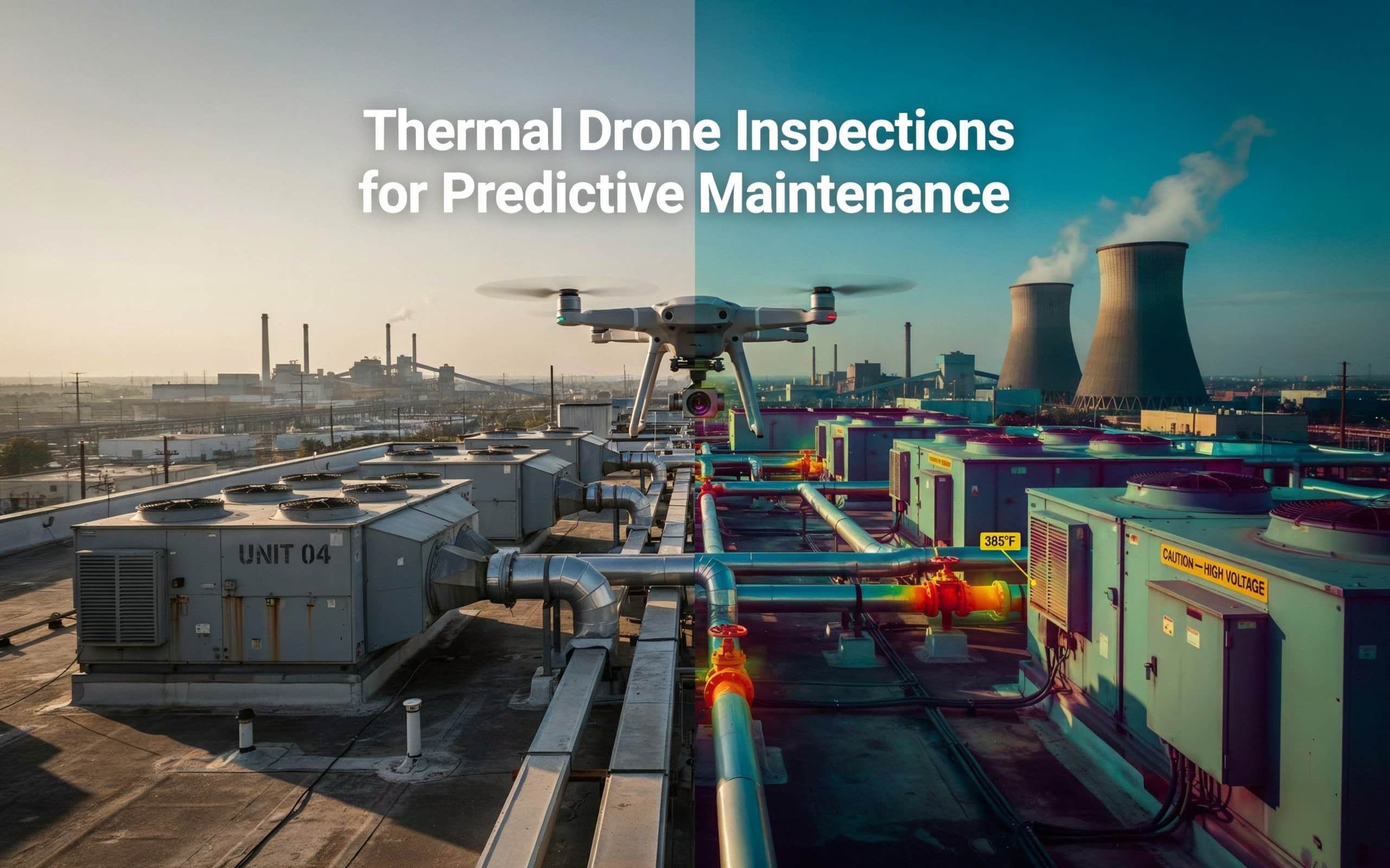
Imagine your industrial facility’s HVAC system suddenly failing during a heatwave, causing major downtime and…
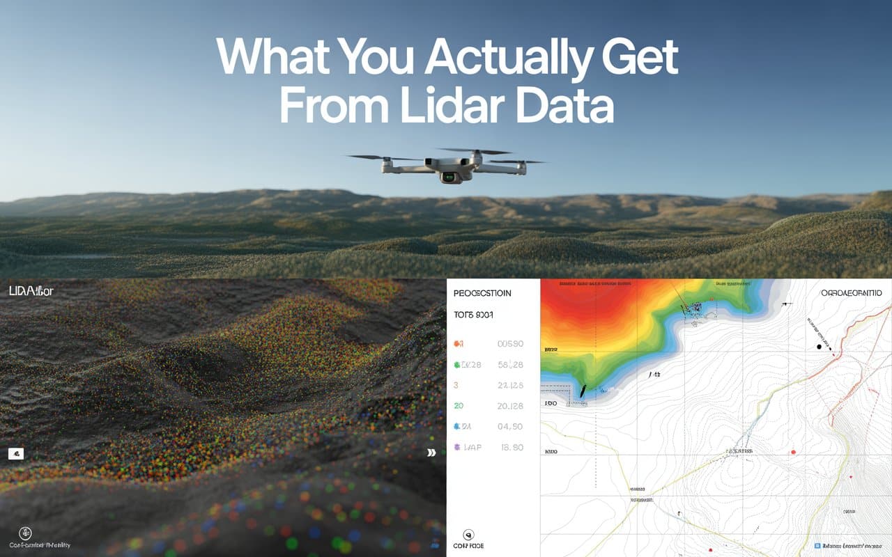
When you order a LiDAR survey, what should actually land in your inbox? Understanding your…
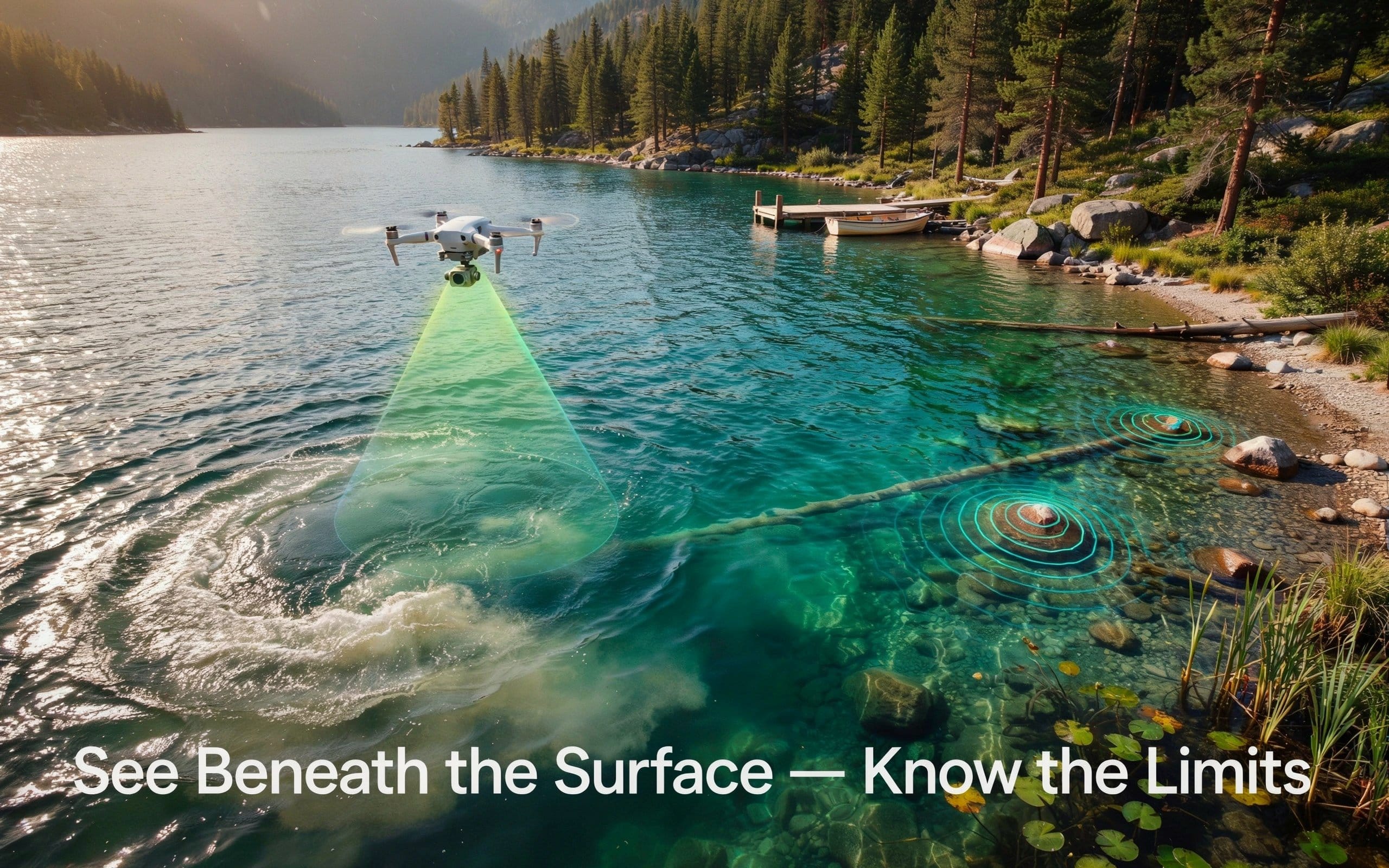
Mapping the bottom of a river or lake once meant a boat, a sonar unit,…
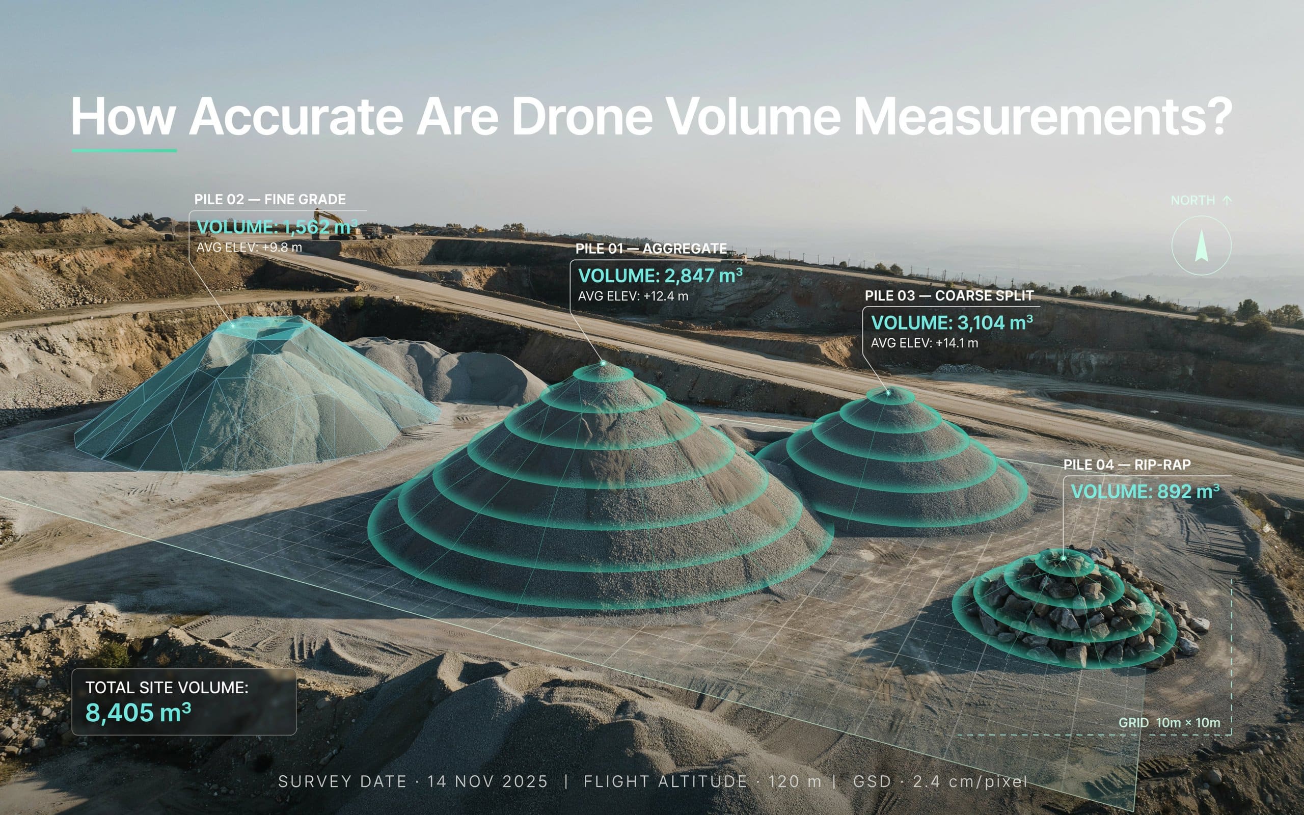
If you have ever doubted a stockpile number, you are not alone. Drone volume measurement…
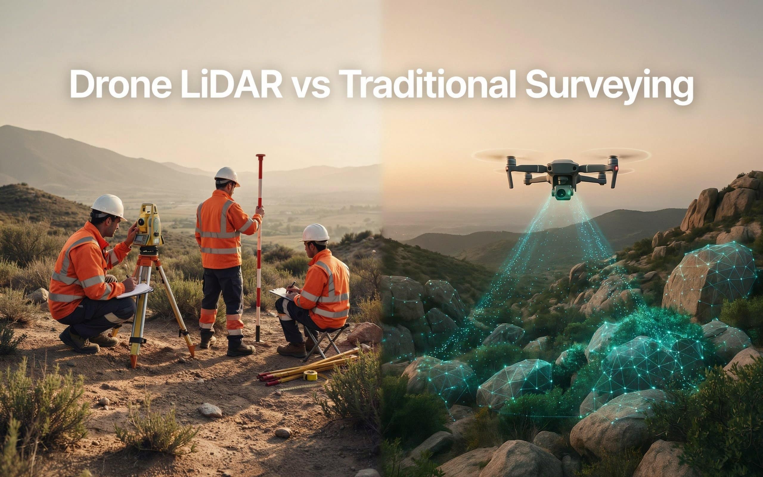
Picking between drone lidar vs traditional surveying can be tricky. And the wrong choice can…

Surveying has always been about gathering accurate information. The challenge is that collecting that information…
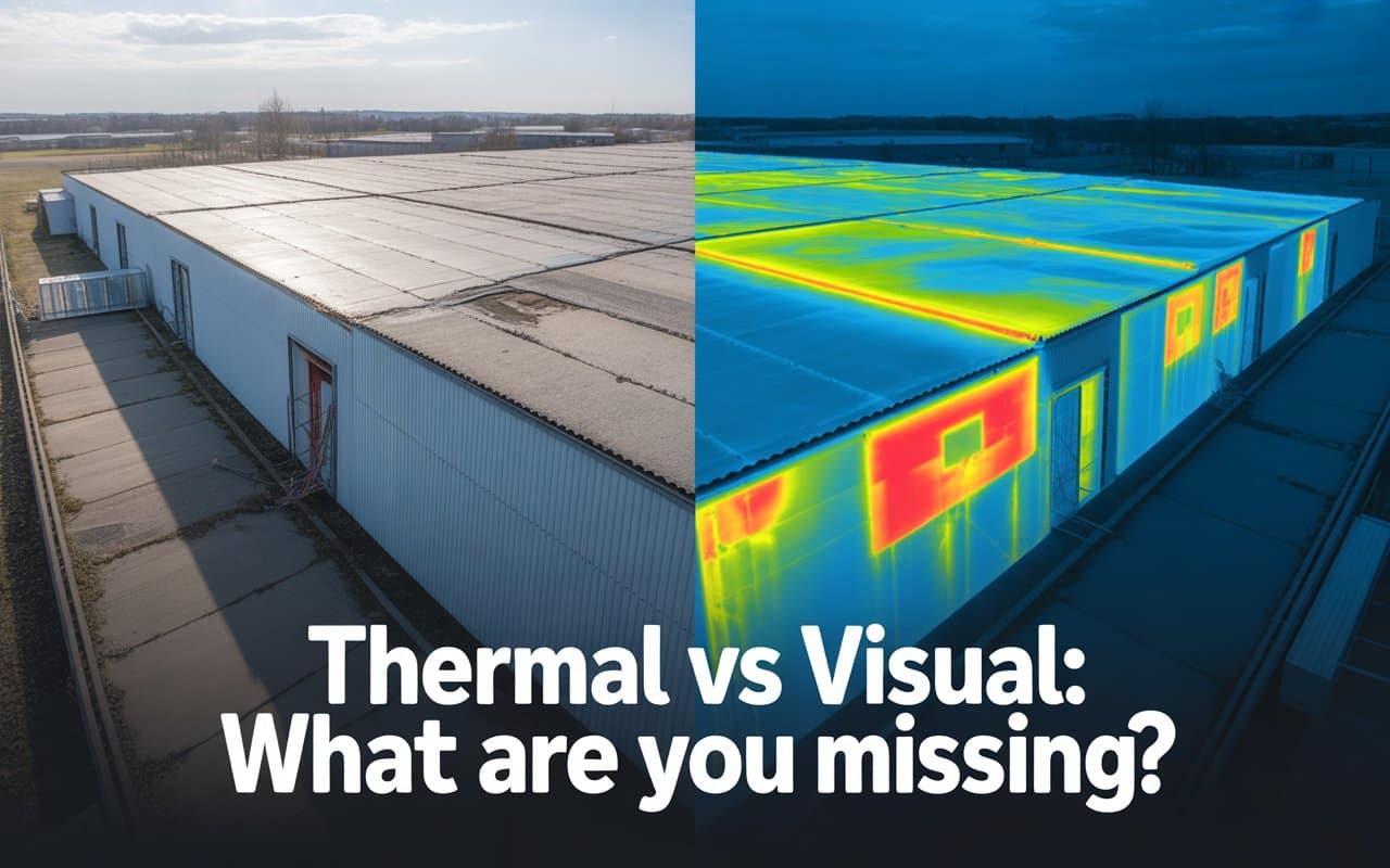
Many inspection programs rely heavily on what can be seen with the human eye. Cracks,…

Drone inspection accuracy is the foundation of good decisions in inspection and infrastructure projects. Whether…

Many teams assume LiDAR quality depends only on the drone or sensor being used. In…
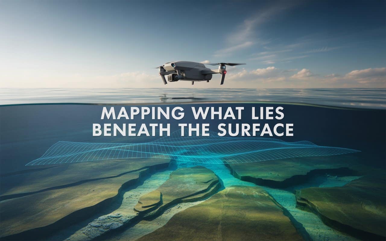
What lies beneath the water often matters just as much as what sits above it. …
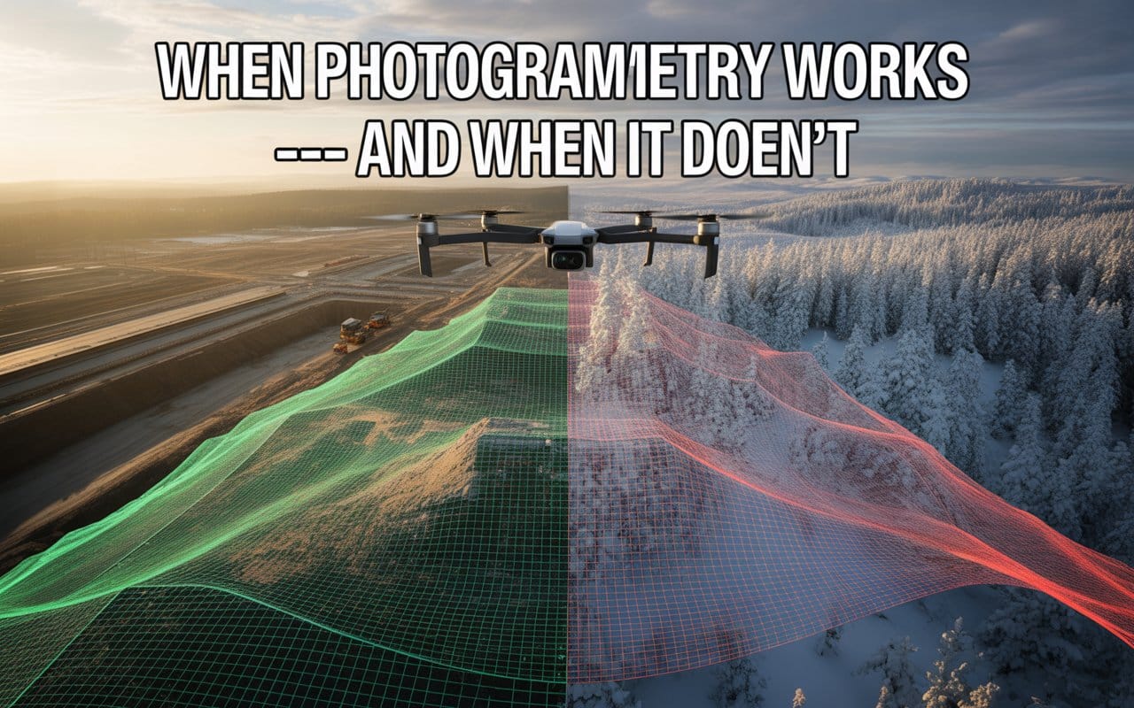
Choosing the wrong mapping method can quietly affect your entire project. Many teams adopt drone…
Many teams invest in drone LiDAR services for mapping without fully understanding what they are…
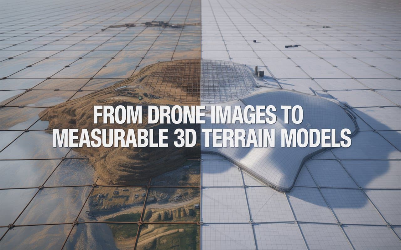
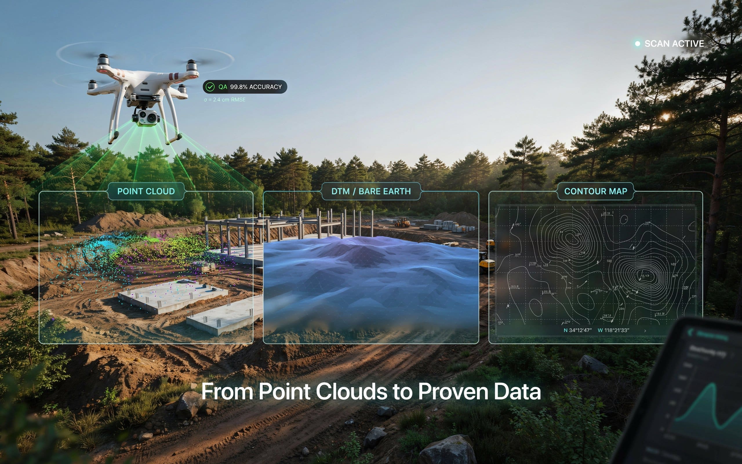
Project teams today need more than simple aerial photos. They need accurate measurements, terrain insights,…


